Navajo Peak Hike
View Photos
Navajo Peak Hike
Difficulty Rating:
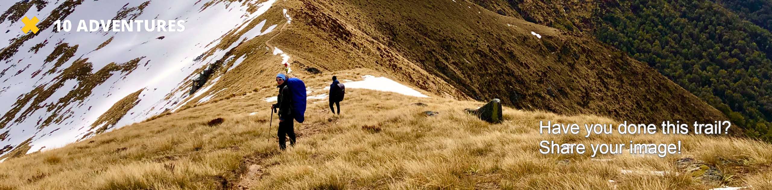
Navajo Peak Hike is a demanding adventure up to the summit by way of an airplane gully. Years ago, a plane crashed into the side of the Navajo Peak and remnants of the plane remain on the flank of the summit. The expedition to the summit is both undeniably scenic and sobering. The hike to the peak is a Class 3 scramble up a steep rocky talus, but once summited, Navajo Peak delivers unparalleled views of the Indian Peaks Wilderness.
Getting there
The Navajo Hike departs from the Long Lake Trailhead in the Brainard Lake Recreational Area. Parking permits are required and can be purchased on-site. Note that the Brainard Lake Recreational Area closes seasonally from late October until mid-June.

About
| Backcountry Campground | Yes, permits required. |
| When to do | June-October |
| Pets allowed | Yes - On Leash |
| Family friendly | No |
| Route Signage | Average |
| Crowd Levels | High |
| Route Type | Out and back |
Navajo Peak Hike
Elevation Graph
Weather
Navajo Hike Description
Navajo Hike is a stimulating adventure in the Indian Peaks that is reserved for experienced hikers. Scrambling is unavoidable as you ascend Navajo Peaks. Be careful—navigating loose scree and the steep rocky talus field can be dangerous. As you approach the rearmost section of the trail, signposts are replaced by cairns, so keep an eye out for them to make sure you are on the right track. Additionally, expect bitter weather at the summit due to high altitude. Lace up your hiking books and grab your poles, and adventure to Navajo Peak!
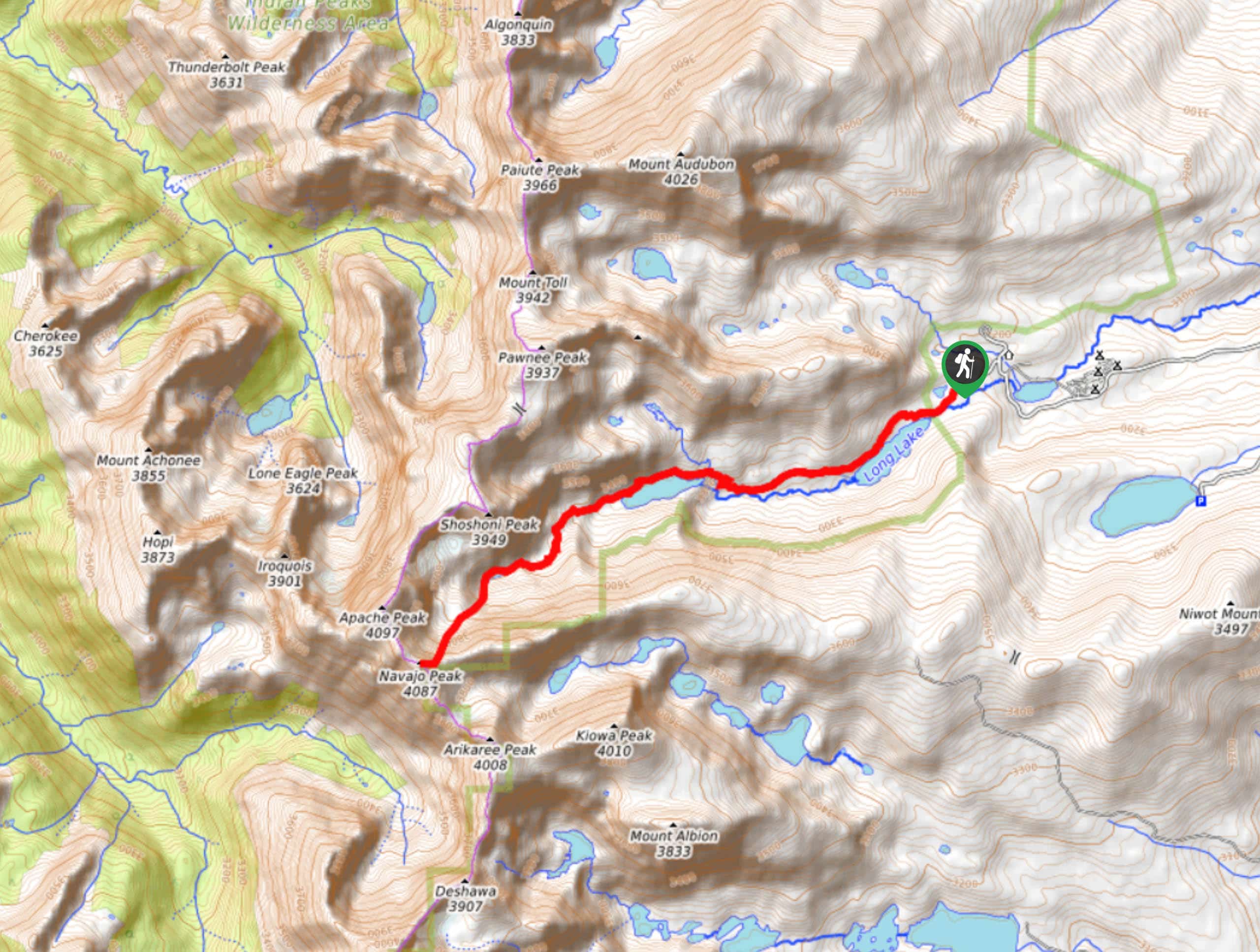
The Navajo Peak Hike departs from the Long Lake Trailhead. Head west onto the Pawnee Pass Trail and continue along the path as it guides you along the shores of Long Lake. Hike this trail until you reach Isabelle Lake and the trail junction. Head left, merging onto the Isabelle Glacier Trail. This section of the trail is often crowded as you walk along the shores of the picturesque Isabelle Lake. Continue along the path until it begins to curve north, and you meet a pool of water. Get off the trail here. Cairns will guide you southwest up the trail from this point forward. Navigate the rocky mountain side with caution, keeping an eye out for loose boulders and rocks. As you begin your ascent, it will get aggressively steep and rocky. Scramble up the talus past Navajo glacier and up the Airplane Chute. Explore the plane’s remnants before continuing up the gulley. Once you conquer the climb, you will summit Navajo Peak. If it is a clear day, sights of neighbouring Indian Peaks and the alpine landscape below will reward you.
Bask in the beauty of the Colorado Front Ranges and rehydrate before attempting your descent. Take it slow as you maneuver back down Navajo Peak the way you came. Descend the rocky talus and follow the cairns back to Isabelle Glacier Trail. Retrace your steps back to the carpark.
Similar hikes to the Navajo Peak Hike hike

Caribou Pass Hike
The Caribou Pass Trail scales the west side of the Continental Divide. This short but steep hike will get your…

Beaver Creek Trail
Beaver Creek Trail is a great wooded hike through the Colorado wilderness. With picturesque babbling brooks and past vast wildflower…
Beaver Reservoir to Monarch Lake Hike
Beaver Reservoir to Monarch Lake Hike is a one-way trail in the Indian Peaks Wilderness. We love this hike because…
Comments