

Beaver Creek Trail
View Photos
Beaver Creek Trail
Difficulty Rating:
Beaver Creek Trail is a great wooded hike through the Colorado wilderness. With picturesque babbling brooks and past vast wildflower meadows, you will be delighted by the sights and ambiance that the Indian Peaks Wilderness has to offer. This trail culminates on a rocky ridge on the east side of Mount Audubon, where you will be rewarded with up close and personal views of the impressive peak.
Getting there
The Beaver Creek Trail begins at the Beaver Creek Reservoir Parking Lot off Country Road 96.

About
| Backcountry Campground | Yes, permits required. |
| When to do | June-November |
| Pets allowed | Yes - On Leash |
| Family friendly | Older Children only |
| Route Signage | Average |
| Crowd Levels | High |
| Route Type | Out and back |
Beaver Creek Trail
Elevation Graph
Weather
Beaver Creek Hike Description
The Beaver Creek Trail is a great introductory trail into the Indian Peaks Wilderness. With gradual elevation gain and fairly solid terrain, this hike will get you warmed up before you go to summit one of the surrounding sky-scraping peaks. Not to mention this trail is scenic in itself, so make sure you bring your camera!
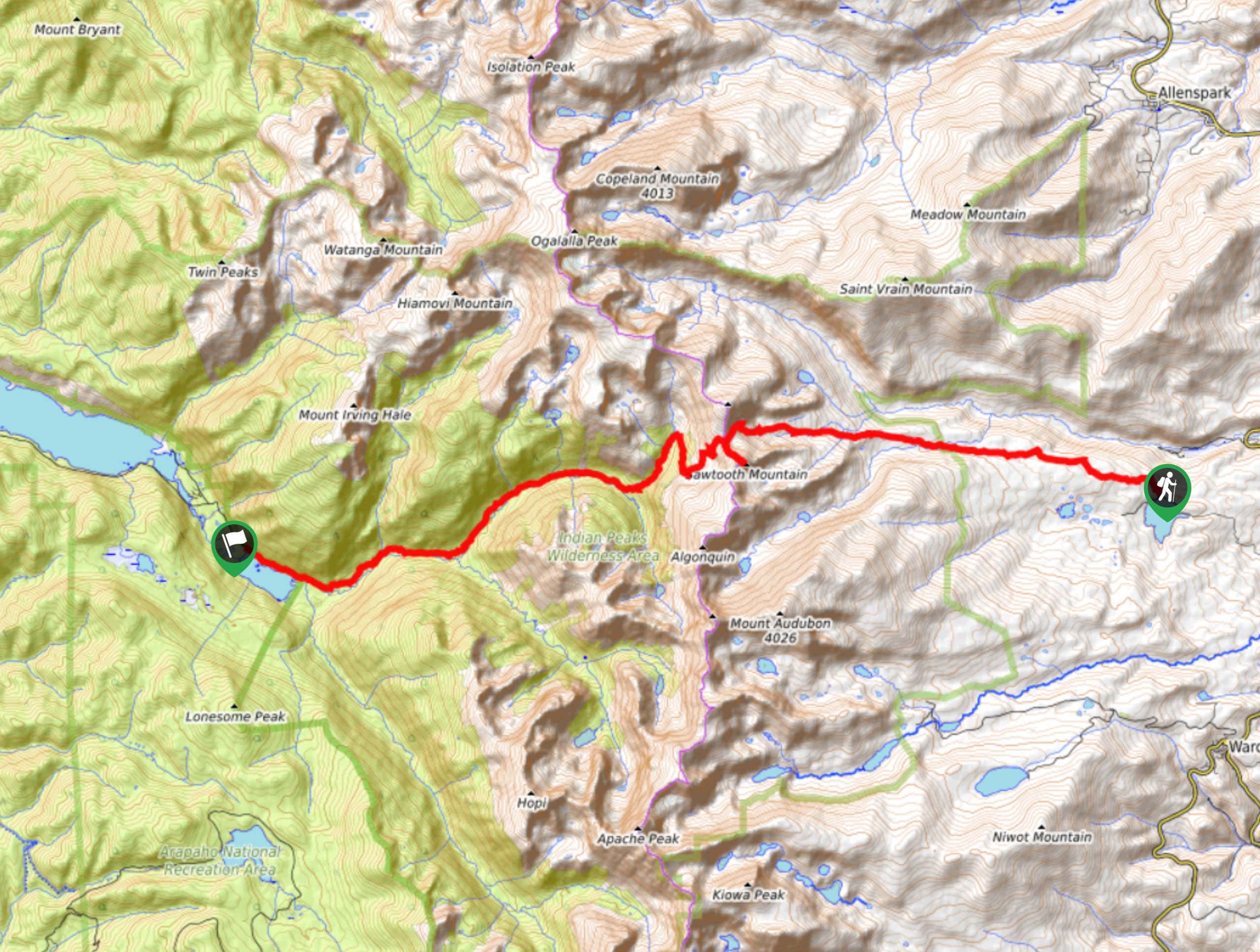
The Beaver Creek Hike departs from the Beaver Creek Reservoir Parking lot. From here, take Coney Creek Road west. The dirt road will guide you to a small pond and bridge crossing. At this point, take a hard left onto Beaver Creek Trail. This section of the trail will curve you along a creek as you gradually ascend the rocky path and top the timberline. Once above the treeline the path will get steeper as you climb a ridge. Be careful of loose rocks. Once you summit the ridge, you will arrive at an intersection. This is your turnaround point.
If you’ve still got some gas in the tank turn right and scramble up the steep rocky ledge and summit Mount Audubon. This is a difficult and lengthy add on to your excursion. If you’ve had enough and you are ready to return, descend the ridge and retrace your steps back to the parking lot.
Similar hikes to the Beaver Creek Trail hike

Caribou Pass Hike
The Caribou Pass Trail scales the west side of the Continental Divide. This short but steep hike will get your…

Buchanan Pass Loop
The Buchanan Pass Loop is an awesome adventure trail. Adults and kids alike will enjoy this wildflower-speckled trail as it…
Beaver Reservoir to Monarch Lake Hike
Beaver Reservoir to Monarch Lake Hike is a one-way trail in the Indian Peaks Wilderness. We love this hike because…
Comments