
Mount Audubon Hike
View Photos
Mount Audubon Hike
Difficulty Rating:
The Mount Audubon Hike is one of the most picturesque adventures to one of Colorado’s 13ers. Challenging, but not impossible, this trail is one of the most popular in the Brainard Lake Recreational Area. The awe-inspiring panoramic views of the Continental Divide and surrounding Front Range compensate for the rugged, rocky terrain to the summit. This trail is a great introduction to the Colorado peaks, but do not expect it to be easy!
Getting there
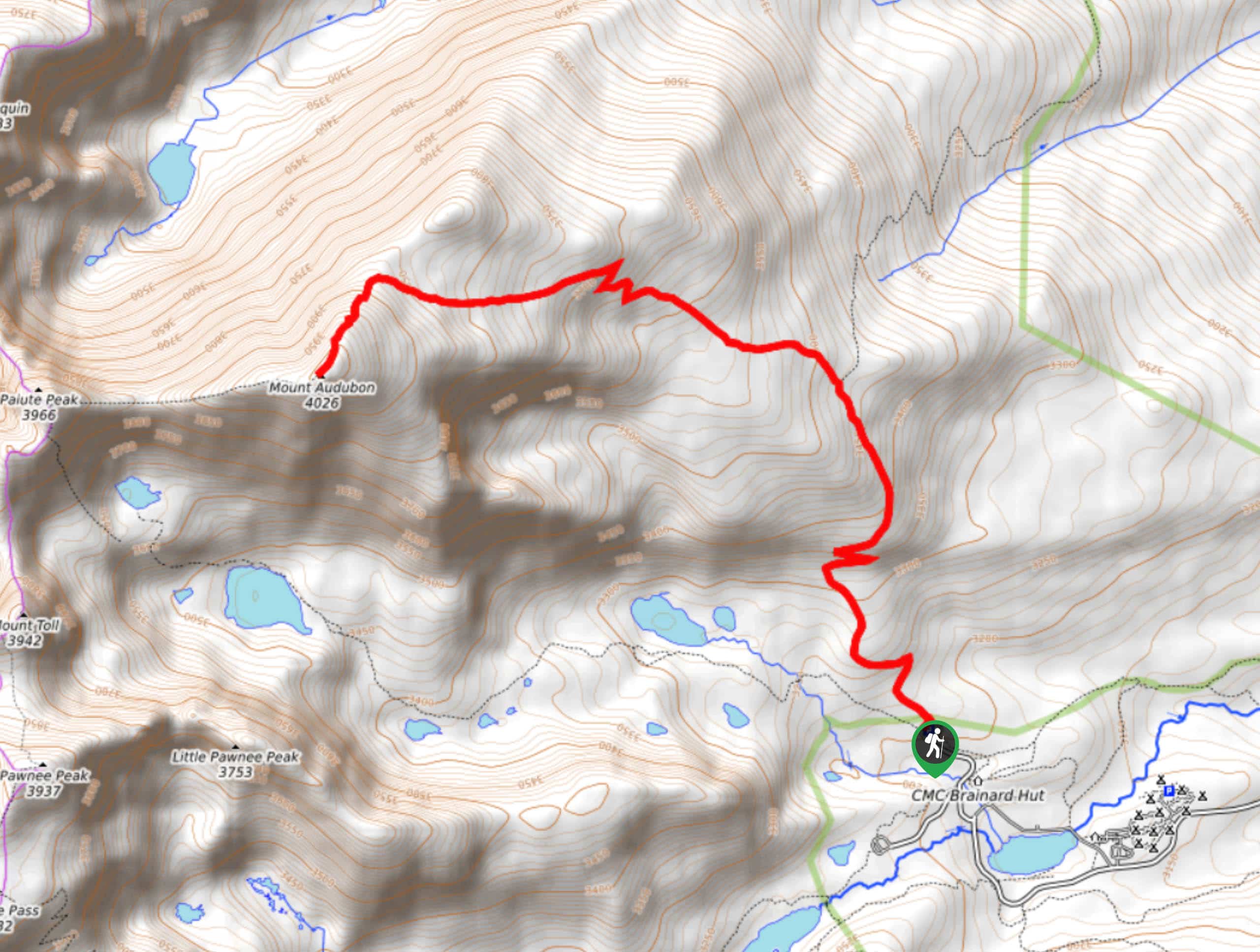
The Mount Audubon Trail is located in the Brainard Lake Recreational Area. Visitors require a pass—these can be reserved online or purchased on-site. This hike begins at the Mitchell Lake Trailhead off the car park. Note that the Brainard Lake Recreational Area closes seasonally from mid-October until mid-June. Winter visitors will have to park at the Gateway Trailhead and walk in, adding onto their excursion.

About
| Backcountry Campground | |
| When to do | June-October |
| Pets allowed | Yes - On Leash |
| Family friendly | Older Children only |
| Route Signage | Average |
| Crowd Levels | High |
| Route Type | Out and back |
Mount Audubon Hike
Elevation Graph
Weather
Mount Audubon Hike Description
The Mount Audubon Hike will get your blood pumping, and by the time you reach the summit, your legs will be burning! This trail gives no mercy, continuously gaining elevation until you reach the summit, be sure to bring plenty of water! As hikers approach the last segment of the hike the terrain becomes rocky and steep. The rocky talus field will require you to scramble until the summit, be sure to wear appropriate footwear. The extreme elevation of the peak presents the challenge of inclement weather, check the forecast before heading out and be prepared for windy conditions above the timberline.
Starting from the Mitchell Lake Carpark, head north on the Beaver Creek Trail. The initial section of this hike will guide you through the lush woodlands. As you continue along this trail, the incline increases as you exit the alpine forest and surmount the treeline. It will be quite windy here! Follow the path until you encounter a junction. Turn left, heading west onto the Mount Audubon Trail. Shortly after the intersection you will meet the saddle, where the developed part of the trail ends. Don’t worry, rock cairns mark the remainder of the hike. At this point you will have to navigate a boulder field. Be mindful of your footing as you scramble up the talus, following the cairns until you summit Mount Audubon. The peak will reward hikers with 360-degree views of the picturesque alpine landscape and neighboring snow-covered craggy peaks.
At the summit there are plenty of rock shelters to shield you from the wind, consider bringing lunch and hunkering down before your descent! After exploring the peak, begin maneuvering the talus field back to the trail. Retrace your steps, staying right at the intersection onto Beaver Creek Trail. Follow this path back to the parking lot.
Similar hikes to the Mount Audubon Hike hike

Caribou Pass Hike
The Caribou Pass Trail scales the west side of the Continental Divide. This short but steep hike will get your…

Buchanan Pass Loop
The Buchanan Pass Loop is an awesome adventure trail. Adults and kids alike will enjoy this wildflower-speckled trail as it…

Beaver Creek Trail
Beaver Creek Trail is a great wooded hike through the Colorado wilderness. With picturesque babbling brooks and past vast wildflower…
Comments