Jasper Lake Trail
View Photos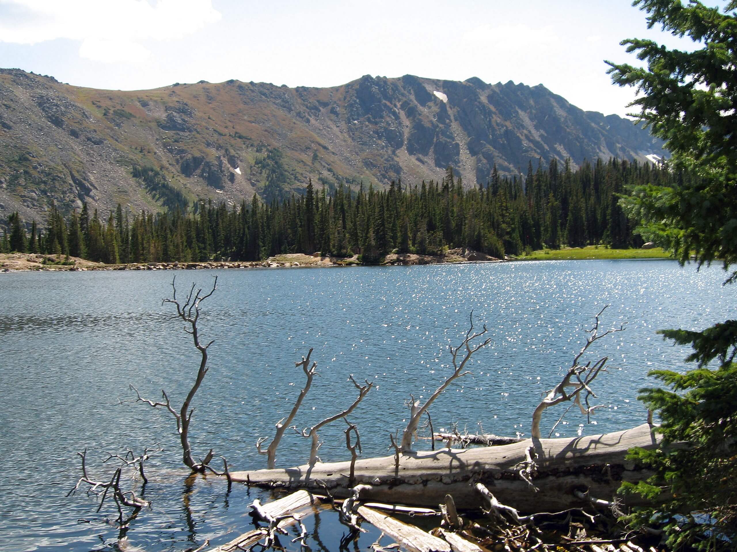
Jasper Lake Trail
Difficulty Rating:
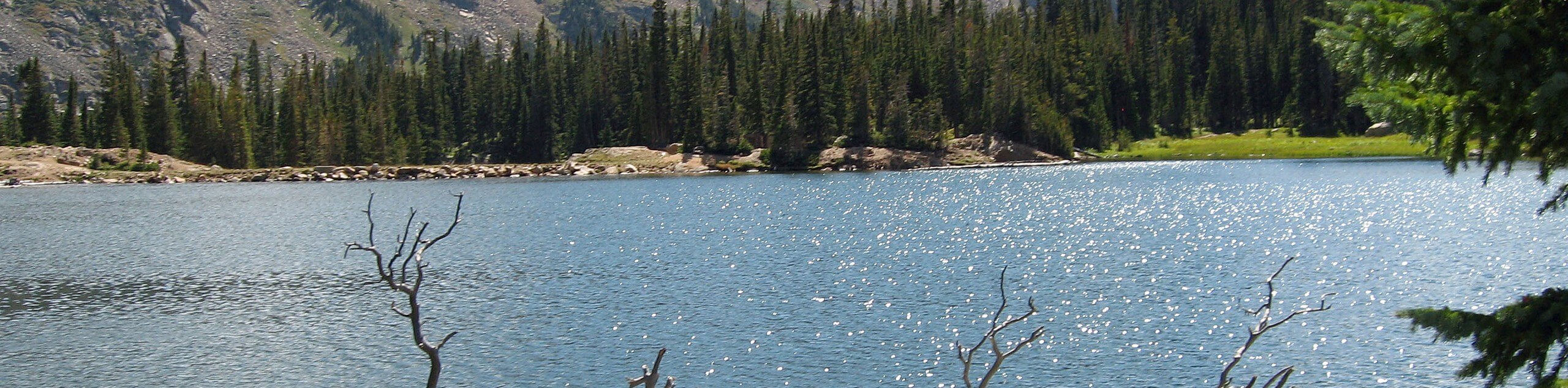
Jasper Lake Trail is a nice, half-day hike through the Indian Peaks Wilderness to Jasper Lake. Following the curves of the Jasper Creek, this route guides hikers through the scenic, meadow laden valley between Chittenden and Skyscraper Peak before delivering you to Jasper Lake. The vistas from this alpine lake are like no other! Bask in the beauty of the Colorado Ranges and spot the towns of Nederland and Eldora in the distance!
Getting there
The trailhead for the Jasper Lake Hike is off the Fourth of July Road at the Hessie Parking Lot.

About
| Backcountry Campground | |
| When to do | March-October |
| Pets allowed | Yes - On Leash |
| Family friendly | Older Children only |
| Route Signage | Average |
| Crowd Levels | High |
| Route Type | Out and back |
Jasper Lake Trail
Elevation Graph
Weather
Jasper Lake Hike Description
The Jasper Lake Hike is a crowd-favorite in the Roosevelt National Forest. The trail begins from the Hessie Carpark, arrive early to secure a spot as parking is limited! If you are worried about securing a spot, consider taking the RDT free shuttle from the town of Nederland! This trail is moderate, and the elevation gain is fairly gradual, but nonetheless considerable. Wear sturdy footwear and consider bringing hiking poles to help you navigate this trail. As you meander through the aspen forests and lush meadows keep an eye out for moose and elk! They are often spotted along this trail!
Start your journey from the Hessie trailhead by hooking onto the Hessie Road Trail. Keep venturing along Hessie Road, crossing the North Fork Middle Boulder Creek. After crossing the creek, the trail becomes the Devil’s Thumb Trail. Continue along this wooded trail staying right at the junction, merging onto Devil’s Thumb Bypass Trail. The path will border the edge of Jasper Creek as it gains elevation and merges back onto the Devil’s Thumb Trail. Following along this path, the elevation gain will become more intense. At this point the trial becomes exposed and rocky. Stay left at the next junction. This last segment of the trek requires attention as you navigate rocks and boulders prior to cresting the lake. Once at the lake you will have an exceptional vantage point of Mount Jasper and neighboring peaks! On a clear day you will also be able to spot the towns of Eldora and Nederland in the distance!
If you want to lengthen your adventure, continue left on Devil’s Thumb Trail. This extension will bring you to Devil’s Thumb Lake. If you wish to return to the carpark, retrace your steps, staying right at the first junction. Continue along the path until you arrive back at the parking lot.
Similar hikes to the Jasper Lake Trail hike

Caribou Pass Hike
The Caribou Pass Trail scales the west side of the Continental Divide. This short but steep hike will get your…

Buchanan Pass Loop
The Buchanan Pass Loop is an awesome adventure trail. Adults and kids alike will enjoy this wildflower-speckled trail as it…

Beaver Creek Trail
Beaver Creek Trail is a great wooded hike through the Colorado wilderness. With picturesque babbling brooks and past vast wildflower…
Comments