
Lake Isabelle Trail
View Photos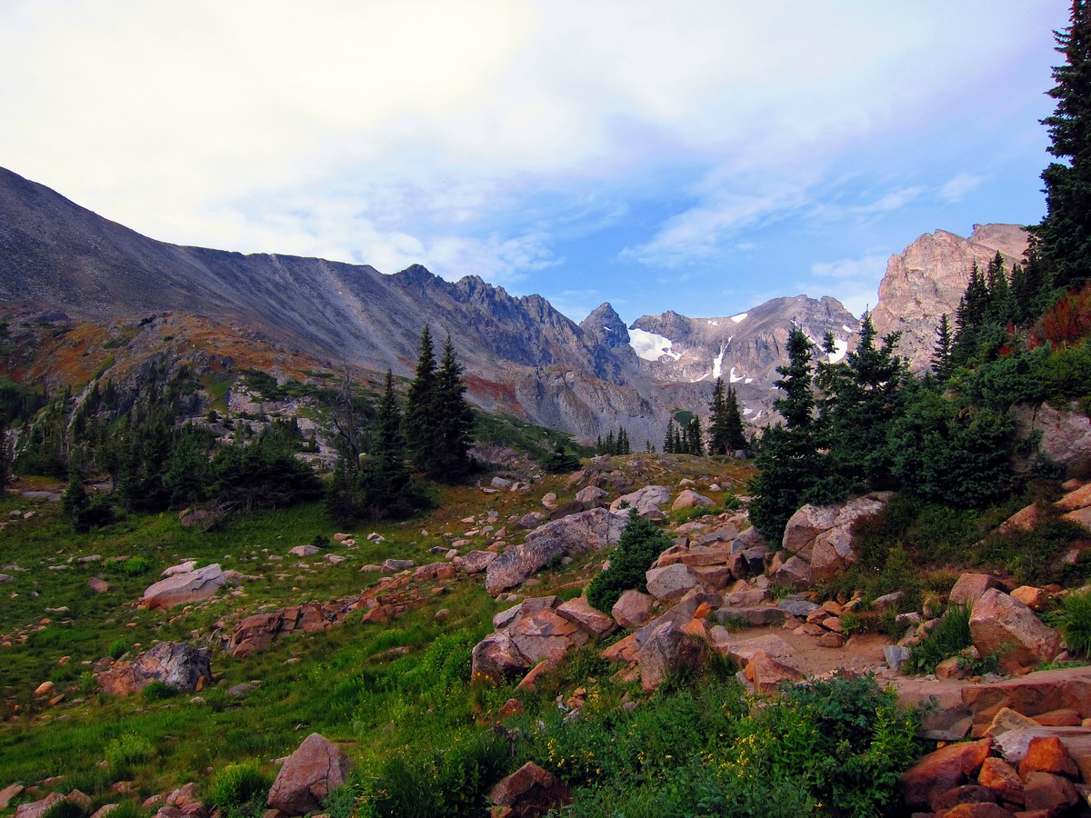

Lake Isabelle Trail
Difficulty Rating:
The fantastic Lake Isabelle trail is one of the best Nederland hikes, and one of our favorites in the Indian Peaks Wilderness! You’ll need to arrive early, as the parking lot tends to fill up very quickly in peak season; however, this beautiful alpine lake with views of the Isabelle Glacier is well worth the trouble.
Getting there
To get to the Lake Isabelle trailhead, drive through the town of Ward to the end of Lefthand Canyon Drive. Turn right on CO-72 then quickly turn left onto Brainard Lake Road. Go through the pay gate, and head to the Long Lake trailhead.

About
| When to do | Early June to Late September |
| Backcountry Campsites | Yes, at Pawnee Campground |
| Toilets | Yes, primitive pit toilets |
| Family friendly | No |
| Route Signage | Average |
| Crowd Levels | High |
| Route Type | Out and back |
Lake Isabelle Trail
Elevation Graph
Weather
Route Description for Lake Isabelle Trail
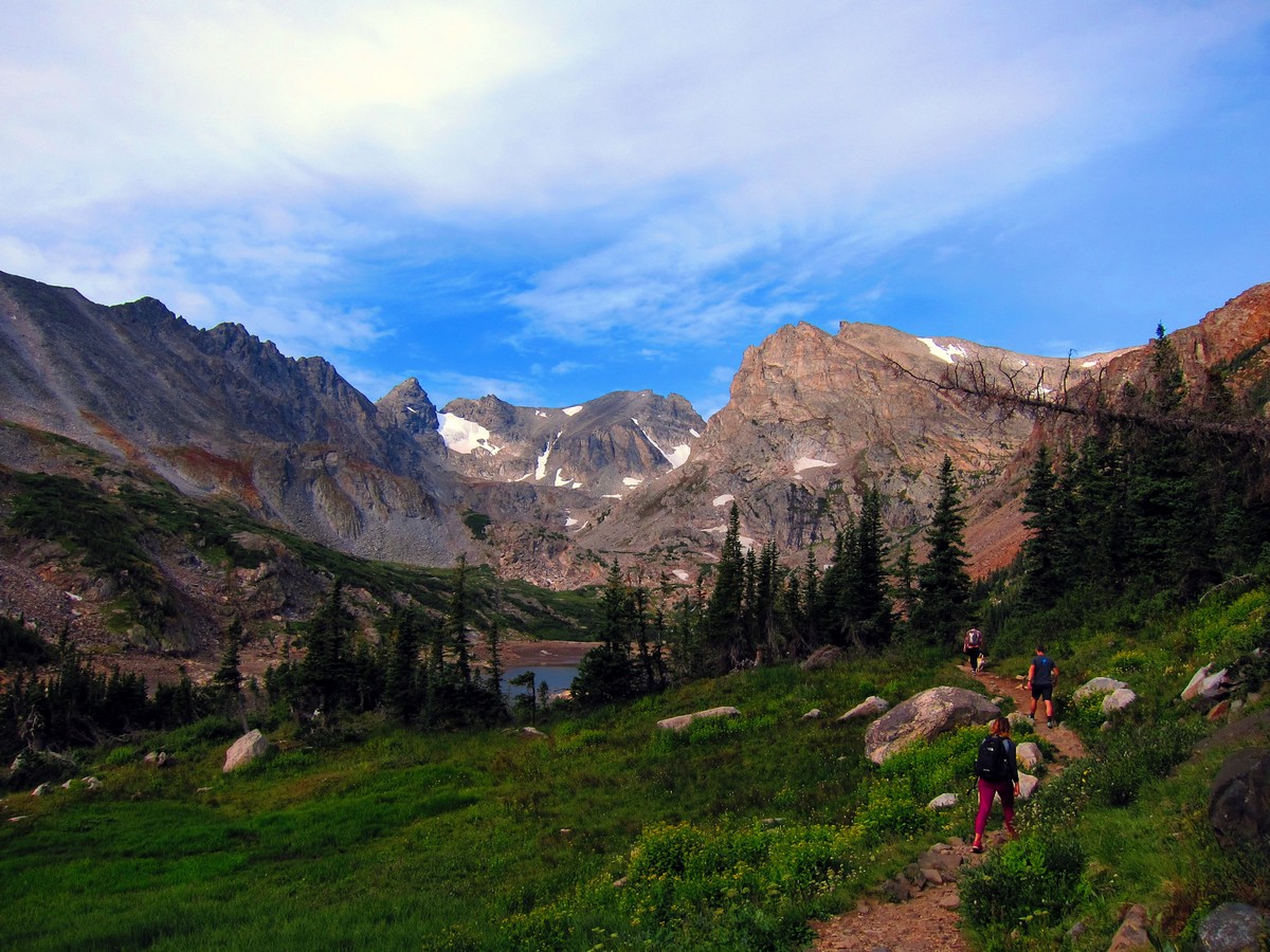
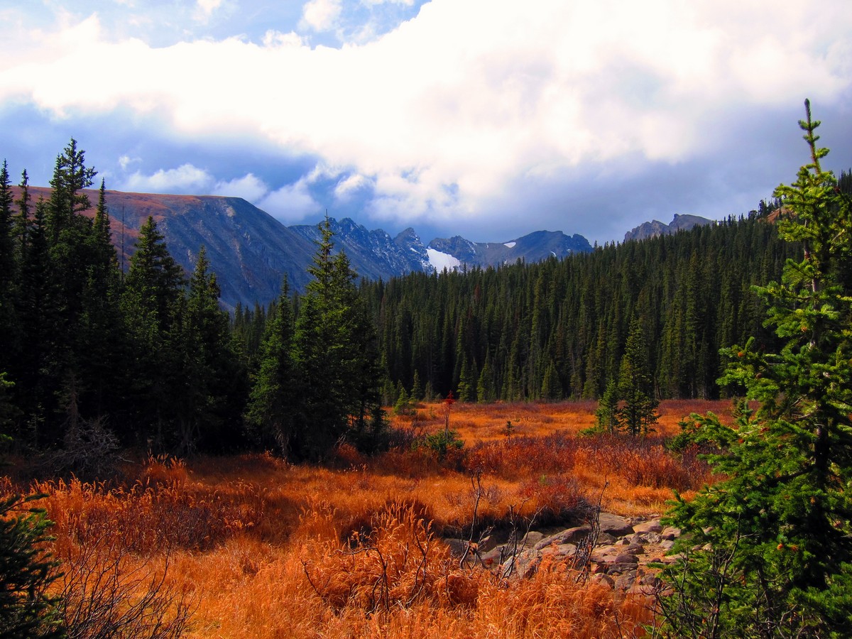
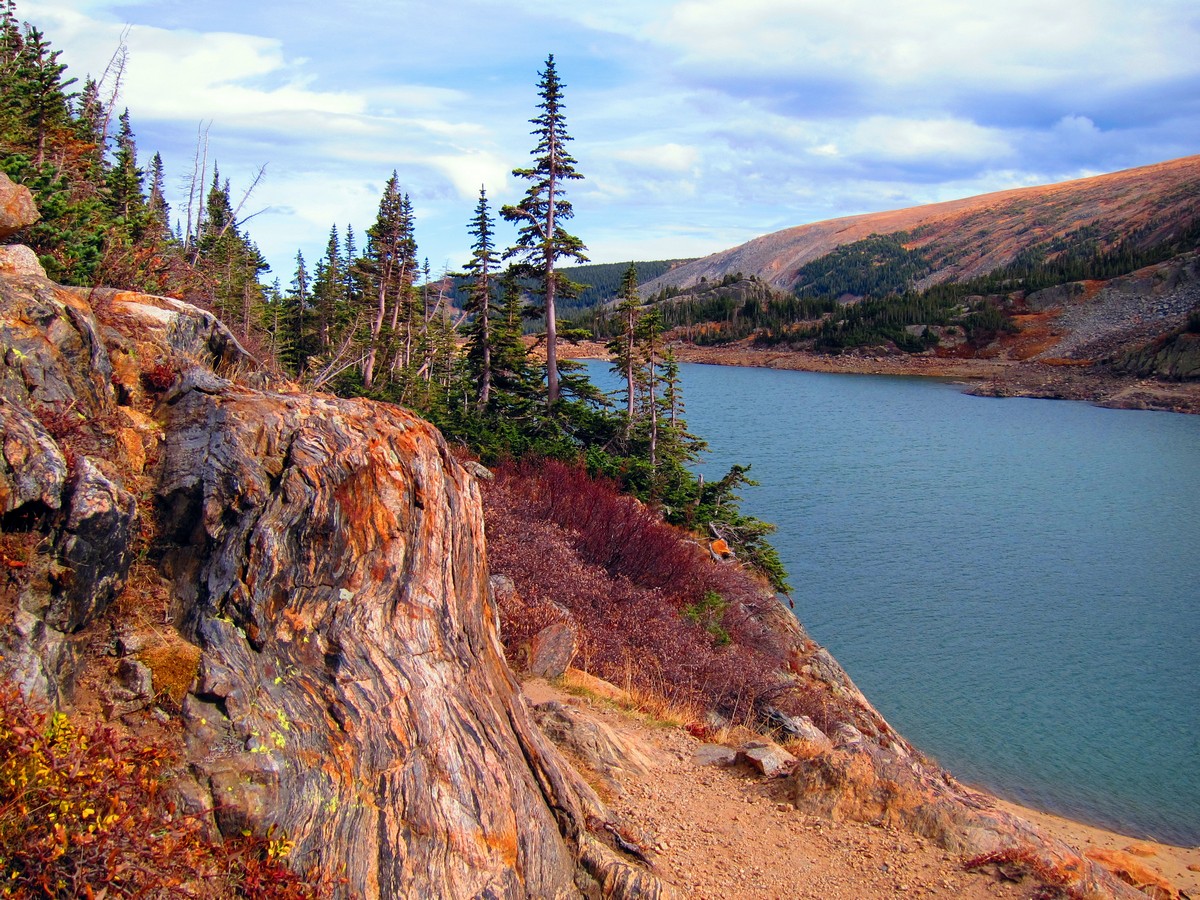
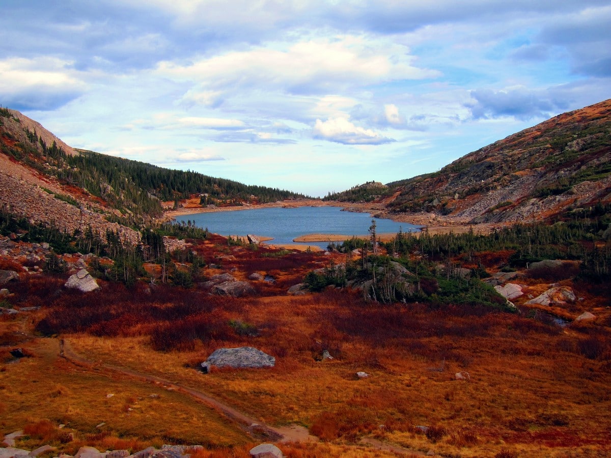
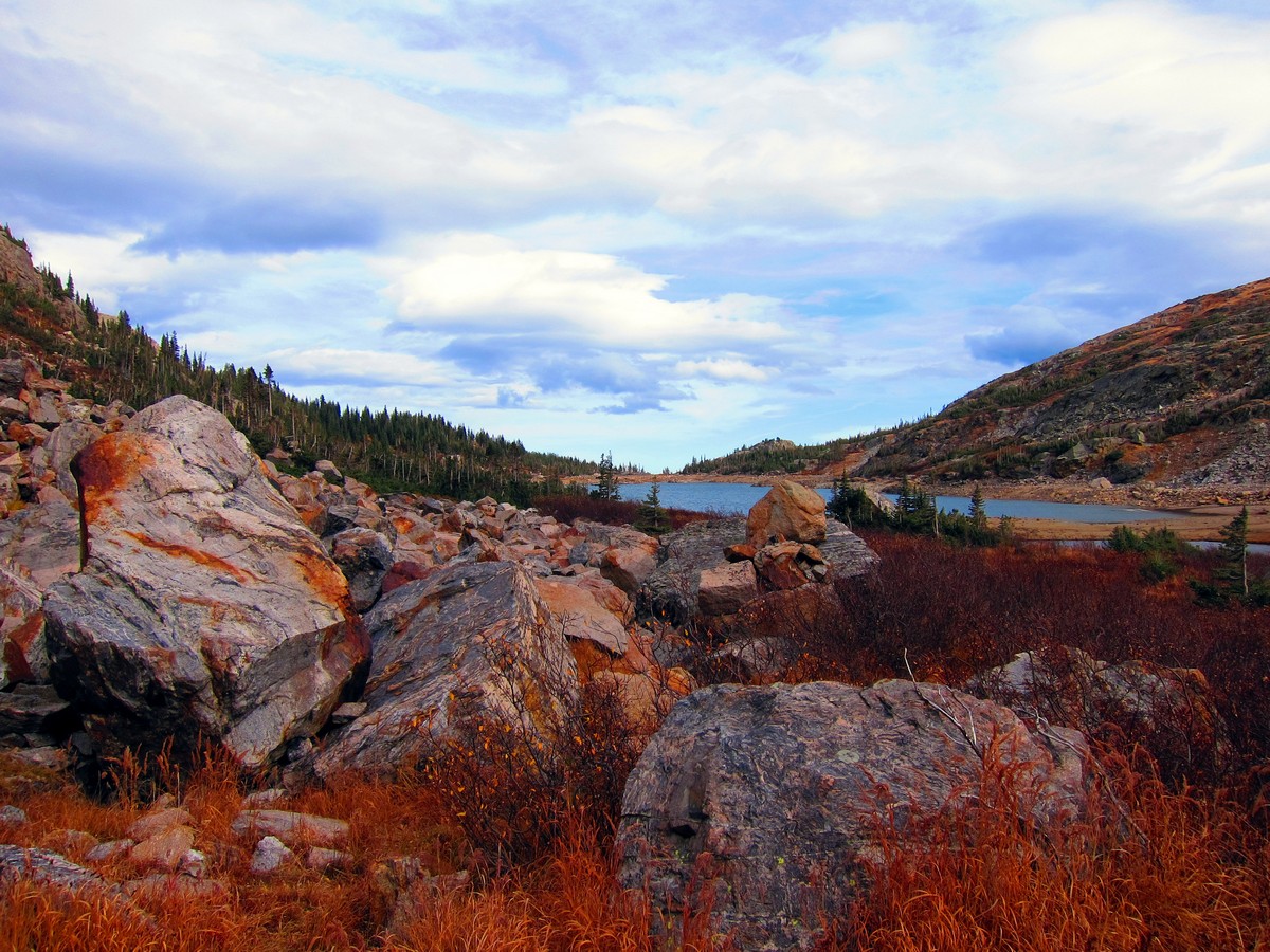
Start the Lake Isabelle Trail by finding the trailhead with the same title. From the trailhead, the trail gradually ascends through the forest until it reaches the tip of Long Lake. At Long Lake the views open up and you should be able to see Isabelle Glacier and the surrounding Indian Peaks. Stay on the north side of the lake as you hike parallel to the shore.
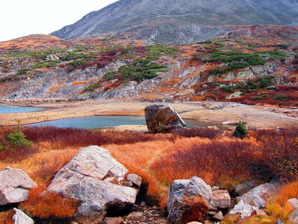
You will understand why it is called Long Lake as you continue to hike along the shore further back into the mountains. Past Long Lake, the trail gains elevation, and slowly ascends above the tree line. A few small switchbacks take you to the amazing Lake Isabelle with views of the surrounding mountains. You can appreciate this for a moment before the final ascent.
You’ll take some exciting switchbacks up and up until you find a pool that is part of the South Saint Vrain Creek. From here you can look up to Navajo Peak (13409ft). It’s the prominent mountain in the middle of the mountain cirque. When you’ve had your fill of great mountain views, head back down the way you came.
Hiking Trail Highlights
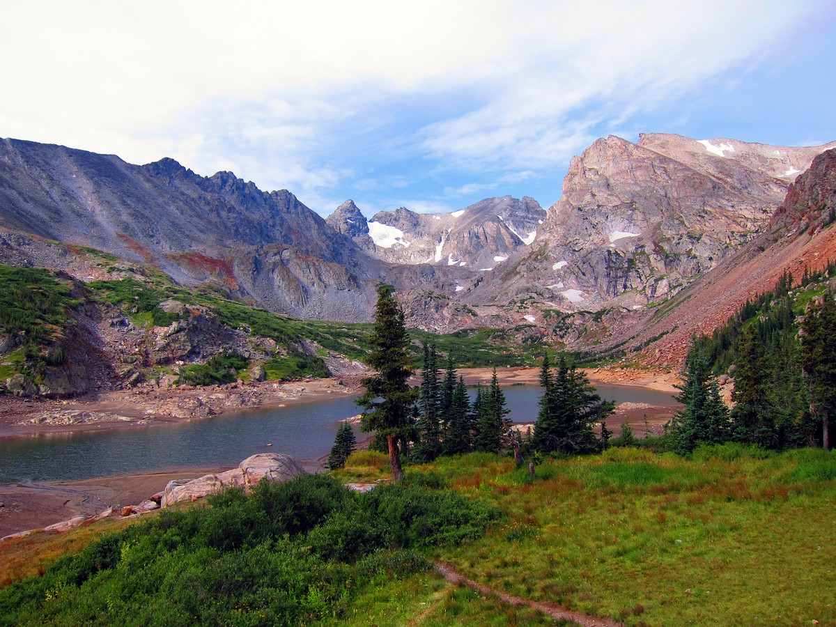
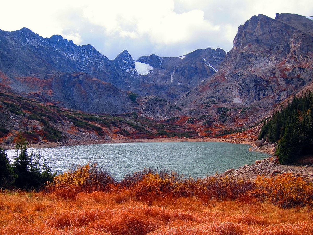
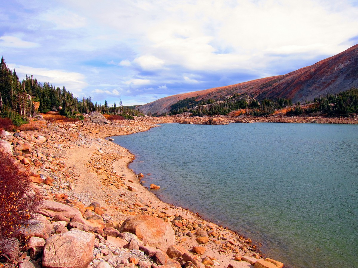
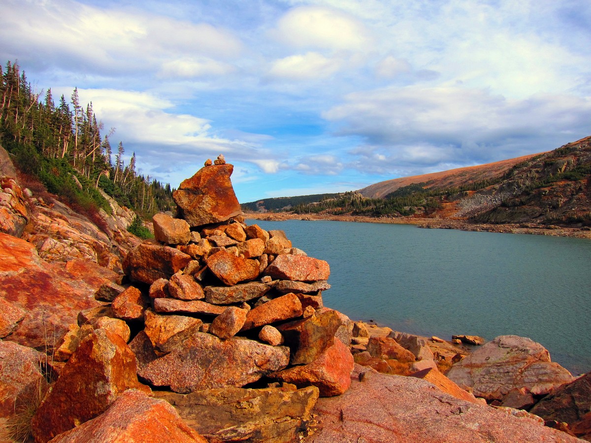
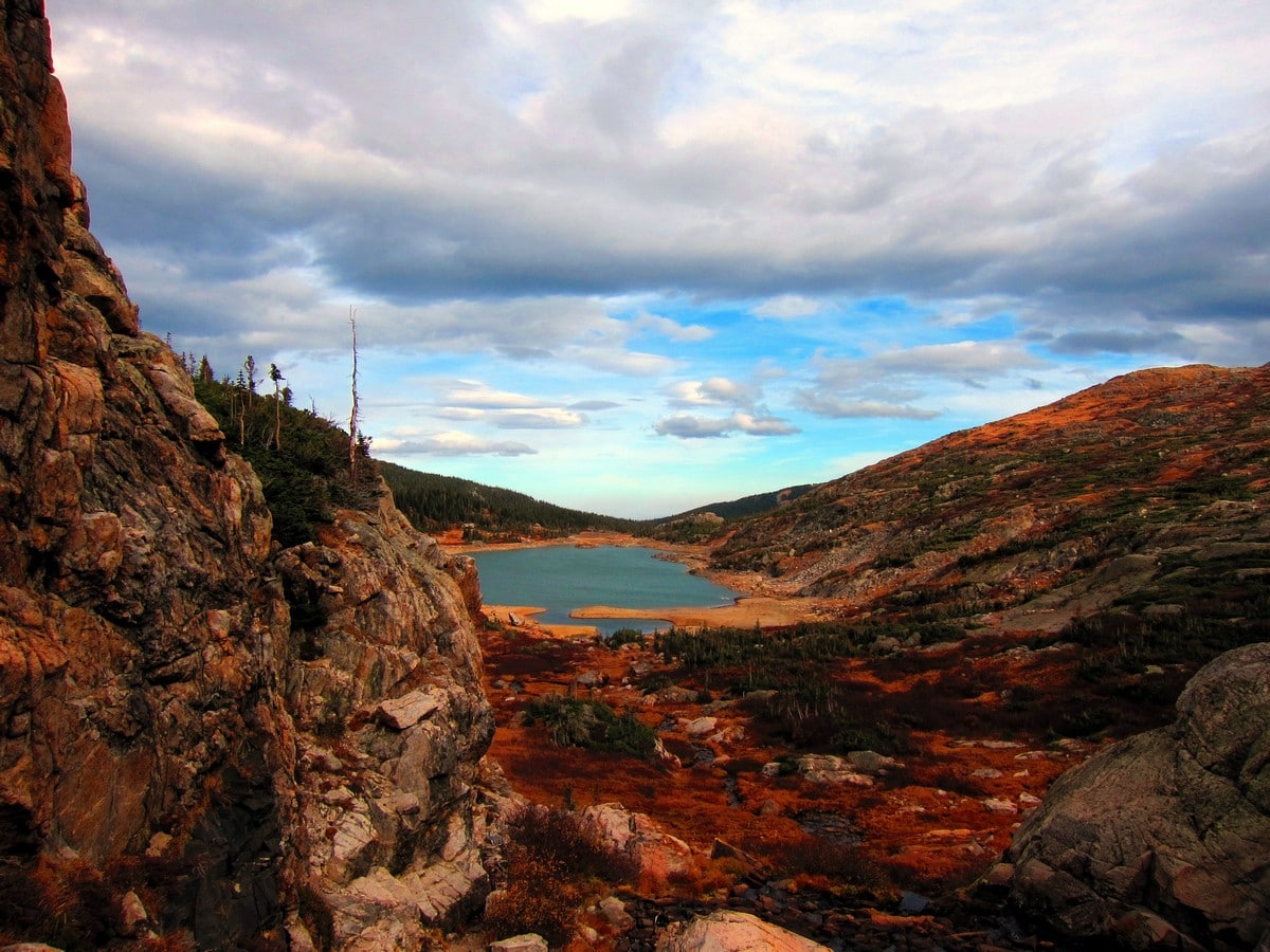
Lake Isabelle

Lake Isabelle is one of the prettiest lakes in the Indian Peaks Wilderness, located just 2.1 miles from the Long Lake trailhead in the Brainard Lake Recreation Area. It sits at the heart of a stunning alpine valley, surrounded by imposing, craggy peaks and sparsely dotted green trees.
This beautiful part of the Indian Peaks Wilderness Area is very popular, and once you set out on this hike, you’ll soon understand why! In spring and summer the trail leading to the lake is strewn with colorful wildflowers, and the snow-capped peaks provide the perfect backdrop for a fun family picnic.
Visitors should note that Lake Isabelle is actually a reservoir, and in August it is often drained to provide water for local agriculture. We’d recommend visiting before August or in late September to enjoy the views of the lake at its best.
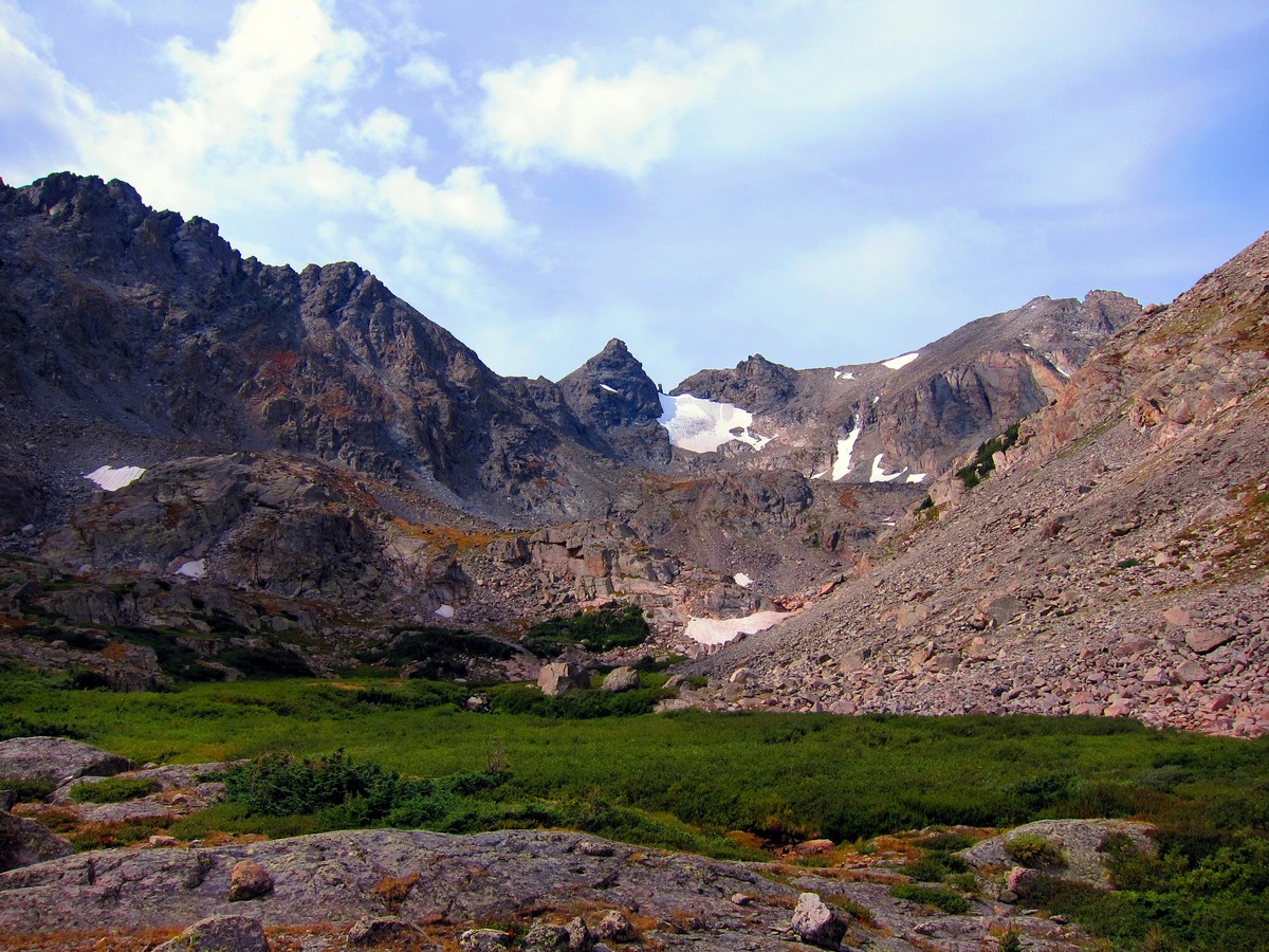
Isabelle Glacier
The Isabelle Glacier is located a quarter of a mile southwest of Shoshoni Peak, one of the towering mountains that looks over Lake Isabelle. The glacier sits on the east side of the Continental Divide, mirrored by Fair Glacier, which occupies a similar position on the west side of the Continental Divide.
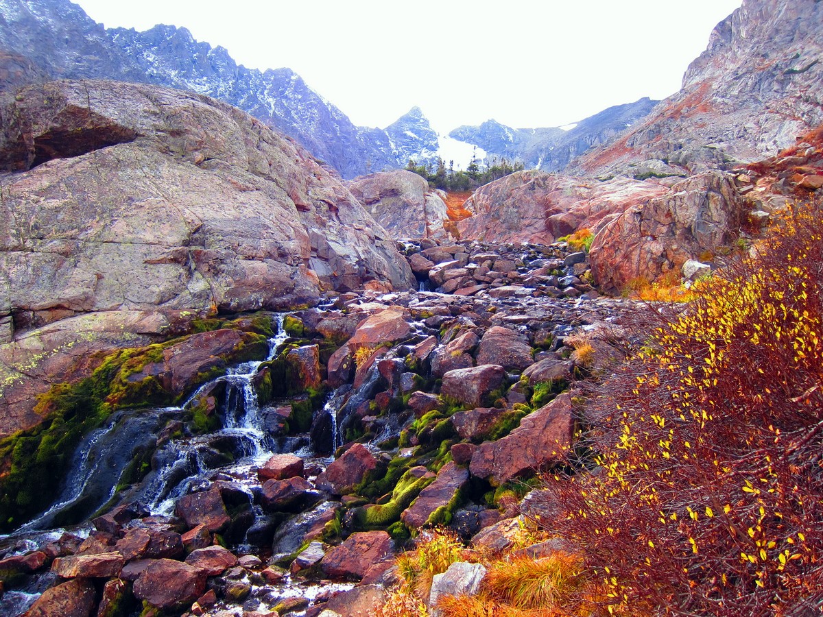
The Isabelle Glacier is the source of the South Saint Vrain Creek, and the route to the glacier is through a wet valley, passing picturesque meadows and tumbling waterfalls. The views from the base of the glacier itself are incredibly dramatic, looking over the Navajo, Apache and Shoshoni peaks.
Navajo Peak
The towering Navajo Peak will dominate your view on this lovely trail in the Indian Peaks Wilderness. Standing at an elevation of 13409ft above sea level, this distinctive, craggy mountain is a powerful draw for mountaineers and hikers, although summiting it is a significant challenge.
Although it just misses out on being classed as one of Colorado’s iconic 14ers, Navajo Peak should not be taken lightly, and is an excellent choice for hikers looking for a really strenuous challenge. Navajo Peak is the third highest mountain in the Indian Peak Wilderness, and is particularly famous as the site of a fatal plane crash in January 1948. The debris from the wreckage can still be seen on the mountain.
If you want to find other great hikes in Indian Peaks Wilderness, check out the Lone Eagle Peak hike, Rainbow Lakes trail or the Arapaho Glacier Trail.
Insider Hints
National Park Annual Pass is accepted at the gate, otherwise, Brainard Lake Recreation Area is Cash Only ($11 per Passenger Vehicle).
Many people stop at Lake Isabelle and this makes an easier and wonderful day trip for people who want a less strenuous hike.
Explore this area in early spring when there is still snow on the ground. Be aware of avalanche conditions. The main gates will be closed, but you can park at a large parking lot at the main entrance and hike in for free. During this time there will be fewer people on the trails and it’s ideal for snowshoeing. You can hike in following the main road, past Brainard Lake, until you reach the trailhead for Lake Isabelle. This will add about 4mi to the overall trip, but this area is incredible with snow on the ground. Snowshoes can be rented in the Town of Nederland at Happy Trails Café.
This trail is exposed to the elements, so be prepared for high winds, sun exposure and storms in the afternoon and evenings.

Similar hikes to the Lake Isabelle Trail hike

Caribou Pass Hike
The Caribou Pass Trail scales the west side of the Continental Divide. This short but steep hike will get your…

Buchanan Pass Loop
The Buchanan Pass Loop is an awesome adventure trail. Adults and kids alike will enjoy this wildflower-speckled trail as it…

Beaver Creek Trail
Beaver Creek Trail is a great wooded hike through the Colorado wilderness. With picturesque babbling brooks and past vast wildflower…
marysmith 4 years ago
We fell in love with the vibrant color of the surroundings here. It's simply stunning!
CandyJ 4 years ago
It is a lovely trail with lots of great views to offer.
Suzy TQ 4 years ago
Beautiful trail and views! Lots of wildflowers. The approach to Lake Isabelle is steep and rocky but the views are amazing!
Earl M. 4 years ago
Great for a short afternoon hike! The mountains around the lake were so beautiful this time of year.
Stevie M 4 years ago
This is a spectacular hike with breathtaking views. I have done it several times and it never fails to impress.
Kelsi Honet 4 years ago
10 out of 10 because the weather was spectacular as well.
Jane Lewitt 4 years ago
I have done this hike multiple times and it just amazes me every time. The lake, the mountains ... breath taking views!
BoulderBound 4 years ago
This is a spectacular hike with breathtaking views. I'm really impressed with the pretty Lake Isabelle.
Digi K. 4 years ago
Good hike. Nature's beauty was fantastic. Took us solid 4 hours to complete this hike. It was pretty cool.
merry g. 4 years ago
Splendid hike with incredible lake views. There were small switchbacks along the way.