Lake Dorothy hike
View Photos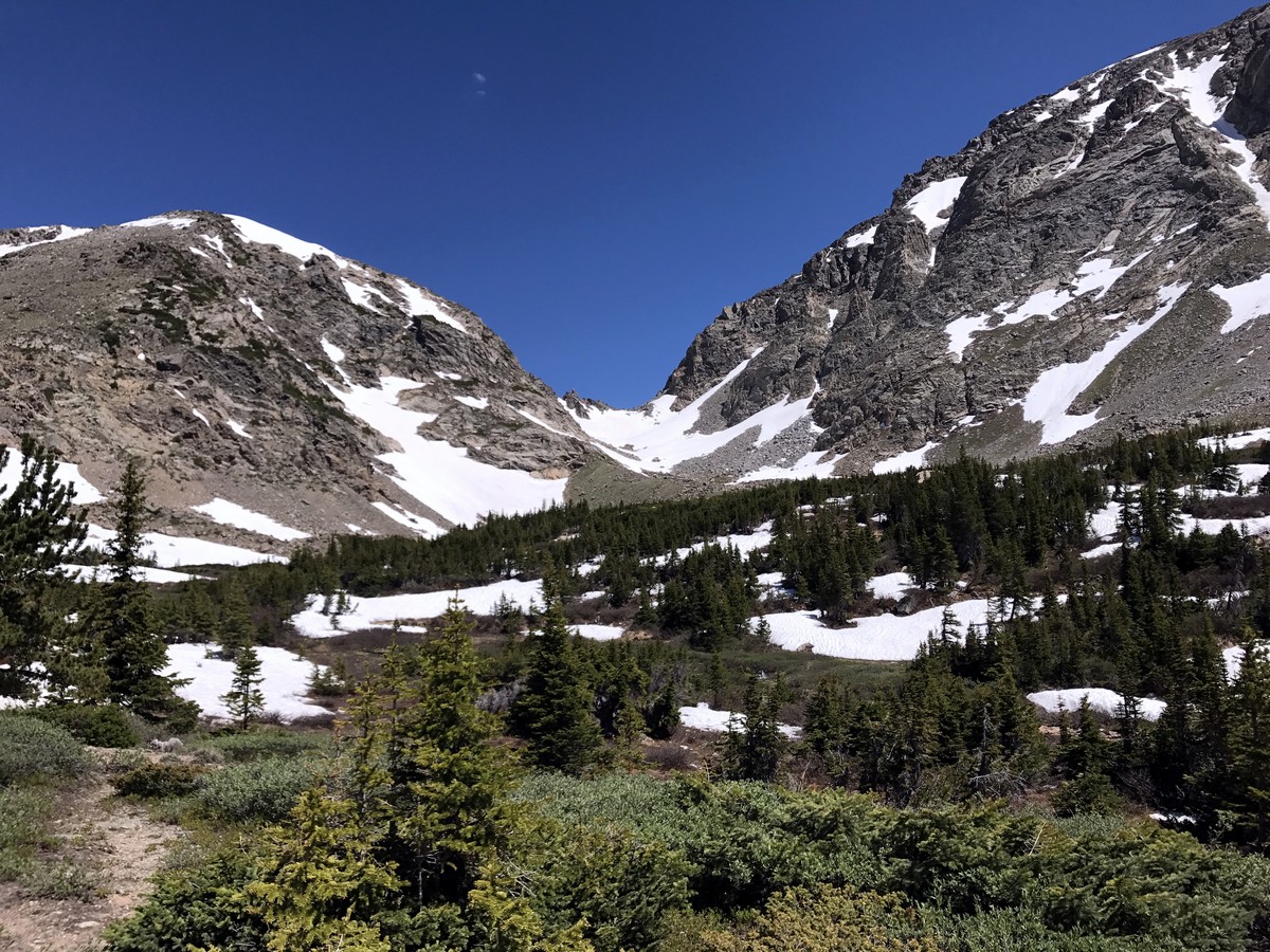
Lake Dorothy hike
Difficulty Rating:
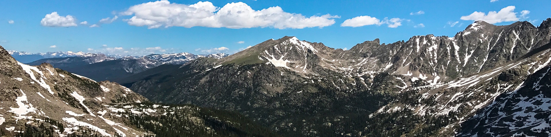
This hike through the Indian Peaks has an awesome reward: Lake Dorothy. Lake Dorothy is a beautiful alpine lake at the base of Mount Neva. The stunning mountain backdrop of Mount Neva is something special.
Getting there
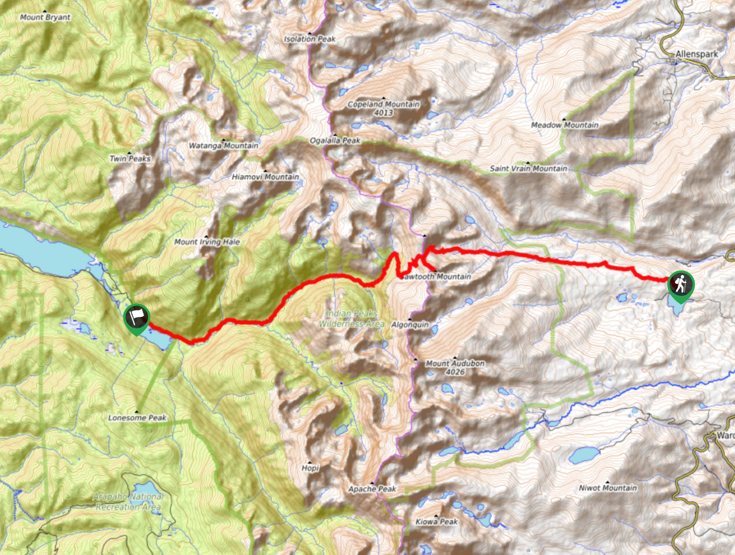
To get to the Lake Dorothy Trailhead, from Nederland traffic circle, take the 3rd exit, South onto N Bridge St./Peak to Peak Hwy. Turn right on Eldora Rd. Continue onto Hessie Road where it turns to gravel. Take a Right on 4th of July Rd up to the parking.

About
| When to do | Early June to Late September |
| Backcountry Campsites | Yes, in the Fourth of July Campground |
| Toilets | Yes, see insider hints |
| Family friendly | No |
| Route Signage | Average |
| Crowd Levels | Moderate |
| Route Type | Out and back |
Lake Dorothy
Elevation Graph
Weather
Lake Dorothy Trail Description
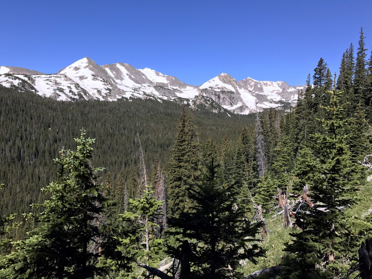
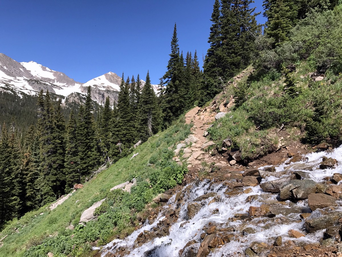
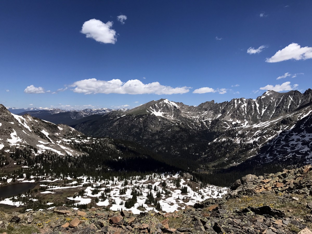
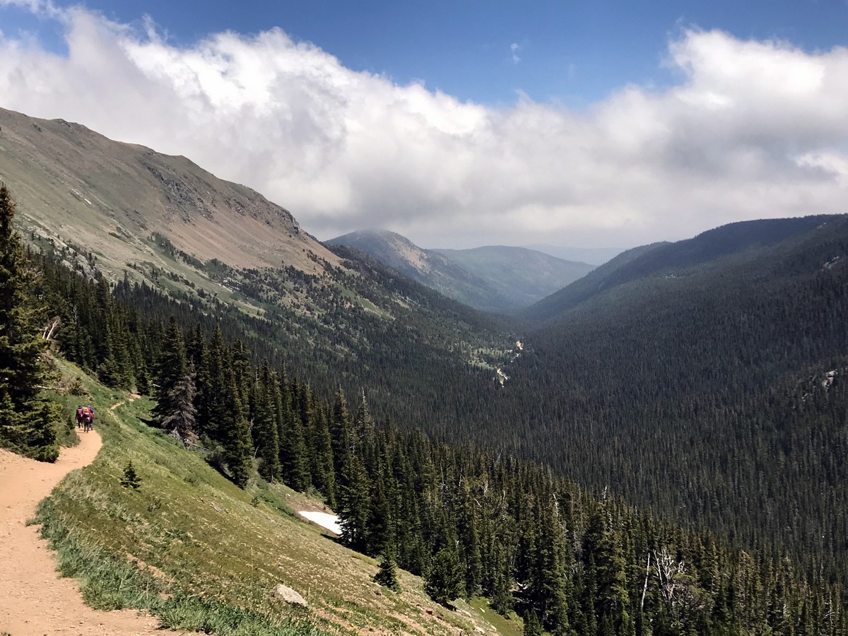
The Lake Dorothy Trailhead begins at the end of Fourth of July Road. At the trailhead you will begin on Arapaho Pass Trail from a well-marked trailhead with a map of the surrounding area. From the trailhead you can look down the valley and see Eldora Mountain Ski Resort. The trail slowly gains elevation as it traverses along the valley below, through the thick pine forest.
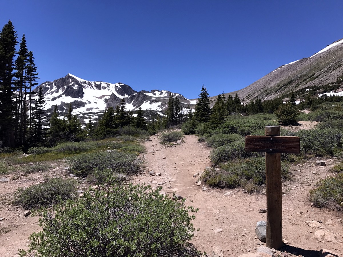
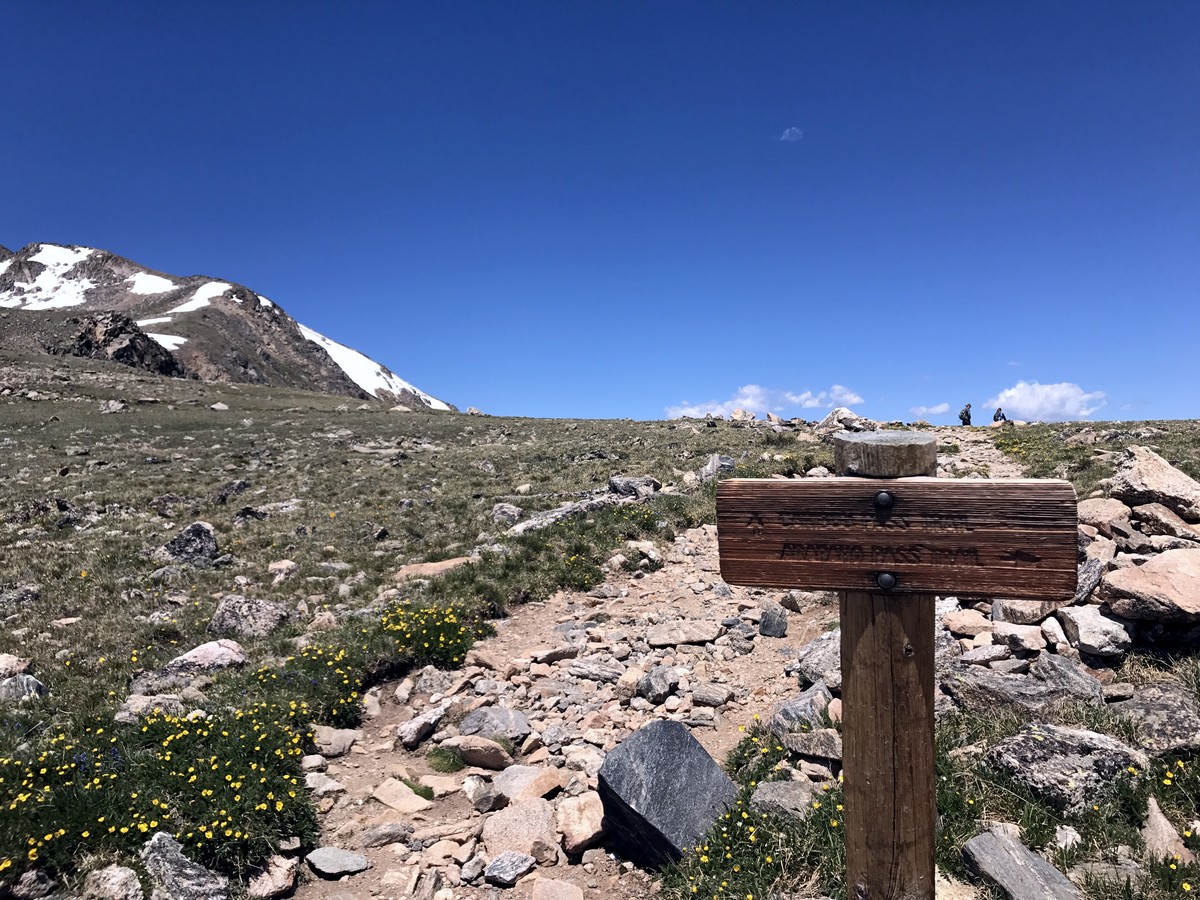
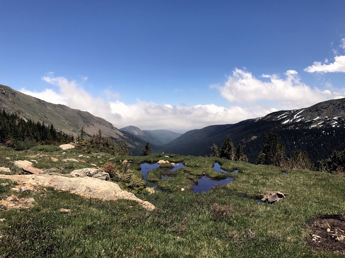
As you continue to gain elevation, there is a junction in the trail and a sign; you’ll continue to Arapaho Pass / Lake Dorothy. Eventually, the trail rises above the tree line and the views become expansive.
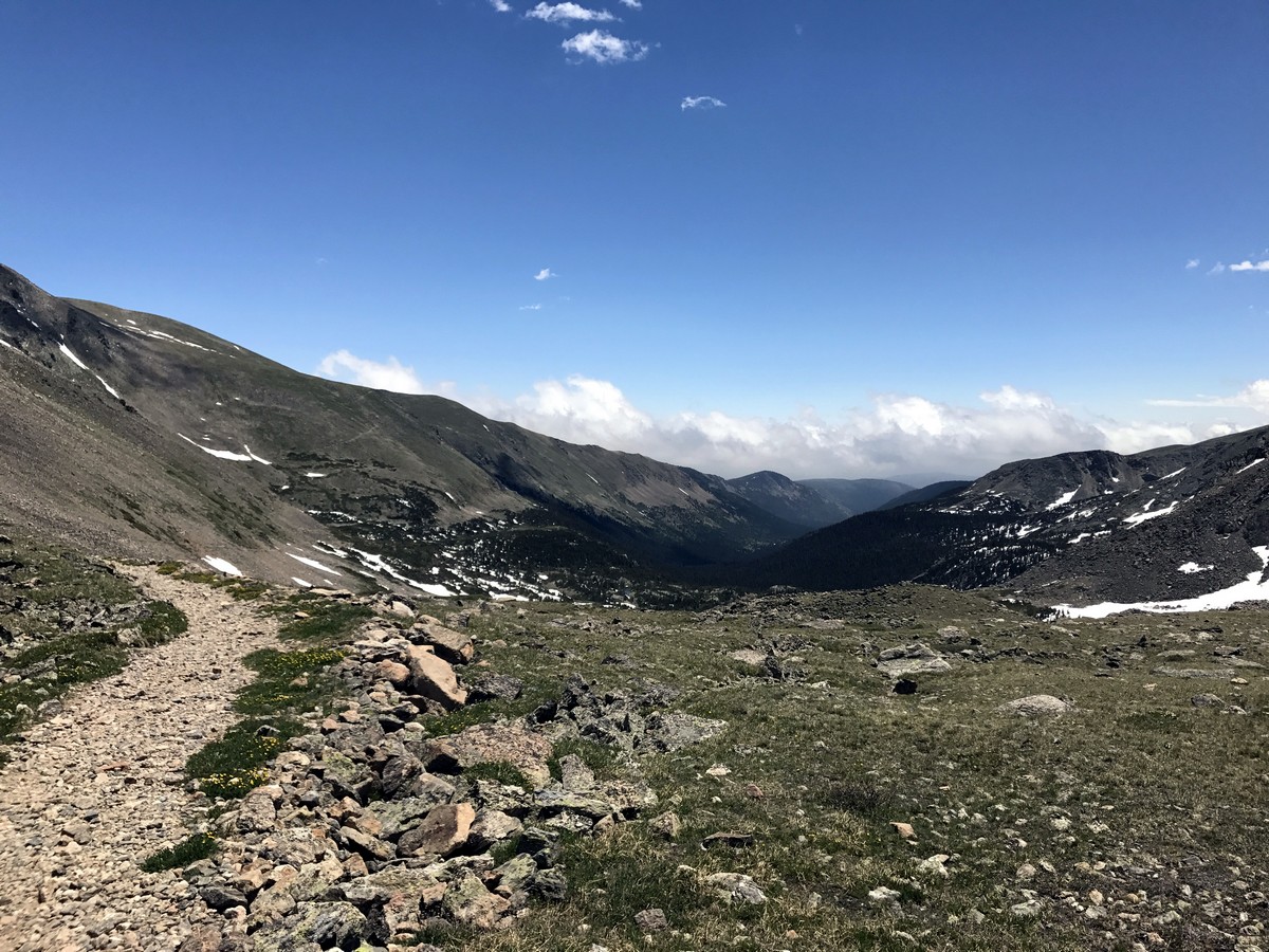
Once you arrive in the flat alpine meadow there is a second junction in the trail. Continue to Arapaho Pass, avoiding the steep switchbacks that lead up to Arapaho Glacier.
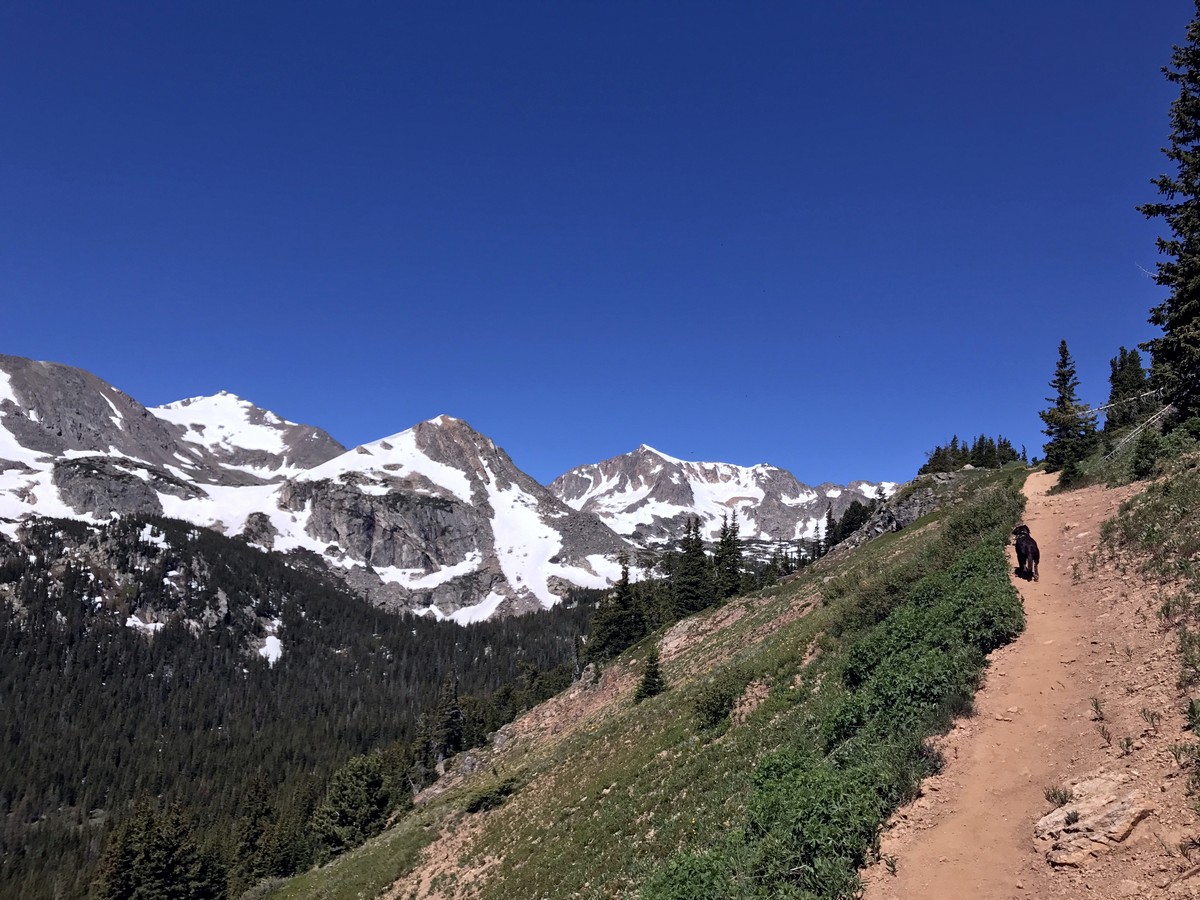
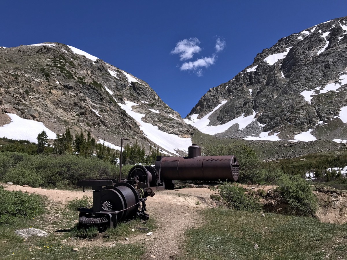
Along the way there is a historic mining site with remains of heavy industrial equipment. This area makes for a good rest stop before marching up the sustained climb to the Continental Divide and Lake Dorothy. The path to the top is obvious and straightforward.
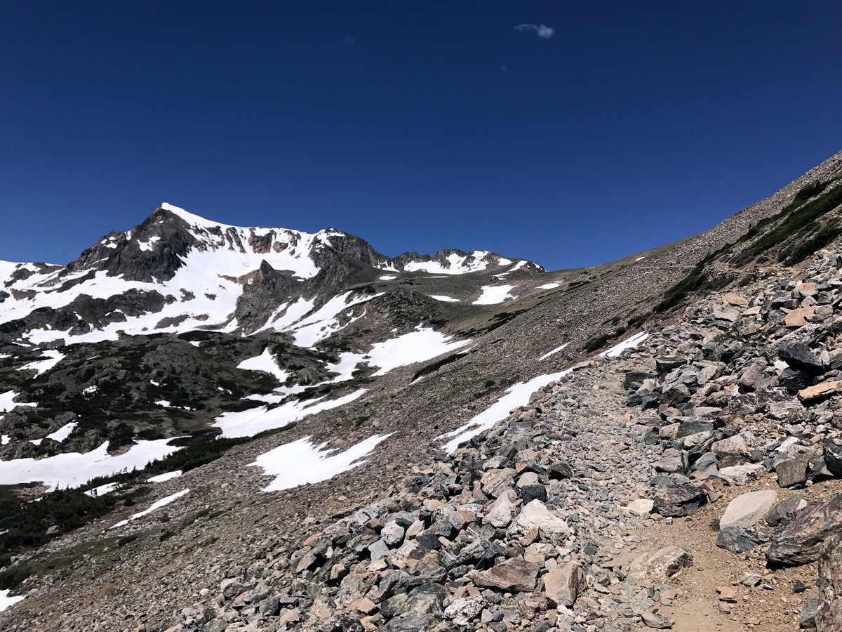
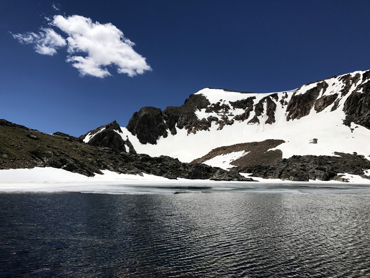
A ramp traversing along the side of the mountain becomes rocky and exposed to the elements. Once arriving on top of Arapaho Pass, Lake Dorothy is to the west, or hikers’ left, and sits at the base of Mt. Neva with an elevation of 12821ft.
You can walk back to the pass and look down onto Caribou Lake, before heading back down the way you came.
Hiking Trail Highlights
Lake Dorothy
Nestled in the southern part of Indian Peaks Wilderness, hikers can find the lopsided heart-shaped Lake Dorothy. This natural alpine lake makes for a fantastic picnic spot, where hikers can rest their legs and enjoy a sandwich or two.
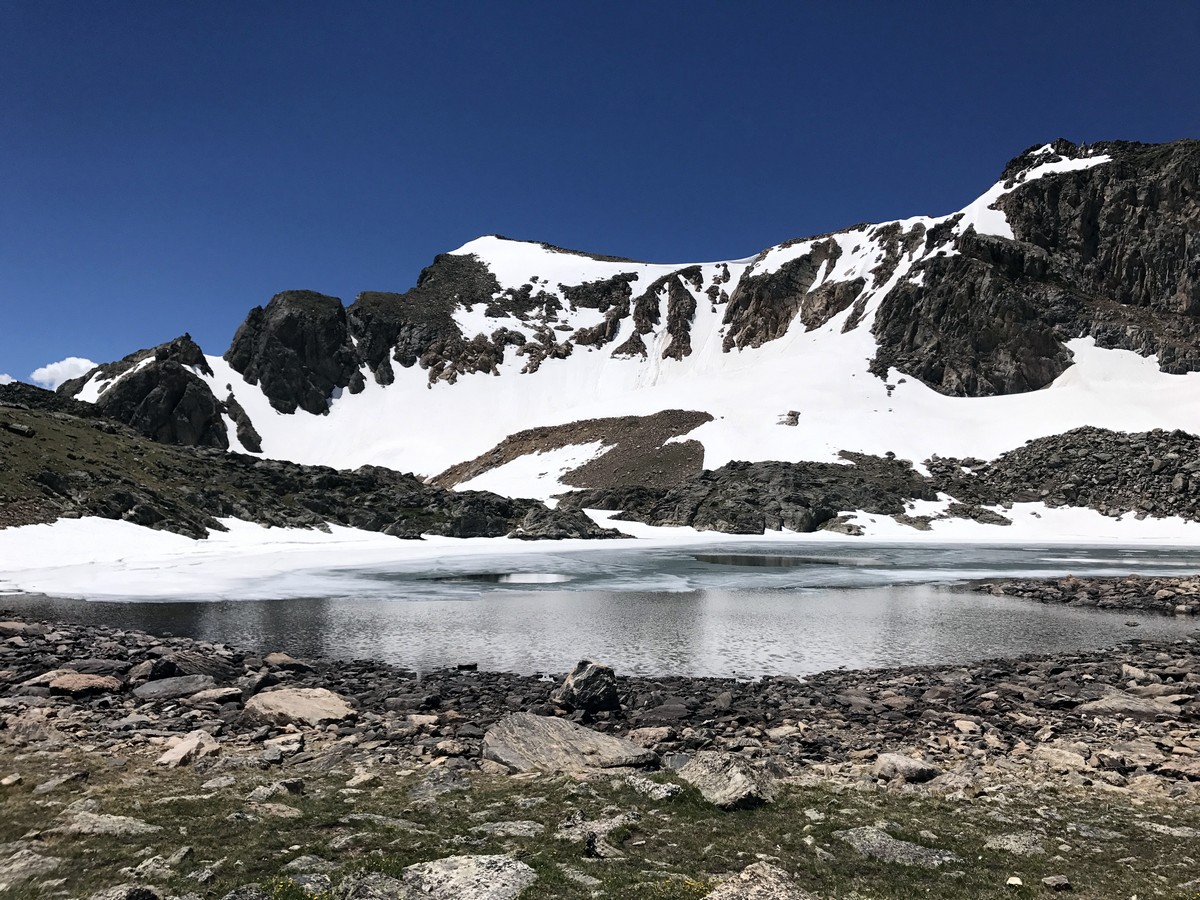
As you walk along the lake, keep eyes peeled for red belly marmots, which can be seen sunbathing on the rocks. Though, it’s best to visit here during late summer, as Lake Dorthy can still be frozen in June— which isn’t surprising considering it’s the highest lake in the Indian Peaks Wilderness.
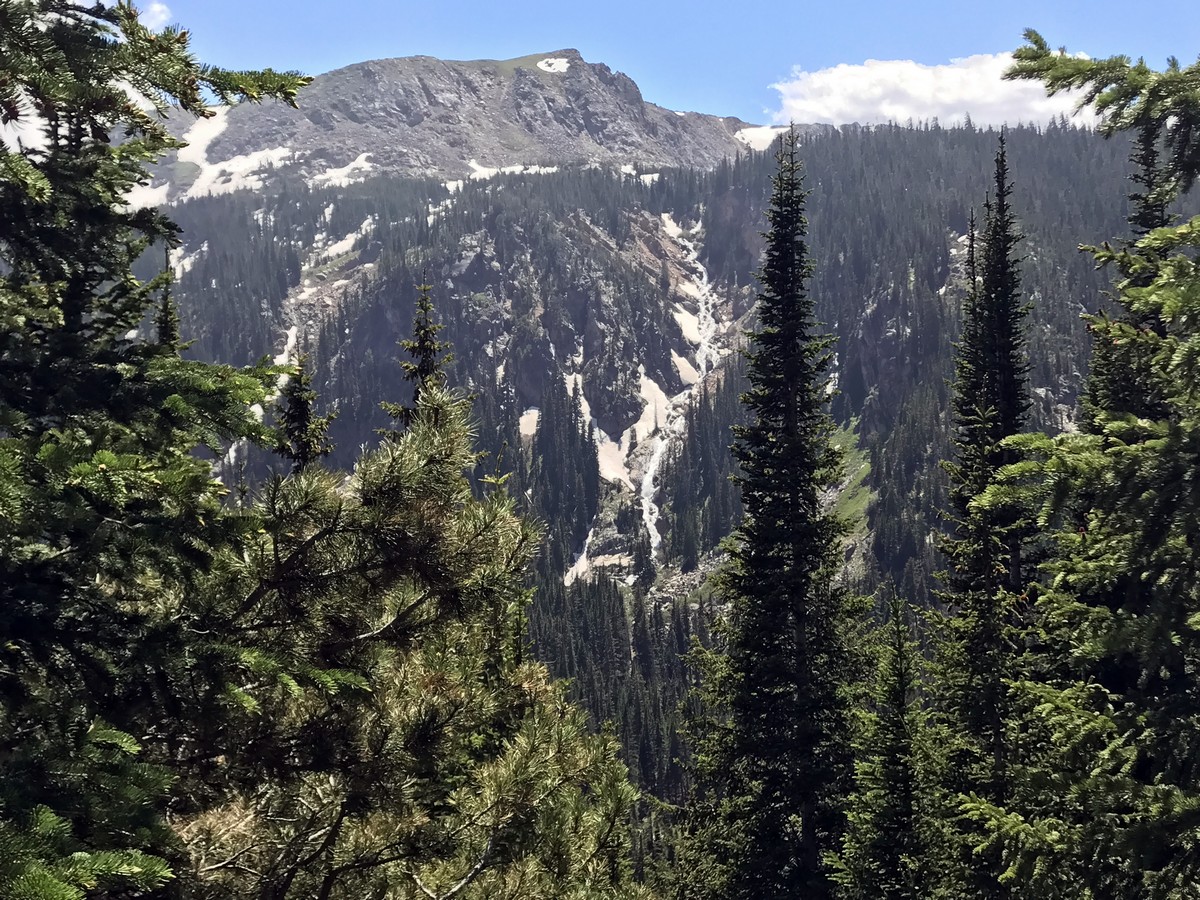
Mount Neva
Standing at 12821ft tall, Mount Neva is rather hard to miss on this hike. Noted as one of the most iconic peaks in the Indian Peaks Wilderness, you’ll want to stop and take in this mammoth throughout your walk. The mountain is actually climbable, but only those with extreme scrambling skills should attempt it, as it requires lots of crawling on hands and feet. For those less risk-averse, we recommend snapping a picture or two from the safety of the well-paved trail.
If you want to find other great hikes in Indian Peaks Wilderness, check out the Lone Eagle Peak hike, Lake Isabelle trail, Rainbow Lakes trail or the Arapaho Glacier Trail.
Insider Hints
Unimproved camping is available at 4th of July Campground, you might be able to guess how this area came to be named 4th of July, here is a guess; it has to do with snow!
The pit toilets on the trail are only open during the peak season (6/1-9/15).
Visit the Town of Nederland, and grab a bite at Crosscut Pizzeria & Taphouse or a beer at the Very Nice Brewing Company after your hike.
High clearance 4x4 vehicles are not required to tackle the gravel road up, but it wouldn’t hurt!
Plan for hiking over rocks and roots, and don’t be surprised if there is water that has collected on the trail. During late spring and summer, water runoff from the high mountains will continue to keep this trail wet; this creates an exciting waterfall crossing with stepping stones to get across.

Similar hikes to the Lake Dorothy hike

Caribou Pass Hike
The Caribou Pass Trail scales the west side of the Continental Divide. This short but steep hike will get your…

Beaver Creek Trail
Beaver Creek Trail is a great wooded hike through the Colorado wilderness. With picturesque babbling brooks and past vast wildflower…
Beaver Reservoir to Monarch Lake Hike
Beaver Reservoir to Monarch Lake Hike is a one-way trail in the Indian Peaks Wilderness. We love this hike because…
TopherSan 4 years ago
Make sure to bring your cameras if you plan to visit Lake Dorothy, as there are lots of great views to enjoy.
Stevie M 4 years ago
This is an absolutely beautiful trail from start to finish, with stunning views throughout and especially from the top.
Earl M. 4 years ago
Absolutely a beautiful and slightly challenging trail.
Jethro P. 4 years ago
Rewarding moderate hike. It is a good leg burner and a cardio workout. Gorgeous views.
Digi K. 4 years ago
One beautiful hike you shouldn't miss! The trail was rough and challenging but the rewards are great at the end.
Jordan A. 4 years ago
Sublime beauty. One of the most beautiful alpine lakes I've ever seen.
Jericho D. 4 years ago
An excellent workout! Not that hard but very rewarding.
Jasper Herrera 4 years ago
At the top, you'll find amazing views of mountain peaks. Lake Dorothy itself was a great beauty.
Em L. 4 years ago
Impressive scenery throughout the entire hike. It was moderately-easy and best for experienced hikers.
Ruel Z. 4 years ago
Marvelous hike. Would recommend it for those that have a good chunk of time and are ready for a challenge.