Arapaho Pass Trail
View Photos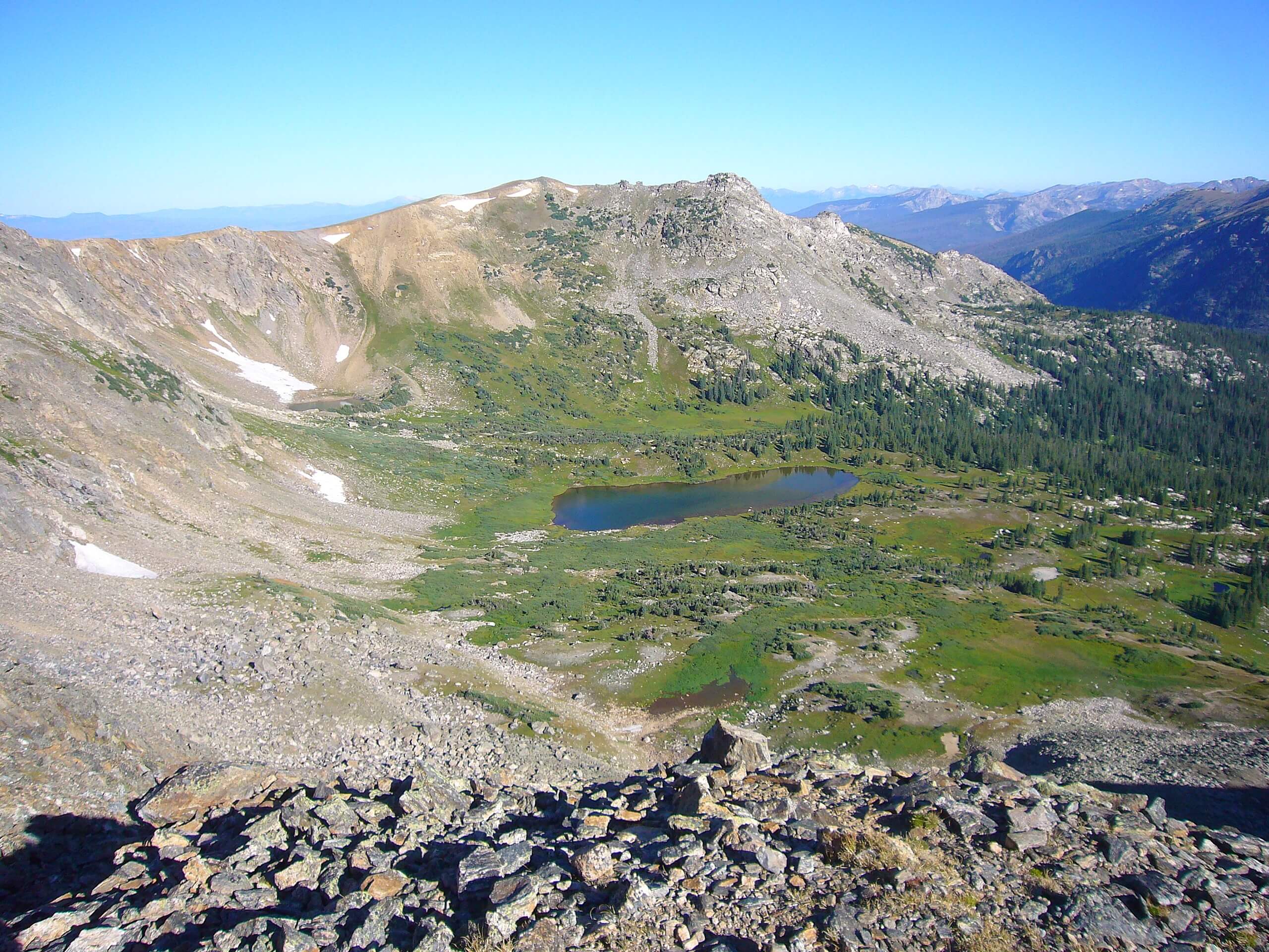
Arapaho Pass Trail
Difficulty Rating:
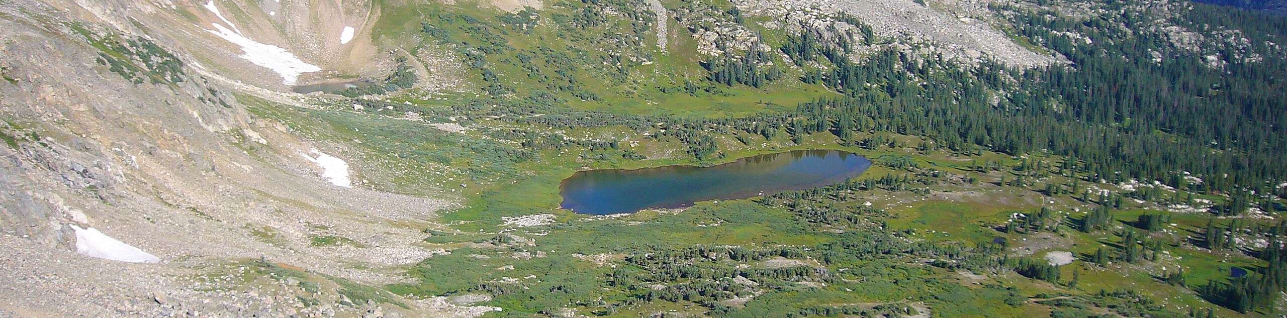
The Arapaho Pass Trail is a stunning hike through the wooded Colorado terrain up to the rocky pass. The sights from Arapaho Pass are unparalleled—you will be rewarded with views of the quintessential alpine lakes, snow-dusted summits, and forested valleys below. Short but steep, the trail is great for novice hikers and beginners alike.
Getting there
The Arapaho Pass Trail departs from the Fourth of July Trailhead at the end of the Fourth of July Road

About
| Backcountry Campground | Yes, permits required. |
| When to do | June-September |
| Pets allowed | Yes - On Leash |
| Family friendly | Older Children only |
| Route Signage | Average |
| Crowd Levels | High |
| Route Type | Out and back |
Arapaho Pass Trail
Elevation Graph
Weather
Arapaho Pass Hike Description
The Arapaho Pass Trail is a manageable hike up the ridge of the Continental Divide. The trail to the pass may be just as picturesque as the pass itself! You will begin this trail by walking through the dense Colorado woodlands near an alpine creek. The babbling creek creates a meditative ambiance as you ascend the trail. Additionally, this hike offers something for the history buffs too. After you summit the timberline, you will pass the Fourth of July Mine. Filled mine shafts are still visible and some rusted remnants of the old mine remain. T The path to the mine and up to the pass is very rocky, wear sturdy shoes to avoid rolling an ankle!
Begin this hike from the Fourth of July Parking lot. Take the trail signposted for Arapaho Pass. Follow along this path as it climbs through the forest, past cascading waterfalls and lush meadows. You will eventually meet an intersection, keep right on the Arapaho Pass Trail. After intersecting with the creek, you will encounter another junction. Again, stay on the Arapaho Pass Trail by heading northwest. At this point, you will be above the treeline and you will pass the mine before beginning your final ascent. This section of the trail will be rocky and exposed as you climb up the pass. You will meet your journey’s end when you encounter a fork in the road at the top of the pass.
Enjoy the views from the Arapaho Pass before beginning your descent. If you are craving a longer adventure, follow the trail markers to Dorothy Lake or Caribou Lake. Once you are ready to return to the carpark, retrace your steps, following the Arapaho Pass the whole way.
Similar hikes to the Arapaho Pass Trail hike

Caribou Pass Hike
The Caribou Pass Trail scales the west side of the Continental Divide. This short but steep hike will get your…

Buchanan Pass Loop
The Buchanan Pass Loop is an awesome adventure trail. Adults and kids alike will enjoy this wildflower-speckled trail as it…

Beaver Creek Trail
Beaver Creek Trail is a great wooded hike through the Colorado wilderness. With picturesque babbling brooks and past vast wildflower…
Comments