Teton Valley Trail
View Photos
Teton Valley Trail
Difficulty Rating:
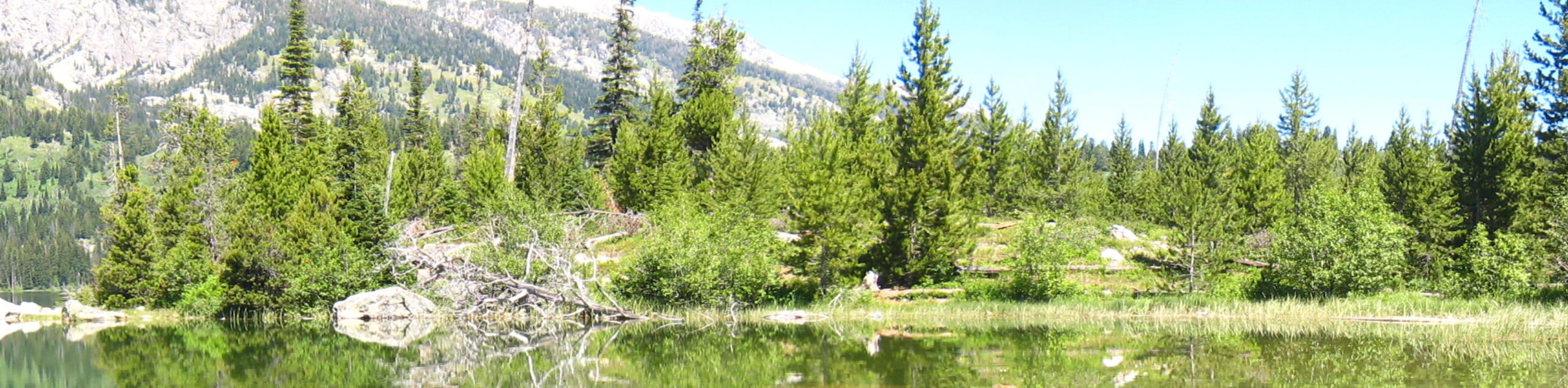
The Teton Valley Trail is a lovely one-way expedition that traces the foot of the Teton Mountains. Featuring several gorgeous glacial lakes, lush meadows, woodlands, and wildlife, this route also exhibits gobsmacking views of the towering craggy crests and the Jackson Hole.
Getting there
The Teton Valley Trail departs from the Lupine Meadows Trailhead off the Lupine Meadows Park Access Road.

About
| Backcountry Campground | No |
| When to do | May-September |
| Pets allowed | No |
| Family friendly | Older Children only |
| Route Signage | Average |
| Crowd Levels | Moderate |
| Route Type | One Way |
Teton Valley Trail
Elevation Graph
Weather
Teton Valley Trail Description
Those seeking an adventure that showcases the beauty and quintessential terrain of the Grand Tetons are encouraged to explore the Teton Valley Trail. One-way hikes are arguably one of our favorite ways to experience the outdoors as you are rewarded with new scenery every step of the way—you just can’t forget to drop off a vehicle or arrange for pickup at the route’s end! As with all outdoor exploration in the Tetons, bear spray is a must carry in your pack! While not necessary, the trail GPS could prove useful along this excursion as there are several intersections, some of which are poorly signposted. Note the Grand Teton National Park charges an entrance fee; refer to the NPS website for additional information.
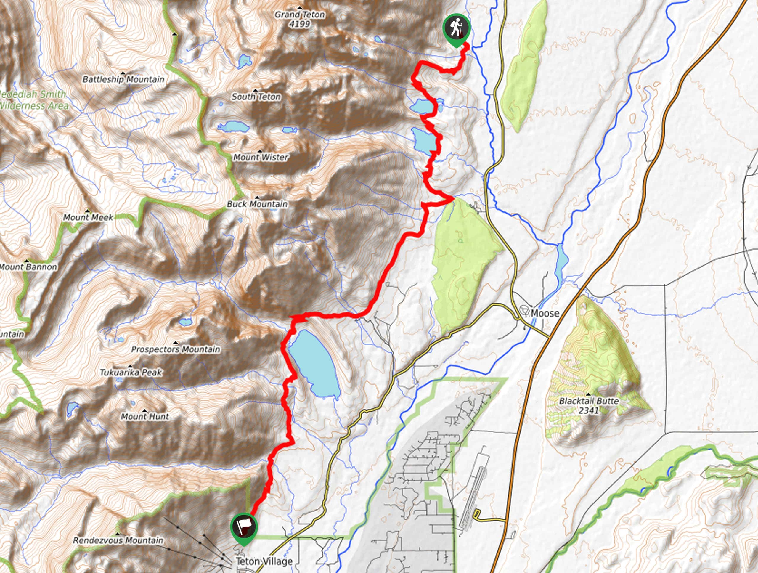
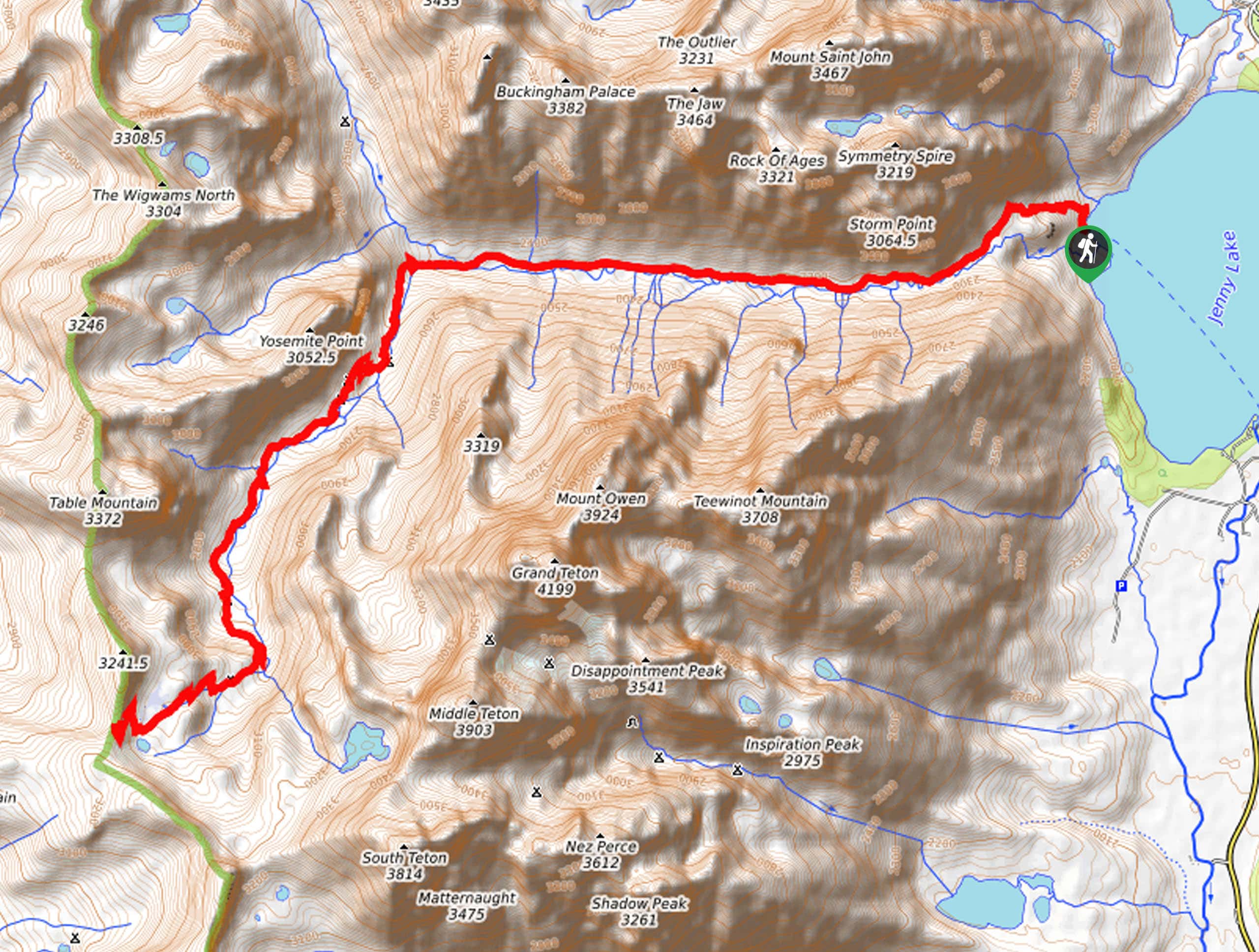
Setting out from the Lupine Meadows Trailhead, the Teton Valley Hike follows the Valley Trail heading southwardly. Traveling in the shadow of the Cathedral Group, the path will climb to the shoreline of Bradley Lake and, subsequently, Taggart Lake. Beyond this point, the terrain plateaus and remains fairly flat for the remainder of the trek. After the lake, you can either take a detour on the Taggart Lake Loop Trail or stay on the Valley Trail, which is what we recommend. After some hiking, you will reach the Phelps’s Lake Overlook before diving down to the shoreline.
Be sure to take the time to admire the beauty and diversity of the encompassing landscape as you wander. Then, continue hiking, eventually passing the mouth of Granite Canyon before reaching the route’s end in Teton Village.
Similar hikes to the Teton Valley Trail hike
Sheffield Creek Trail
Located on the border of the Yellowstone and the Grand Tetons National Parks, the Sheffield Creek Trail has remained relatively…
Delta Lake via Taggart Lake Hike
Rise and shine, it's time to climb! The Delta Lake via Taggart Lake Hike is a marvelous adventure into the…
South Fork Cascade Canyon to Hurricane Pass Hike
Explore the alpine oasis and enjoy unrivaled views of the Teton Mountains as you trek the South Fork Cascade Canyon…
Comments