Icefloe Lake Hike
View Photos
Icefloe Lake Hike
Difficulty Rating:
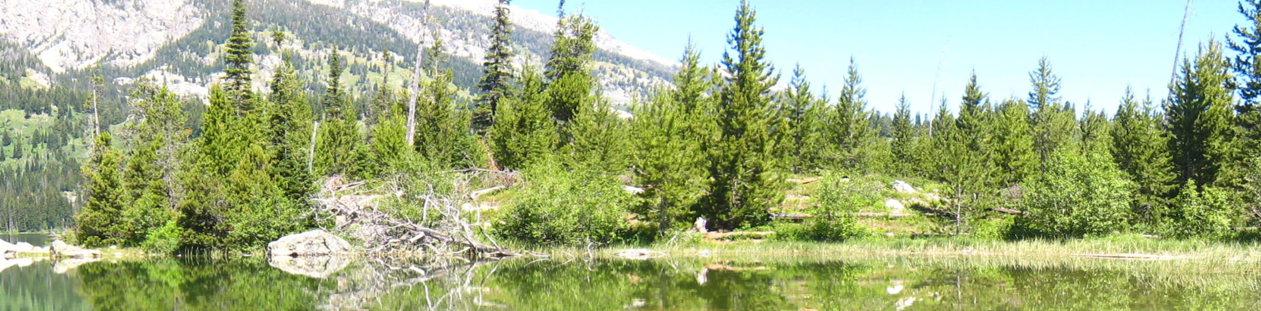
Beckoning the exploration of intrepid spirits, the Icefloe Lake Hike is not for the faint of heart. Travel into the heart of the Teton Mountains to the highest of all the park’s lakes. Nestled amongst the soaring crests, the scenery and seclusion along this demanding trek are unrivaled.
Getting there
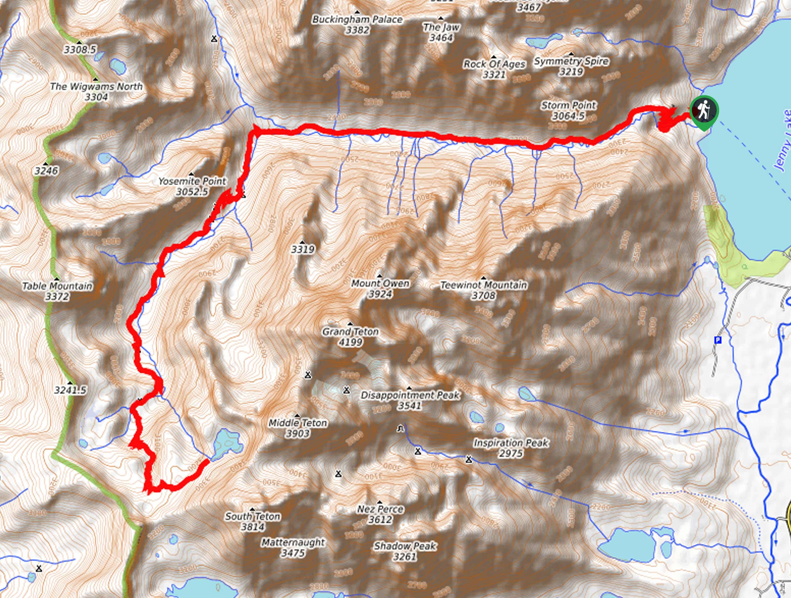
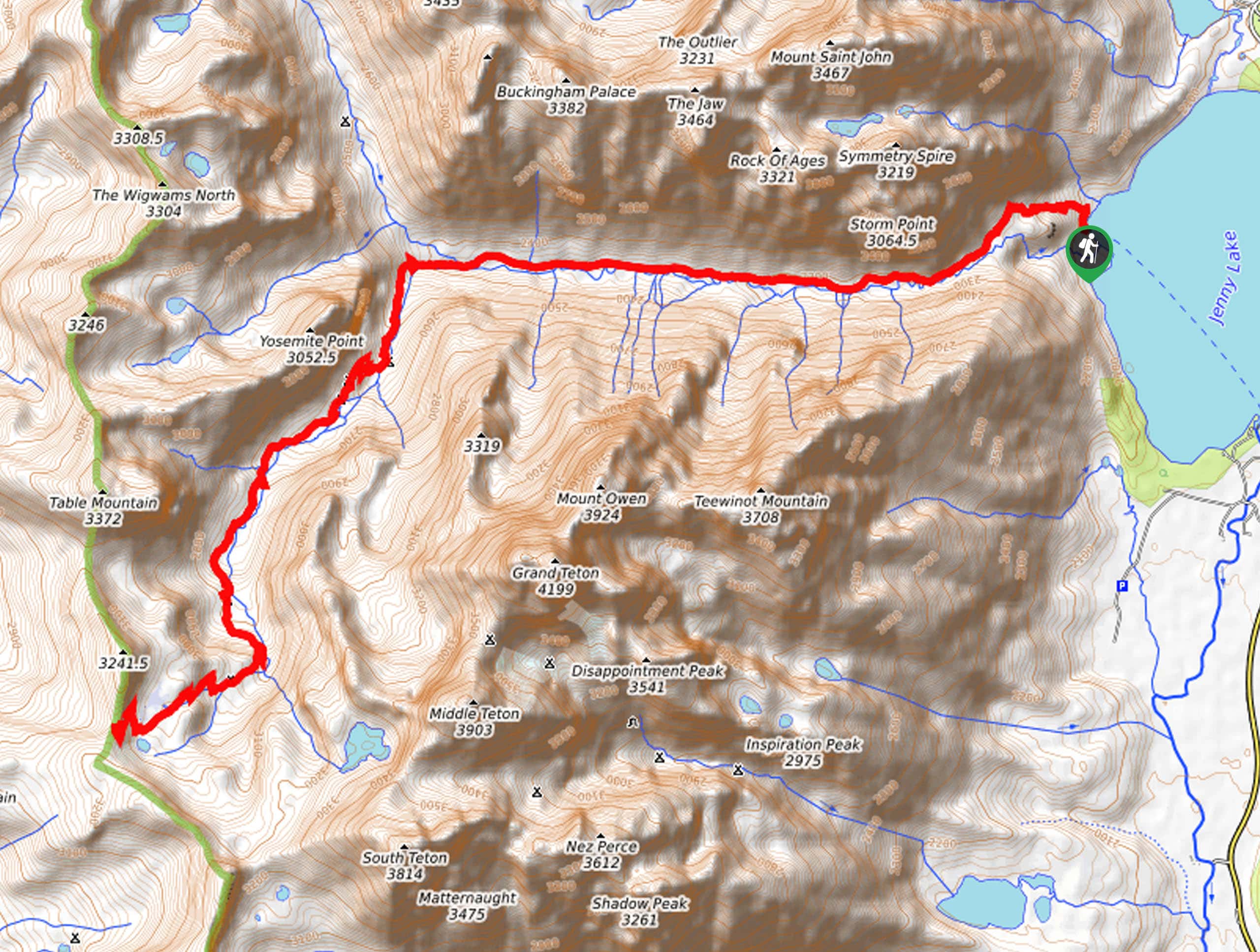
The Icefloe Lake Hike departs from the Jenny Lake Trailhead off the Jenny Lake Boat Dock on the western side of the lake.

About
| Backcountry Campground | Backcountry Camping, wilderness permit required. |
| When to do | May-September |
| Pets allowed | No |
| Family friendly | No |
| Route Signage | Poor |
| Crowd Levels | Low |
| Route Type | Out and back |
Icefloe Lake Hike
Elevation Graph
Weather
Icefloe Lake Hike Description
Put your navigational competencies and endurance to the ultimate test as you hike the Icefloe Lake Trail. An extreme day hike or epic overnight expedition, this route is sure to test your limits. Pack a water filter, bear spray, plenty of snacks, and a small first aid kit. Additionally, the tail end of this hike is off route, so download the trail GPS before departure. If you are one of the few seeking to tackle this trek in a day, make sure you head out at dawn to avoid hiking after nightfall. Note: this route is accessed via the Jenny Lake Boat Shuttle. This boating service charges a fee outside of the Grand Teton National Park entrance fee.
Once you are all set, begin your hike to Icefloe Lake from the Jenny Lake Trailhead. Following the Jenny Lake Loop Trail south before merging onto the North Fork Cascade Creek Trail and subsequently onto the Inspiration Point Trail. From the scenic overlook, you will link to the Cascade Canyon Trail, which will guide you into the U-shaped glacial valley. Marvel in the grandeur of the Tetons that loom above the prolific canyon and enjoy the scene of the charming snow-melt cascades that adorn the Cascade Canyon Creek. At the canyon’s end, turn left, and you will be diverted onto the South Fork Cascade Canyon Trail, which will climb up the valley behind the Cathedral Range, passing several dispersed campsites along the way.
After some climbing, you will reach the Avalanche Divide Trail. Using the trail GPS, navigate the loose scree, aiming for the saddle between Middle Teton and South Teton. Soon you will reach the Icefloe Lake, the highest alpine pool in the entire park. Relish in the tranquility and revel in the grandeur of the Tetons bounding the lake and commanding the skyline. After rehydrating and resting, begin your return, retracing your footing back to the trailhead.
Similar hikes to the Icefloe Lake Hike hike
Sheffield Creek Trail
Located on the border of the Yellowstone and the Grand Tetons National Parks, the Sheffield Creek Trail has remained relatively…
Delta Lake via Taggart Lake Hike
Rise and shine, it's time to climb! The Delta Lake via Taggart Lake Hike is a marvelous adventure into the…
South Fork Cascade Canyon to Hurricane Pass Hike
Explore the alpine oasis and enjoy unrivaled views of the Teton Mountains as you trek the South Fork Cascade Canyon…
Comments