
Lee Ridge Trail
View Photos
Lee Ridge Trail
Difficulty Rating:
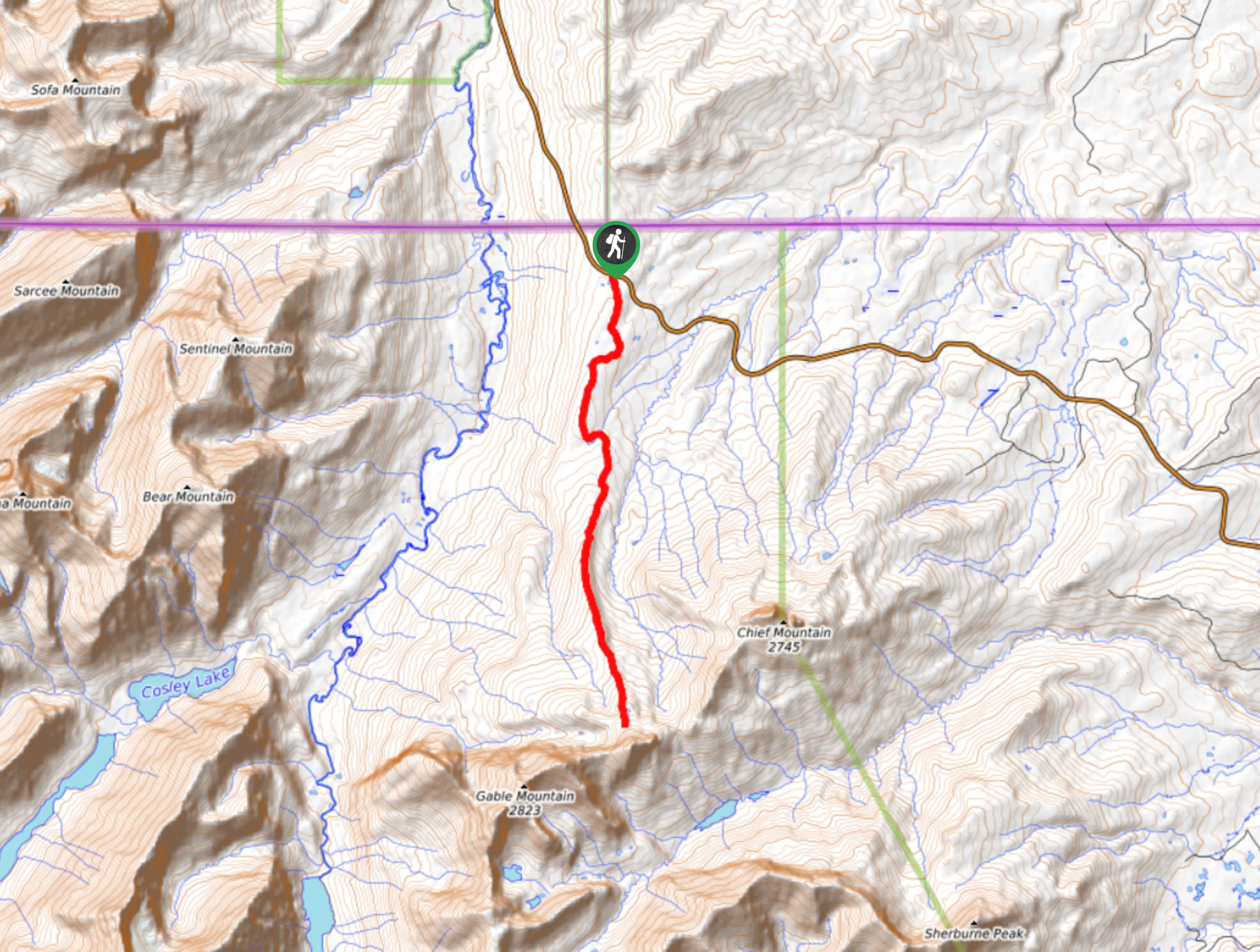
Glacier National Park is home to over 700.0mi of incredible trails; however, the Lee Ridge Trail has a special view that expands past the United States. Atop the winding ridge, when you emerge from the trees, you will be met with views of Chief Mountain, Gable Mountain and the plains of Calgary, Canada. You can view two countries at once on this spectacular hike and explore all of the reasons this is a popular place to be.
Getting there
To get to Lee Ridge Trail from the Canadian/United States border, head Southeast on MT-17 South/Chief Mountain Highway for 1.6mi and find Lee Ridge Trail on the left hand side. There is a pullout area and you will see the orange markers for the trailhead.

About
| When to do | April - September |
| Backcountry Campsites | No |
| Pets allowed | Yes |
| Family friendly | No |
| Route Signage | Average |
| Crowd Levels | Moderate |
| Route Type | Out and back |
Lee Ridge Trail
Elevation Graph
Weather
Lee Ridge Trail Description:
The Lee Ridge Trail is a popular hike, especially because you can see two countries at the same time! The trail is accessible off of the Chief Mountain Highway, about 1.6mi from the Canadian/United States border crossing. There is no parking at the Lee Ridge Trail; however, there is a pullout area that you can park at and look for orange markers for the trailhead. The beginning of the trail takes you into a forest where you will have the opportunity to see deer and elk running around in their natural habitat.
As you continue on, there is not much elevation as you will pass by wet areas and a pond, but beyond this the trail begins to elevate. You will begin to see views of Chief Mountain, and across the ridge, the plains will open up, and you will be able to see all the way out to Canada and will gain a view of Gable Mountain as well. To the west, you will take in sights of the tallest mountain in Glacier National Park, Mt. Cleveland.
Similar hikes to the Lee Ridge Trail hike

Fish Lake Trail
Fish Lake Trail is a mix between relaxing and heart pumping. The start of the trail takes you through a…

Quartz Creek Trail
Quartz Creek Trail is a relaxing hike on a remote trail in Glacier National Park. The hike takes you through…

Snyder Ridge Trail
Hiking through Snyder Ridge Trail takes you through a forest for most of the trail that follows the ridge along…
Comments