
Beaver Pond Trail
View Photos
Beaver Pond Trail
Difficulty Rating:
The Beaver Pond Trail is a place that holds a lot of history, from the Historic Ranger Station and barn to the Red Eagle Fire that burned 34,000 acres of Glacier National Park and Blackfeet Lands in 2006. Wander through the groves and grassy fields, and don’t forget to check out the marshy shores of Beaver Pond for a moose or two, as this is their favourite place to forage. Continue past Red Eagle Lake, and you will see more damage done by the fires as you pass burned tree trunks heading to St. Mary Lake and out of this trail.
Getting there
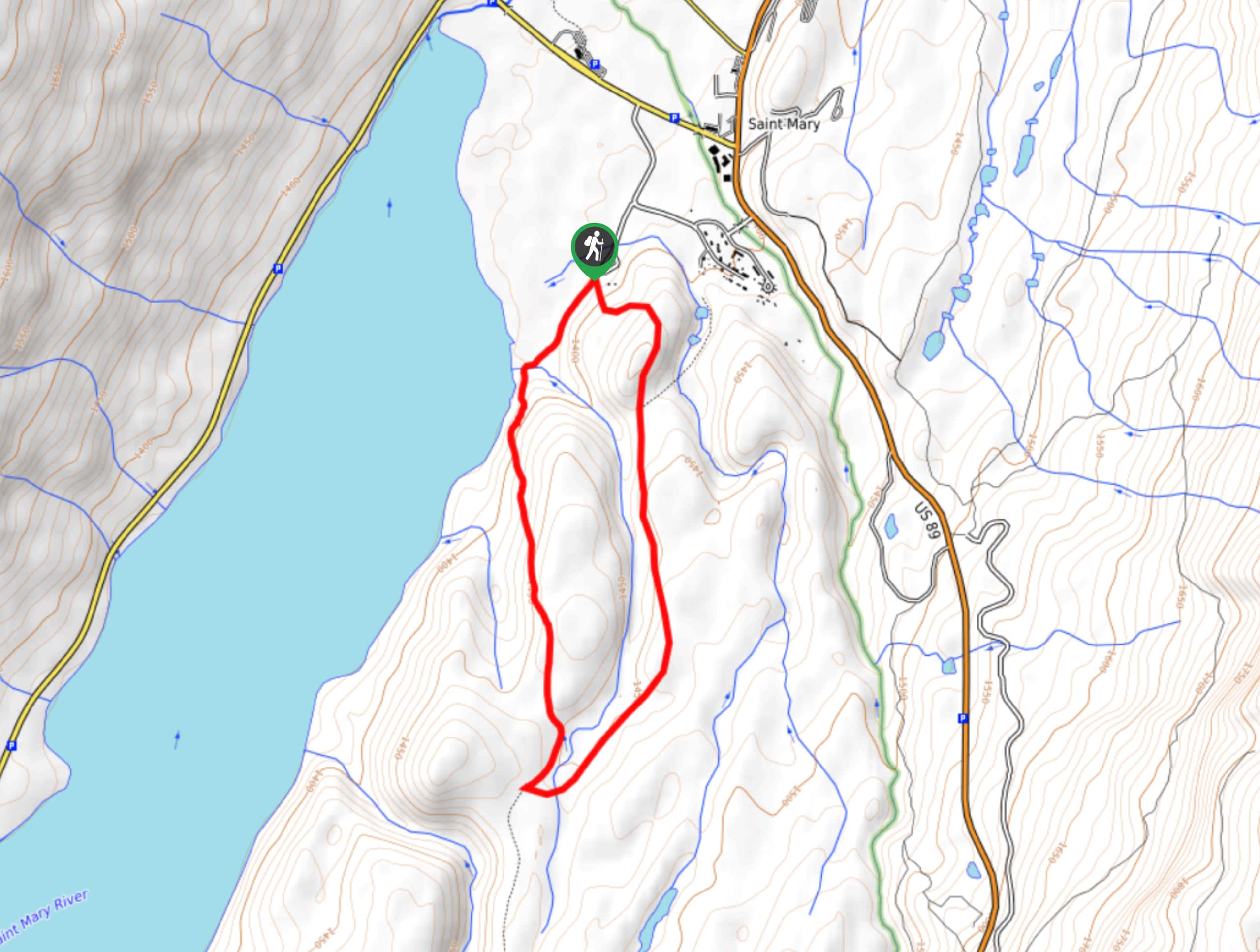
To get to Beaver Pond Trail from St. Marys, head northwest on Glacier Route 1/Going-to-the-Sun Road. In 0.3mi, turn left, and after 0.3mi, turn right. Turn left onto St Mary Area Road, and Beaver Pond Trail will be on your right-hand side.

About
| When to do | April - October |
| Backcountry Campsites | No |
| Pets allowed | No |
| Family friendly | Yes |
| Route Signage | Average |
| Crowd Levels | Low |
| Route Type | Circuit |
Beaver Pond Trail
Elevation Graph
Weather
Beaver Pond Trail Description
The Beaver Pond Trail is a popular hike that reminds us of the tragic wildfires that swept through Glacier National Park in 2006. The ponds make for excellent moose spotting opportunities, and give you a mild workout and is great for all skill levels.
If you are looking for stunning views, a bit of history and some solitude, then the Beaver Pond Trail is for you. Few visitors frequent the trails, so you can take in the beauty and find peace without it being overcrowded with hikers and tourists. The hike begins in the parking area for the Historic 1913 Ranger Station and continues in a loop with the remnants of the Red Eagle fire 1.0mi from the trailhead. Continuing on for 0.5mi will take you to the Beaver Pond from which the trail was named, and another 0.4mi will bring you to the Red Eagle junction, where you will turn right and head towards St. Marys Lake. Stopping for lunch here is what many hikers enjoy before continuing on back to the Ranger Lodge and to the parking lot.
Similar hikes to the Beaver Pond Trail hike

Fish Lake Trail
Fish Lake Trail is a mix between relaxing and heart pumping. The start of the trail takes you through a…

Quartz Creek Trail
Quartz Creek Trail is a relaxing hike on a remote trail in Glacier National Park. The hike takes you through…

Snyder Ridge Trail
Hiking through Snyder Ridge Trail takes you through a forest for most of the trail that follows the ridge along…
Comments