Apgar Lookout Trail
View Photos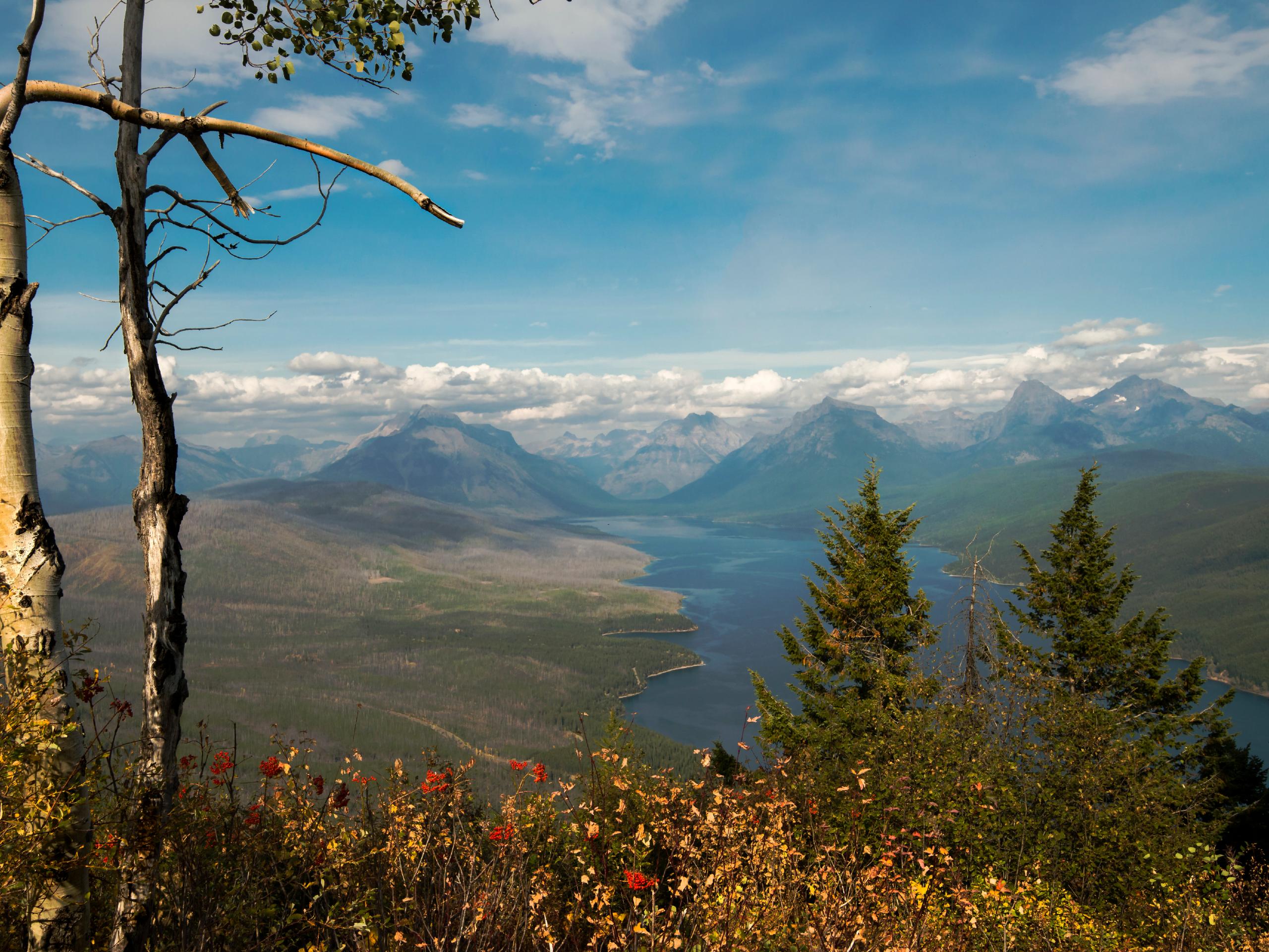
Apgar Lookout Trail
Difficulty Rating:
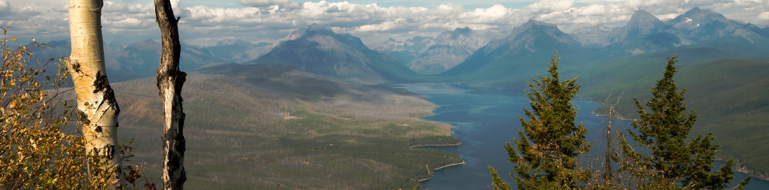
Apgar Lookout Trail is a breathtaking journey through the forest that was devastated by the Robert Fire, but rebuilt itself over the years. Feast your eyes on the collosal mountains that touch the sky and tower over the lakes below. This lookout takes you high above the trees and treats you to views you won’t soon forget.
Getting there
To get to Apgar Lookout Trail from Columbia Falls, head Southwest on North Fork Road/Railroad Street East toward North Nucleus Avenue. Turn left onto North Nucleus Avenue for 0.6mi and then turn left onto US-2 East. After driving for 16.2mi, turn left onto Glacier Route 1 Road/Going-to-the-Sun Road, and then after 1.2mi turn left onto Quart Circle Bridge Road. Drive for 2.4mi, and arrive at your destination.

About
| When to do | June - October |
| Backcountry Campsites | No |
| Pets allowed | No |
| Family friendly | No |
| Route Signage | Average |
| Crowd Levels | High |
| Route Type | Out and back |
Apgar Lookout Trail
Elevation Graph
Weather
Apgar Lookout Trail Description
The Apgar Lookout Trail is a breath of fresh air way up in the sky. As you perch yourself at the top and lookout for miles, you feel higher than the mountains themselves. The views on this hike are spectacular as you begin walking down a dirt road and start to see the effects on the forest from the Robert Fire. Continuing on, you will begin a steep climb to the lookout point. Hiking for the next 2.7mi, you will peak more than 1700ft and find yourself just below the lookout. When you have finished taking in the views, head back the way you came as this is an out-and-back trail.
Find more epic hikes in Glacier National Park
Similar hikes to the Apgar Lookout Trail hike

Fish Lake Trail
Fish Lake Trail is a mix between relaxing and heart pumping. The start of the trail takes you through a…

Quartz Creek Trail
Quartz Creek Trail is a relaxing hike on a remote trail in Glacier National Park. The hike takes you through…

Snyder Ridge Trail
Hiking through Snyder Ridge Trail takes you through a forest for most of the trail that follows the ridge along…
Comments