
Brown Peak Trail
View Photos
Brown Peak Trail
Difficulty Rating:
A longer route with a fair amount of elevation gain, the Brown Peak Trail should only be attempted by experienced hikers. Ending at a scenic vista where beautiful views of the surrounding Death Valley National Park Landscape can be enjoyed, the Brown Peak Trail is well worth the effort!
Getting there
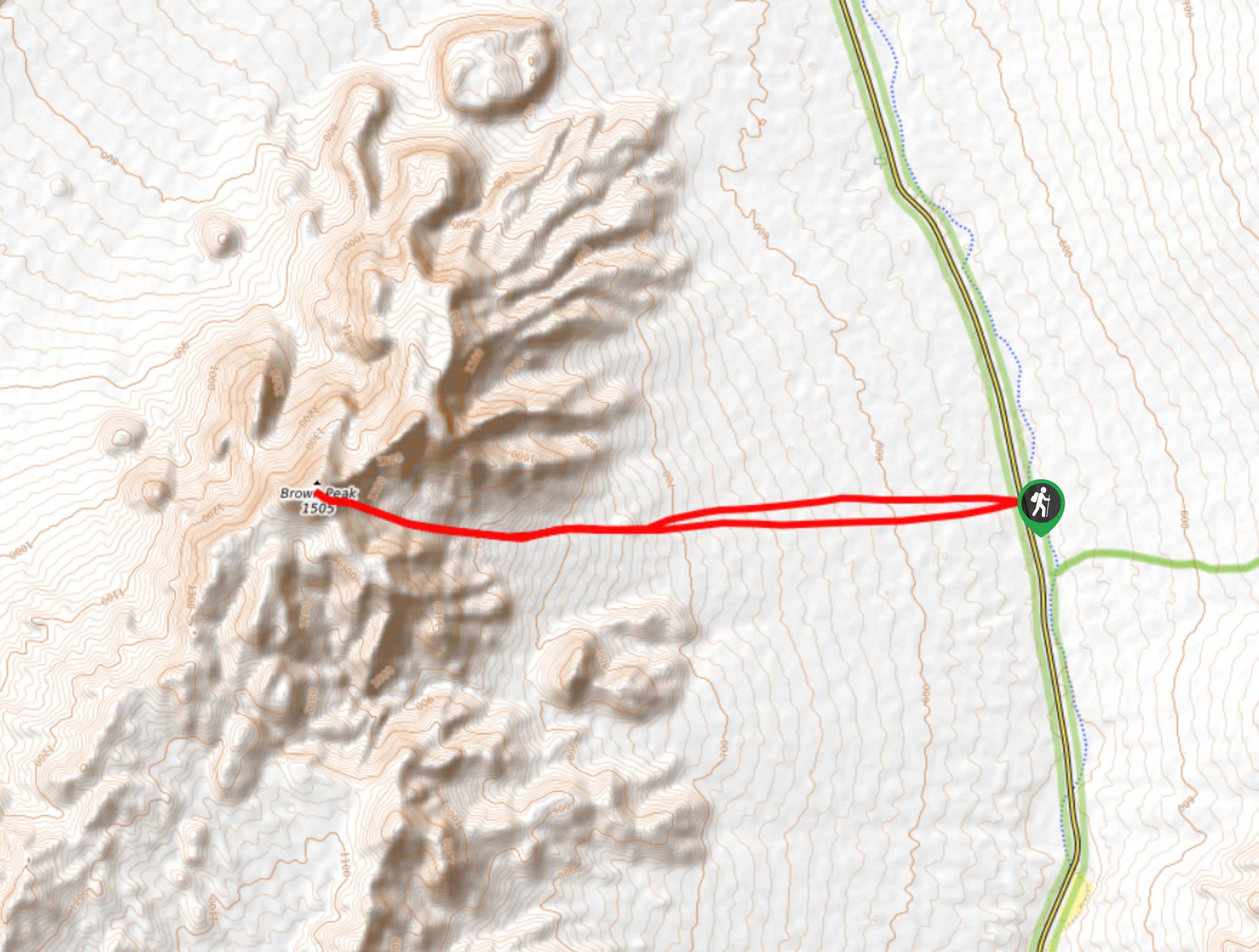
The trailhead for Brown Peak Trail is located off of Highway 127.

About
| Backcountry Campground | No |
| When to do | October-May |
| Pets allowed | No |
| Family friendly | No |
| Route Signage | None |
| Crowd Levels | Low |
| Route Type | Lollipop |
Brown Peak Trail
Elevation Graph
Weather
Brown Peak Trail Description
The Brown Peak Hike’s length and elevation gain make it a difficult route that is not appropriate for beginner hikers, or families with children. The route is also not along designated Death Valley National Park pathways, and so we suggest bringing some sort of navigation tool with you to help aid in wayfinding throughout the route’s duration.
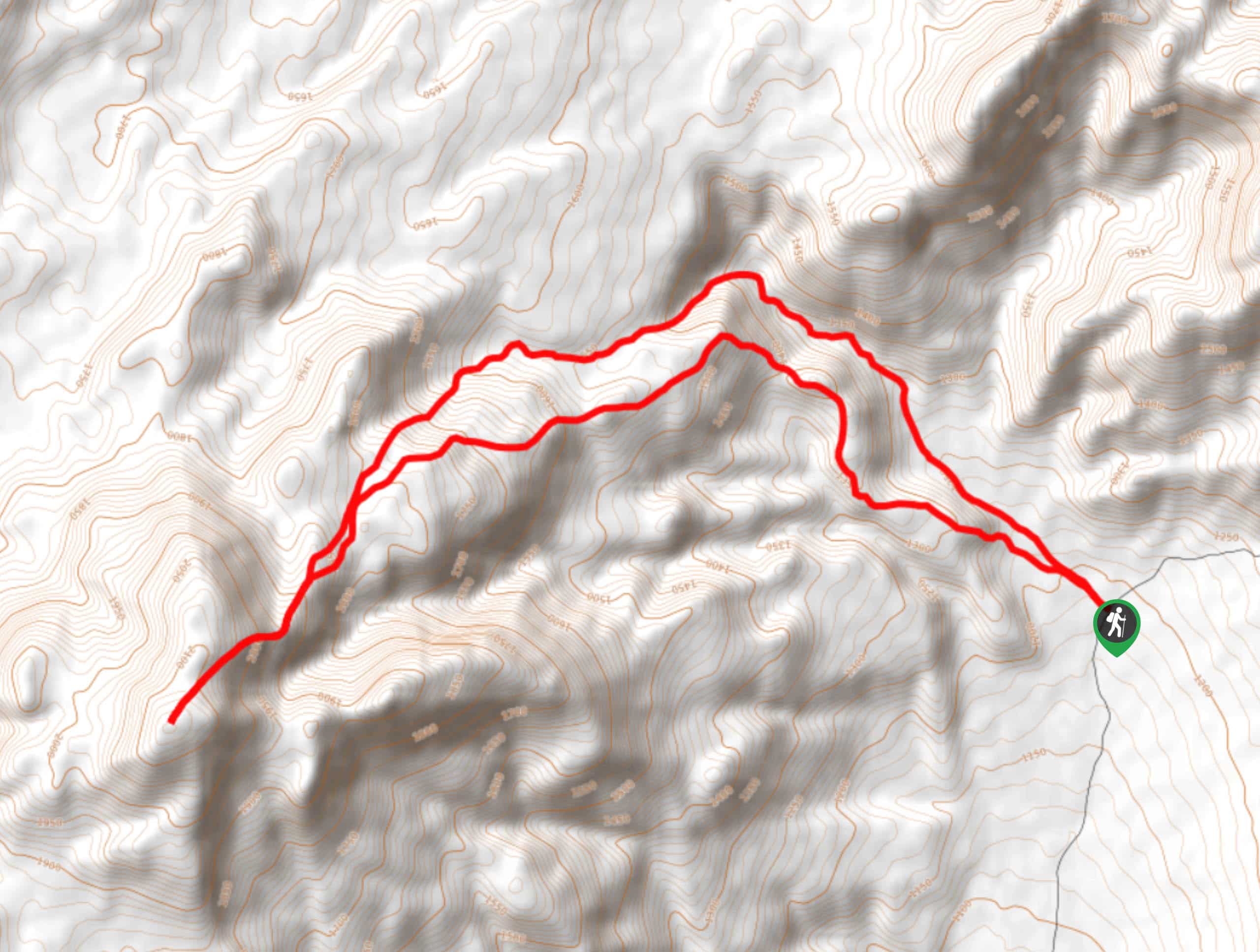
Having parked your vehicle along Highway 127, make your west over terrain with a constant, but slight incline. For the next few miles, continue west heading towards the highlands in the foreground. You will soon arrive at the base of the highlands, where you will begin to climb a saddle on the eastern side of Brown Peak. Once you have completed climbing the saddle, you will arrive at a short plateau.
After the plateau, continue west towards Brown Peak. Here the incline becomes rather steep, so take your time. Having completed the steep incline, you will arrive at a second plateau, where Brown Peak will be visible a short distance away. At the peak, be sure to enjoy the scenic labours of your hard work, before backtracking your steps and veering left to take a slightly different route back towards Highway 127, and your waiting vehicle.
Similar hikes to the Brown Peak Trail hike
Saline Mountain Trail
A physically demanding but beautiful route, the Saline Mountain Trail is a must do for experienced hikers in Death Valley…
Lower Telephone Canyon Trail
A difficult route that leads to an incredible vista where panoramic views of the surrounding area can be enjoyed, the…
Funeral Canyon Trail
A longer route with a fair amount of elevation gain, Funeral Canyon Trail is a perfect route for the more…
Comments