
The Templer Way
View Photos
The Templer Way
Difficulty Rating:
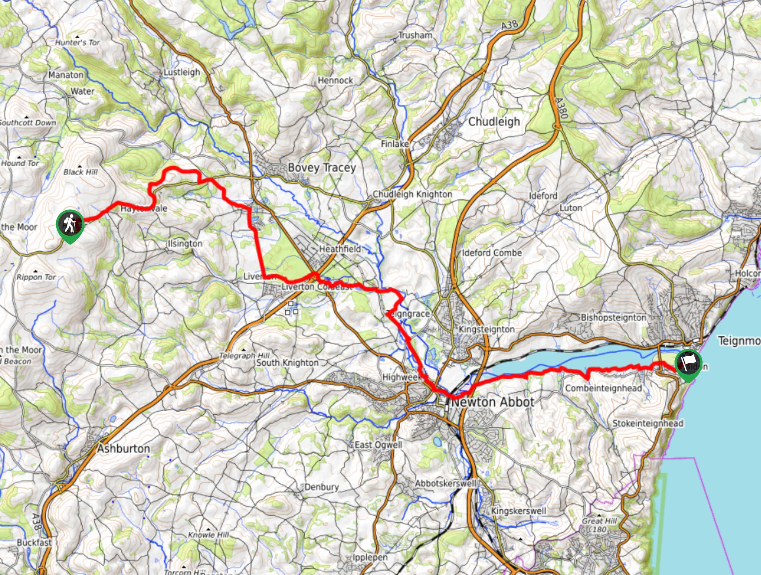
Walking the Templer Way is a scenic but lengthy adventure that will lead you from Dartmoor National Park to Teignmouth to a position overlooking the English Channel. This one-way route will see you traverse points of interest like the Haytor Rocks, the Great Plantation, and Stover Park; as you work your way along the River Teign towards the ferry that will take you across the water to Teignmouth. What a fantastic way to see the eastern part of Dartmoor and the surrounding Devon landscape - just be sure to arrange a pick up at the end-point of your walk.
Getting there
To reach the trailhead for The Templer Way from Widecombe in the Moor, drive northeast on B3387 for 3.0mi and turn right to enter the car park.

About
| When to do | Year-Round |
| Backcountry Campsites | Twelve Oaks Caravan Park |
| Pets allowed | Yes - On Leash |
| Family friendly | Older Children only |
| Route Signage | Average |
| Crowd Levels | Moderate |
| Route Type | One Way |
The Templer Way
Elevation Graph
Weather
The Templer Way Description
Other than a stretch of hilly terrain near the beginning of the route, the Templer Way isn’t an overly challenging walk, making it perfectly suitable for beginner/casual walkers that want to try their hand at a longer distance adventure. As the route is over 18.6mi, be sure to wear comfortable walking boots and bring plenty of water/snacks. There is also a ferry near the end of the trail that will take you across the waters at the mouth of the River Teign, so plan accordingly if this is a part of the route that you would like to do. Additionally, you will need to arrange a pick up at the end-point of the route, as it is a one-way trail.
Setting out from the car park, you will make your way uphill across the terrain of the moor to reach the rugged summit of Haytor Rocks. From here, you will turn to the east to traverse the undulating landscape of Dartmoor National Park before turning to the southeast towards Newton Abbot. This part of the walk will see you make your way across the Devon countryside and through smaller towns and villages, as you pass through the Great Plantation and Stover Park to meet up with the River Teign. Continue to the southwest and make your way through the city, following along the water’s edge until you arrive at the beautiful expanse of the English Channel. In Shaldon, you can take the ferry across the water to reach the opposite bank at Teignmouth, where you can explore the coast while you wait for your pre-arranged pick up.
Similar hikes to the The Templer Way hike

Shipley Bridge and Avon Dam Reservoir Walk
Located in the southern part of Dartmoor National Park, the Shipley Bridge and Avon Dam Reservoir Walk is a lovely…

The Sherlock Holmes Track
The Sherlock Holmes Track is a fun adventure in the southeast corner of Dartmoor National Park that will take you…

Ryder’s Hill via Sandy Way Trail
The Ryder’s Hill via Sandy Way Trail is a beautiful walking route in Dartmoor National Park that will lead you…
Comments