

Ryder’s Hill via Sandy Way Trail
View Photos
Ryder’s Hill via Sandy Way Trail
Difficulty Rating:
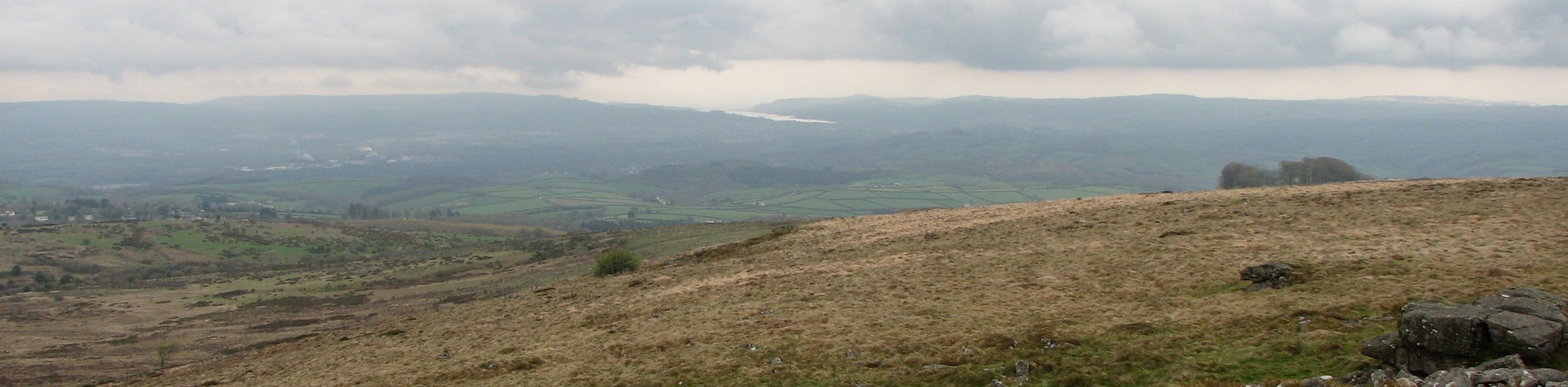
The Ryder’s Hill via Sandy Way Trail is a beautiful walking route in Dartmoor National Park that will lead you across the moor for some scenic views. While out walking the trail, you will traverse the rugged landscape and work your way uphill across the undulating terrain to reach the summit of Ryder’s Hill that offers panoramic views of both the park and the wider Devon countryside. This is a fantastic way to explore the stunning landscapes within Dartmoor.
Getting there
To reach the trailhead for the Ryder’s Hill via Sandy Way Trail from the Church House Inn in Holne, drive south for 0.1mi and turn right to continue on for another 0.7mi. You will find the entrance to the parking area on the left.

About
| Backcountry Campground | No |
| When to do | Year-Round |
| Pets allowed | Yes |
| Family friendly | Older Children only |
| Route Signage | Average |
| Crowd Levels | Moderate |
| Route Type | Out and back |
Ryder’s Hill via Sandy Way Trail
Elevation Graph
Weather
Ryder’s Hill via Sandy Way Trail Description
If your aim is to get out into the wild for a few hours to explore the natural beauty of Dartmoor National Park, then Ryder’s Hill via Sandy Way Trail is a great way to do it. This trail will lead you uphill across the undulating terrain of the moor, offering the chance to gaze out across the barren, yet beautiful landscape from a wonderful hilltop summit. You will also likely be able to spot a number of cattle and the iconic Dartmoor pony roaming freely around in the area. What a beautiful way to experience this scenic location!
Similar hikes to the Ryder’s Hill via Sandy Way Trail hike

Shipley Bridge and Avon Dam Reservoir Walk
Located in the southern part of Dartmoor National Park, the Shipley Bridge and Avon Dam Reservoir Walk is a lovely…

The Sherlock Holmes Track
The Sherlock Holmes Track is a fun adventure in the southeast corner of Dartmoor National Park that will take you…
Rippon Tor and Pil Tor Walk
The walk up Rippon Tor and Pil Tor is a fun journey that won’t take you very long, but will…
Comments