
White Lady Waterfall and Lydford Gorge Walk
View Photos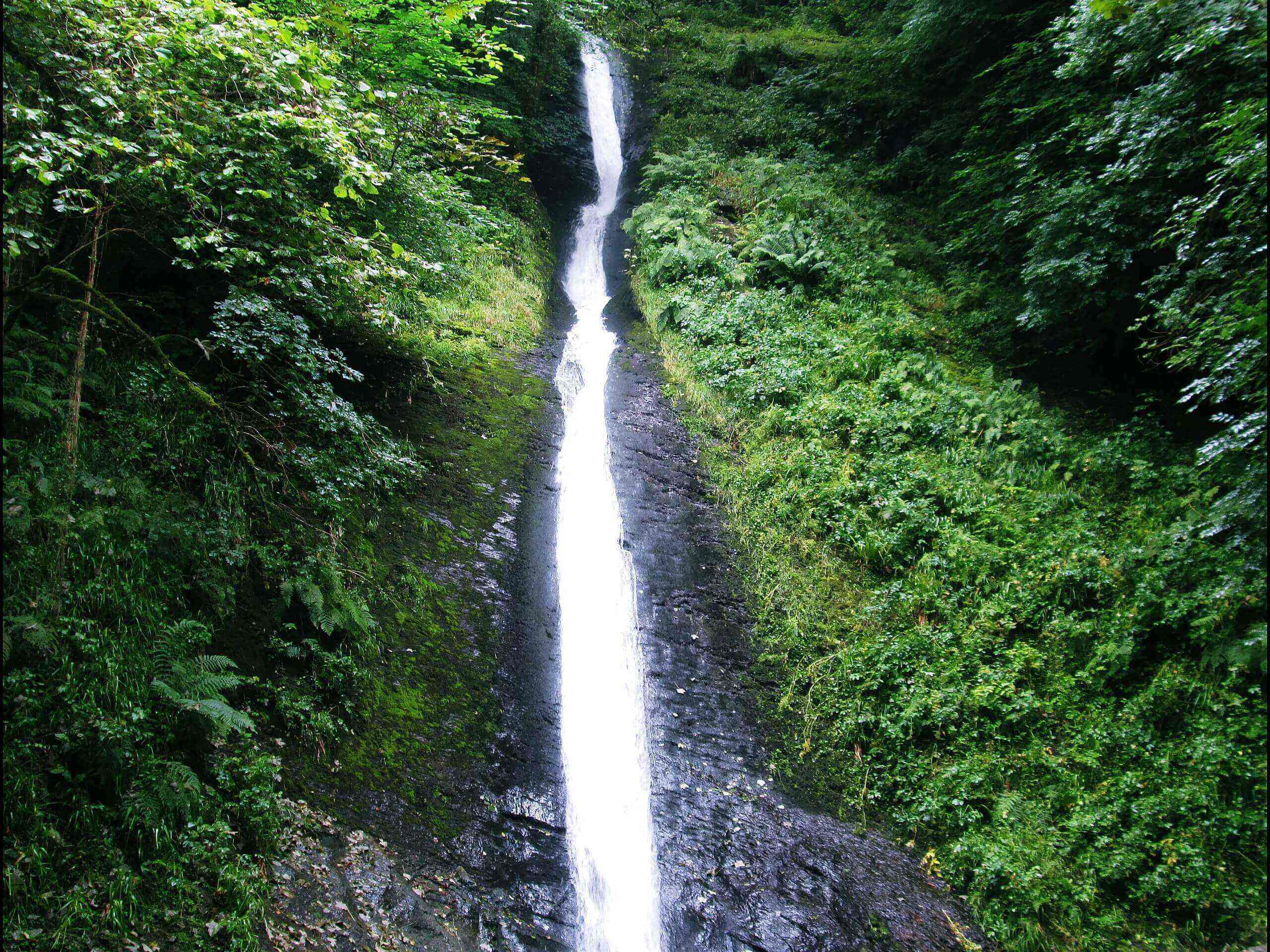
White Lady Waterfall and Lydford Gorge Walk
Difficulty Rating:
The White Lady Waterfall and Lydford Gorge Walk is a fantastic excursion in Dartmoor National Park that will take you to several natural and historic points of interest. While out walking the trail, you will take in views of the plunging White Lady Waterfall and visit the churning waters of the Devil’s Cauldron, before climbing uphill to the 13th Century remains of Lydford Castle. With a wealth of amazing highlights, there is no reason to put off exploring the terrain around Lydford Gorge.
Getting there
To reach the trailhead for the White Lady Waterfall and Lydford Gorge Walk from Tavistock, head north on Abbey Place for 0.1mi and continue straight onto Butcher Park Hill. After 6.4mi, you will find the car park on the left.

About
| When to do | Year-Round |
| Backcountry Campsites | No |
| Pets allowed | Yes - On Leash |
| Family friendly | Yes |
| Route Signage | Average |
| Crowd Levels | High |
| Route Type | Lollipop |
White Lady Waterfall and Lydford Gorge Walk
Elevation Graph
Weather
White Lady Waterfall and Lydford Gorge Walk Description
While the White Lady Waterfall and Lydford Gorge Walk will be an easy day on the trails for most walkers, there are some portions of the trail that are rocky and can be quite slippery after a period of rain. Be sure to wear proper footwear and keep an eye on children if travelling through these areas. Additionally, there will likely be livestock grazing in the fields surrounding Lydford Castle, so remember to keep your dog on a leash.
Setting out from the car park, you will make your way northwest to descend the hillside into the gorge, where you will meet up with the River Lyd. Head east here and follow along the banks of the river until you come to the viewing point for the crashing waters of White Lady Waterfall. After taking in the beautiful views, continue along the water’s edge and relax in the serene riverside setting, where you will eventually come to the churning waters of the Devil’s Cauldron. From here, you will cross over the river and make your way uphill to visit Lydford Castle. In addition to checking out the remains of the medieval castle-turned prison, you can explore the Norman and Saxon defence works that pre-date the building. After learning about some unique local history, head back downhill and follow along the east bank of the River Lyd to return to the trailhead.
Similar hikes to the White Lady Waterfall and Lydford Gorge Walk hike

Shipley Bridge and Avon Dam Reservoir Walk
Located in the southern part of Dartmoor National Park, the Shipley Bridge and Avon Dam Reservoir Walk is a lovely…

The Sherlock Holmes Track
The Sherlock Holmes Track is a fun adventure in the southeast corner of Dartmoor National Park that will take you…

Ryder’s Hill via Sandy Way Trail
The Ryder’s Hill via Sandy Way Trail is a beautiful walking route in Dartmoor National Park that will lead you…
Comments