Lydford Gorge Walk
View Photos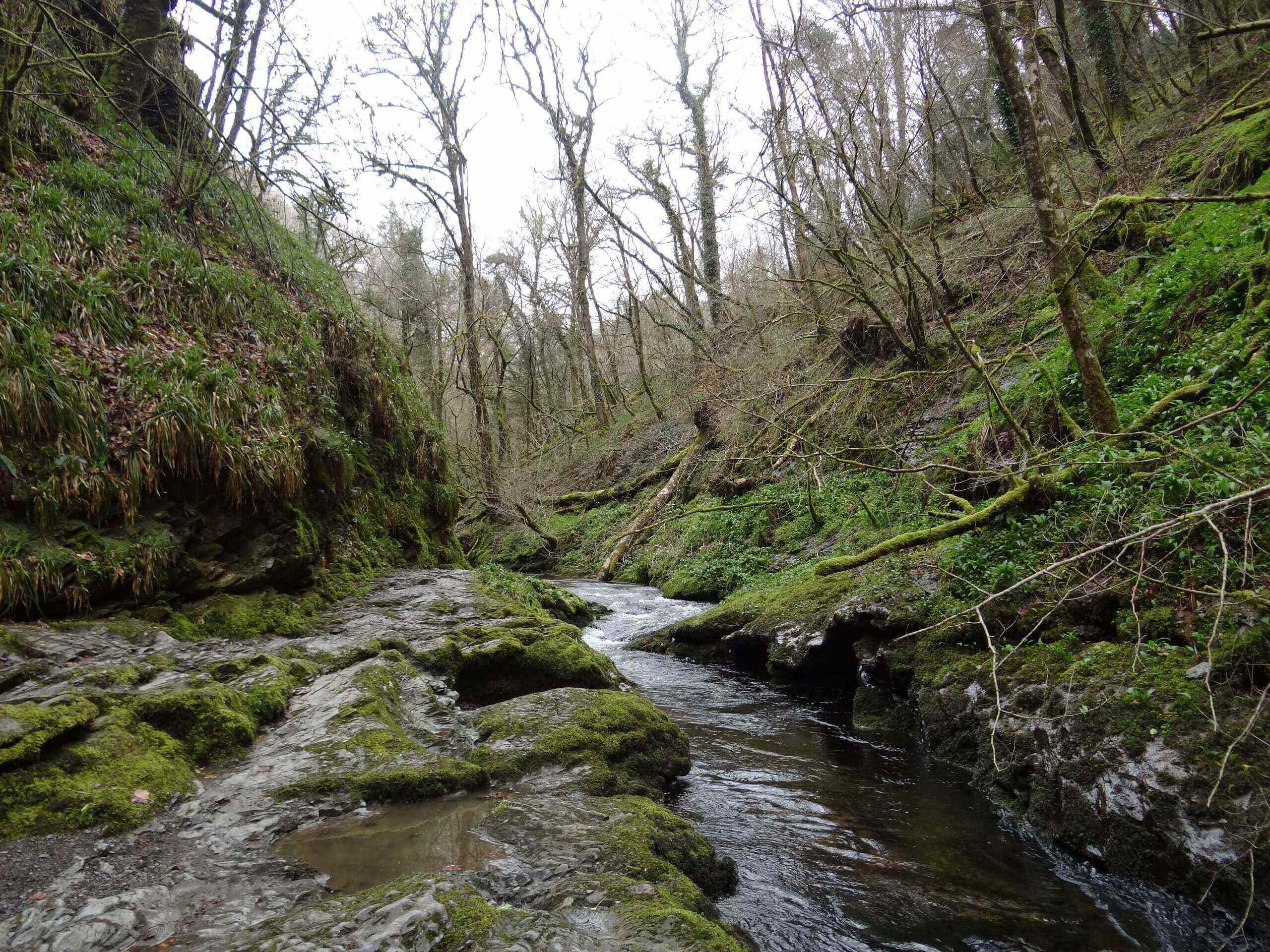
Lydford Gorge Walk
Difficulty Rating:
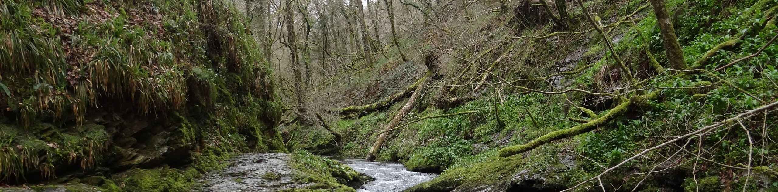
If you enjoy peaceful woodland landscapes, winding rivers, and dramatic waterfall views, then the Lydford Gorge Walk is a perfect way to spend a weekend afternoon. Located just north of Tavistock in the western part of Dartmoor National Park, this route will take you through a serene gorge along the River Lyd to view the White Lady Waterfall and Devil’s Cauldron. This is a great walking route for anyone interested in exploring a beautiful stretch of riverside terrain.
Getting there
To reach the trailhead for the Lydford Gorge Walk from Tavistock, drive northwest for 0.2mi along Drake Road and continue straight for another 7.4mi. Turn left here and continue on for 0.2mi, where you will find the car park on the left.

About
| When to do | Year-Round |
| Backcountry Campsites | No |
| Pets allowed | Yes - On Leash |
| Family friendly | Yes |
| Route Signage | Average |
| Crowd Levels | Moderate |
| Route Type | Lollipop |
Lydford Gorge Walk
Elevation Graph
Weather
Lydford Gorge Walk Description
Walking through Lydford Gorge is a breathtaking experience that will allow you to view stunning waterfalls, dramatically weathered rock formations, and coursing rivers within Dartmoor National Park; however, the rocky terrain along the river’s edge is not suitable for all people. There are parts of the walk that will require you to traverse a series of stairs hewn into the rock that can be very slippery and are without a handrail for guidance, so make sure that you wear proper walking boots for the most secure footing.
Setting out from the car park, you will head southwest through the serene woodland landscape and follow along the winding banks of the River Lyd, before arriving at the beautiful site of the White Lady Waterfall. Take some time to appreciate the beauty of the gushing falls, before heading back to the northeast along the river. Reaching the area near the Devil’s Cauldron, you will need to traverse a series of slippery rock steps that are cut into the gorge in order to make it to the viewpoint of the weathered rock formation. Here, you will be able to look out over the churning water set within a dramatic landscape before making your way along the trail to return to the car park.
Similar hikes to the Lydford Gorge Walk hike

Shipley Bridge and Avon Dam Reservoir Walk
Located in the southern part of Dartmoor National Park, the Shipley Bridge and Avon Dam Reservoir Walk is a lovely…

The Sherlock Holmes Track
The Sherlock Holmes Track is a fun adventure in the southeast corner of Dartmoor National Park that will take you…

Ryder’s Hill via Sandy Way Trail
The Ryder’s Hill via Sandy Way Trail is a beautiful walking route in Dartmoor National Park that will lead you…
Comments