Glas Maol Munros Circular Walk
View Photos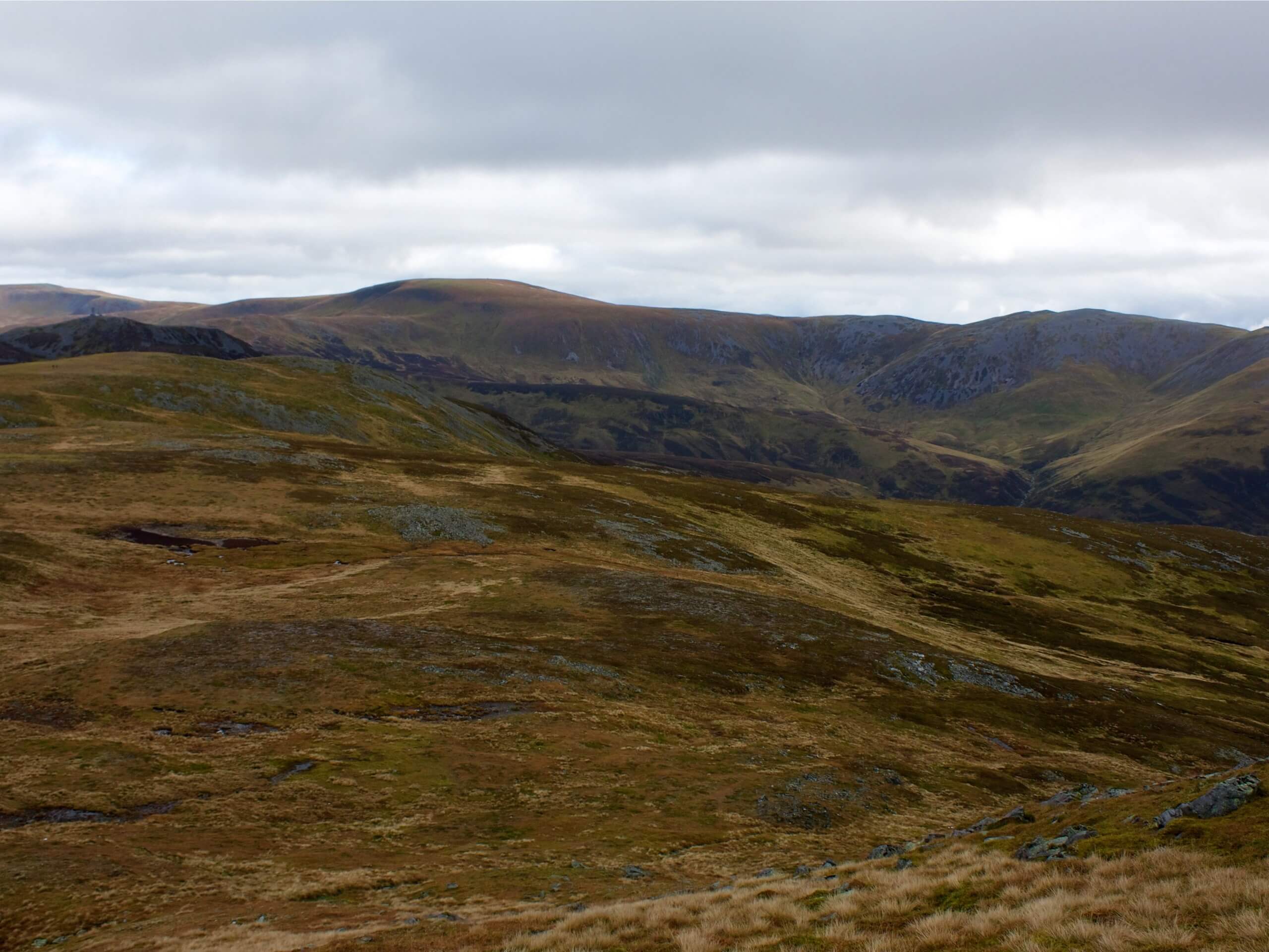
Glas Maol Munros Circular Walk
Difficulty Rating:
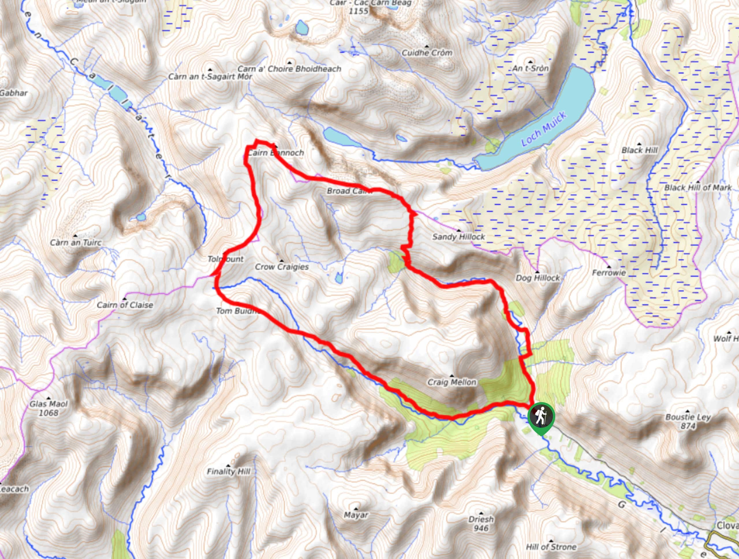
The 12.1mi Glas Maol Munros Circular Walk is a thrilling adventure across a hilly plateau in the Cairngorms. With little descent between summits, this walk presents the perfect opportunity to conquer 4 Scottish Munros in under 8 hours. This full-day adventure is bound to get the adrenaline pumping with the added bonus of incredible panoramas from the summits. On this walk, you’ll climb Càrn an Tuirc (3343ft), Cairn of Claise (3491ft), Glas Maol (3504ft), and Creag Leacach (3238ft).
Getting there
To get to the Glas Maol Munros Circular Walk from Dundee, take Meadowside to Victoria Rd and continue 0.2mi. Then, follow A923 to A93 and drive for 44.4mi until you reach the layby on A93’s east side just 1.2mi north of the Glenshee Ski Centre.

About
| Backcountry Campground | Wild Camping |
| When to do | Year-round access |
| Pets allowed | Yes |
| Family friendly | No |
| Route Signage | Average |
| Crowd Levels | Moderate |
| Route Type | Lollipop |
Glas Maol Munros Circular Walk
Elevation Graph
Weather
Glas Maol Munros Trail Description
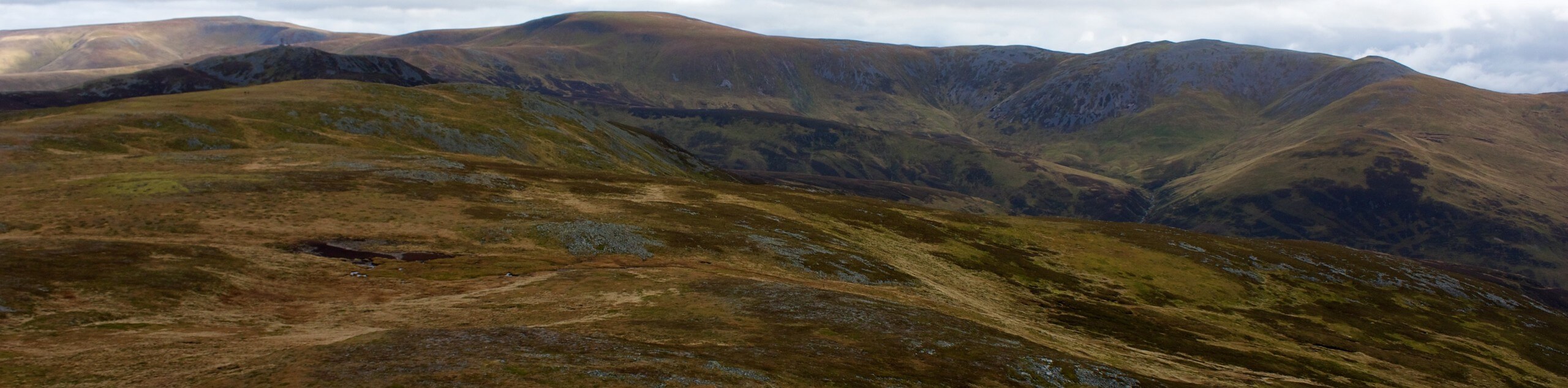
Escape the city and experience the beauty of the remote Cairngorms on the superb Glas Maol Munros Circular Walk. From the grassy hills to the endless panoramic views, this walk is guaranteed to immerse you in the pristine beauty of the Cairngorms, whilst challenging you to reach 4 incredible summits, all conveniently accessible with little descent between them. The approach in particular features some boggy sections, so waterproof shoes are a must.
From the parking layby, spot the wooden bridge and instead of heading towards this, join the rugged path that leads down to an older stone bridge. After passing two sets of old shielings, continue on the path as it leads towards a tributary burn. Spot an ideal place to cross the burn, then press on towards the first summit, Càrn an Tuirc.
Enjoy views back over the Cairnwell Pass from atop Càrn an Tuirc then look out for the peak’s subsidiary cairn, from where you’ll walk ESE to descend towards a grassy track below. Set out along the grassy track SSE making your way towards the Cairn of Claise. When a drystone wall is reached up ahead, follow it to climb to the summit of Cairn of Claise.
A little further on, you’ll join another track found to the left of a small lochan. You’ll then blaze a trail across Glas Maol’s east side. When a good path of ascent presents itself, take it and head for the large cairn and pillar that marks the summit of Glas Maol. Enjoy the views from this walk’s highest summit, as the Cairngorms sprawl endlessly before you.
Up next, you’ll cross the grassy terrain that paves the way as you walk SW towards Bathach Beag. Follow the wall southwards along the ridge and reach the bealach where you’ll note a small stone shelter. Enjoy the rocky slopes as you rise and fall. You’ll soon find yourself set up for the final ascent of Creag Leacach.
If walking in the summer, your best path of descent will be to return by tracing your steps back to Bathach Beag’s cairn. From here, you’ll follow an undefined path that wraps around the west side of Glas Maol.
Once the Meall Odhar side is reached, proceed in a zig-zag fashion down Glas Maol’s path of descent. When the ski tows are reached, pick up the track that leads through the ski area’s upper parts soon passing some ski buildings. Follow the track that leads you to the top of the Cairnwell Pass then walk 1.5mi downhill northwards to return to the start of the walk.
Similar hikes to the Glas Maol Munros Circular Walk hike

Glen Banvie Trail and Blair Castle Walk
The Glen Banvie Trail and Blair Castle Walk is a great adventure in Cairngorms National Park that takes in the…

Beinn Udlamain Munro and Sgairneach Mhòr Walk
The Beinn Udlamain Munro and Sgairneach Mhòr Walk is a rugged and exciting journey in Cairngorms National Park that will…
Cairn of Gowal Loop
The Cairn of Gowal Loop is a rough and rugged excursion in Cairngorms National Park that will take you over…
Comments