
Sage and Eagle Loop Trail
View Photos
Sage and Eagle Loop Trail
Difficulty Rating:
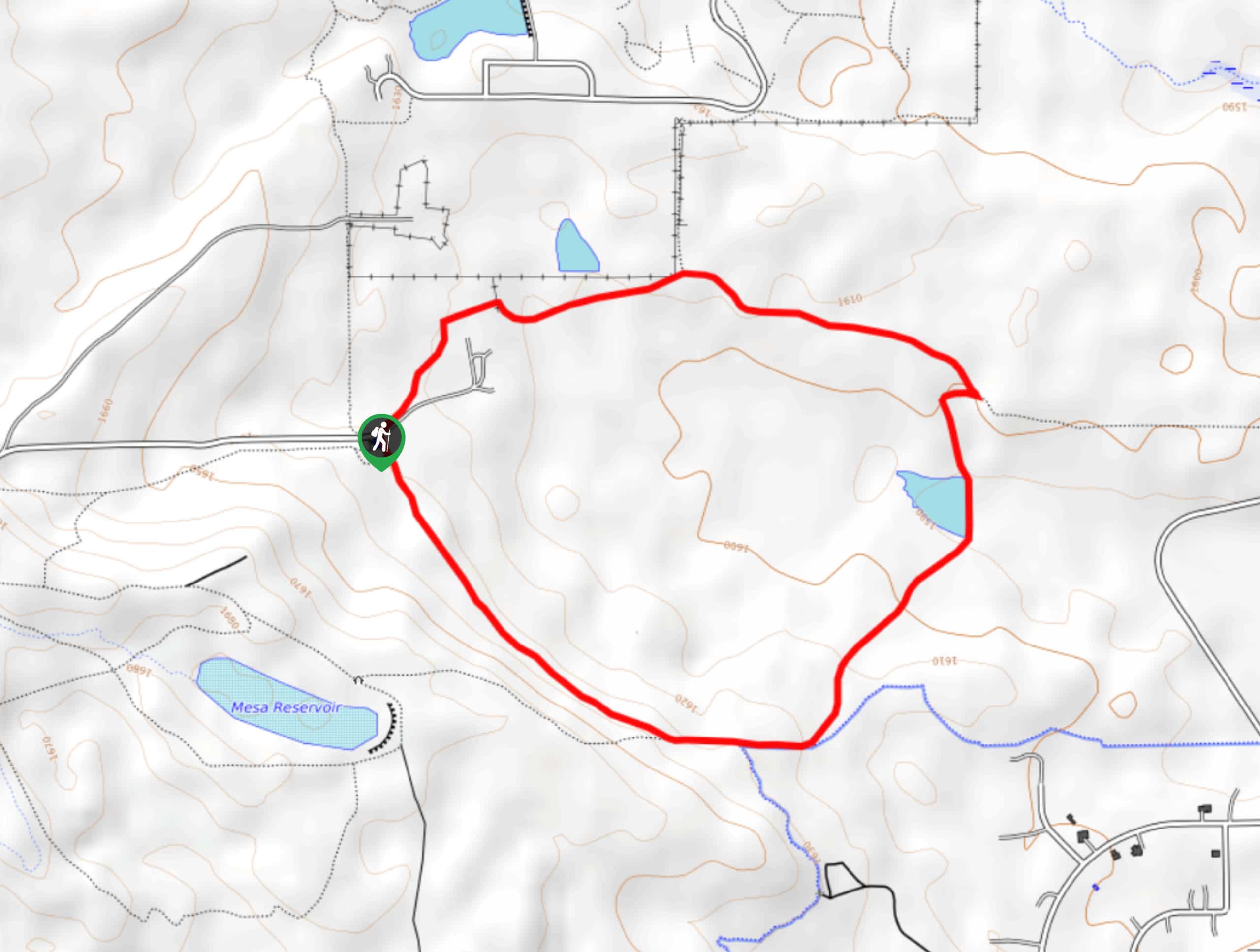
The Sage and Eagle Loop Trail exhibits the diversity of the Colorado wilderness as you walk through luxuriant meadowlands and ponds that reveal views of the rolling foothills and the cityscape. Short and sweet, this is the ideal family-friendly nature walk in the city.
Getting there
The Sage and Eagle Loop Trail departs from the Sage Trailhead off Longhorn Road.

About
| Backcountry Campground | No |
| When to do | Year-round |
| Pets allowed | Yes - On Leash |
| Family friendly | Yes |
| Route Signage | Average |
| Crowd Levels | Moderate |
| Route Type | Circuit |
Sage and Eagle Loop Trail
Elevation Graph
Weather
Sage and Eagle Loop Trail Description
Escape the hustle and bustle of the city and reconnect with nature along the Sage and Eagle Loop Hike. The ideal outdoor experience for the whole family, kids will enjoy exploring the pond’s ecosystems and wildlife like herons, ducks, and geese! Adults will enjoy the sights of the foothills that line the horizon and Boulder’s cityscape. Note this path is completely exposed, so it can be unbearably hot in the summer months, so we opt for early morning walks in the warmer months.
Embark on your journey along the Sage and Eagle Loop Trail from the Sage Trailhead. Though this path can be completed from either direction, we recommend hiking counterclockwise. From the trailhead, track southeast along the Sage Trail. Soon after your departure from the trailhead, you will encounter an intersection, stay left here and you will be diverted onto the Eagle Trail. Hike along the route, passing the Boulder Valley Ranch Pond.
At the next junction, keep left, reconnecting with the Sage Trail. Now wandering west, you will be rewarded with sights of the foothills. Follow this path all the way back to the trailhead, marking the end of your adventure.
Similar hikes to the Sage and Eagle Loop Trail hike

Crown Rock Trail
The Crown Rock Trail is a short but sweet nature walk that presents the perfect excuse to get the family…
Chautauqua, Bluebell and Baird Trail
Immerse yourself into nature and get some fresh air along the Chautauqua, Bluebell and Baird Trail. Conveniently located just outside…
Bluebell, Woods Quarry, and Enchanted Mesa Loop
The Bluebell, Woods Quarry and Enchanted Mesa Loop is a charming nature walk in the Boulder Open Space. Conveniently located…
Comments