Chautauqua, Bluebell and Baird Trail
View Photos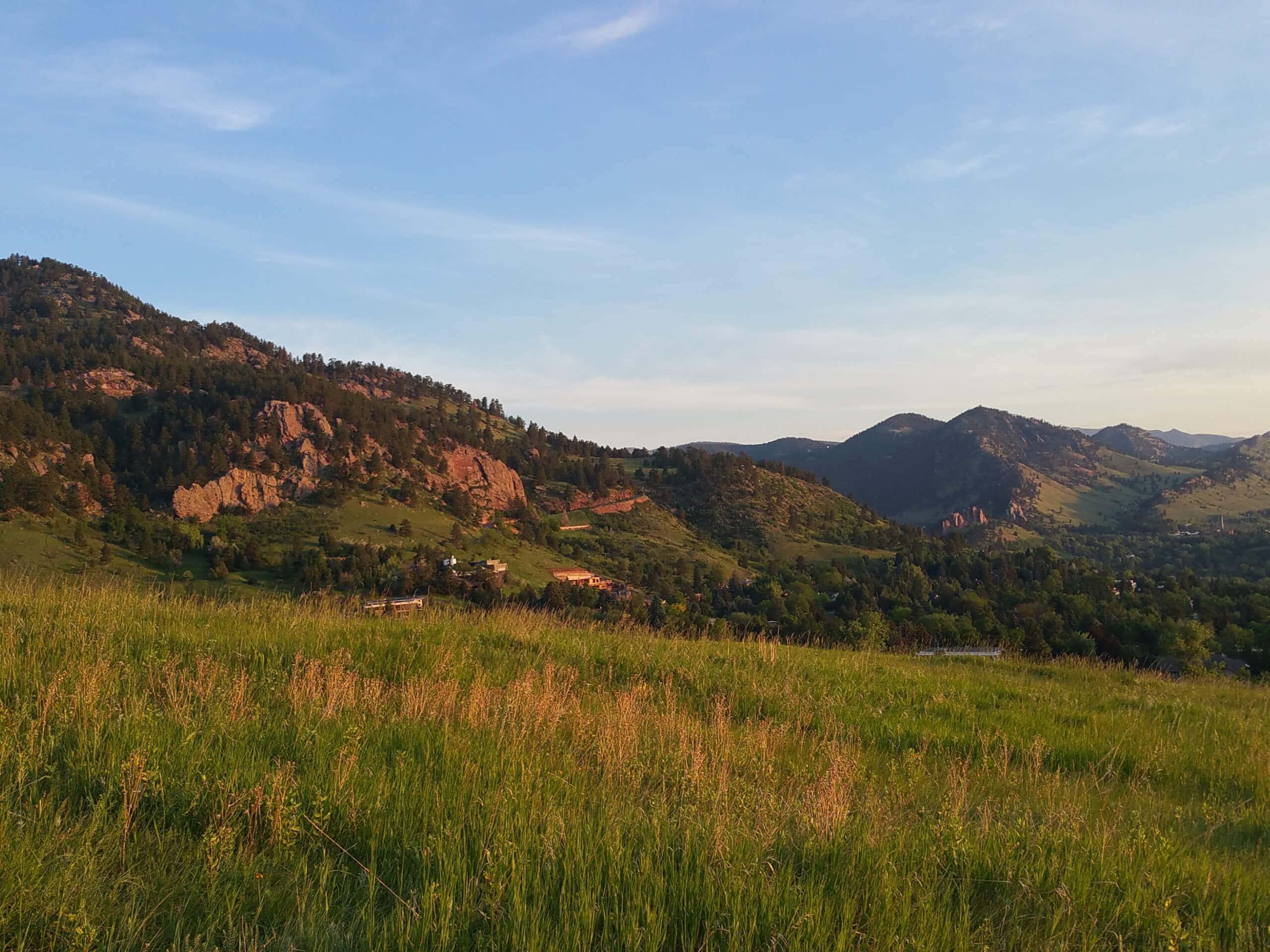
Chautauqua, Bluebell and Baird Trail
Difficulty Rating:
Immerse yourself into nature and get some fresh air along the Chautauqua, Bluebell and Baird Trail. Conveniently located just outside of Boulder’s city center, this is an epic escape from the busyness of the city into the wilderness. Though it is only a few minutes from the city, you will feel as though you have been transported to the middle of nowhere, which is why we love this trek so much.
Getting there
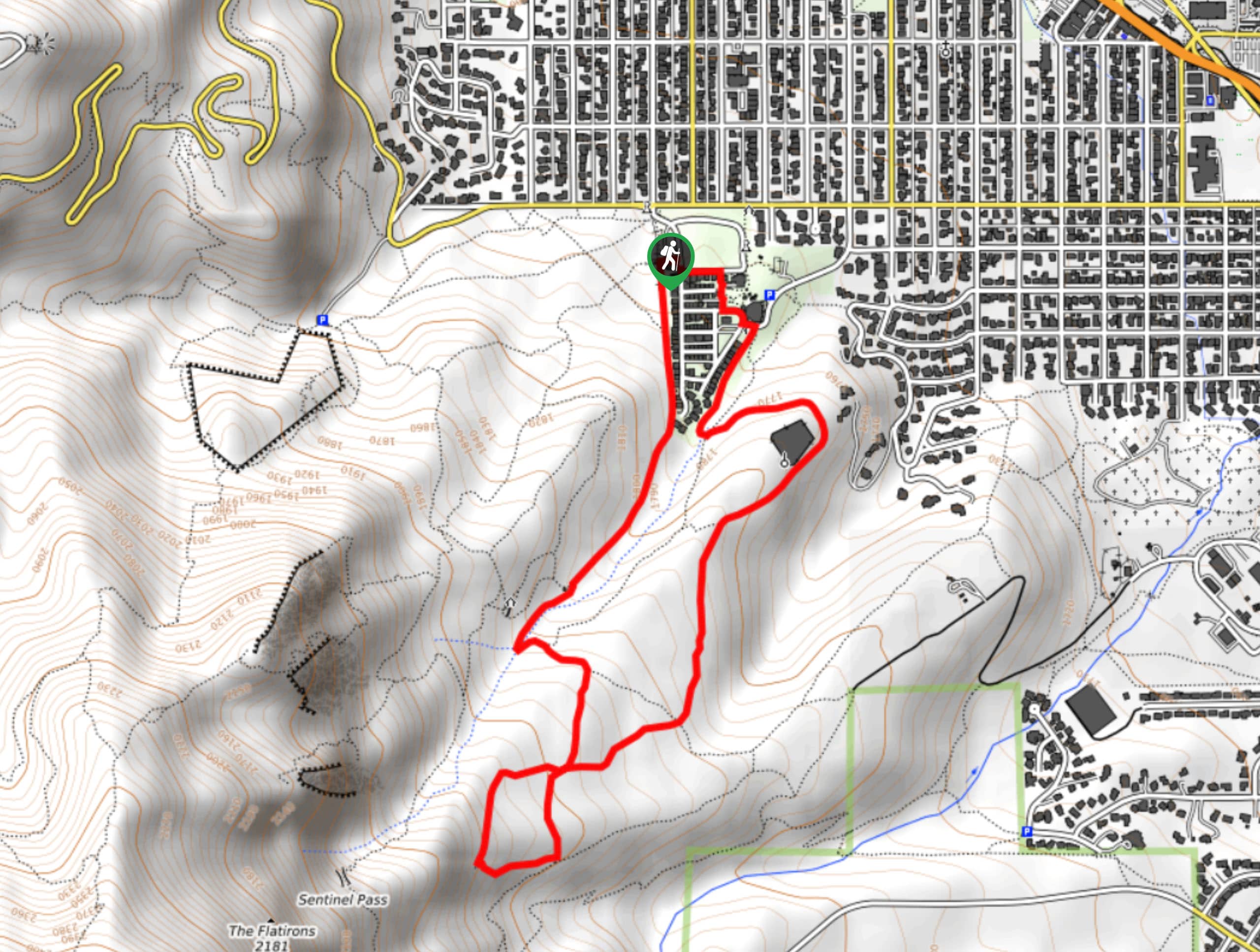
The Chautauqua, Bluebell and Baird Trail departs from the Chautauqua Trailhead off Kinnikinnick Road.

About
| Backcountry Campground | No |
| When to do | Year-round |
| Pets allowed | Yes - On Leash |
| Family friendly | Yes |
| Route Signage | Average |
| Crowd Levels | Extreme |
| Route Type | Lollipop |
Chautauqua, Bluebell and Baird Trail
Elevation Graph
Weather
Chautauqua, Bluebell and Baird Trail Description
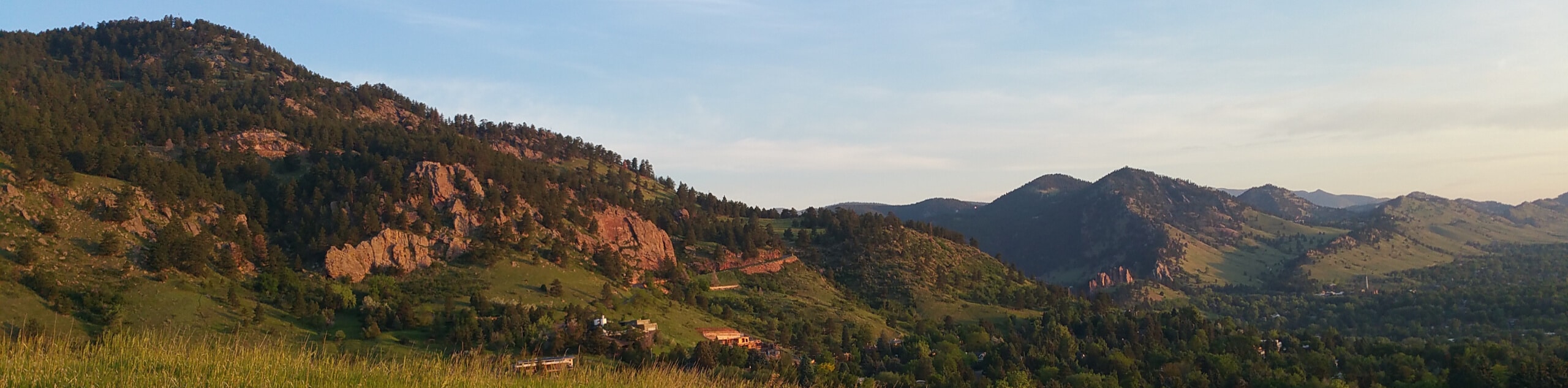
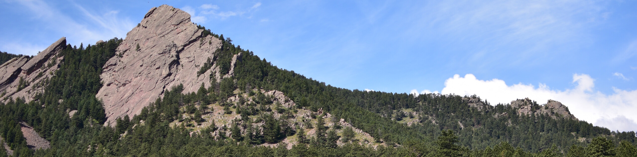
The Chautauqua, Bluebell and Baird Trail is a unique nature walk through the Boulder Open Space that delivers sights of the famous Flatirons looming above and the surrounding verdant foothills. In the company of several other like-minded adventurers, this is a great social adventure. If you are seeking a more secluded walk, then we suggest heading out in the early morning to beat the crowds. Open year-round, simply trade your hiking boots for snowshoes in the winter months. As you are travelling into the wilderness be mindful of fauna, keeping an eye out for grazing deer in the grasslands.
Departing from the Chautauqua Trailhead, the Chautauqua, Bluebell and Baird Hike tracks southwest along the meadow-cloaked path. Revel in the sights of the impressive sandstone slabs towering above as you trek near the base of the foothills. Soon you will encounter an intersection. From here, turn left and you will be diverted onto the Bluebell Mesa Trail.
The Bluebell Mesa Trail will lead adventurers out of the treeshade and back into the meadowlands. Hike this route until you reconnect with the Chautauqua Trail. Turn right at the intersection and follow this path back to the trailhead.
Similar hikes to the Chautauqua, Bluebell and Baird Trail hike

Crown Rock Trail
The Crown Rock Trail is a short but sweet nature walk that presents the perfect excuse to get the family…
Bluebell, Woods Quarry, and Enchanted Mesa Loop
The Bluebell, Woods Quarry and Enchanted Mesa Loop is a charming nature walk in the Boulder Open Space. Conveniently located…
Royal Arch, Bluebell and Meadow Loop
The Royal Arch, Bluebell and Meadow Loop is a unique adventure through the Boulder Open Space that reveals stunning sights…
Comments