NCAR Ramble Trail
View Photos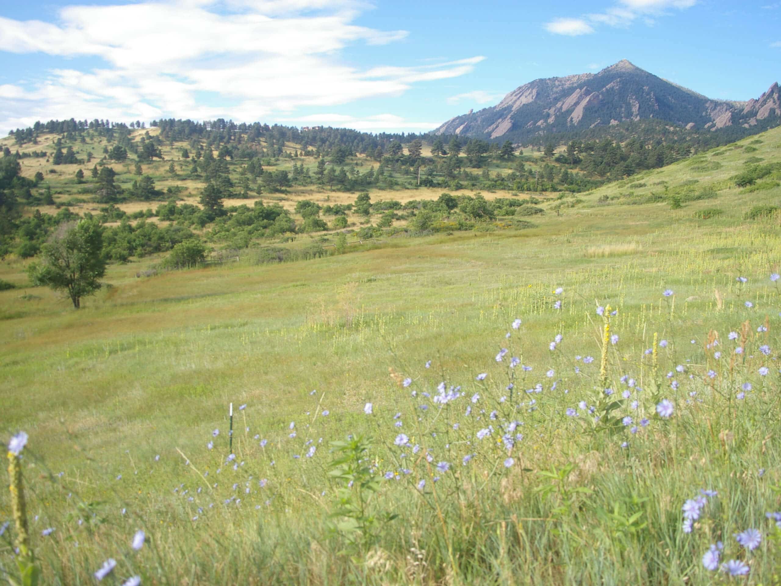
NCAR Ramble Trail
Difficulty Rating:
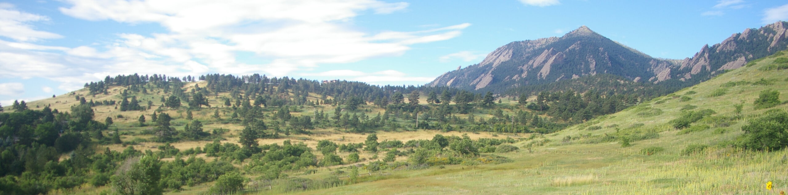
The NCAR Ramble Trail is a charming nature walk near the National Center for Atmospheric Research and through the quintessential Boulder wilderness. Perfect for families and novice hikers, this path will guide adventurers through charming grassland that reveals dumbfounding views of the famous Flatirons without having to exert much effort. Scenic, informative, and unique, this walk is a must add to your Boulder itinerary.
Getting there
The NCAR Ramble Hike departs from the trailhead and parking lot off NCAR Road.

About
| Backcountry Campground | No |
| When to do | Year-round |
| Pets allowed | Yes - On Leash |
| Family friendly | Yes |
| Route Signage | Good |
| Crowd Levels | High |
| Route Type | Circuit |
NCAR Ramble Trail
Elevation Graph
Weather
NCAR Ramble Trail Description
The NCAR Ramble Trail is a charming nature walk through the verdant wilderness that sits in the shadows of the Flatirons and Dinosaur Mountain. Exhibiting the diversity of the Colorado ecosystems, the path tours through arid meadowlands and ponderosa pine forests while revealing sights of the sandstone blades that protrude out of the landscape. Undoubtedly interesting, this hike will keep you on your toes. However, be mindful of the odd loose rock on the trail and keep an eye and ear out for rattlesnakes as you walk. If you venture this lovely route in the winter months, be sure to wear snowshoes or crampons to help navigate the snow-packed and likely icy terrain.
Versatile and open year-round, the NCAR Ramble Hike packs a punch. Perfect for hikers of all skill levels, adults and children alike, this route presents the perfect opportunity to get the whole crew away from their screens and into the wilderness. Let the fresh air fill your lungs and appreciate the grandeur of the flanking cliffs. Also informative, the NCAR has lined the lovely path with interpretive signs explaining the area’s vegetation, wildlife, weather, and geology. How cool! Learn more about the environment surrounding you as you get in your daily step count! Don’t forget to explore the grounds or take a tour of the National Center for Atmospheric Research before you leave!
Embark on your adventure along the NCAR Ramble Trail from the parking lot. From here, find the trailhead on the northwestern side of the lot and keep right along the NCAR-Table Mesa Trail. Now atop Table Mountain, you will begin descending northeast down the mesa. As you travel down the grassy mesa, you will be rewarded with sights of Boulder. Eventually, you will have to cross over Table Mesa Drive. Once you cross the intersection, you will be diverted onto the NCAR-Skunk Canyon Trail. Now trekking northwest, the path will merge onto the Skunk Canyon Service Road. The path will become increasingly forested as you near the base of the Flatirons. Enjoy the sights of the sandstone blades that loom above before you are completely engulfed in ponderosa pines.
Now intersecting with Skunk Creek, the route will divert you onto the Skunk Canyon Trail. Navigate a few sets of switchbacks beneath the timberline. At the next junction, keep left, and you will be diverted onto the Mesa Trail. Trek along the forested ridge beneath the sparse tree coverage, enjoying cityscape sights peeking through the tree breaks. You will once again cross over Skunk Creek, where you will take the Mesa Connector Trail before merging onto the NCAR Trail. This path will guide you out of the forestlands and through lush grasslands before delivering you back to the NCAR buildings and the parking lot, marking the end of your walk.
Trail Highlights
National Center for Atmospheric Research
The National Center for Atmospheric Research (NCAR) is a federally funded research and development center that sits atop Table Mountain near Boulder, CO. The NCAR is a research and scientific facility that investigates atmospheric topics of weather, water, climate, atmospheric chemistry, and more! Be sure to explore the impressive grounds and check if they are offering tours!
Frequently Asked Questions
Where can you park at NCAR?
When NCAR is closed, there is plenty of parking at the trailhead off Deer Valley Road.
Are dogs permitted on the NCAR Ramble Trail?
Yes, dogs are permitted on the NCAR Ramble Trail but must remain on-leash.
Insider Hints
If NCAR is closed, you can park at an alternative trailhead off Deer Valley Road
Trade your hiking boots for snowshoes in the winter months!
Take a camera, trust us
Keep an eye out for rattlesnakes as you walk along the arid terrain
Why not grab a coffee at The Laughing Goat after your hike?
Similar hikes to the NCAR Ramble Trail hike

NCAR to Fern Canyon Hike
The NCAR to Fern Canyon Hike is an awesome but challenging adventure up to the summit of Nebel Horn. Put…

Crown Rock Trail
The Crown Rock Trail is a short but sweet nature walk that presents the perfect excuse to get the family…

Rattlesnake Gulch Trail
The Rattlesnake Gulch Trail is an epic adventure through the Eldorado Canyon State Park. Ascend the steep cliffs of Eldorado…
Comments