
Enchanted Mesa, Bluebell Spur, and Chautauqua Loop
View Photos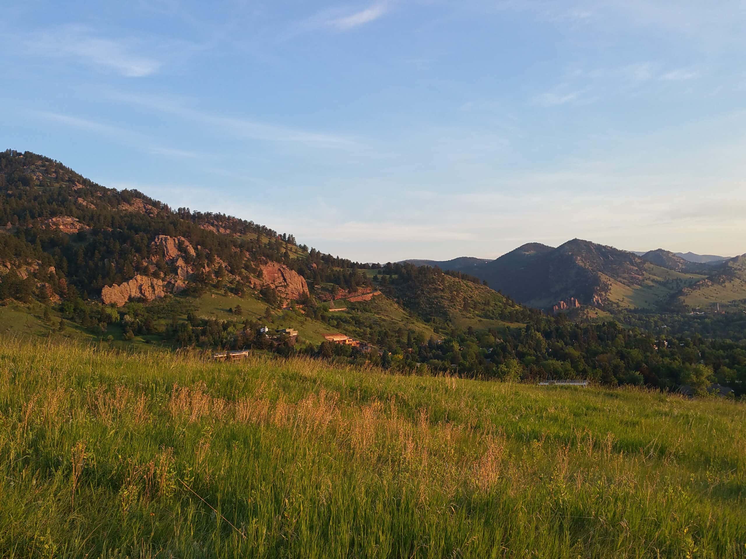
Enchanted Mesa, Bluebell Spur, and Chautauqua Loop
Difficulty Rating:
The Enchanted Mesa, Bluebell Spur, and Chautauqua Loop is a must-add to your Boulder adventure bucket list. Hike through luxuriant meadowlands, dense evergreen forests, and along wonderful routes that reveal astounding sights of the Flatirons that so famously represent the city of Boulder. What are you waiting for? Lace-up those hiking shoes, because we are going on an adventure!
Getting there
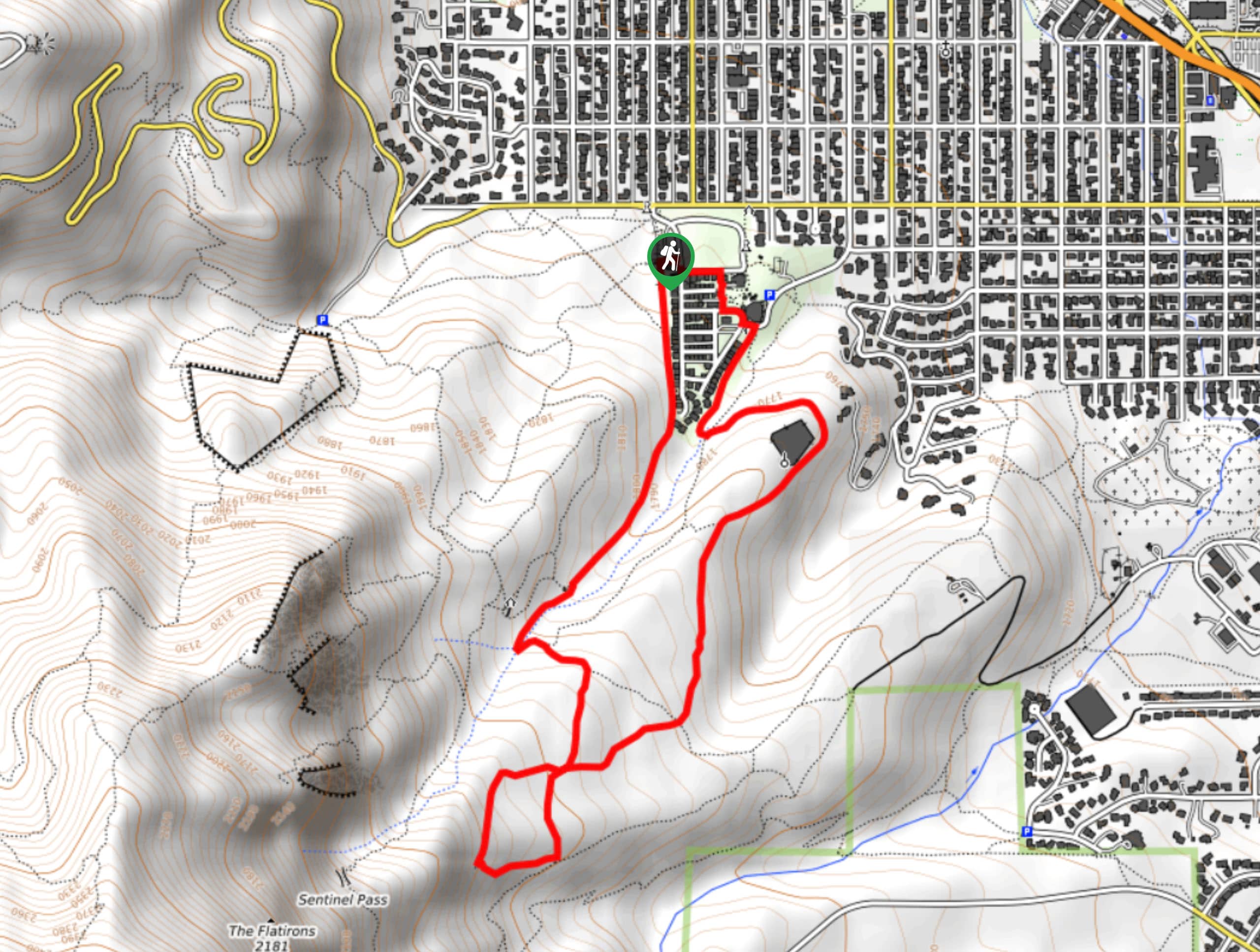
The Enchanted Mesa, Bluebell Spur, and Chautauqua Loop departs from the Chautauqua Park Parking Lot.

About
| Backcountry Campground | No |
| When to do | Year-round |
| Pets allowed | Yes - On Leash |
| Family friendly | Yes |
| Route Signage | Average |
| Crowd Levels | Extreme |
| Route Type | Circuit |
Enchanted Mesa, Bluebell Spur, and Chautauqua Loop
Elevation Graph
Weather
Enchanted Mesa, Bluebell Spur, and Chautauqua Loop Description
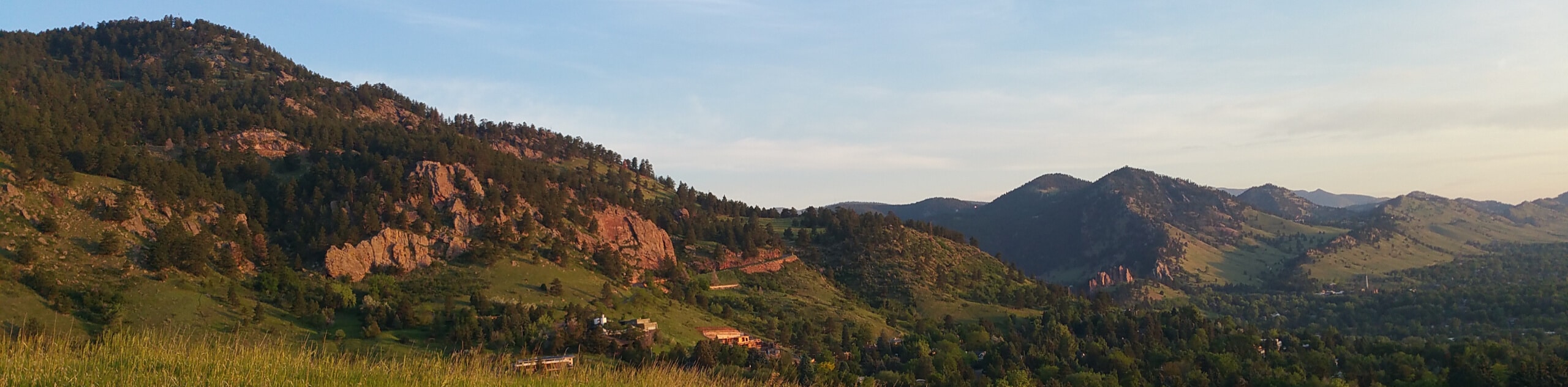
Presenting the ideal excuse to get out into the fresh air, the Enchanted Mesa, Bluebell Spur, and Chautauqua Loop will please all its hikers. Travel along meadowland paths lined with interesting interpretive signs and revel in the sight of the sandstone blades towering above. So conveniently located near Boulder and unassumingly beautiful, the Enchanted Mesa, Bluebell Spur, and Chautauqua Loop is a popular weekend escape, so expect to share the path with like-minded individuals. If you are seeking a more sequestered experience, then we urge you to consider another area. Note that parking within Chautauqua Park is limited and often charged per hour in the peak season, so we recommend walking in from the city center.
Departing from the parking lot in Chautauqua Park, the Enchanted Mesa, Bluebell Spur, and Chautauqua Loop heads south, connecting with the McClintock Lower Trail before merging onto the Enchanted Mesa Trail. Enjoy the sights of the Flatirons before the path treks through the woodlands. Hike along this path until the trail’s end, where hikers will want to take a sharp right onto the Mesa Trail. Follow this route over a small creek to the Bluebell Shelter.
From here, take the Bluebell Road Trail and connect with the Bluebell Spur Trail. This path will guide you out of the forestlands before merging onto the rightmost Bluebell Mesa Trail. At the next intersection, veer right and you will be diverted onto the Chautauqua Trail. Travel along this path until you meet the Kinnikinnick Road. From here, take the Clematis Drive East, through the green space and playground, reconnecting with the Chautauqua Park Road. Follow the route southwest all the way back to the trailhead.
Similar hikes to the Enchanted Mesa, Bluebell Spur, and Chautauqua Loop hike

Crown Rock Trail
The Crown Rock Trail is a short but sweet nature walk that presents the perfect excuse to get the family…
Chautauqua, Bluebell and Baird Trail
Immerse yourself into nature and get some fresh air along the Chautauqua, Bluebell and Baird Trail. Conveniently located just outside…
Bluebell, Woods Quarry, and Enchanted Mesa Loop
The Bluebell, Woods Quarry and Enchanted Mesa Loop is a charming nature walk in the Boulder Open Space. Conveniently located…
Comments