
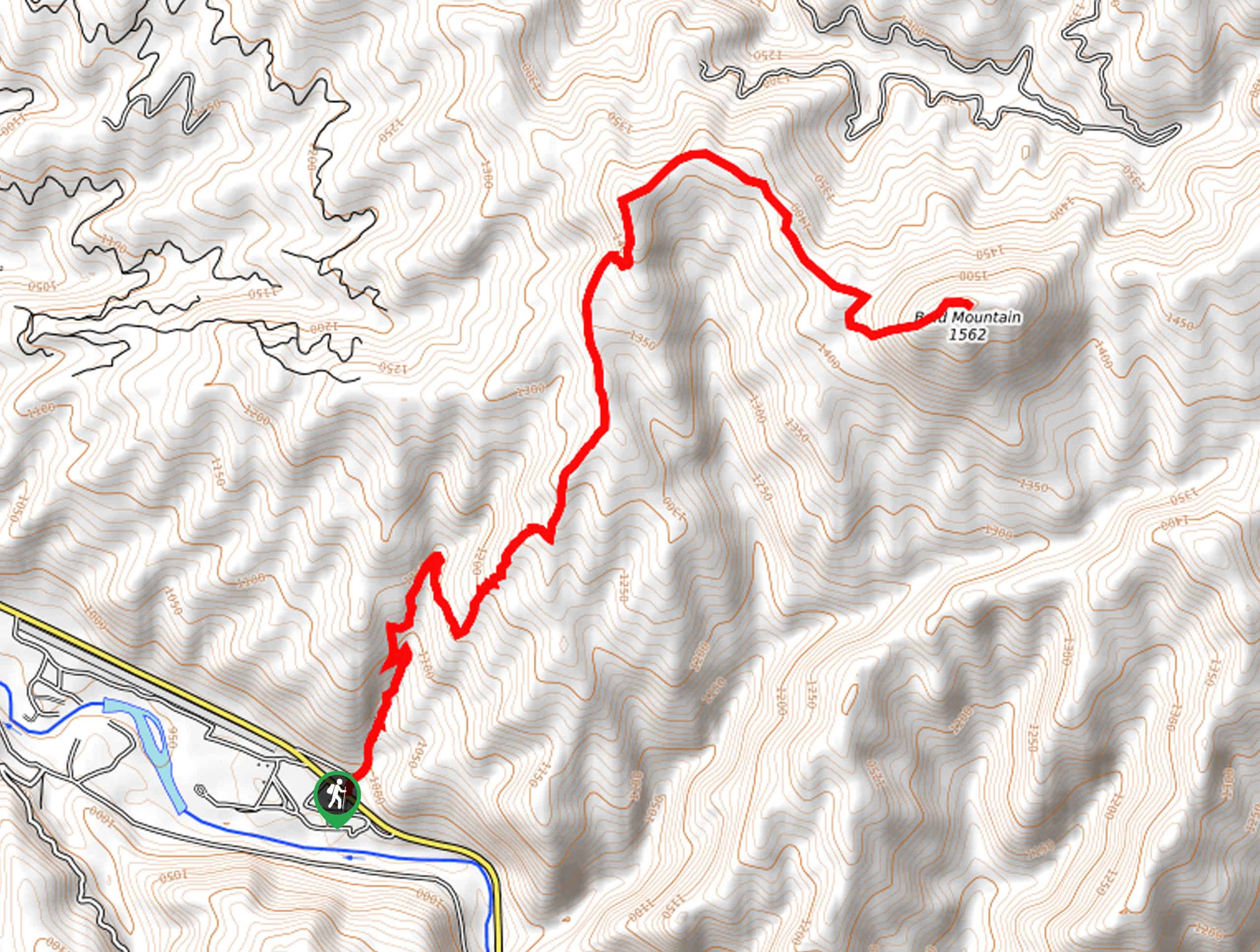
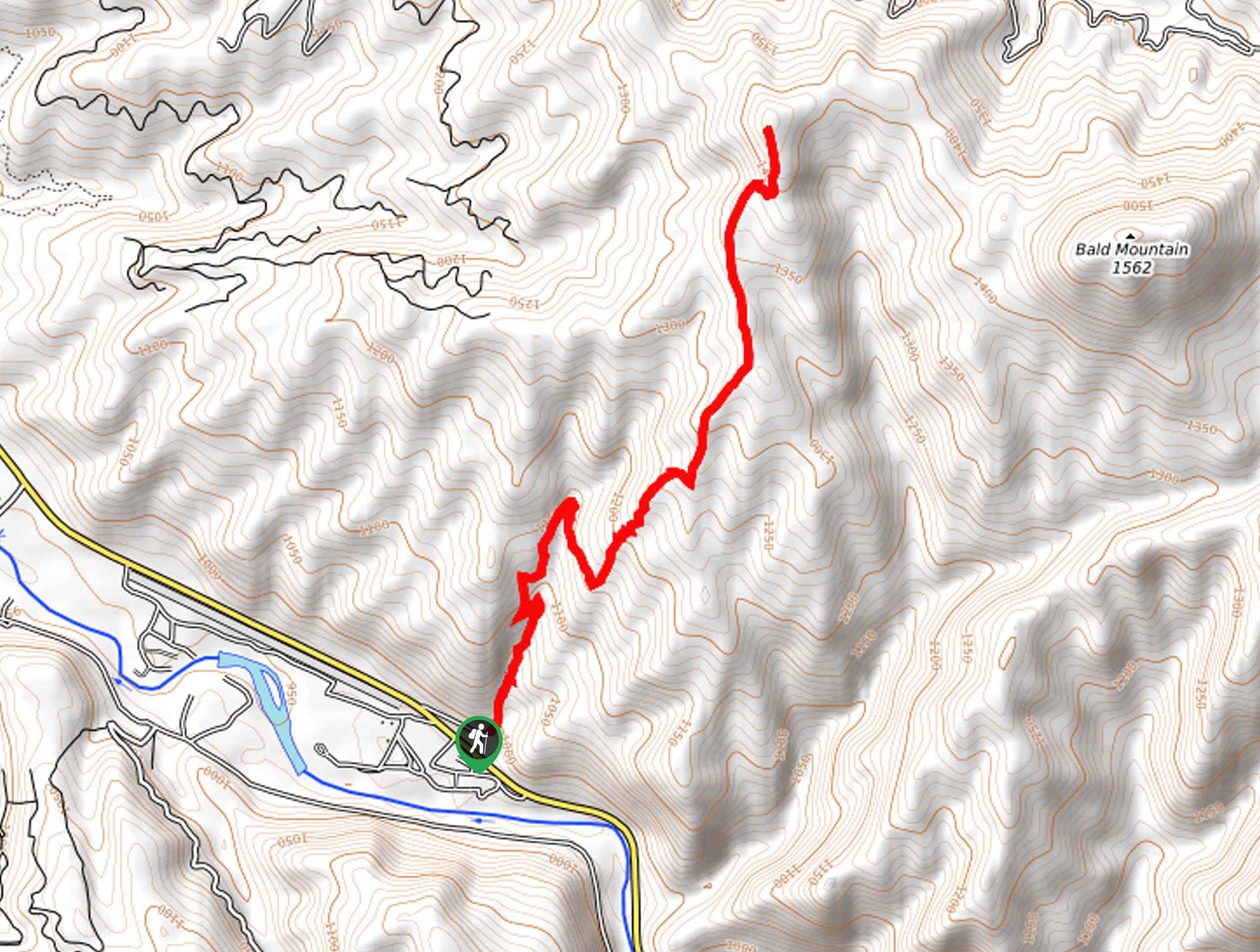
Station Creek to Bald Mountain Hike
View Photos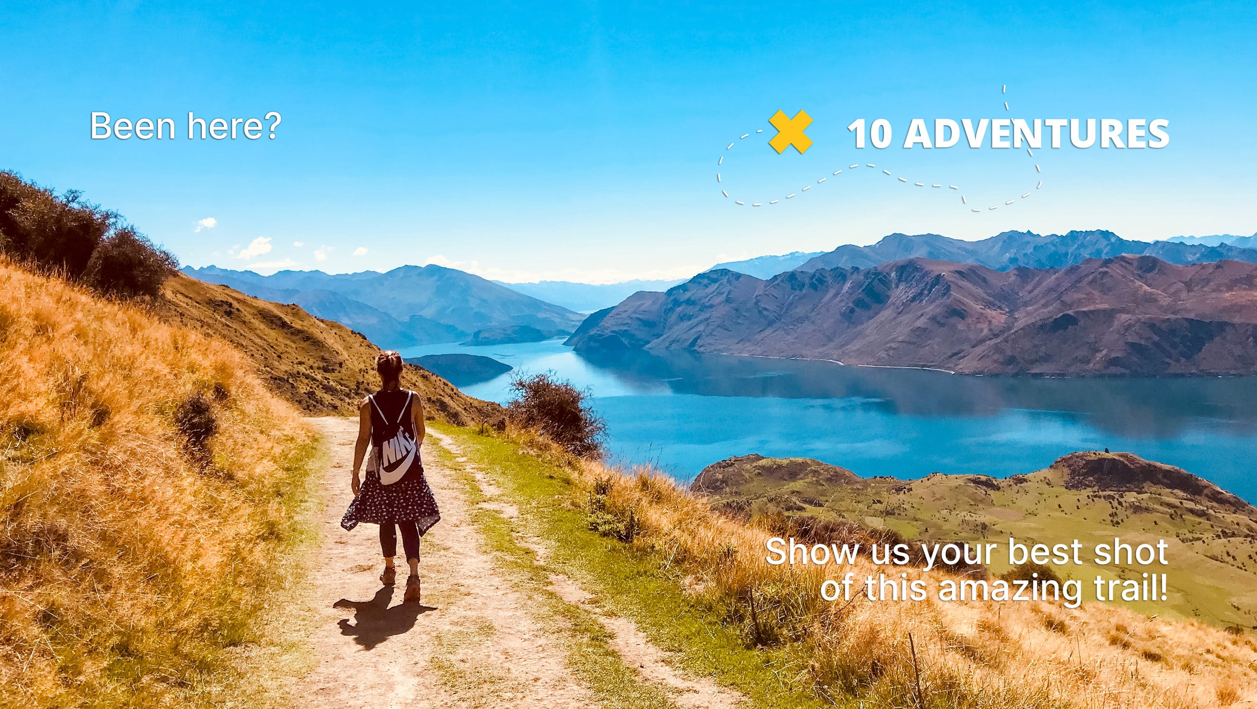
Station Creek to Bald Mountain Hike
Difficulty Rating:
The Station Creek to Bald Mountain Hike demands an arduous, off-trail ascent into the Boise Mountains, but the panoramic views from the summit are worth the sweat. Yielding a diversity of flora and fauna along the way, there is no shortage of excitement along this climb!
Getting there
The Station Creek to Bald Mountain Hike departs from the Station Creek Trailhead off Banks Lowman Road.

About
| Backcountry Campground | No |
| When to do | Year-round |
| Pets allowed | Yes - On Leash |
| Family friendly | No |
| Route Signage | Poor |
| Crowd Levels | Moderate |
| Route Type | Out and back |
Station Creek to Bald Mountain Hike
Elevation Graph
Weather
Station Creek to Bald Mountain Hike Description
Seeking an involved adventure in the Boise National Forest? Well, you have come to the right place. The Station Creek to Bald Mountain Hike is a challenging but rewarding trek. While the hike up Station Creek is lovely in and of itself, the views are not comparable to those from the summit of Bald Mountain. Note that the final push-up to the peak is overgrown and primitive, so you’ll have to do some bushwhacking and likely use the trail GPS. Be sure to pack plenty of water to stay hydrated and dress in layers as insurance against changing conditions.
Embark on your journey along the Station Creek to Bald Mountain Hike from the Station Creek Trailhead. Setting out from here, the Station Creek Trail will begin to steeply climb beneath the tree coverage of ponderosa pines. Enjoy the shade of the enchanting woodlands while you can because soon enough, the terrain will alternate between exposed meadows. Mind your footing on the uneven, steep terrain, and you will ultimately reach the summit of the Station Creek Trail. Beyond this point, the path is poorly marked, so use the trail GPS.
Traveling eastwardly through the overgrown forest and up the rocky terrain to the exposed summit. The 360-degree panoramas of the Boise Mountains and the Rockies in the Sawtooth Wilderness will render you speechless. Snap a few photos of the gorgeous landscape, then head back down the path the way you came.
Similar hikes to the Station Creek to Bald Mountain Hike hike
Station Creek Trail
The Station Creek Trail is a hidden treasure in the Boise National Forest. This lovely path explores shaded pine forests…
Around the Mountain Hike
Enjoy a different perspective of Bogus Basin along the Around the Mountain Hike. What is a bustling ski resort in…

Kepros Mountain Trail
The Kepros Mountain Trail ascends one of Boise’s famed ‘Grand Slam Peaks’. Tempting experienced hikers and ambitious beginners, this demanding…
Comments