Around the Mountain Hike
View Photos
Around the Mountain Hike
Difficulty Rating:
Enjoy a different perspective of Bogus Basin along the Around the Mountain Hike. What is a bustling ski resort in the winter turns into a hiking and mountain biking paradise in the summer for us to enjoy. This lovely route is ideal for intermediate hikers and families with older children.
Getting there
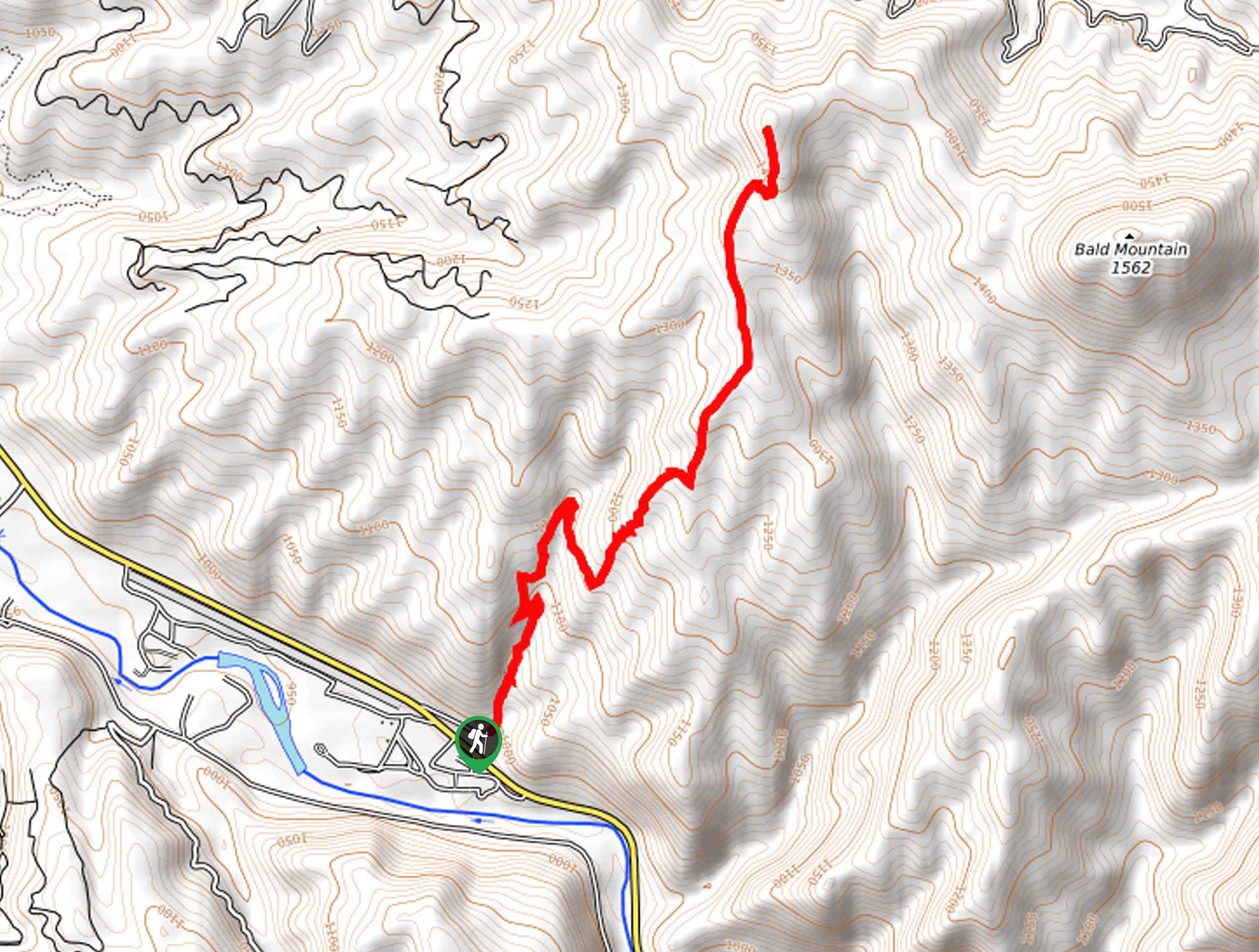
The Around the Mountain Hike is accessed from the #91 Deer Point Trailhead off N Bogus Basin Road.

About
| Backcountry Campground | No |
| When to do | March-October |
| Pets allowed | Yes - On Leash |
| Family friendly | Older Children only |
| Route Signage | Average |
| Crowd Levels | Moderate |
| Route Type | Circuit |
Around the Mountain Hike
Elevation Graph
Weather
Around the Mountain Hike Description
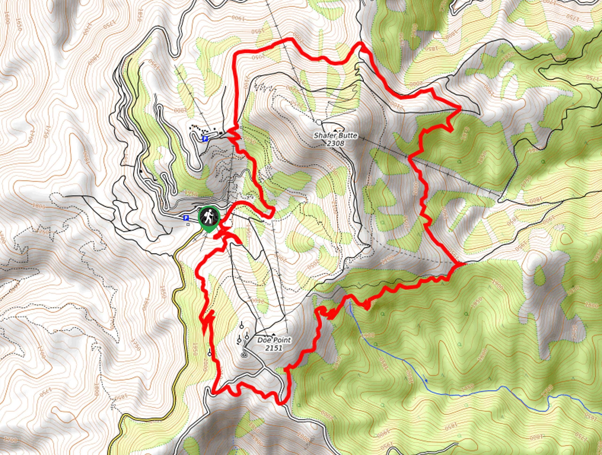
Bogus Basin is one of the most popular recreation destination areas near Boise, and there is no question as to why. The. Around the Mountain Hike loops around the forested flanks of the Shafer Butte—the highest peak in the Boise Ridge Mountains. In the spring, the terrain is often unstable with mud, but the trade-off is blossoming wildflowers—so we’ll take it! Note the network of trails is shared with mountain bikers, so as you wander, be mindful of passers-by! While the paths are mostly well-marked, the dozens of intersecting paths can be confusing, so use the trail GPS!
Embark on your adventure along the Around the Mountain Hike from the #91 Deer Point Trailhead. Setting out from here, the #91 Deer Point Trail will guide you southwardly, up to several switchbacks beneath a chairlift. Soon the path will straighten out, delivering you to an intersection. Next, merge onto the #98 Around the Mountain Trail, which, as you likely guessed, will contour the slopes of the mountain.
You will ultimately reach the trail’s end at Pioneer’s Lodge. Here, merge onto the Pioneer Trail, which will lead you down the slopes of the forested mountain to N Bogus Creek Road. Wander along the shoulder of the road back to the #91 Deer Point Trailhead, marking the end of your adventure.
Similar hikes to the Around the Mountain Hike hike
Moondipper Hot Spring and Pine Burl Hot Spring Hike
The Moondipper Hot Spring and Pine Burl Hot Spring Hike is a family-friendly adventure beckoning your exploration. Wander along the…
Station Creek Trail
The Station Creek Trail is a hidden treasure in the Boise National Forest. This lovely path explores shaded pine forests…

Kepros Mountain Trail
The Kepros Mountain Trail ascends one of Boise’s famed ‘Grand Slam Peaks’. Tempting experienced hikers and ambitious beginners, this demanding…
Comments