

Kepros Mountain Trail
View Photos
Kepros Mountain Trail
Difficulty Rating:
The Kepros Mountain Trail ascends one of Boise’s famed ‘Grand Slam Peaks’. Tempting experienced hikers and ambitious beginners, this demanding ascent explores arid moorlands and pockets of pines up to the summit that exposes breathtaking vistas.
Getting there
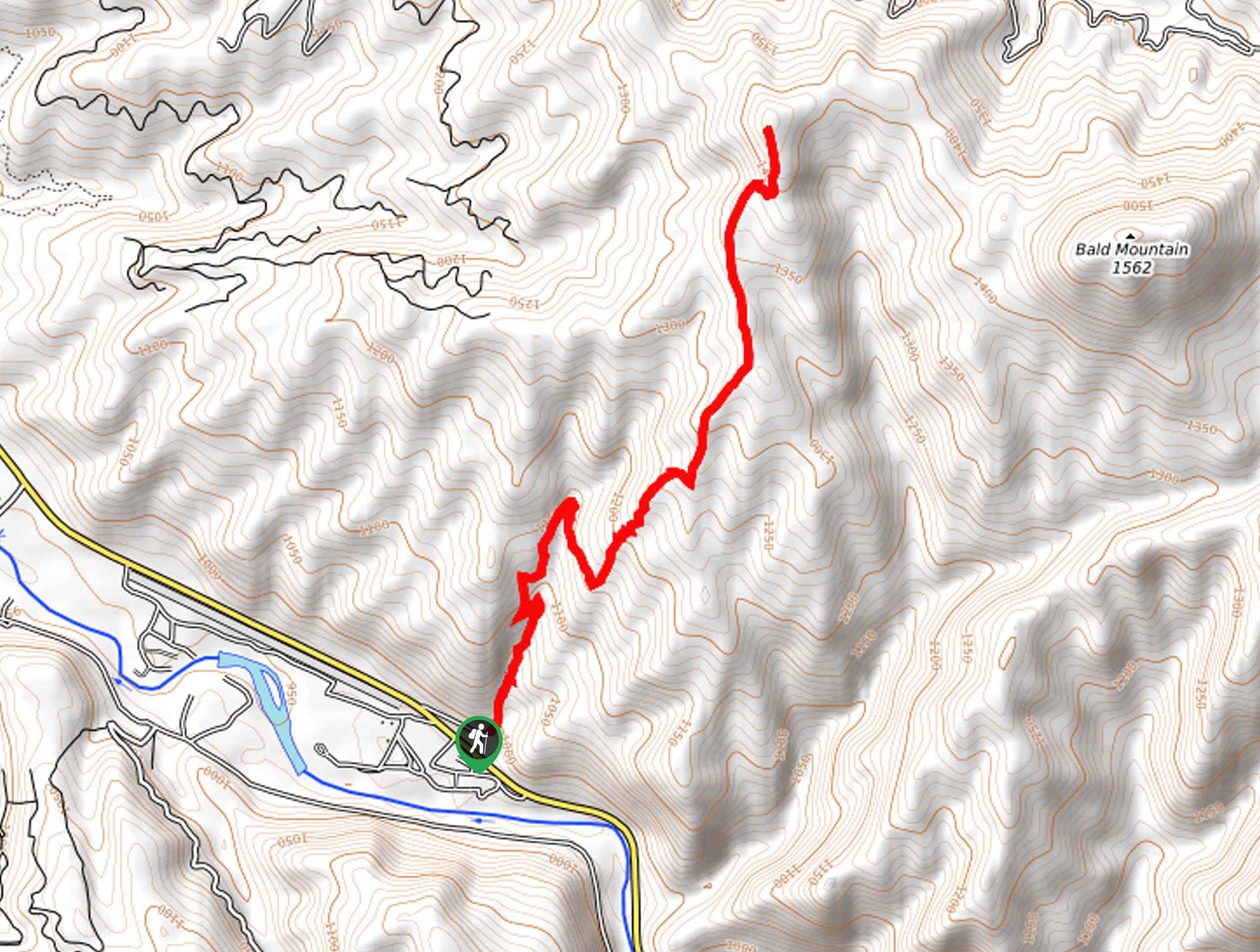
The Kepros Mountain Hike departs from the trailhead off Blacks Creek Road.

About
| Backcountry Campground | No |
| When to do | March-October |
| Pets allowed | Yes - On Leash |
| Family friendly | No |
| Route Signage | Poor |
| Crowd Levels | Low |
| Route Type | Out and back |
Kepros Mountain Trail
Elevation Graph
Weather
Kepros Mountain Trail Description
The Kepros Mountain Trail is a strenuous and impressively scenic trek that will surely put your navigational skill and stamina to the test. The exposed climb is consistent and tireless, so it is wise to pack plenty of water, wear SPF, and dress in layers as insurance against changing conditions. Additionally, the route is not well signposted and hard to follow, so use the trail GPS for easy navigation. Don’t forget your camera; the scenery is postcard-perfect.
Embark on your adventure up Kepros Mountain from the trailhead off Blacks Creek Road. Setting out from here, you will be guided northwestwardly up the flanks of Three Point Mountain. From here, you will gain the northern ridge. Now wandering north, the route will alternate through bitterbrush and bunches of arrowleaf balsamroot. As you climb, take the time to admire the beauty and grandeur of the mountainous landscape that stretches for as far as the eye can see.
Continuing along the northern ridge, the path will dip down toward Birch Creek before arduously ascending up to the summit of Kepros Mountain. The views from atop the peak will leave you speechless. Enjoy distant views of the rugged Sawtooth Mountain and the nearby Boise Mountains. After resting and rehydrating, retrace your steps back to the Trailhead.
Similar hikes to the Kepros Mountain Trail hike
Station Creek Trail
The Station Creek Trail is a hidden treasure in the Boise National Forest. This lovely path explores shaded pine forests…
Around the Mountain Hike
Enjoy a different perspective of Bogus Basin along the Around the Mountain Hike. What is a bustling ski resort in…
Dry Creek Trail
The Dry Creek Trail explores the wild character of the Boise Foothills. This epic expedition travels through the large drainage…
Comments