Pat's Trail Loop
View Photos
Pat's Trail Loop
Difficulty Rating:
The Pat’s Trail Loop explores a more secluded area of the Boise National Forest, allowing you to indulge in the beauty of the landscape without many distractions. Wander through pine groves and expansive grasslands that offer great views of the mountainscape.
Getting there
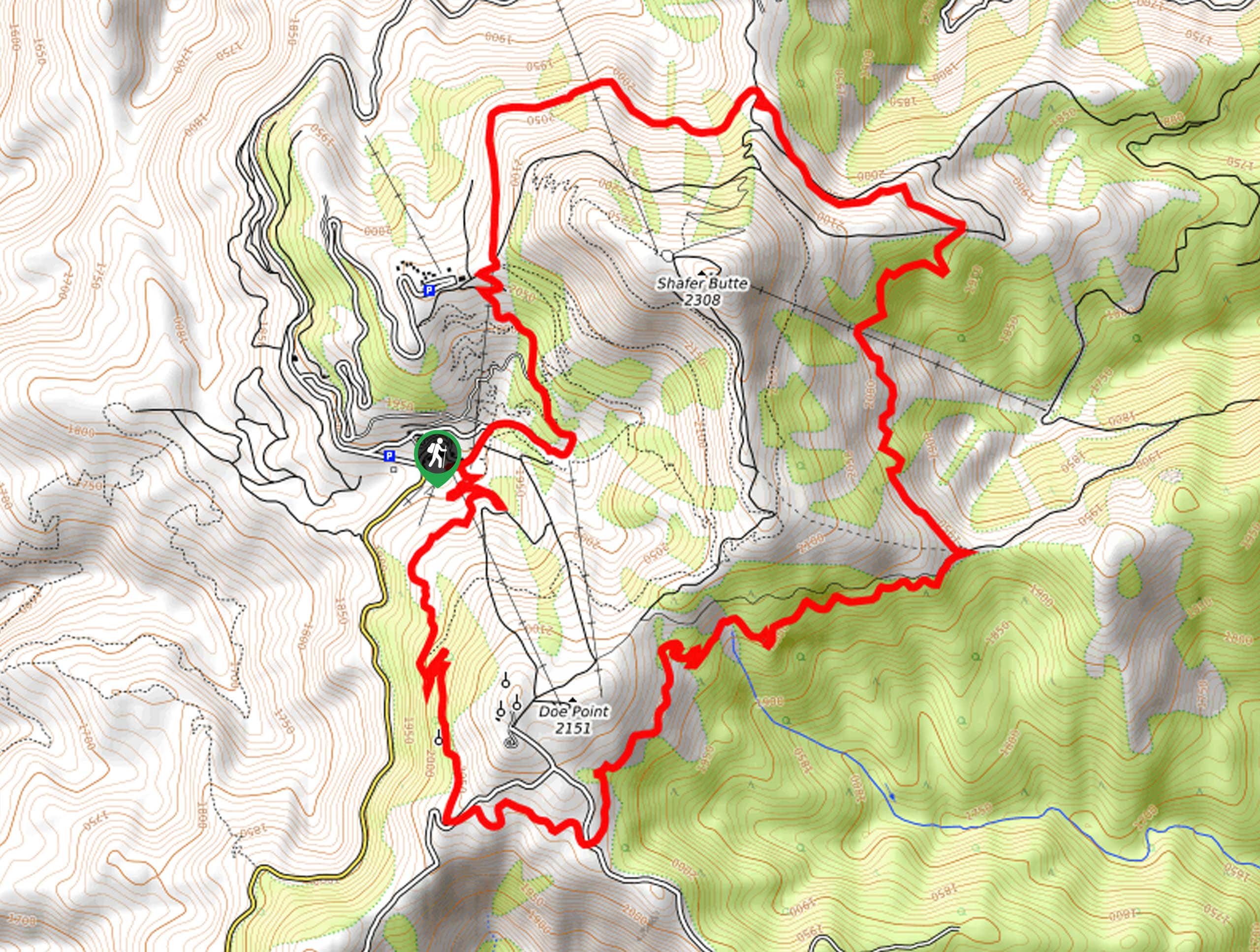
Access this adventure from the trailhead off N Bogus Basin Road.

About
| Backcountry Campground | No |
| When to do | Year-round |
| Pets allowed | Yes - On Leash |
| Family friendly | Older Children only |
| Route Signage | Average |
| Crowd Levels | Low |
| Route Type | Lollipop |
Pat's Trail Loop
Elevation Graph
Weather
Pat's Trail Loop Description
The Pat’s Trail Loop is not at the top of many adventurers’ Boise bucket list, but it should be. Reconnect with nature, no matter the season, and revel in the beauty of the mountainous landscape. As this path is lightly trafficked, it is not uncommon to encounter washouts and downed trees to navigate, though we like to think it’s all part of the fun! While it doesn’t pose much of an issue for hikers, mountain bikers may have to hop off and carry their wheels over the blowdown. Don’t forget to bring your camera; the scenery is unrivaled!
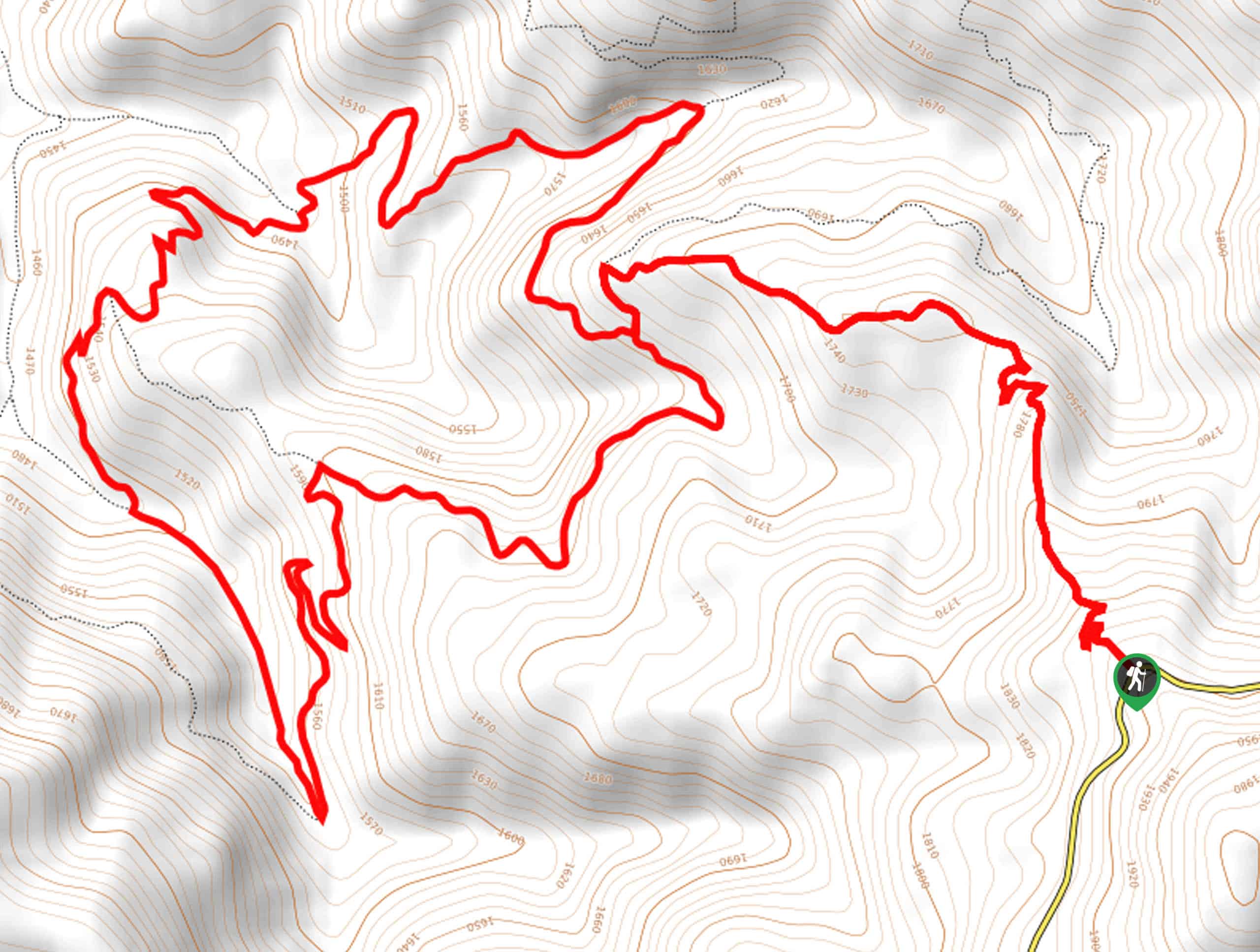
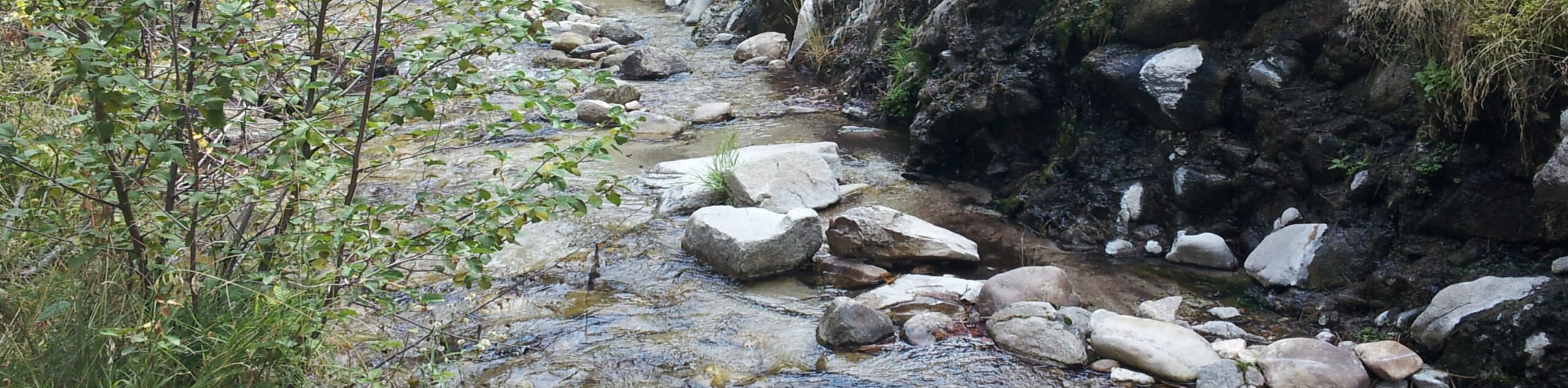
Setting out from the trailhead, you will be led northwardly along Pat’s Trail. This pleasant path will gently descend into the woodlands, offering some shade from the beating sun. After some hiking, the path will reroute you westwardly, ultimately delivering you to an intersection. Turn left here onto the Eastside Trail, then take a sharp right onto the Sinker Creek Trail. Now wandering north, the path will cross over Shafer Creek on two occasions before finally nearing Sinker Creek.
Enjoy the peaceful sounds of the babbling creek, then reconnect with the northbound Eastside Trail. Soon you will reach the junction with the Pat’s Trail, turn right, then retrace your steps back to the trailhead.
Similar hikes to the Pat's Trail Loop hike
Moondipper Hot Spring and Pine Burl Hot Spring Hike
The Moondipper Hot Spring and Pine Burl Hot Spring Hike is a family-friendly adventure beckoning your exploration. Wander along the…
Station Creek Trail
The Station Creek Trail is a hidden treasure in the Boise National Forest. This lovely path explores shaded pine forests…
Around the Mountain Hike
Enjoy a different perspective of Bogus Basin along the Around the Mountain Hike. What is a bustling ski resort in…
Comments