Morette Waterfall
View Photos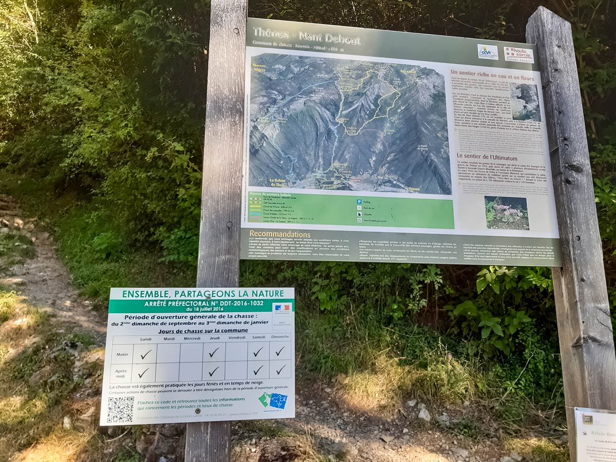
Morette Waterfall
Difficulty Rating:
Hidden behind the cliff face and woody forest of the entrance of this short hike is a beautiful waterfall as well as a peek into the past. Discover an unfinished World War II bunker after you admire the collection of waterfalls dotting this route!
Getting there

About
| Route Signage | Poor |
| Crowd Levels | Moderate |
| Route Type | Circuit |
| When to do | April - October |
| Backcountry Campsites | No |
| Toilets | No |
| Family friendly | Yes, but not for pushchairs |
Morette Waterfall
Elevation Graph
Weather
Route Description for Morette Waterfall
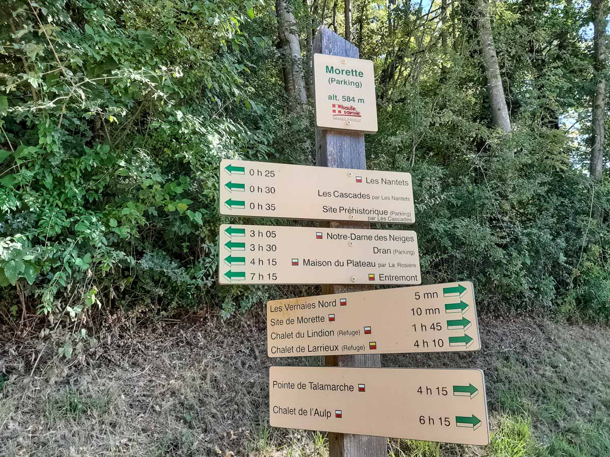
From the Morette car park opposite the Auberge de Morette, walk towards the panel showing the different walks. Look for the hunting season notice below the panel (it begins at the end of summer) and check that you’re not hiking during a hunting day if you’re visiting outside peak season.
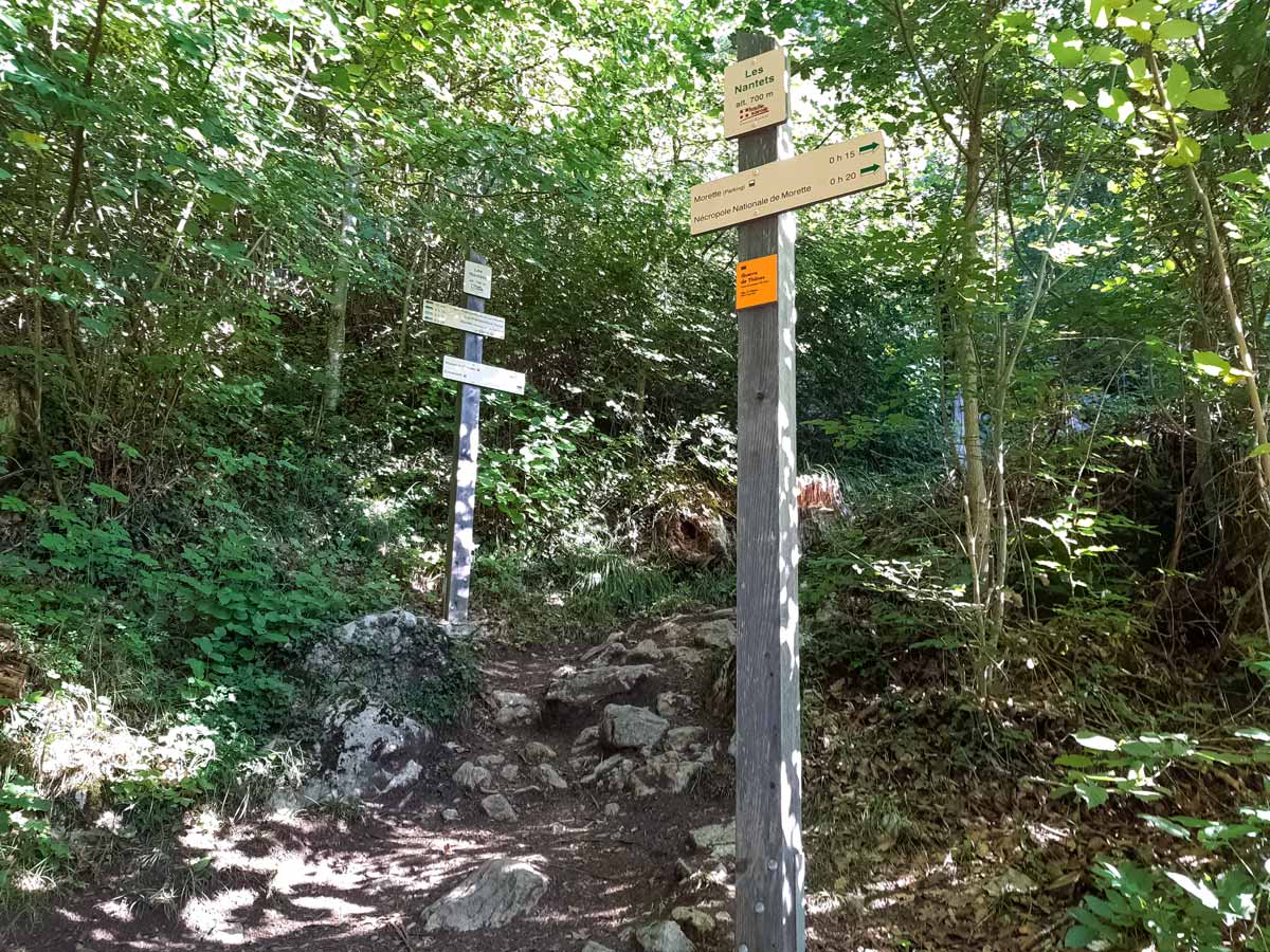
There are a number of walking signs here too. Look for the one that indicates 30 minutes to ‘Les Cascades par Les Nantets’ (‘The waterfalls via Les Nantets’). This is the steep way up, which is easier to get up than it is to walk down.
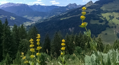
As you walk up the well-trodden dirt path, keep an eye out for Alpine cyclamen flowers native to this area. Also keep an eye out for tree roots: they jut out along the path throughout this walk, sometimes providing handy steps on the steepest parts.
As you climb up, you might hear a waterfall just beside the track. There are a few small waterfalls along the way which make the perfect spot for dogs to cool down and drink on your way to the larger waterfall.
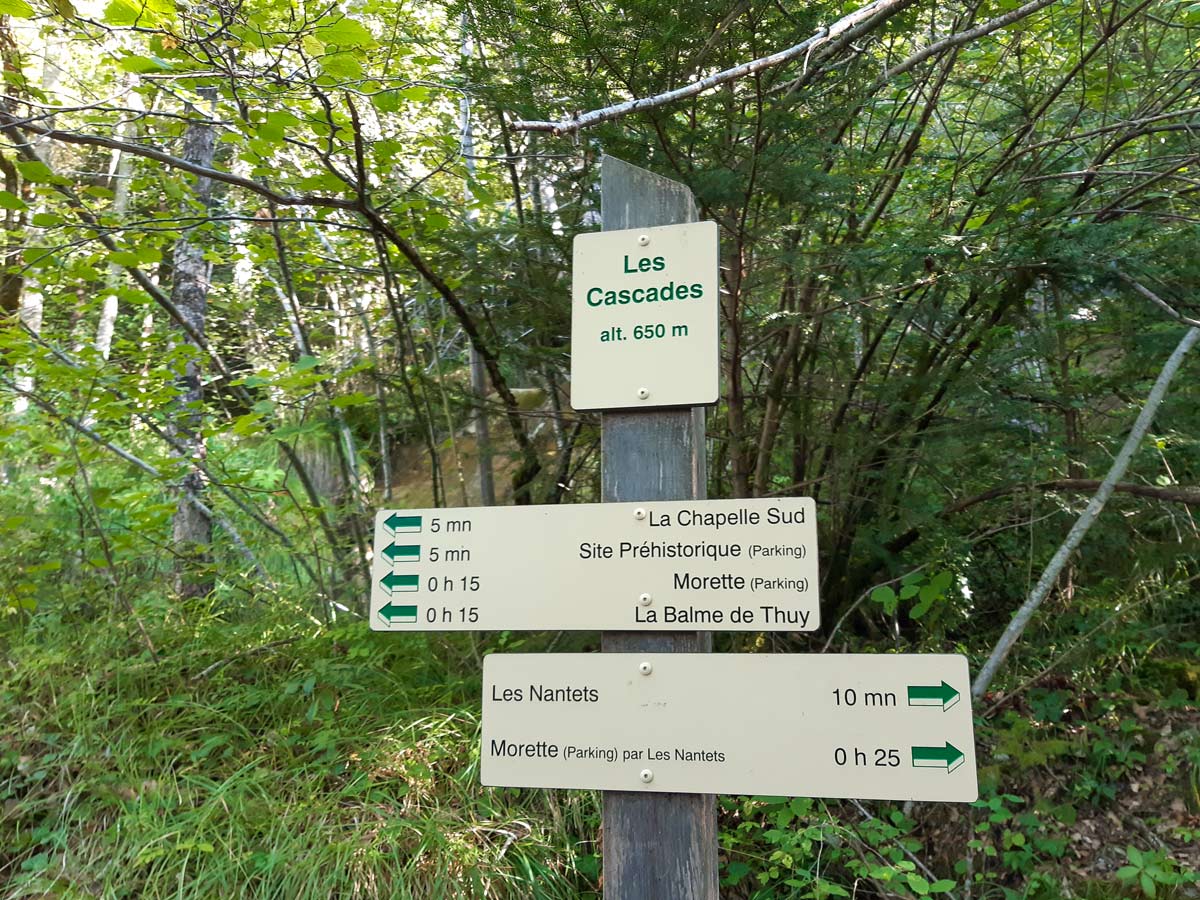
Although there is really only one track going up, look out for a split with very poor signage — on a rock. The rock has an arrow painted on it, indicating you should go left of the split. However, this track peters out to scrub. Ignore the arrow and take the other route, which climbs further up into the forest for 15 metres before it veers left and runs parallel to the scrubby path below.
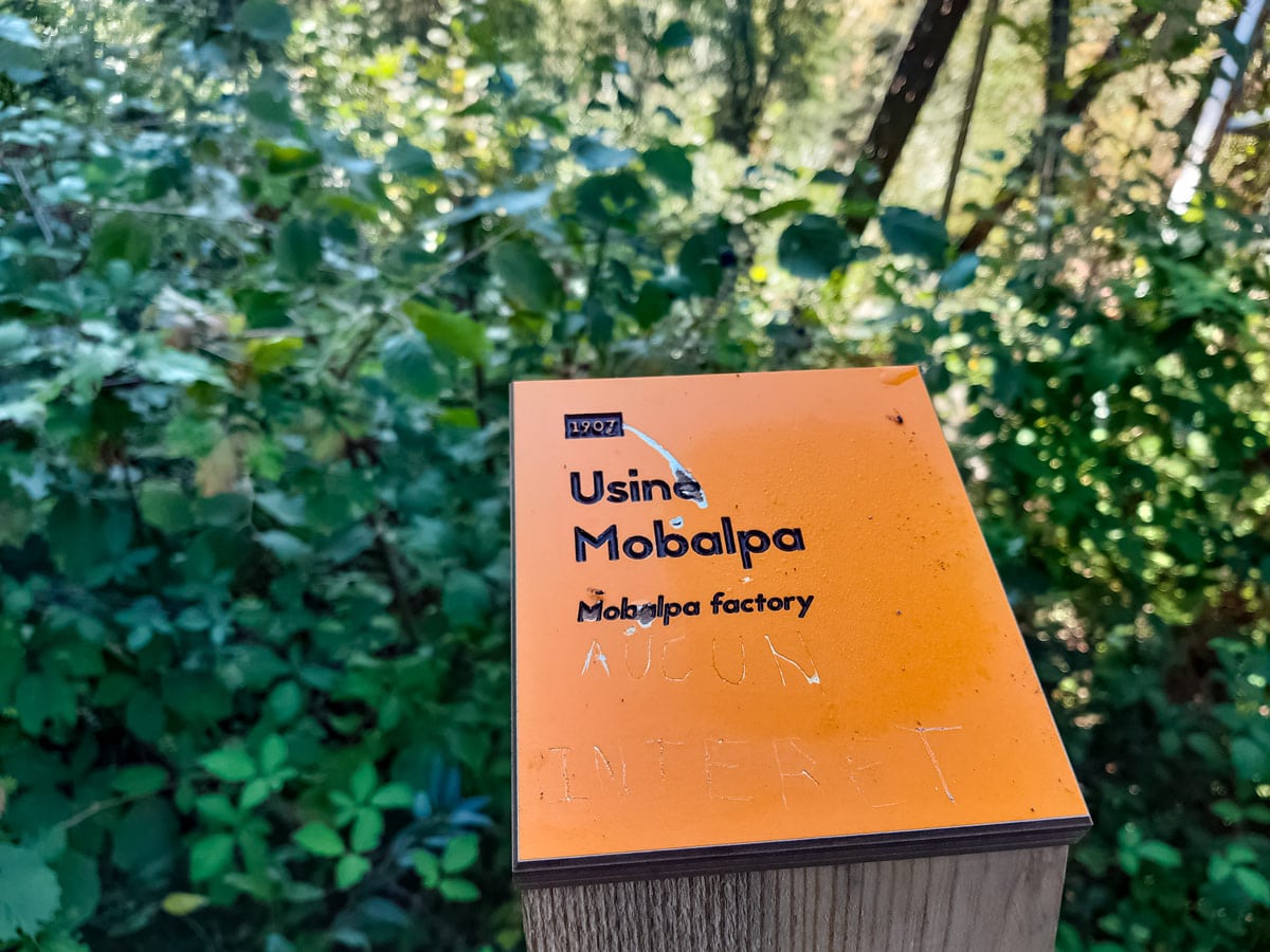
Signposts reappear when you hit Les Nantets soon after. This is the beginning of some very long hikes through the woods, so read the signposts carefully. You should turn left here, towards ‘Site Préhistorique’ (prehistoric site). Cross over a few bridges and small waterfalls towards the electricity tower where there’s an orange plaque pointing to the Mobalpa furniture factory in the valley below. Appropriately, someone has scratched ‘No interest’ onto the plaque.
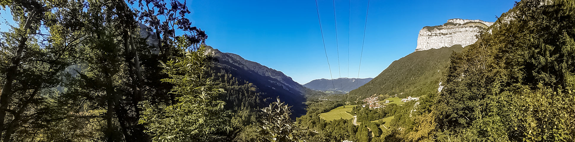
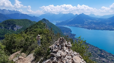
If you’re visiting in autumn, pick some blackberries as you head to the large, flat rock on the path in front. Climb on the rock to enjoy breathtaking views over the valley towards Annecy. Don’t get too close to the edge: it’s a long way down!
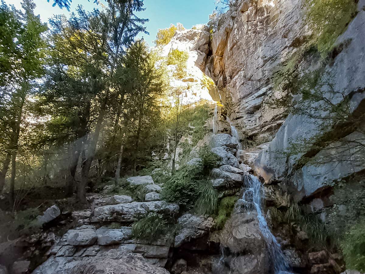
The main waterfall is just a few minutes further along the path, which descends a little. You’ll hear the waterfall before you see it. The locals sometimes take a risky dip in the fast-moving pools of water to cool down on hot summer days.
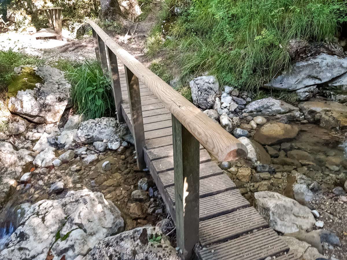
There is a direct path right beside the waterfall heading down, or an easier one among the trees a few metres away. Both paths lead to a wooden bridge over the flowing water and an information panel. Cross this bridge and then the other narrow ones right after.
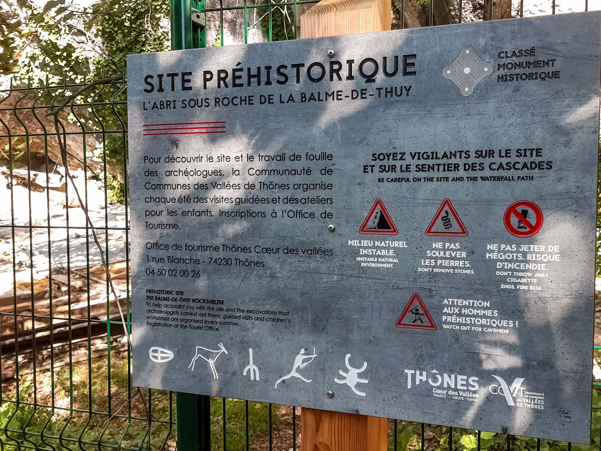
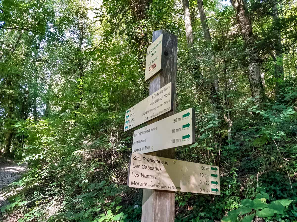
Look out for another split in the path without a signpost. Stay on the lower path to your left. You will soon come across a prehistoric site, which is typically closed except for public tours in summer. Walk past the site until you reach a gravel road. Turn left, following the signposts for ‘Morette (parking)’ — the starting point.
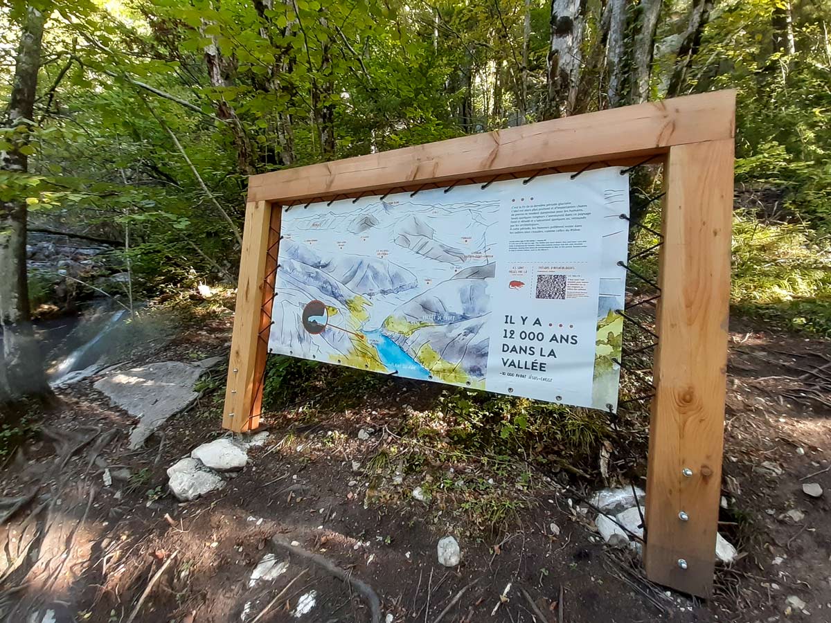
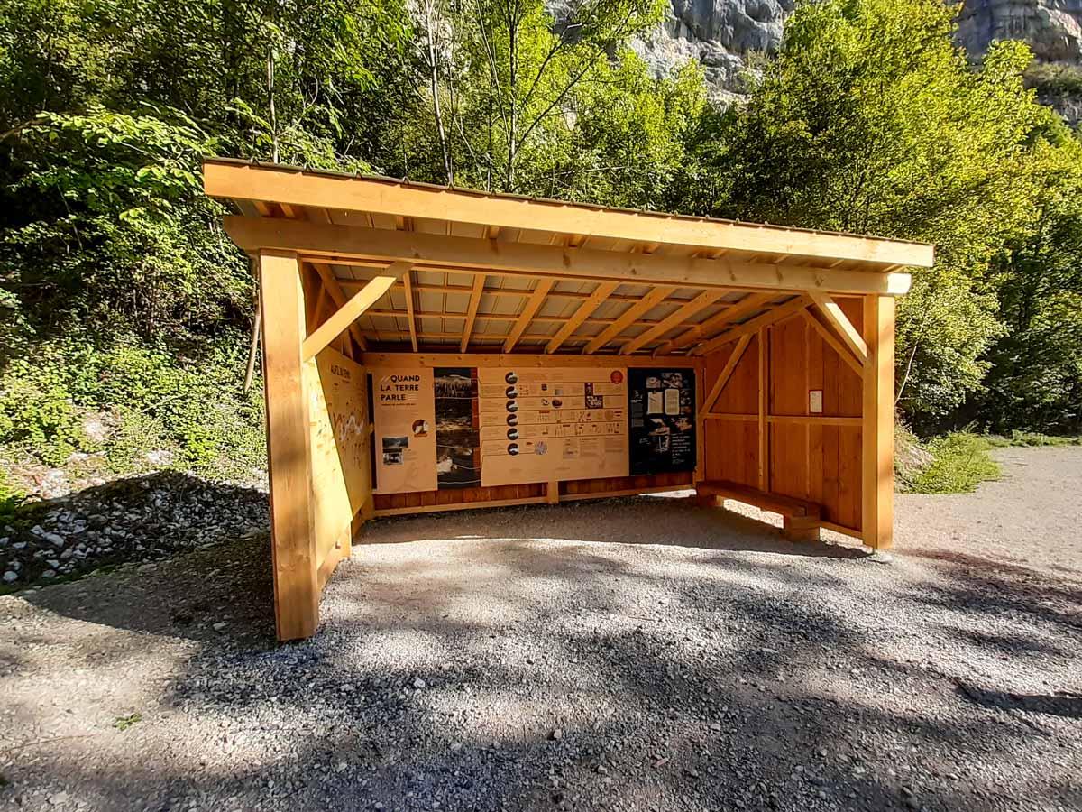
After a few minutes, the road will open to a picnic area with tables among shady trees and a public toilet. There is also a large shelter which contains a timeline of the earth and information in both French and English.
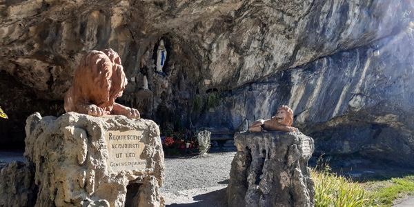
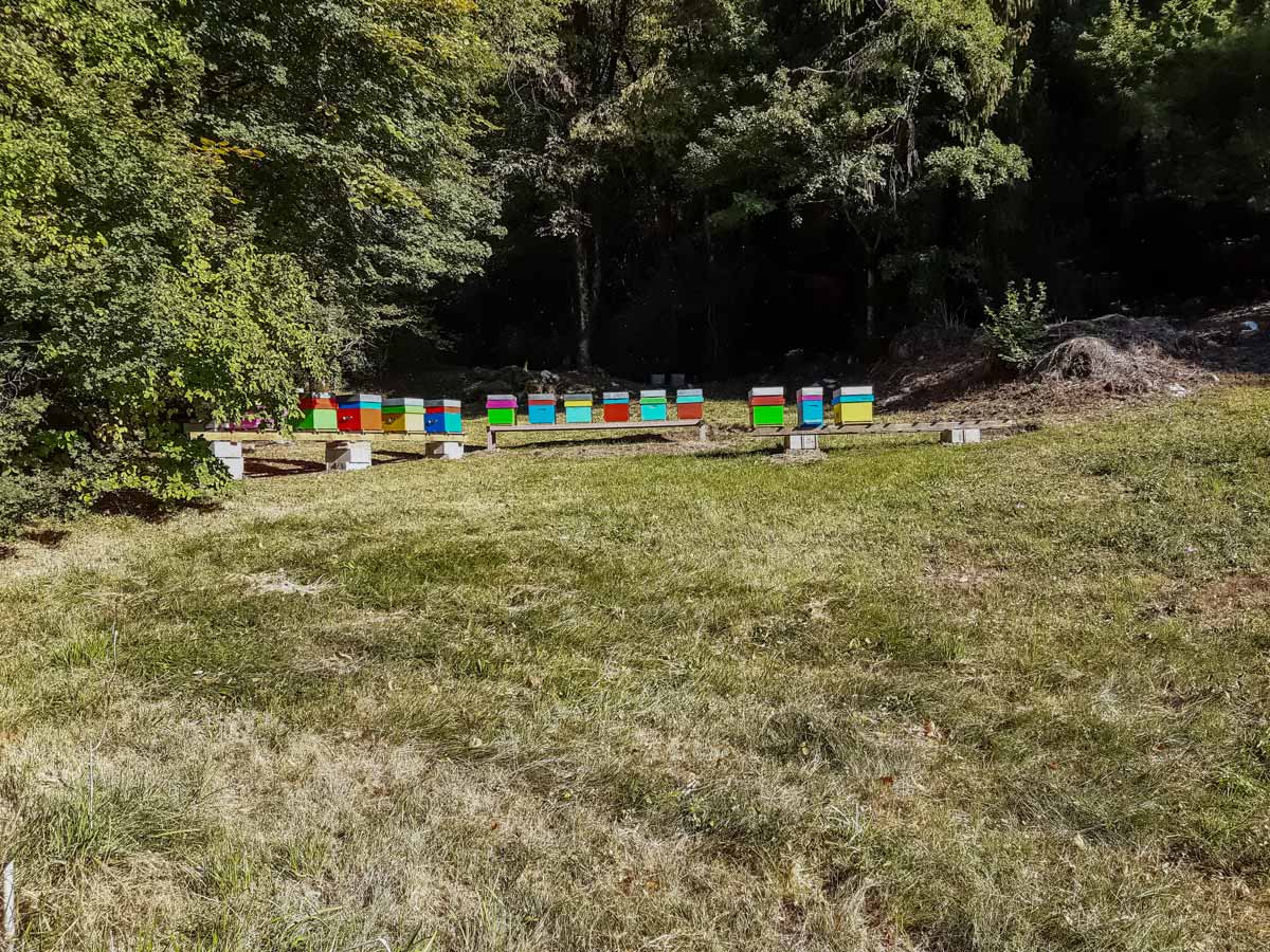
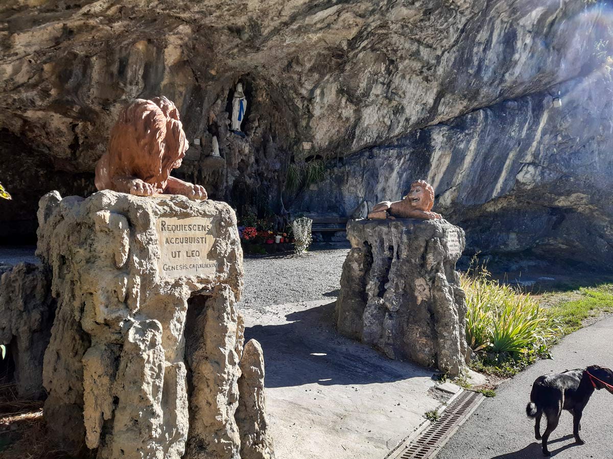
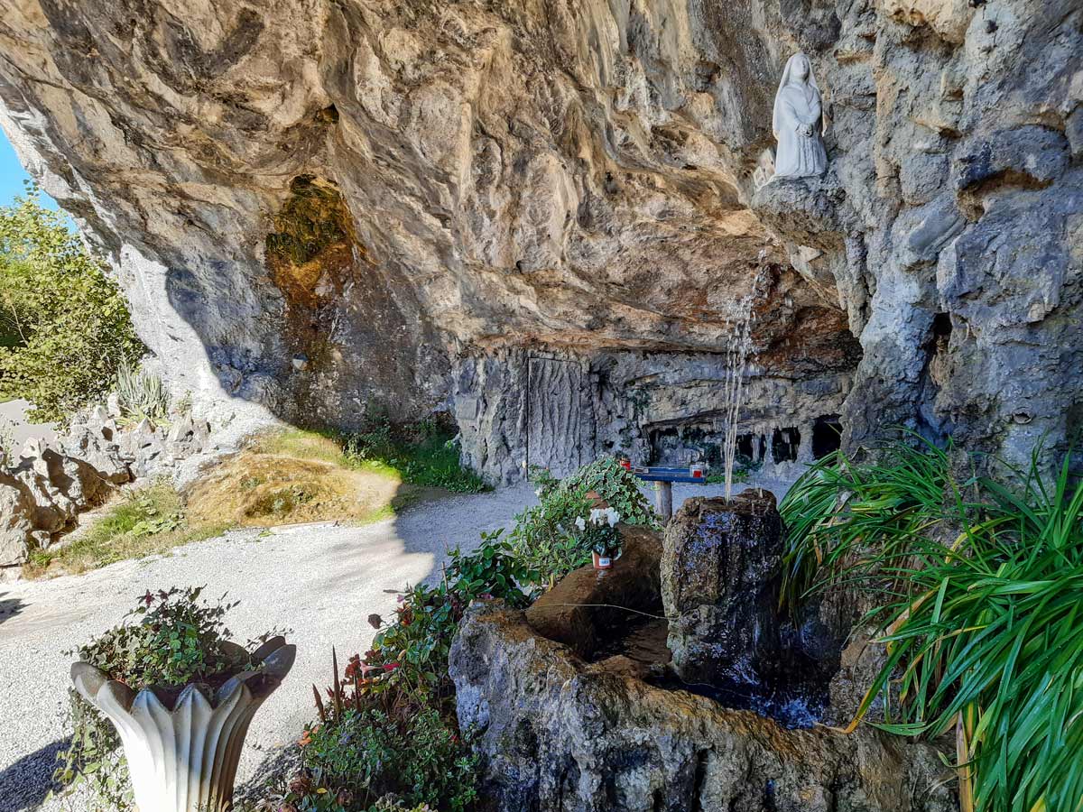
The gravel track ends here and the remainder of the walk is along a local asphalt road, but there’s more to see! Walk past the field of bee hives and a few small waterfalls to get to the grotto guarded by terracotta lions. It has a water feature and modern religious memorials. You can enter this area and look around.
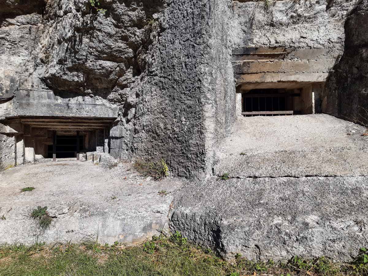
Carry on down the road to the final point of interest — an incomplete bunker from World War II, set in the rock not far from the grotto. It’s not possible to enter, so continue down the road for a few more minutes to return to the Morette car park.
Insider Hints
If your party prefers an easy route, take the reverse direction to the waterfall, then return the same way. It’s a much flatter option, but still not suitable for pushchairs.
If you’re interested in World War II history, cross the road and visit the Resistance museum and memorial (1-2hrs).
There are no toilets at the car park, but there are some at the picnic site.
Similar hikes to the Morette Waterfall hike
Refuge de La Bombardellaz
Like many hikes in the French Alps, this trail can be made shorter or longer depending on which path you…
Semnoz Hike
Semnoz is a ski resort on the Bauges pre-Alps mountain range, overlooking Lake Annecy and the Alps to the east…
Mont Baron
Mont Baron offers a sweeping 360° vista, with Lake Annecy to the west and the foot of the Alps to…
Comments