Rifugio Garelli hike
View Photos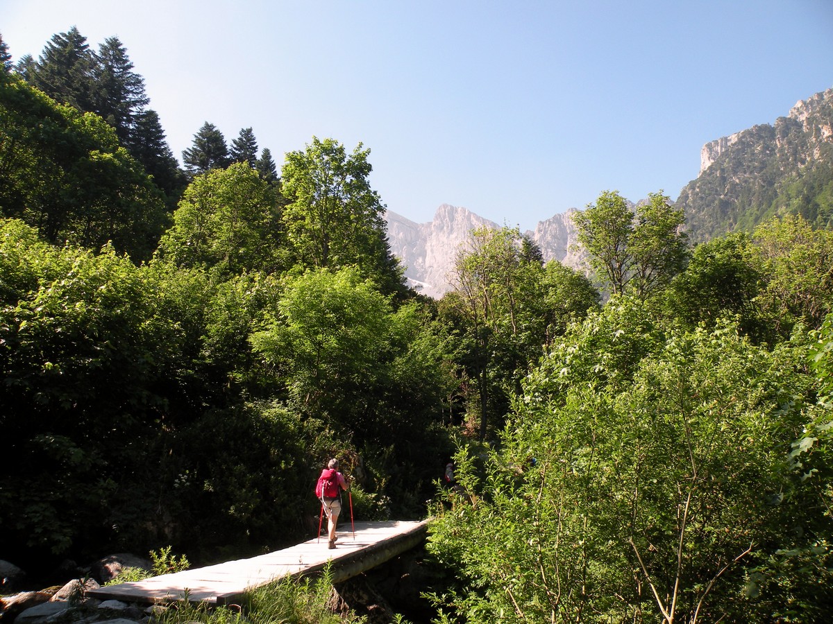
Rifugio Garelli hike
Difficulty Rating:
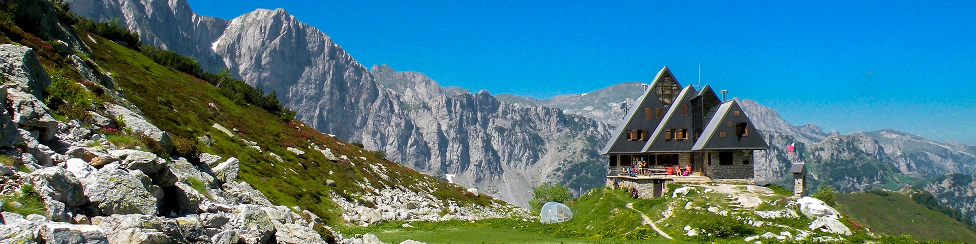
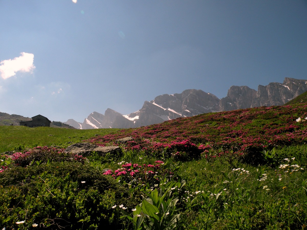
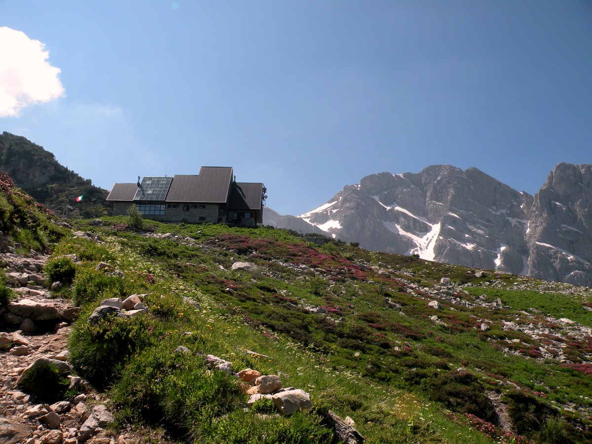
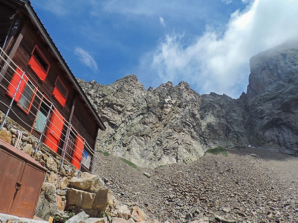
One of the many great Rifugios to hike to, the Garelli Rifugio is the only Rifugio in Valle Pesio. From its windows you can enjoy the view of Punta Marguareis, a limestone mountain in the center of the Ligurian Alps. In the mountain water and time have carved some crevasses that are 2297ft deep. From the Garelli Rifugio, you can get to France, or to the Vermenagna and Ellero valleys.
Getting there
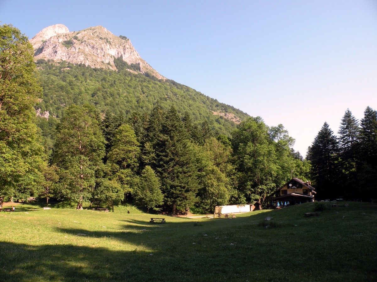
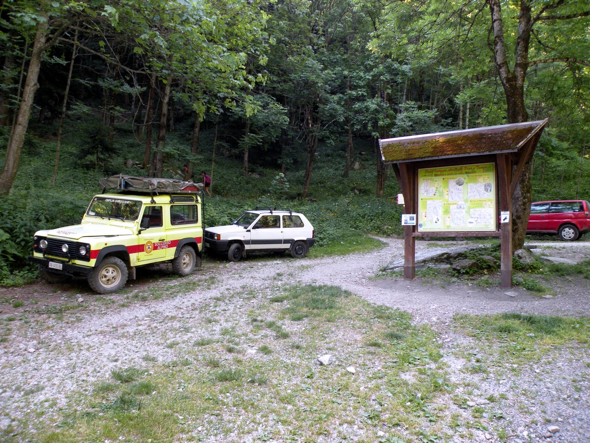
Make your way to Chiusa Pesio then go straight through it. After 6.2mi you’ll arrive at the Certosa di Pesio. You’ll pass the bridge on the left and you go straight for 2.5mi more, until Rifugio Pian delle Gorre (3386ft).

About
| When to do | June to end of October |
| Backcountry Campsites | Yes, in Pian delle Gorre |
| Toilets | Yes, in Pian delle Gorre or in the Rifugio |
| Family friendly | No |
| Route Signage | Average |
| Crowd Levels | Moderate |
| Route Type | Out and back |
Rifugio Garelli
Elevation Graph
Weather
Route Description for Rifugio Garelli
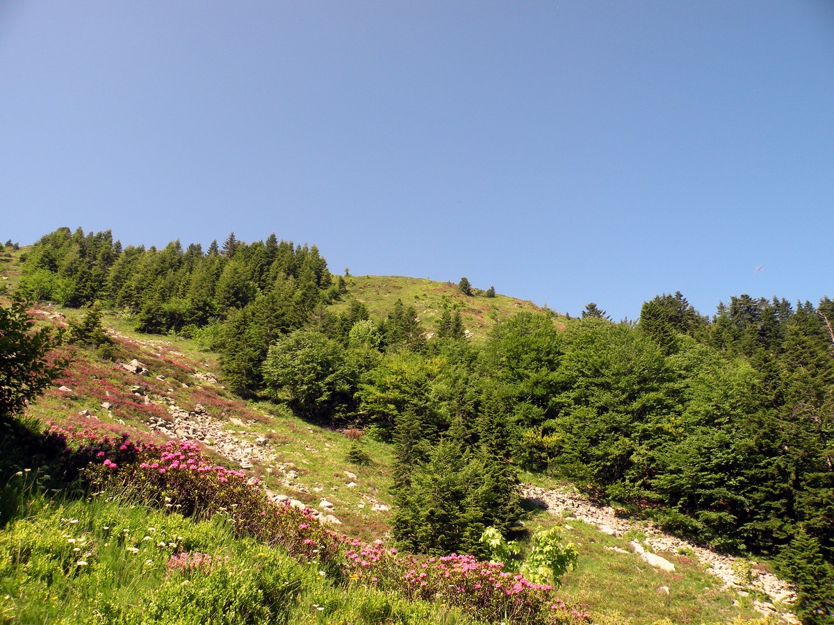
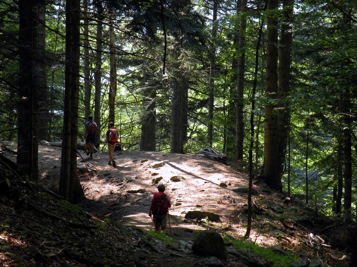
From the parking at Rifugio Pian delle Gorre you’ll walk past the Rifugio. From the open grassy area, you’ll find the trail to the left of the Rifugio. The path goes through one of the oldest forests in the area, and it’s a pleasure to walk between these giants any season.
After 30-45 minutes you’ll reach the Gias Sottano di Sestrera (4400ft). “Gias” means shelter for animals, but it’s obvious this structure no longer serves that purpose.
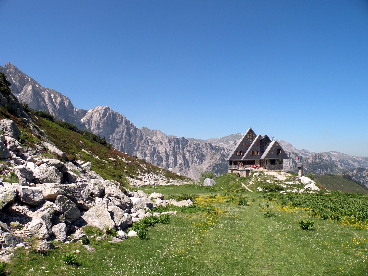
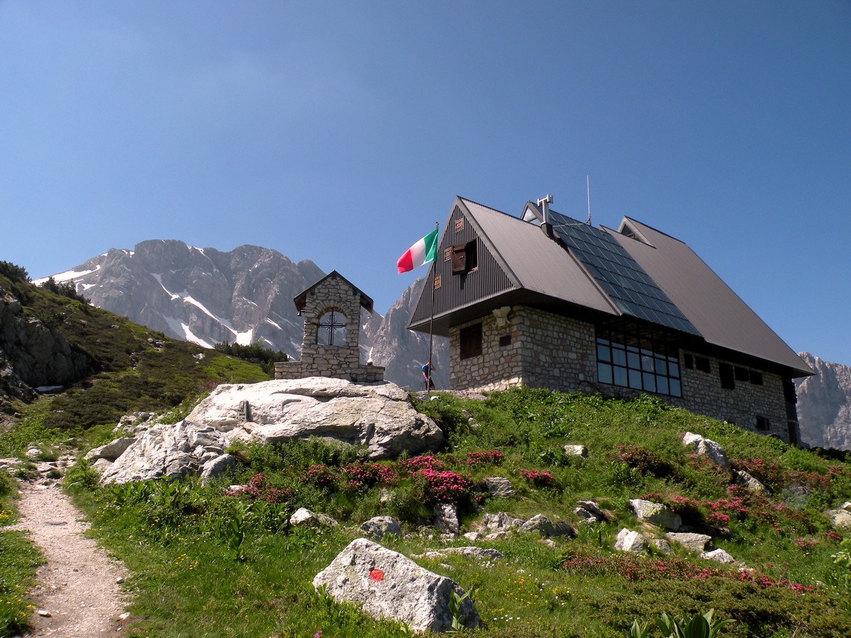
The trail continues in the woods and shrubbery to get to the Gias Soprano di Sestrera (6060ft). The Rifugio Garelli, at 6450ft high, is visible from the Gias and you can reach it after 20-30 minutes of walking.
The views from the Rifugio are amazing. The limestone cliffs of Monte Marguareis dominate the scenery. In July, all along the green mountain prairies, you’ll see purple rhododendron.
The route back is just you came or, if you prefer, you can take the path that goes into the Vallone del Marguareis.
Insider Hints
From the Rifugio you can walk to the Porta Sestrera and the Rifugio Mondovì in Valle Ellero.
Alpinists can climb to the peak, through the Canalino dei Genovesi.
The forest of big firs you walked through was managed by the Carthusians starting in 1173. Later the Consolata Fathers Order bought the land and the forest, and, now finally, the Valle Pesio Natural Park manages them.
The Rifugio was built in 1950, but burned in 1987. In 1991 it was fully restored.
Check out the Marguareis Natural Park’s website for more details.

Similar hikes to the Rifugio Garelli hike
Giro del Valasco
If the Valle Gesso were to have a flagship hike, it would be the Giro del Valasco. From the King’s…
Rifugio Remondino
If you don’t want to climb the whole mountain, this is a great day hike whose views make for a…
Vallone Argentera
The mountain views on this hike are spectacular, which is saying something when every walk in this region takes place…
Tom Zugberg 4 years ago
The trail was amazing and Rifugio Garelli where you can come back happily every summer
Matilda86 4 years ago
Really nice hike and nice views
Alexis Schweitzer 4 years ago
A perfect destination for a nice summer walk
Greenworld88 4 years ago
Great workout. The rocky and steep ascend really burned the fats in my body. Bring lots of water to avoid getting dehydrated.
Larry I. 4 years ago
It's a beautiful hike! I've got to take amazing photos, and they all look great!
claritam 5 years ago
Stunning panoramic views! A great place for rock climbing enthusuasts!
Manny D. 5 years ago
Nice hike with steep and rocky terrain. It's quite challenging, but it's certainly doable.
Chloe P. 5 years ago
Climbing up was challenging because of the steep grade. It's the type of hike that demands a certain level of physical fitness.
Bridget Mcbride 5 years ago
It was a nice experience. There was hardly anyone on the trail while we were hiking. But we experienced some traffic because of the herd of sheep.
Nelly Porter 5 years ago
Gorgeous scenery! The mountain peaks look astonishing. I highly recommend this hike!