Buckden Pike and Lead Mine Walk
View Photos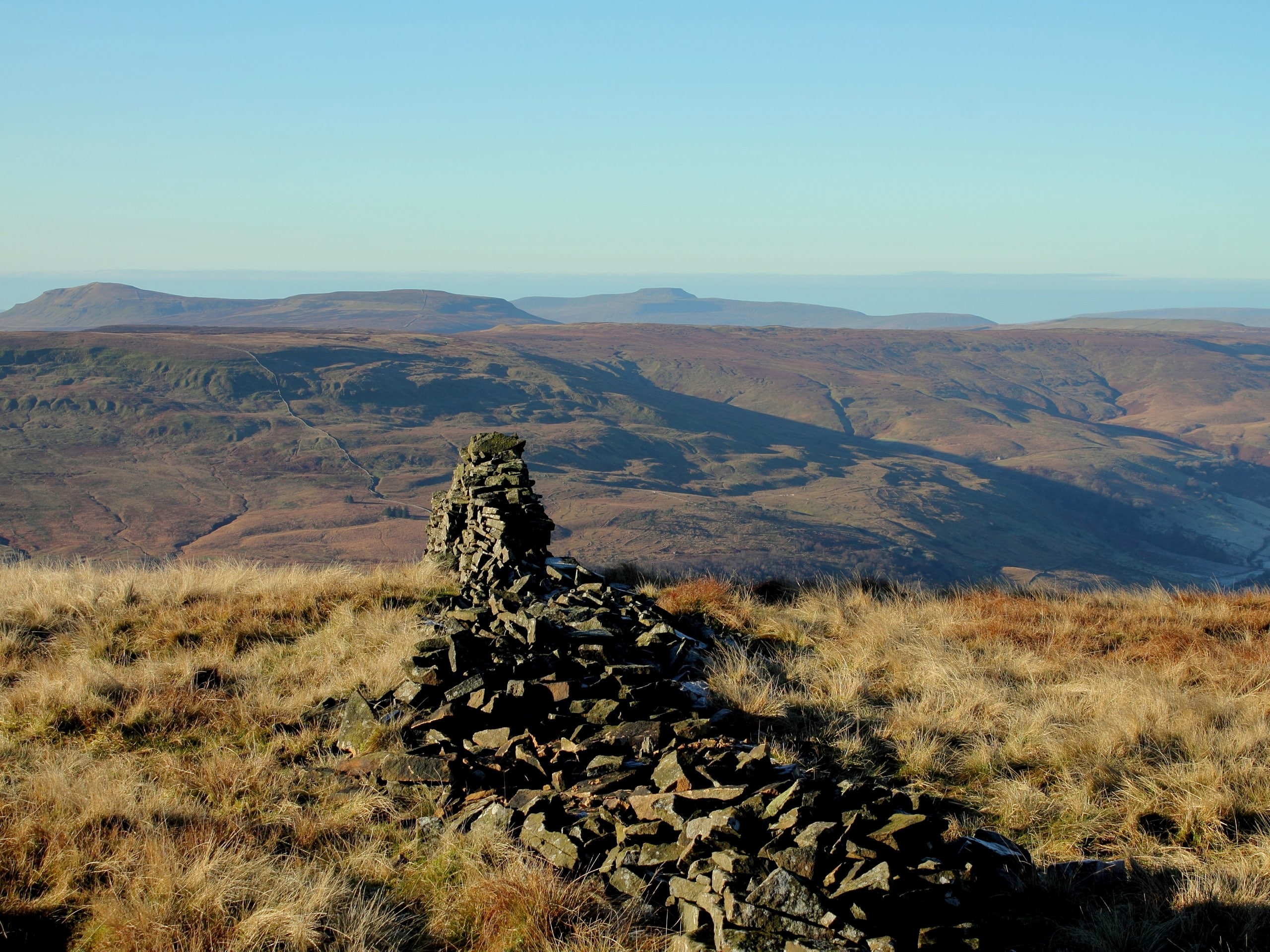
Buckden Pike and Lead Mine Walk
Difficulty Rating:
The Buckden Pike and Lead Mine Walk is an amazing stroll that gives adventure seekers a challenge. Climbing up the side of the highest peak in Yorkshire Dales National Park, the majority of this walk is uphill and some scrambling may be necessary. It provides beautiful views of the surrounding area and takes you to beautiful views of the waterfall.
Getting there
To get to the Buckden Pike and Lead Mine Walk from Skipton, head northwest on Mill Bridge/B6265 toward Water Street and take a slight right onto Grassington Road/B6265. At the roundabout, take the 3rd exit and stay on Grassington Road/B6265 and continue onto B6160 for 11.5mi, and you will arrive at your destination.

About
| When to do | April - September |
| Backcountry Campsites | No |
| Pets allowed | Yes |
| Family friendly | No |
| Route Signage | Average |
| Crowd Levels | Moderate |
| Route Type | Circuit |
Buckden Pike and Lead Mine Walk
Elevation Graph
Weather
Buckden Pike and Lead Mine Trail Description
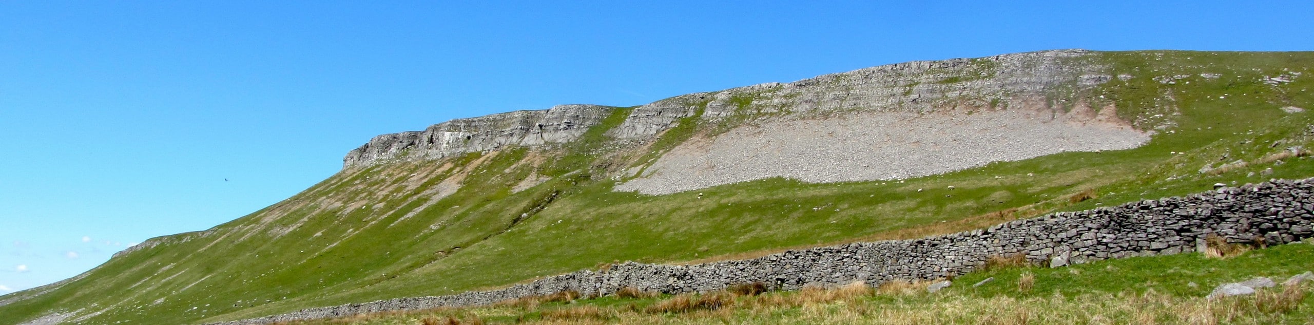
Although the Buckden Pike and Lead Mine Walk is stunning, it is not for the faint of heart. You will be walking along a path up the highest peak in Yorkshire Dales National Park, so the terrain is rough and mostly uphill. Scrambling may also be necessary along this path through steep areas, so be prepared for this and wear appropriate footwear.
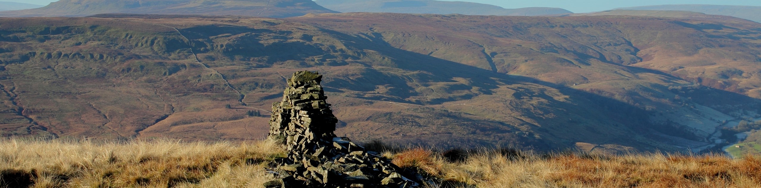
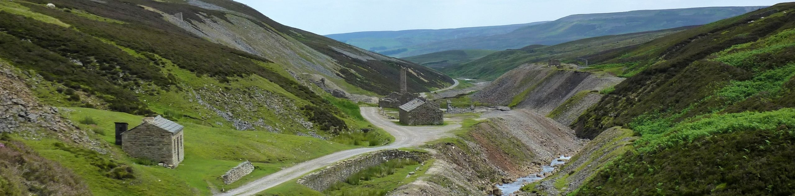
The walk has many incredible viewpoints and takes you through history as you wander along the Buckden Lead Mine and the Polish War Memorial. You can see the orange colour where the Buckden Lead Mine spill occurred, and you will also see the Buckden High Smelt Mill at the bottom of the spill.
Beginning at the car park, pass through the gate and begin heading away from Buckden Village. You will take an immediate right where the Buckden Lead Mine sign is and cross through a stile. Following the path, you will turn right and pass an abundance of sheep in their pens. Continuing along the path to the lead mine, you will encounter a strenuous and steep area of Centenary Path.
As you continue along, you will see the orange colours of the Buckden Lead Mine spill, but do not enter the mine entrance. This area is considered very valuable to the natural habitat and can be very hazardous to walk through.
Instead, turn left and head up to the wall that you can see above you. Follow this wall, and you will arrive at the ridge’s summit, where you will cross a ladder stile. Move along this wall and head towards the trig point, which is the concrete structure that you will see that is used for surveying.
Before you reach the triangulation point, you are able to detour slightly, so that you can see the Polish War Memorial. To get there, turn right instead of left at the summit and follow the path to the memorial.
After, you will continue to follow the bridleway signs that will take you back down into the village of Buckden. You will need to be careful at this point of the summit as it can be boggy and dangerous. As you follow the path, you will arrive back at the car park where you began, as this is a circuit walk.
Other Great Walks in Yorkshire Dales National Park
Check out our trail guides to Malham Tarn, Pen-y-Ghent, Malham Cove, Kisdon Force, Grimwith Reservoir, and the Whernside Walk. Or see all of our Yorkshire Dales walks.
Insider Hints
Wear appropriate shoes as this path can be hazardous
After your walk, head to the Skipton Castle to explore the grounds
Spend a night on the river at the Hotel Rendezvous
Stop at Le Bistro Des Amis for a nice meal
Before you reach the triangulation point after seeing the concrete structure that is used for surveying, you can take a detour to visit the Polish War Memorial
Similar hikes to the Buckden Pike and Lead Mine Walk hike
Old Gang Smelt Mill and Reeth High Moor Walk
The Old Gang Smelt Mill and Reeth High Moor Walk is a rough and rugged adventure that will take you…
Hawes and Sedbusk Walk
The Hawes and Sedbusk Walk is a great family-friendly adventure in Yorkshire Dales National Park that will take you through…
Malham Tarn Upland Farm Walk
The Malham Tarn Upland Farm Walk is a fantastic route in Yorkshire Dales National Park that will take you around…
Comments