Iceline hike
View Photos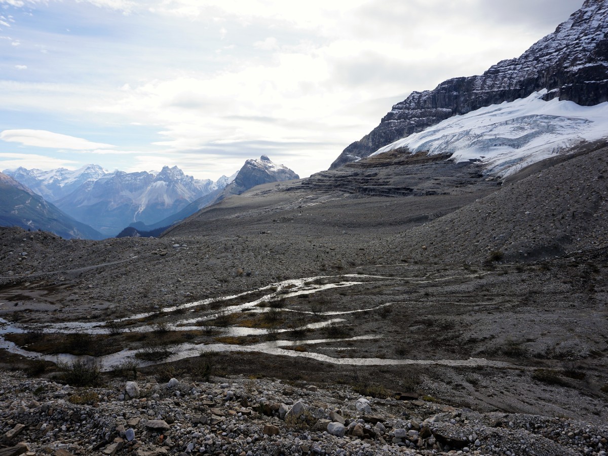
Iceline hike
Difficulty Rating:
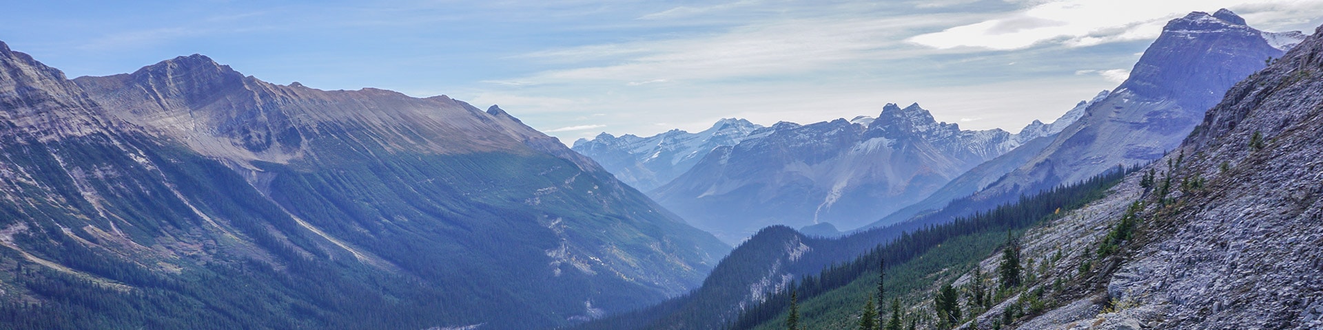
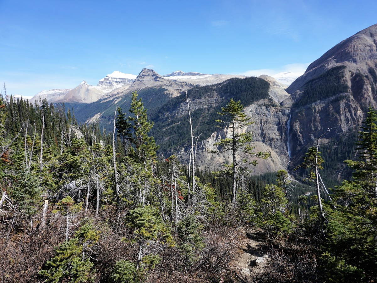
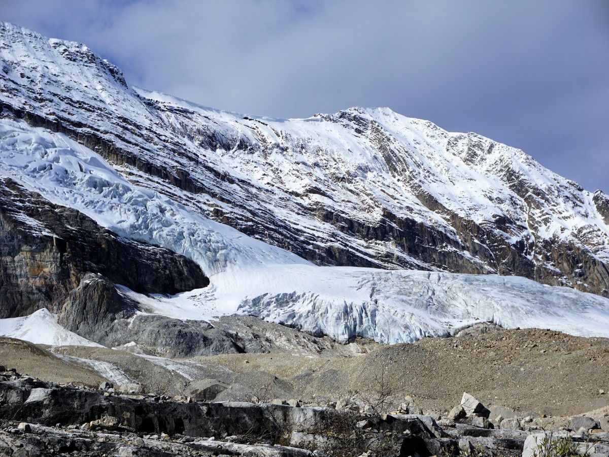
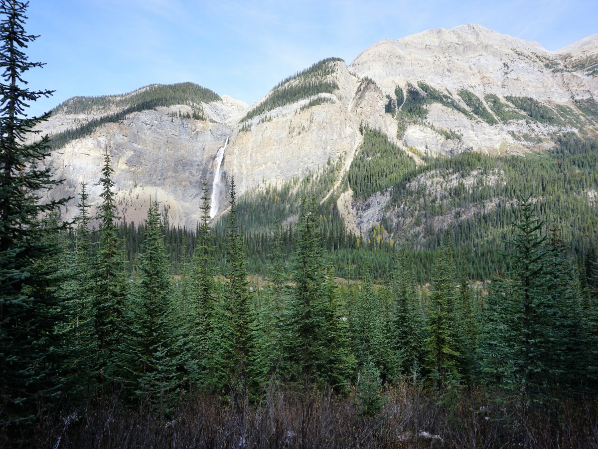
The Iceline hike is a wonderful trail up past tree line to and along a ridge presenting beautiful vistas across the Yoho Valley of Takakkaw Falls as fast-receding glaciers teeter above you. You can make this longer or shorter depending on your energy.
Getting there
Drive west from Banff or Lake Louise along the Trans-Canada Highway. Take the exit north towards Takakkaw Falls. If you reach Field BC, you have gone too far! Go for nearly 8.7mi up the road until you see the parking area. Trailers are not allowed on this road.

About
| When to do | June through October |
| Backcountry Campsites | No |
| Toilets | Trailhead |
| Family friendly | No |
| Route Signage | Average |
| Crowd Levels | Moderate |
| Route Type | Out and back |
Iceline
Elevation Graph
Weather
Route Description for Iceline
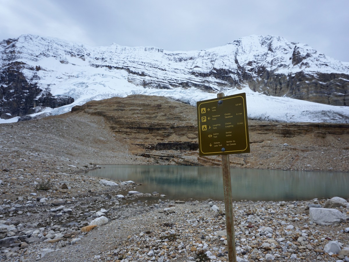
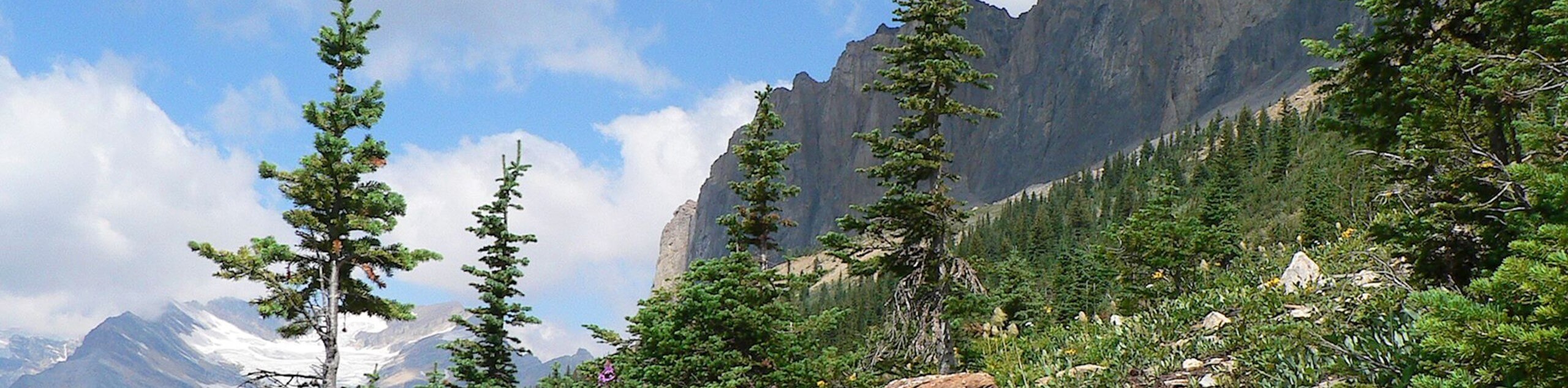
Walk 0.3mi towards the HI Whiskey Jack Hostel, where you will find the trailhead (west side of the road). Keep in mind you cannot park at the hostel unless you’re staying there. Get on the trail and immediately start the steep climb through switchbacks. Don’t worry, it gets better. After a few hundred vertical meters you will find yourself above the treeline. If you can believe it, it wasn’t until recent trail updating that the route went above the forest and allowed for such spectacular views.
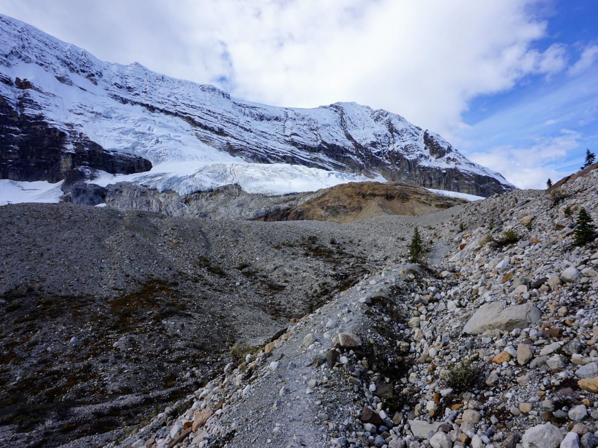
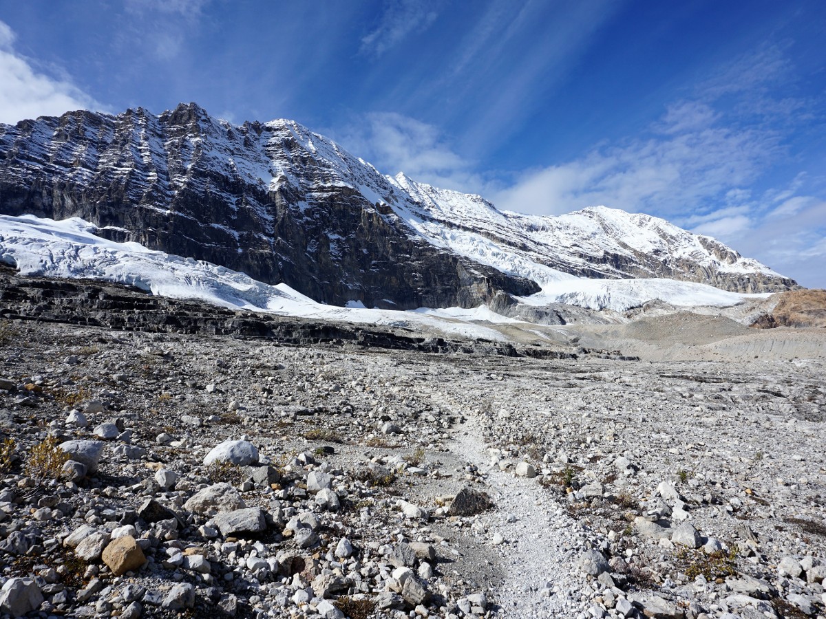
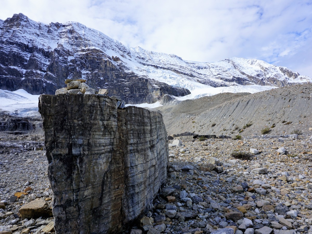
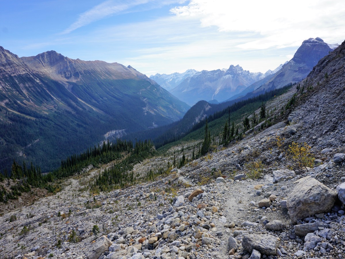
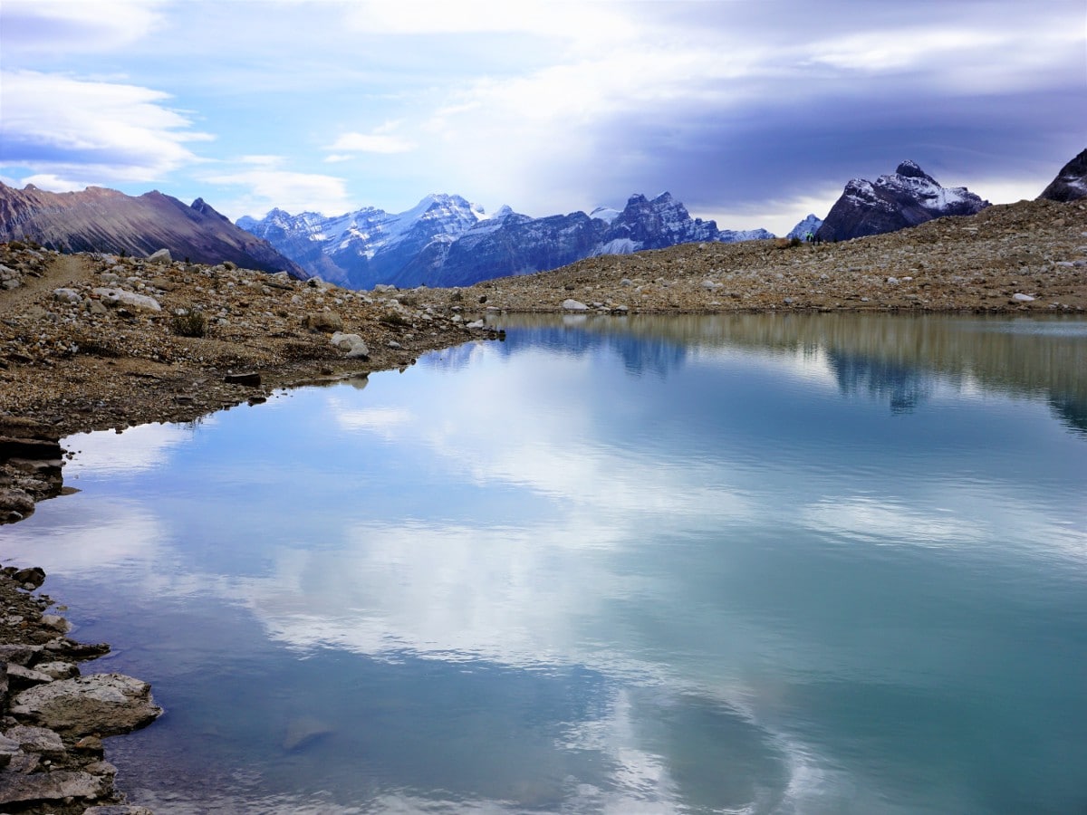
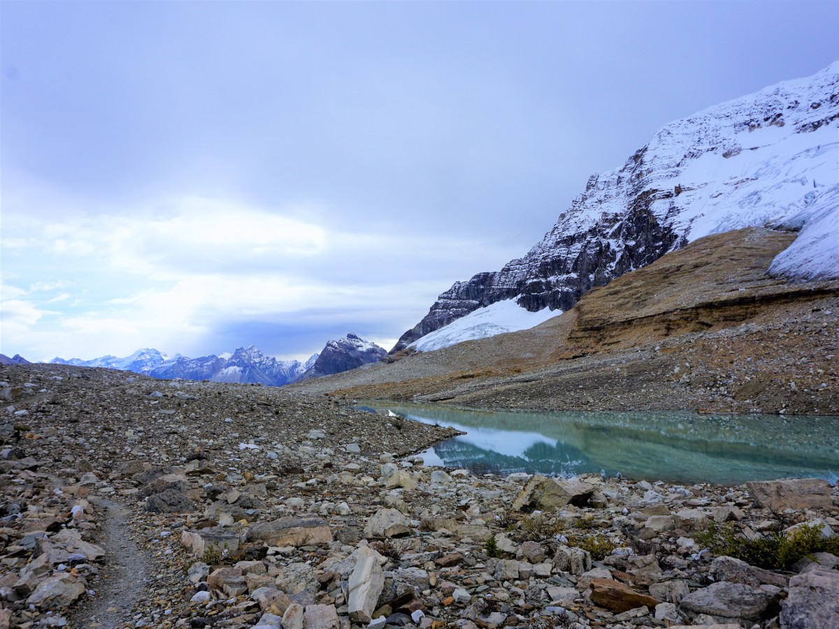
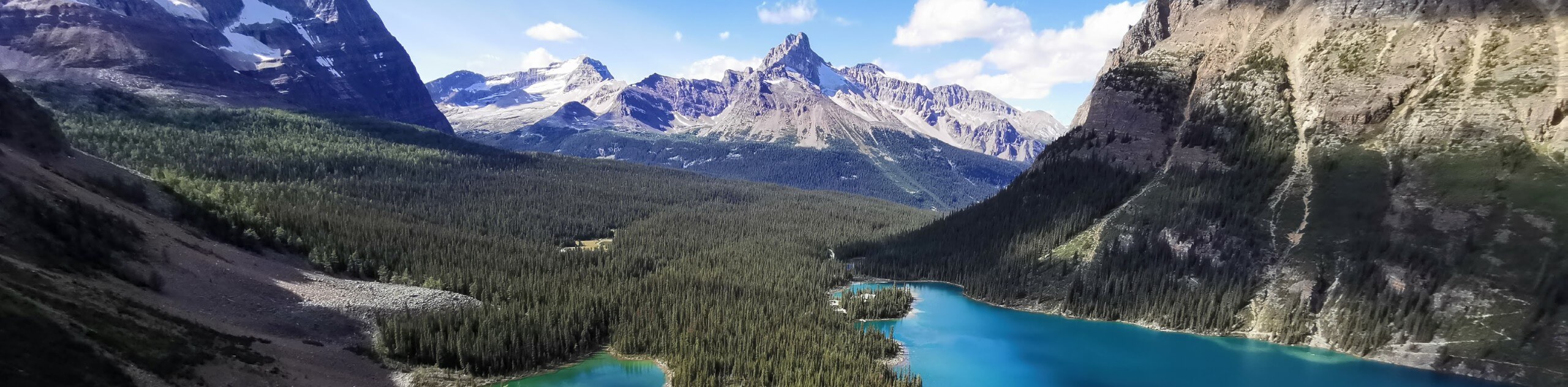
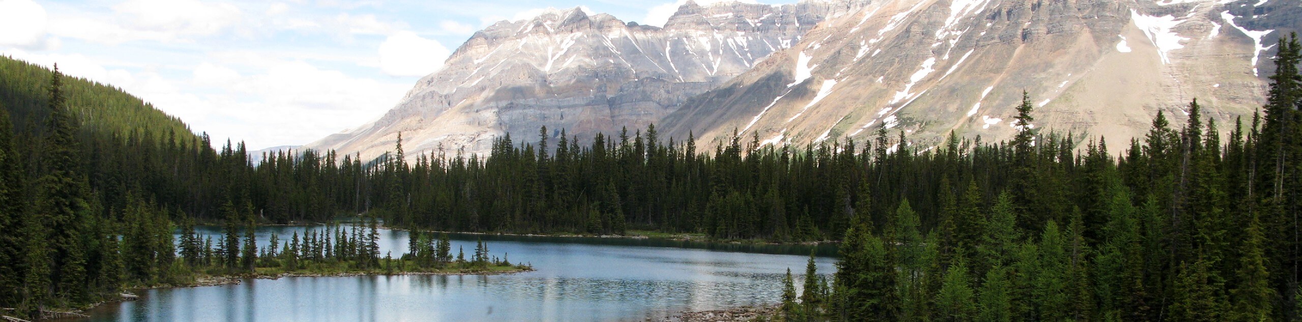
Once past the treeline a little climbing remains, but reinvigorate your legs with the view across the valley. You can see Takakkaw Falls and the Daly Glacier that feeds it. The trail moves through barren moraines and loose scree – a moonscape to say the least. Continue along the trail as it becomes increasingly flatter, passing three beautiful lakes. Take the time to relax by the water and, if it’s a nice day, soak in the view and warm yourself in the sun.
You can turn around any point you want and retrace your footsteps. Those who are more adventurous can descend into the basin and take a woodland trail through the Yoho River Valley. You could also make a big day and descend to the ACC Stanley Mitchell Hut and overnight as part of a longer route.
We prefer to go as far along the Iceline as we can before it starts to lose elevation and then we turn around and head back along the way we came, enjoying the views and staying high.
Insider Hints
Save this hike for a clear day, as missing these amazing views would be a shame.
You can make a weekend here along a longer route by staying at the historical Twin Falls Chalet or the Stanley Mitchell Hut, which is managed by the Alpine Club of Canada.

Similar hikes to the Iceline hike
Burgess Shale Hike
The Burgess Shale Hike is an amazing experience that will take you uphill along the slopes of Wapta Mountain for…
Lake O’Hara Alpine Circuit
Hiking the Lake O’Hara Alpine Circuit is an amazing experience that will see you traverse the rugged, yet beautiful terrain…
Linda Lake Hike
The Linda Lake Hike is a fantastic excursion that will lead you through some beautiful terrain in Yoho National Park…
ddelaloye 4 years ago
One of the very best Canadian Rocky Mtn hikes! The water volume of Takakkaw Falls and all the streams were higher than normal. Also, the glaciers seemed to have grown in size since last year. We did a 16.5 km out and back (to the 3rd lake on Iceline)
Aleysha C. 4 years ago
The views along Iceline where spectacular but the views along Whaleback in my opinion are even better. The view gave us everything: emerald lakes, glaciers, mountains everywhere around, flowers, moraines, rocks... it was very, very worth the ascent.
WendyMag. 4 years ago
Great hike to have a closer look at the glaciers! I would say it is pretty moderate but the views are absolutely stunning.
David L. 4 years ago
i like the awe-inspiring views at the top. bring a picnic up and a camera. iceline is amazing and highly recommend it.
isaacanderson 4 years ago
This was the quintessential mountain experience; it' s what everyone envisions when they think of the Canadian Rockies
Tara Green 4 years ago
What a beautiful trail. You get to see waterfalls, glaciers and many great views of Yoho valley
Eric Parats 4 years ago
Enjoyed the uphill battle to the top. Spectacular views along the way. Lots of lakes I forgot to count, but the experience was nice.
Glori S. 4 years ago
Takakkaw Falls is amazing! Bring water and a walking stick. It will definitely help you out.
Kenneth D. 4 years ago
Magnificent hike! The initial ascend was a great workout. It was exhausting, but the views keep on getting better from there.
Heinrich P. 5 years ago
It was a bit strenuous so you must be prepared and bring enough water and food.