
Lake Louise Trail
View Photos
Lake Louise Trail
Difficulty Rating:
The Lake Louise Trail is perhaps one of our favorite hikes in the Wind River Mountain Range. This short but scenic adventure explores a landscape characterized by soaring granite crests, glacial valleys, crystalline alpine pools, mixed pine stands, and bighorn sheep! Make sure to bring your camera, the scenery is quite photogenic.
Getting there
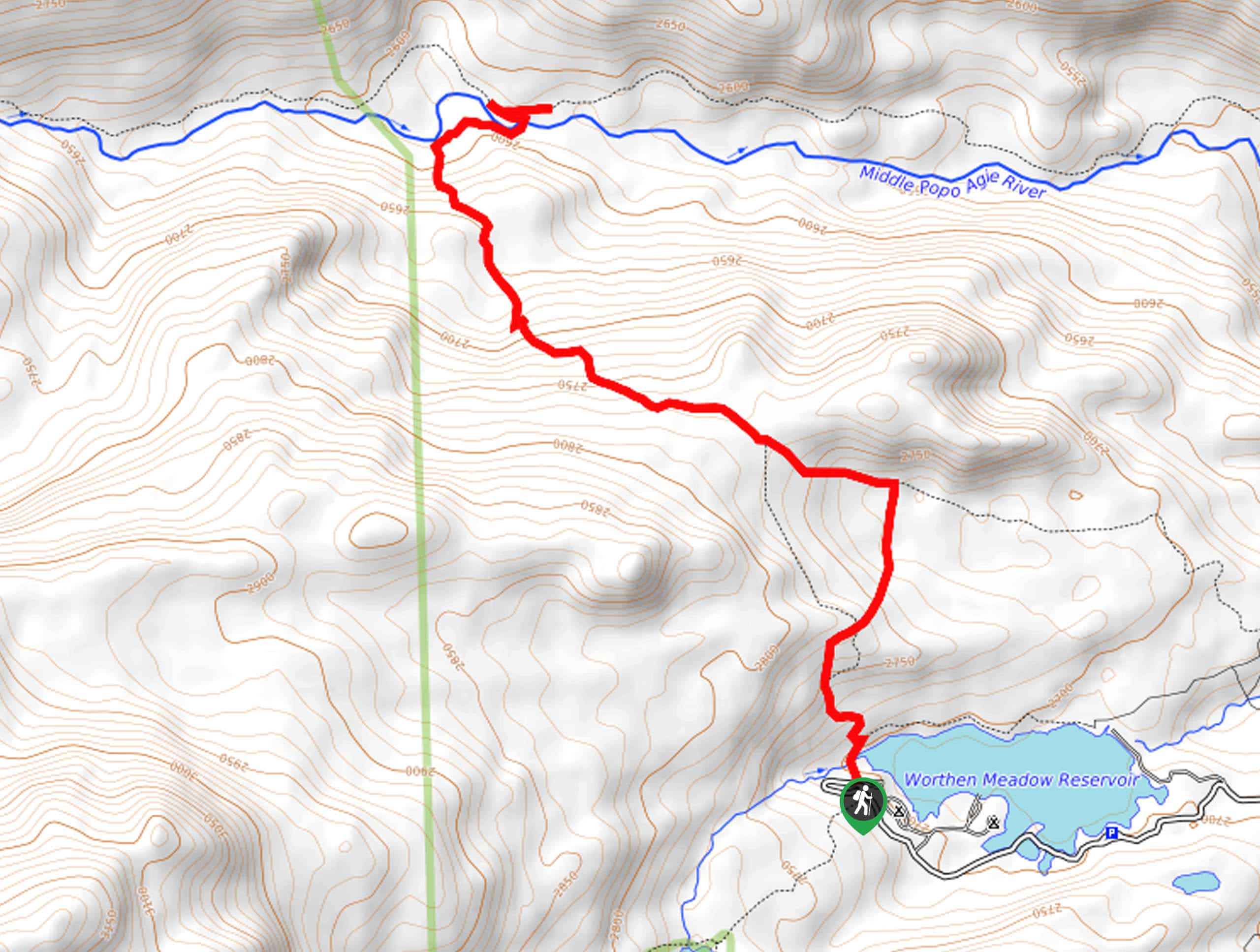
The Lake Louise Hike is accessed from the Whiskey Mountain Trailhead off Trail Lakes Road.

About
| Backcountry Campground | Backcountry Camping |
| When to do | May-October |
| Pets allowed | Yes - On Leash |
| Family friendly | Older Children only |
| Route Signage | Average |
| Crowd Levels | Moderate |
| Route Type | Out and back |
Lake Louise Trail
Elevation Graph
Weather
Lake Louise Trail Description
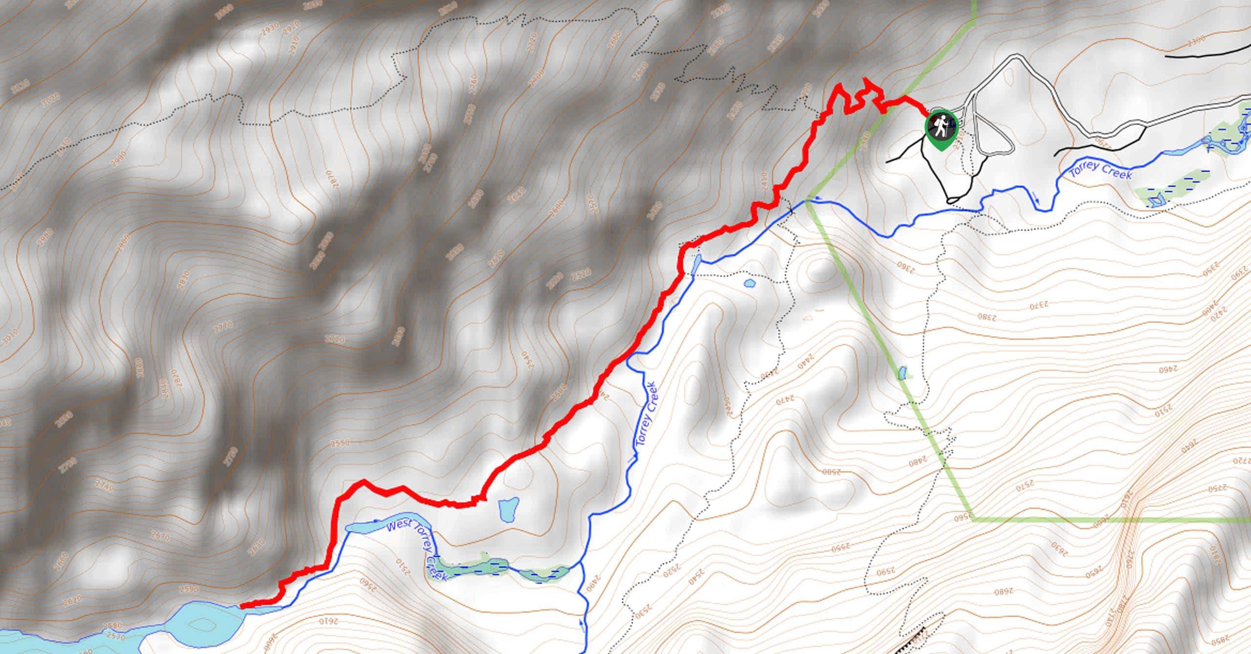
The Lake Louise Trail exemplifies the beauty of the Wind River Mountain Range. Boasting gorgeous scenery along the way, this route culminates at an alpine lake bound by the impressive granite mountains. Rewarding spellbinding scenery, this route demands some stamina and careful footing. Wear a pair of sturdy footwear to avoid a rolled ankle on the steep, uneven terrain. Additionally, as bighorn sheep are often observed along this route, it is important to maintain a safe distance and admire them from afar. Finally, while bear encounters are unlikely, we encourage hikers to carry a can of bear spray—just in case.
With a camera, plenty of water, and bear spray in tow, you will begin your journey along the Lake Louis Trail from the Whiskey Mountain Trailhead. Setting out from here, the Whiskey Mountain Trail will begin to climb into the montane meadowlands along Torrey Creek. Soon after you depart from the trailhead, you will reach an intersection, turn left onto the Glacier Trail, then veer right at the following junction, and you will be diverted onto the Lake Louise Trail. Climbing through the alpine terrain, you will wind between meadows and pine forests.
As you near the lake, the terrain will become increasingly steep and rocky, so mind your footing. Scenes of Lake Louise and the flanking granite bluffs will unfold before your eyes. Marvel at the beauty and grandeur of the high country. Rejuvenate your tired feet in the chilly alpine waters, then head back the way you came back to the trailhead.
Similar hikes to the Lake Louise Trail hike
Glacier Trail
The Glacier Trail is a demanding day hike in the Winds that boasts a scenic and secluded experience. Wander through…
Upper Brewers Trail
The charm of a one-way trek is unrivaled. Enjoy new scenery every step of the way as you hike the…
Sheep Bridge Trail
The Sheep Bridge Trail checks all the boxes—short, scenic, and secluded. What more could you ask for? Mountain views? It…
Comments