
Bluff Creek Trail
View Photos
Bluff Creek Trail
Difficulty Rating:
Exhibiting the beauty and grandeur of the Winds without demanding too much sweat, the Bluff Creek Trail is an excellent adventure for intermediate hikers and families with older children. Offering post-card worth scenery, you won’t want to forget your camera!
Getting there
Access this adventure from the trailhead off New Fork Willow Creek Road.

About
| Backcountry Campground | No |
| When to do | May-October |
| Pets allowed | Yes - On Leash |
| Family friendly | Older Children only |
| Route Signage | Average |
| Crowd Levels | Moderate |
| Route Type | Out and back |
Bluff Creek Trail
Elevation Graph
Weather
Bluff Creek Trail Description
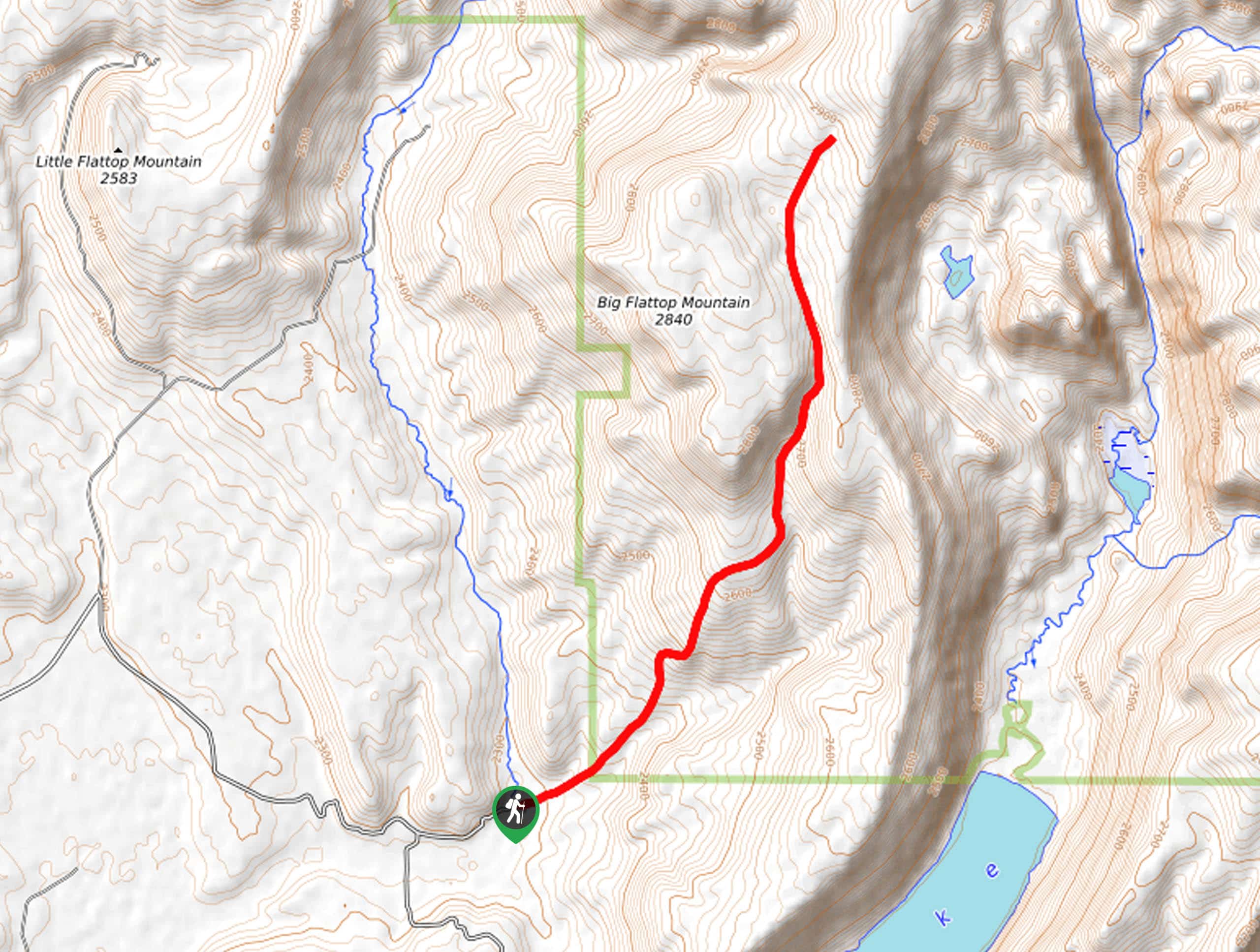
The Bluff Creek Hike explores the gorgeous alpine landscape in the Wind River Range. This moderate adventure explores a swathe of wilderness occupied by seasonal streams, mixed woodlands, montane meadows, and granite gardens. While this route is not overly taxing, it is located at a high altitude, so bring along plenty of water to stay hydrated as you hike. As with all sorts of exploration in the area, we encourage hikers to carry bear spray in the unlikely event of an encounter.
Your high-country hike begins from the Bluff Creek Trailhead off the New Fork Willow Road. From here, you will track northeast into the wilderness, gradually climbing into the meadowlands. After some hiking, you will confront an intersection; keep along the Bluff Creek Trail. Unlike most hikes, you will enjoy the views of the Mountains in the initial stages of your adventure. Soon the path will dip beneath the tree canopy. Enjoy the shade and beauty of the lush vegetation as the route will open into a meadow on the summit of Big Flattop Mountain.
While you may think this is the end of your journey, the Bluff Creek Trail continues further. Continue along the route until you ultimately reach a junction with the Section Corner Trail. From here, turn around and retrace your footing back along the path to the trailhead.
Similar hikes to the Bluff Creek Trail hike
Glacier Trail
The Glacier Trail is a demanding day hike in the Winds that boasts a scenic and secluded experience. Wander through…
Upper Brewers Trail
The charm of a one-way trek is unrivaled. Enjoy new scenery every step of the way as you hike the…
Sheep Bridge Trail
The Sheep Bridge Trail checks all the boxes—short, scenic, and secluded. What more could you ask for? Mountain views? It…
Comments