Farside and Riverside Loop
View Photos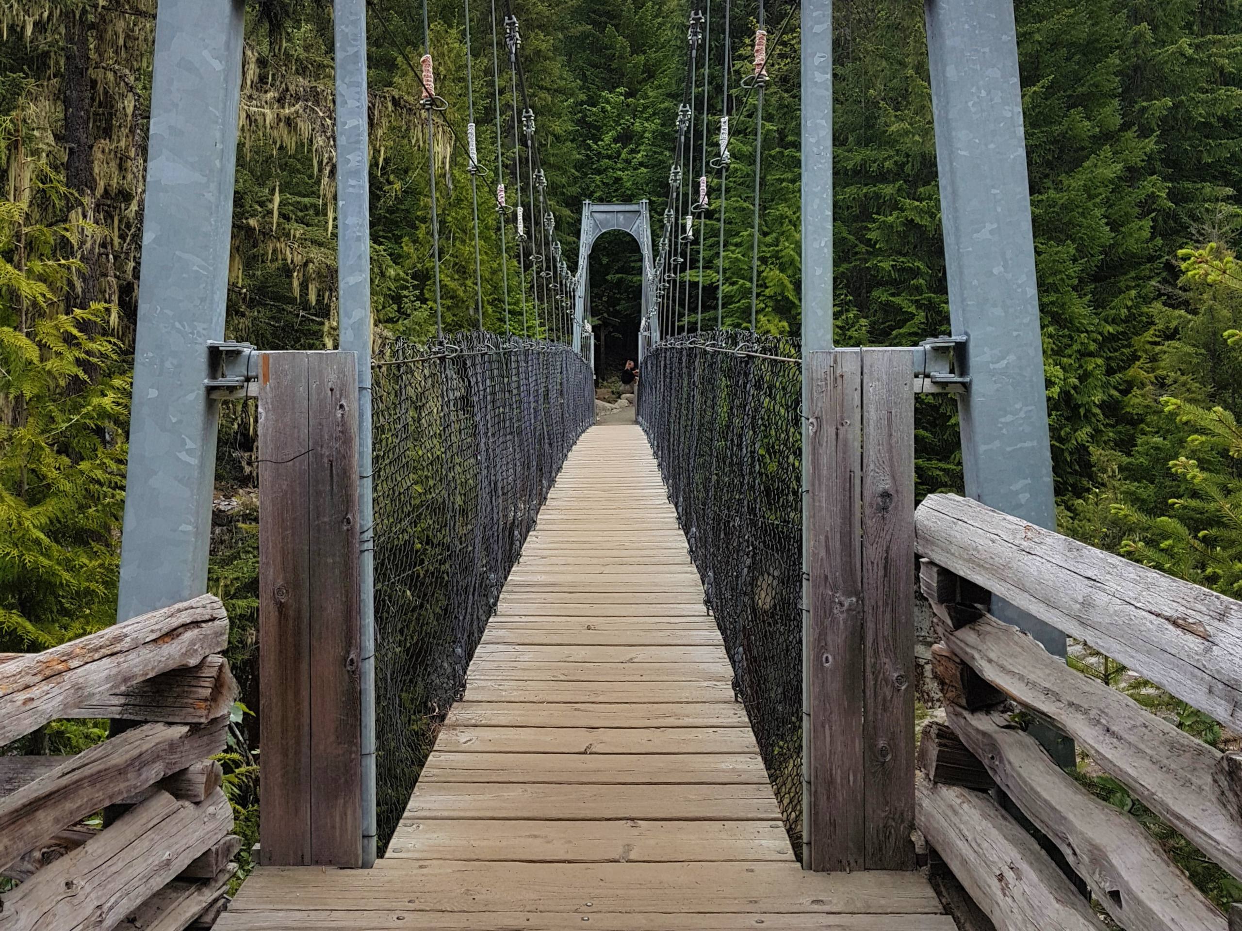
Farside and Riverside Loop
Difficulty Rating:
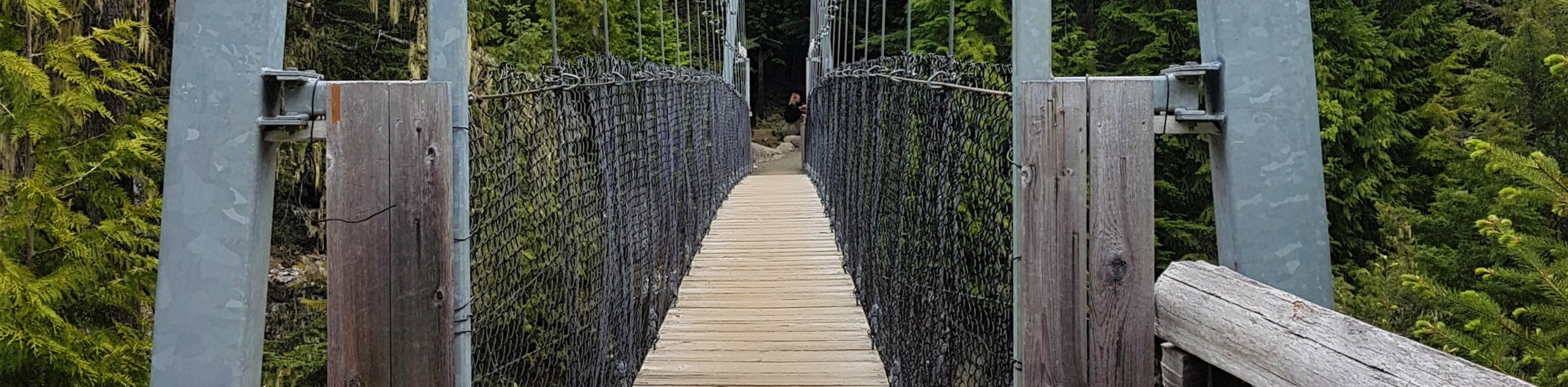
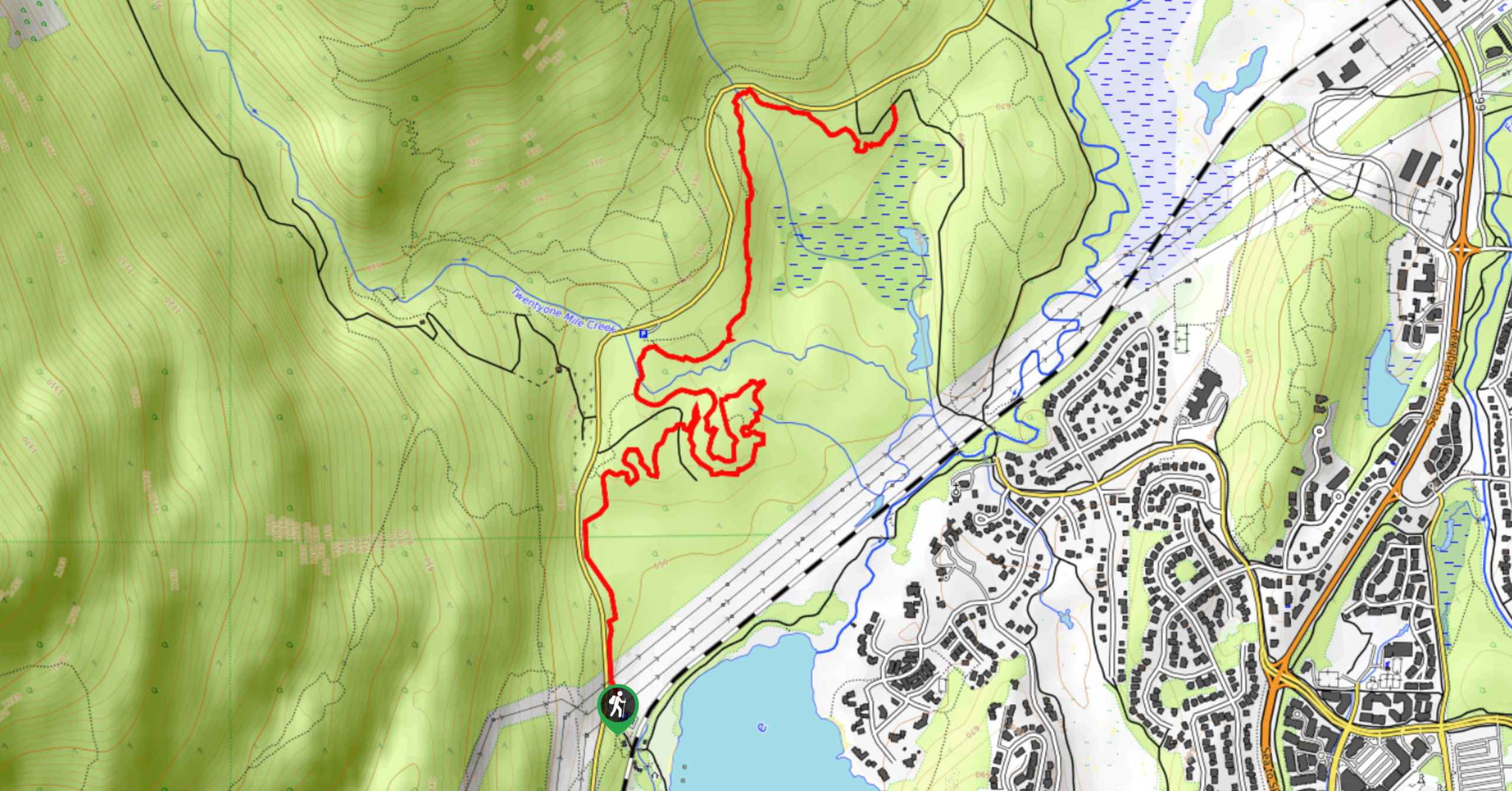
Hiking along the Farside and Riverside Loop is a fun adventure through the Whistler Interpretive Forest that offers scenic woodland views and the chance to cross over a swaying suspension bridge. This trail follows closely alongside the rushing Cheakamus River and allows hikers to stare down at the torrenting water as they cross the bridge. Made up of fairly easy terrain, this moderate hike makes for a fun day outdoors in the Whistler area.
Getting there
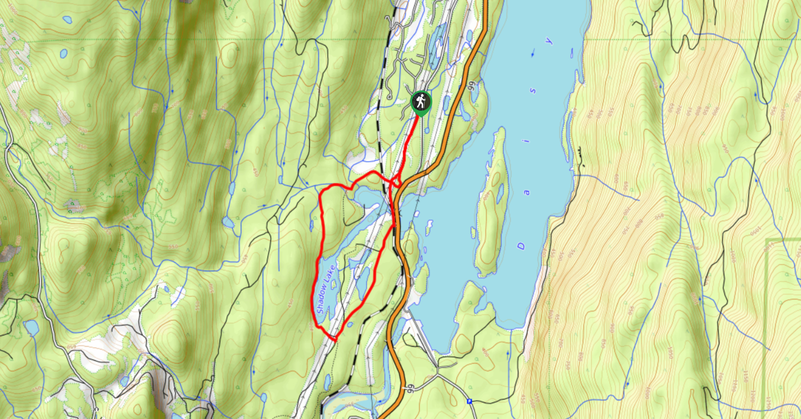
To reach the parking area for the Farside and Riverside Loop from Whistler, drive south on BC-99 and make a left onto Cheakamus Lake Road. Turn left immediately to enter the parking lot.

About
| When to do | June-October |
| Backcountry Campsites | No |
| Pets allowed | Yes - On Leash |
| Family friendly | Older Children only |
| Route Signage | Average |
| Crowd Levels | Moderate |
| Route Type | Circuit |
Farside and Riverside Loop
Elevation Graph
Weather
Farside and Riverside Loop Trail Description
The Farside and Riverside Loop is an exciting intermediate-length hike through the beautifully scenic landscape of the Whistler Interpretive Forest. The trail sets out from the Sea to Sky Highway and winds through the forest alongside the coursing waters of the Cheakamus River. The route travels south along the Farside (east) of the river before crossing over the swaying expanse of the Cheakamus River Suspension Bridge and making the return leg of the loop along the Riverside (west).
This trail offers the opportunity to explore the beautiful woodland setting of the Whistler Interpretive Forest and provides scenic views over the rushing waters of the Cheakamus River. The 4.2mi hike has some minor changes in elevation, but the trail is fairly non-technical, making for a fun route that most hikers will be able to enjoy.
Similar hikes to the Farside and Riverside Loop hike
Shadow Lake Loop
Travel along the Shadow Lake Loop for a quick and easy hiking route just off the Sea to Sky Highway,…
Jane Lakes Trail
The Jane Lakes Trail is a lightly trafficked 6.2mi out-and-back hiking route through the Whistler Interpretive forest that…
A River Runs Through It Trail
The A River Runs Through It Trail is a 5.6mi out-and-back hiking route in Whistler that features scenic…
Comments