
Brandywine Falls Trail Loop
View Photos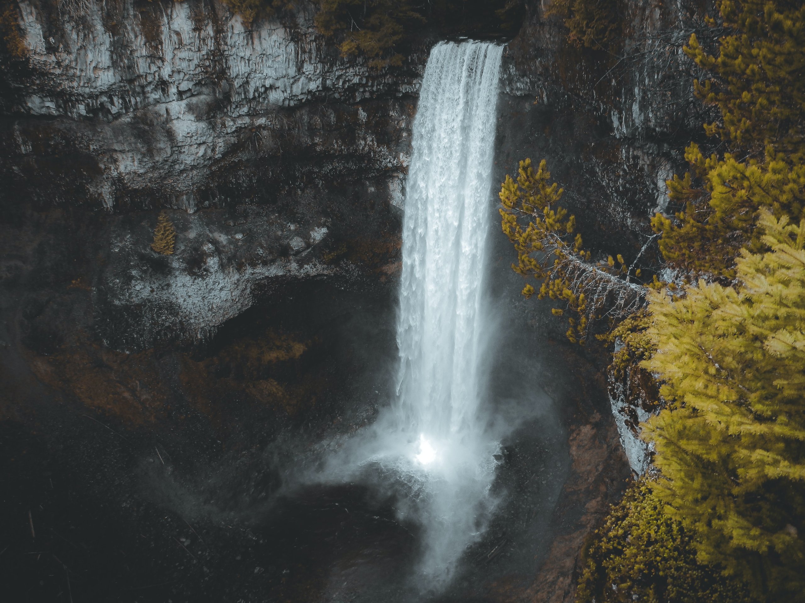
Brandywine Falls Trail Loop
Difficulty Rating:
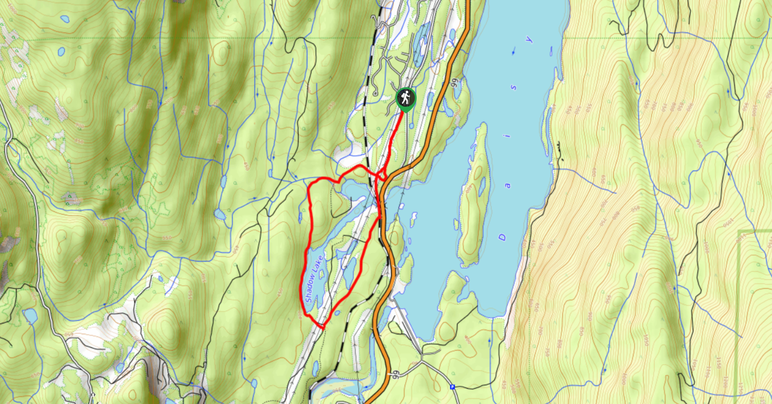
The Brandywine Falls Trail Loop is a scenic 5.9mi hike through the beautiful forests of Brandywine Falls Provincial Park that takes hikers along both sides of the Cheakamus River. Along the trail, you will cross over the expanse of the Whistler Bungee Bridge before making your way to two viewpoints that overlook the cascading waters of Brandywine Falls and the turquoise surface of Daisy Lake. This route contains some truly awesome sights that you won’t want to miss if you are visiting Whistler.
Getting there
To reach the parking area for the Brandywine Falls Trail from Daisy Lake, drive north on BC-99 N and make a right turn onto Cal Cheak. Follow this for 2133ft, where you will find the parking area on your left.

About
| When to do | May-October |
| Backcountry Campsites | Cal Cheak South Camp, Cal Cheak North Camp |
| Pets allowed | Yes - On Leash |
| Family friendly | Older Children only |
| Route Signage | Average |
| Crowd Levels | Low |
| Route Type | Circuit |
Brandywine Falls Trail Loop
Elevation Graph
Weather
Brandywine Falls Trail Loop Description
The Brandywine Falls Trail Loop is a route packed with highlights and because of this, some areas, especially around the falls, can be very busy with visitors. Additionally, the initial stretch of the trail travels along a service road, so hikers should be alert in case there is any traffic. These concerns aside, the trail offers two amazing lookouts over Brandywine Falls and Daisy Lake to the south, as well as the opportunity to cross over the Whistler Bungee Bridge with the rushing waters of the Cheakamus River below. There is a lot to see on this intermediate length hike, making it a great option for a half-day trip in the outdoors around Whistler.
Setting out from the parking area near the Cal Cheak Campground, follow the service road south and cross over the Cheakamus River. From here, continue straight along the trail until you reach the bungee bridge. Take a few moments to watch the jumpers as they descend towards the rushing waters below before crossing over the river and continuing along the trail.
Keep on the path as it winds through Brandywine Provincial Park before arriving at a junction to the left that leads towards the two viewpoints. Take in the amazing views of the cascading falls, making your way to the vantage point looking south over Daisy Lake, before working back to the main trail and following it left to continue on the loop. From here, hikers will follow the trail as it cuts through the centre of the park to once again cross over the Cheakamus River, completing the Brandywine Falls Trail Loop.
Similar hikes to the Brandywine Falls Trail Loop hike
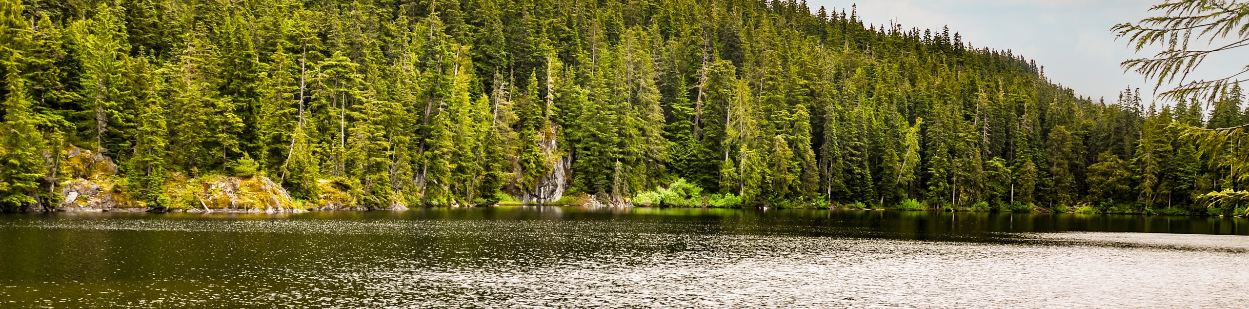
Shadow Lake Loop
Travel along the Shadow Lake Loop for a quick and easy hiking route just off the Sea to Sky Highway,…
Jane Lakes Trail
The Jane Lakes Trail is a lightly trafficked 6.2mi out-and-back hiking route through the Whistler Interpretive forest that…
A River Runs Through It Trail
The A River Runs Through It Trail is a 5.6mi out-and-back hiking route in Whistler that features scenic…
Comments