Helmcken Falls Rim Trail
View Photos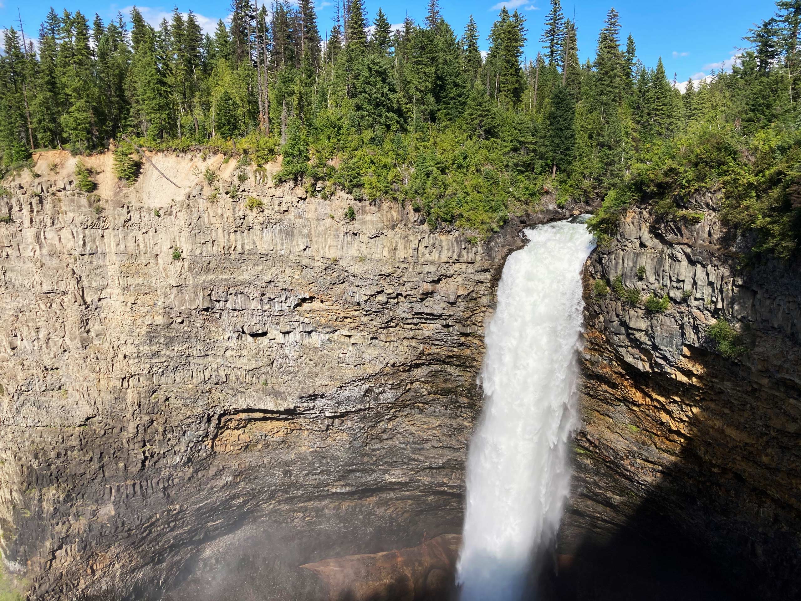
Helmcken Falls Rim Trail
Difficulty Rating:
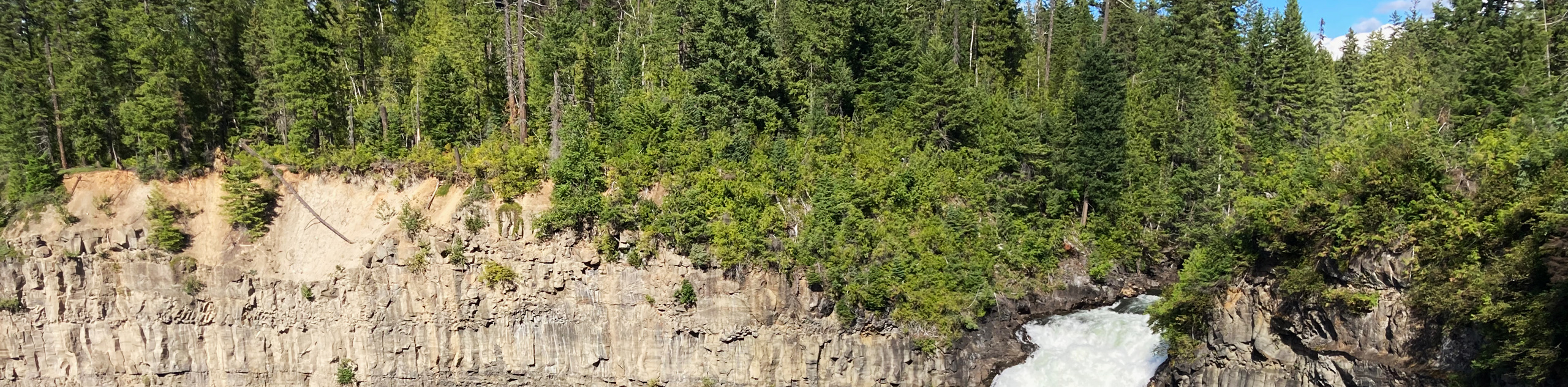
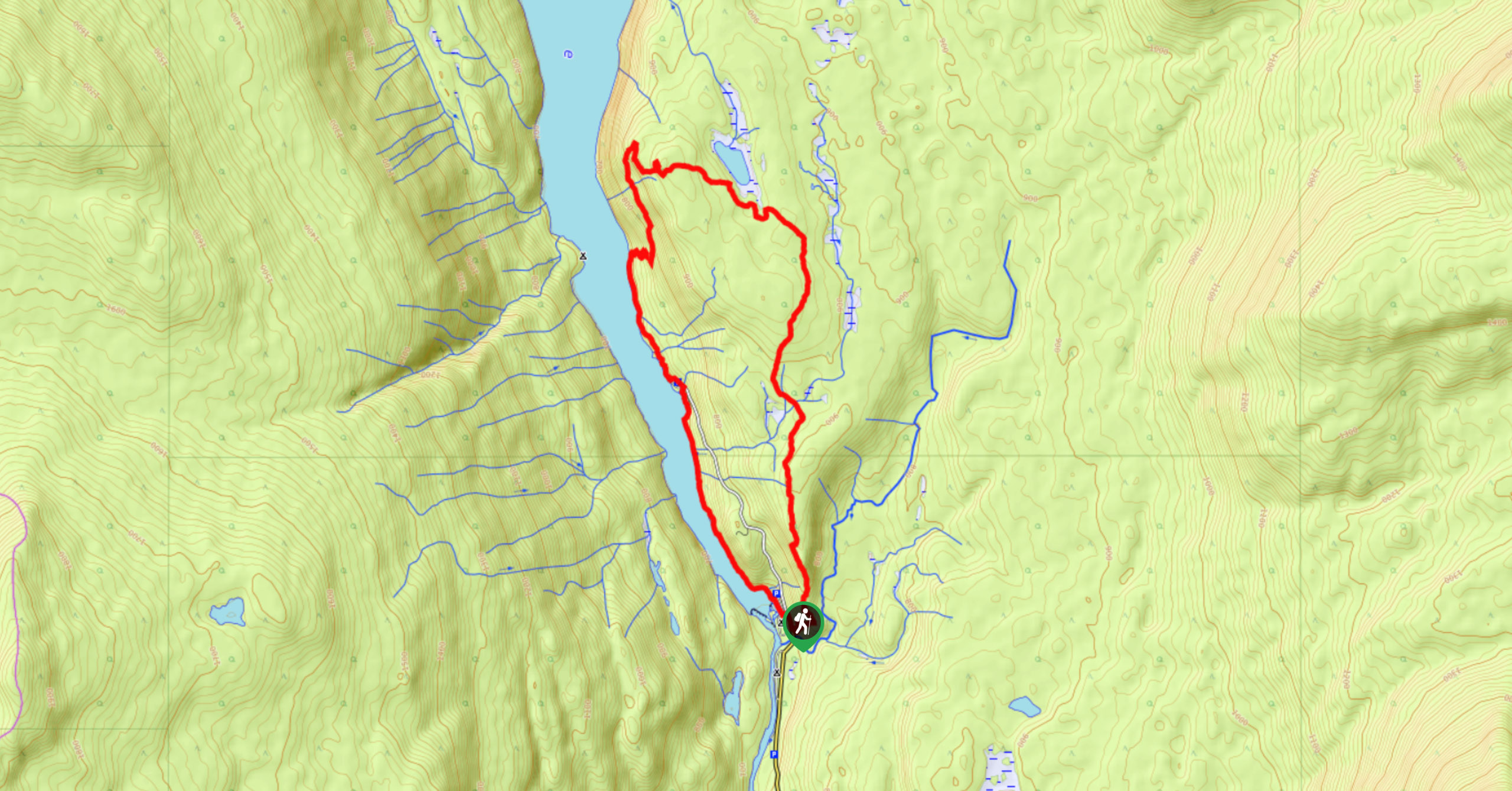
The Helmcken Falls Rim Trail is an 8km out-and-back hiking route that will take you along the edge of the canyon for scenic views of the falls. When measured by its straight drop of 463ft without a break, Helmcken Falls is one of Canada’s tallest waterfalls, making it a must-see if you find yourself in Wells Gray Provincial Park. With well-maintained trails and easy roadside access, this route is perfectly suited for hikers of all skill levels; just make sure to give yourself plenty of space from the edge of the lookout for safety reasons.
Getting there
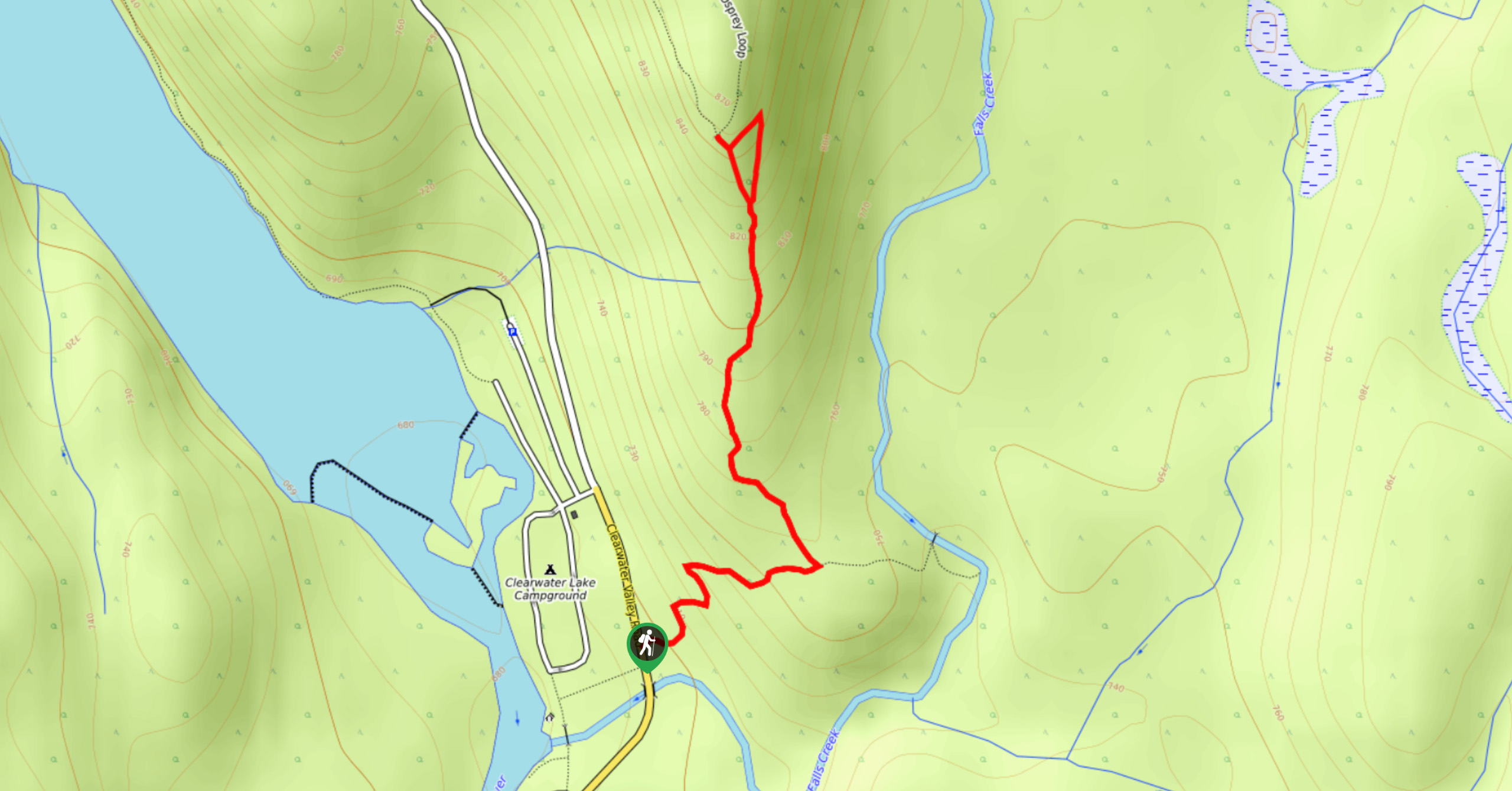
To reach the parking area for the Helmcken Falls Rim Trail from Clearwater, drive to the north along Clearwater Valley Road for 40.8km, where you will find the parking area on the left side of the road.

About
| When to do | Year-Round |
| Backcountry Campsites | No |
| Pets allowed | Yes - On Leash |
| Family friendly | Yes |
| Route Signage | Average |
| Crowd Levels | Low |
| Route Type | Out and back |
Helmcken Falls Rim Trail
Elevation Graph
Weather
Helmcken Falls Rim Trail Description
Hiking the Helmcken Falls Rim Trail is a spectacular hiking route north of Clearwater, BC, that will allow you to experience the powerful waterfalls that can be found along the coursing Murtle River. Setting out from the parking area, follow the trail as it works west through the forest along the edge of the river. As you make your way through the serene woodland landscape, you will gradually climb uphill along the escarpment to arrive at the viewpoint after 4km of hiking. Once there, you will be greeted by an amazing view looking out across the canyon to the rushing water of the falls that drop 141m to crash into the river below. After admiring the power and beauty of Helmcken Falls, head back along the trail to gain a different perspective of the forest as you work your way back to the parking area.
Similar hikes to the Helmcken Falls Rim Trail hike
Osprey Viewpoint
The trek to the Osprey Viewpoint follows a 1.5mi out-and-back hiking route that climbs uphill along a forest…
Pyramid Mountain
The trek up Pyramid Mountain follows a 5.8mi out-and-back hiking route in Wells Gray Provincial Park that provides…
Chain Meadows Loop
The Chain Meadows Loop is a 8.8mi hiking circuit in Wells Gray Provincial Park that traverses some pleasant…
Comments