Blinkhorn Lake
View Photos
Blinkhorn Lake
Difficulty Rating:
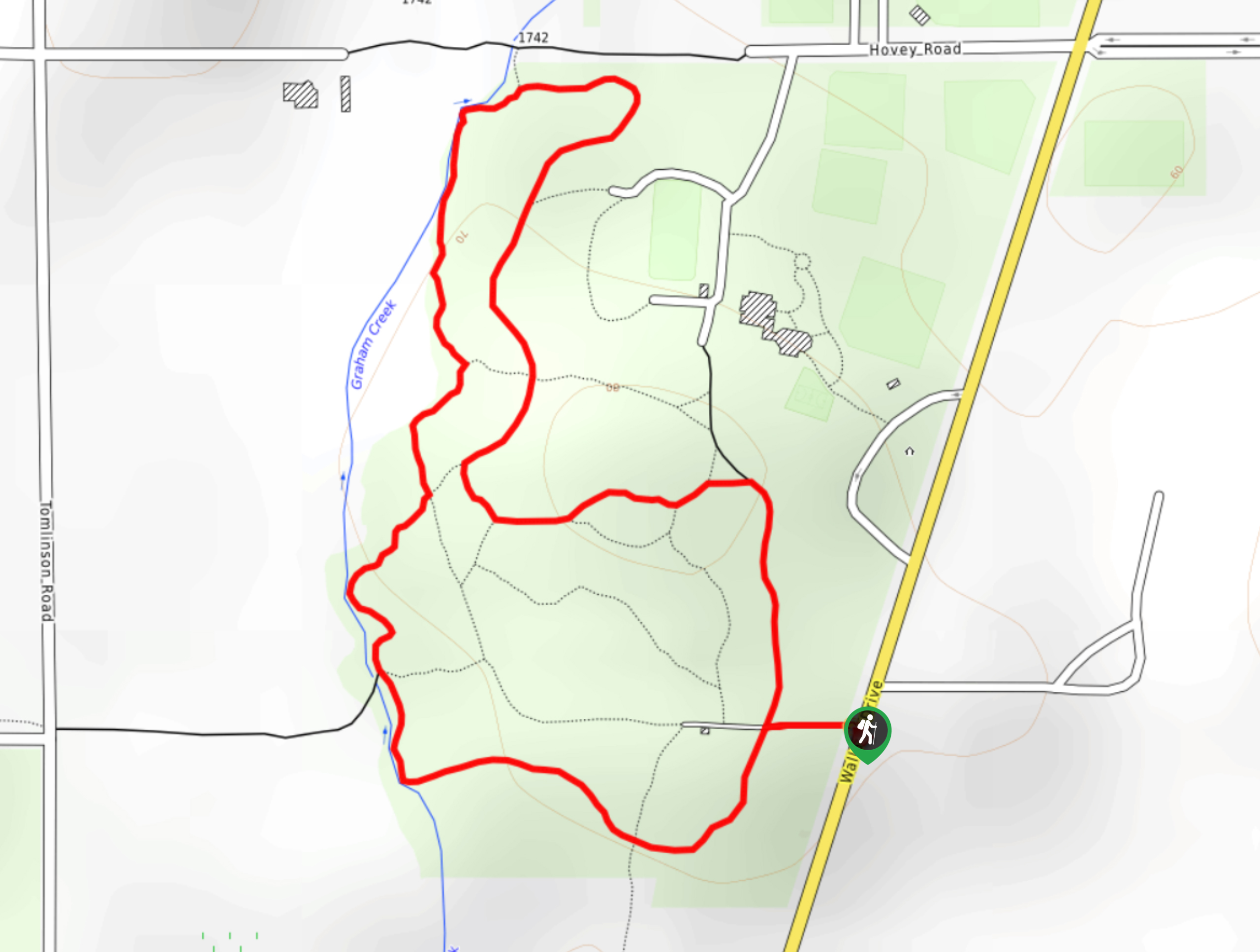
The Blinkhorn Lake Trail is a 0.8mi hiking circuit west of Victoria, BC, that loops around the shores of the lake within the Blinkhorn Nature Park. Along the trail, you will experience a tranquil forest atmosphere and some nice views across the calm water of the lake as you meander through the heavy cover of the forest along wide, well-maintained pathways. This trail is kid and dog-friendly, so make sure to bring the entire family along for this easy hike through a scenic forest landscape.
Getting there
To reach the Blinkhorn Lake trailhead from Langford, head south on BC-14 for 1.4mi and turn right onto the Juan de Fuca Highway. After 1.1mi, turn left onto Happy Valley Road and follow it for 3.3mi. Turn right on Lindholm Road and continue on for 1.7mi, before turning left on Kangaroo Road. You will find the parking area on the left in 1804ft.

About
| When to do | Year-Round |
| Backcountry Campsites | No |
| Pets allowed | Yes |
| Family friendly | Yes |
| Route Signage | Average |
| Crowd Levels | Low |
| Route Type | Circuit |
Blinkhorn Lake
Elevation Graph
Weather
Blinkhorn Lake Description
The only real drawback to hiking around Blinkhorn Lake is that the trail isn’t longer! Although there used to be an extension of the route that led up to the top of nearby Mount Blinkhorn for some amazing views of the surrounding landscape, this has since been closed off to the public, leaving only the pathways that encircle the lake. This trail is lightly travelled; however, spaces at the small parking area can still become limited during peak times. Make sure to arrive early enough to secure parking and enjoy the quiet tranquility of the forest to yourself for a while.
While the trail may be short, it still provides more than enough beautiful terrain to explore, especially if you are hiking with a dog or small adventuring children. The trail itself is very flat and meanders through a serene forest setting while providing some nice views across the lake. It might not be the most physically demanding hike, but if you are looking for a bit of exercise or some quiet time alone in a breathtaking setting, then a little bit of exploration in the Blinkhorn Nature Park might just be what you are after.
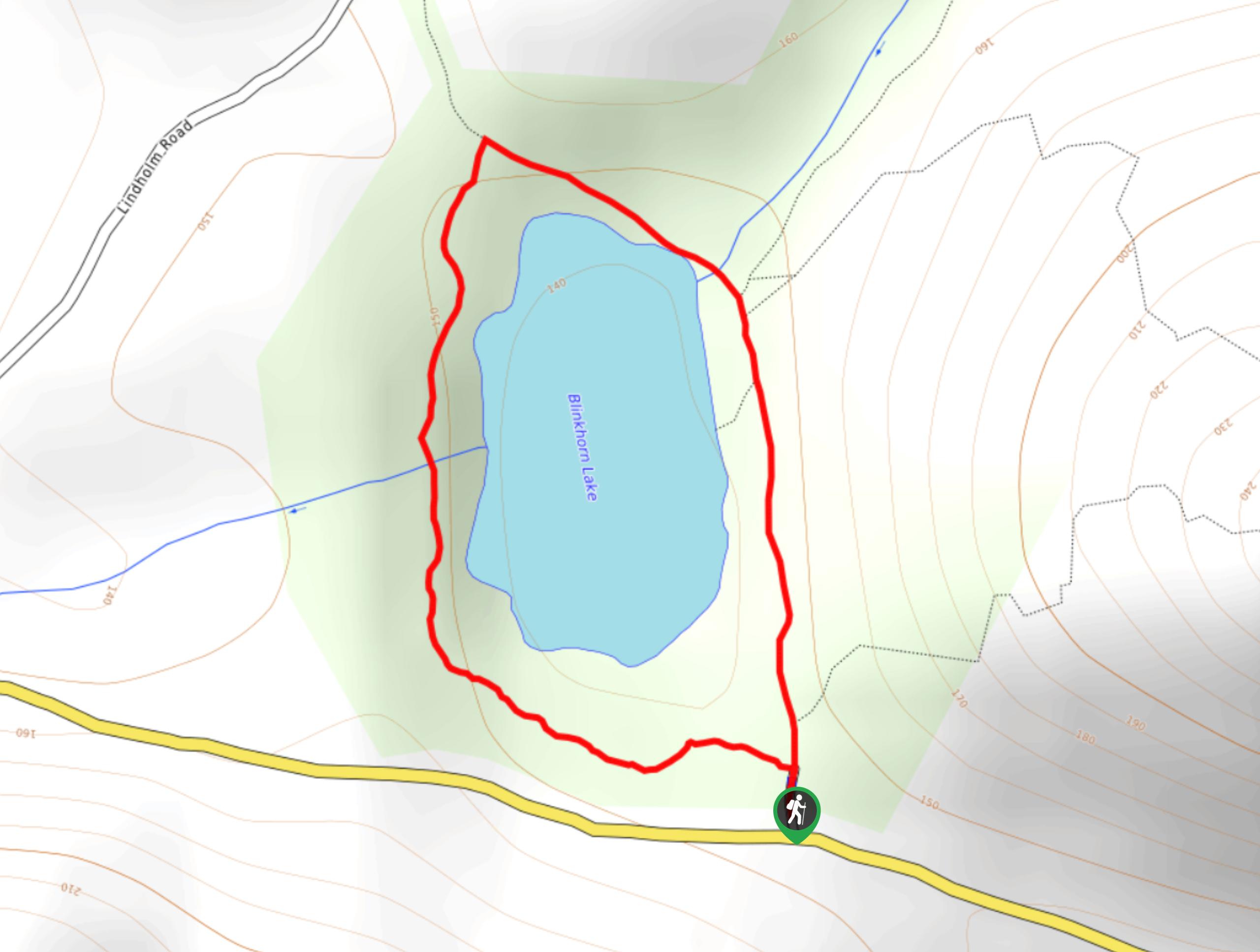
Setting out from the parking area off Kangaroo Road, follow the trail on the left that leads around the western side of the lake. As you hike through the dense cover of the forest, take some time to admire the natural beauty and biodiversity that can be found within this amazingly peaceful setting. After roughly 1148ft, you will crossover a small creek and continue along the loop to the northern side of the lake.
689ft after crossing over the creek, you will come to a junction in the trail. Head to the right to wrap around the lake and cross a bridge spanning another small creek. Shortly after crossing the bridge, you will keep straight and pass by the old trail up Mount Blinkhorn on your left. 164ft after this junction, you will find another path splitting off to the right that will take you to the edge of the lake for some scenic views across the water. After enjoying the scenery, head back to the main trail and go right to complete the final 787ft of the Blinkhorn Lake hike.
Insider Hints
Arrive early to secure a parking spot.
Bring your canine companion for a fun off-leash adventure through the forest.
Similar hikes to the Blinkhorn Lake hike
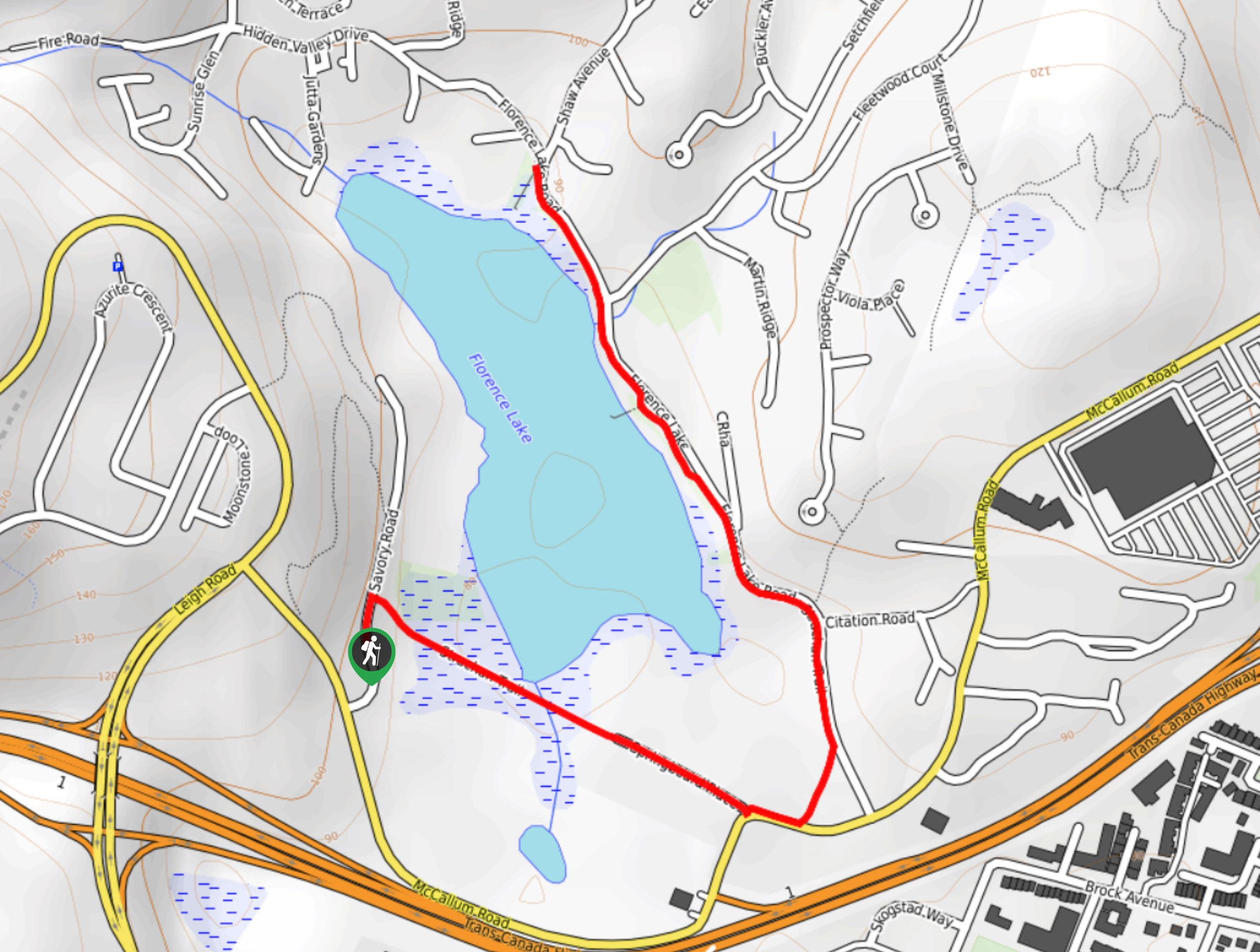
Florence Lake
The hike around Florence Lake follows a 1.9mi out-and-back route in Langford that travels around the southern edge…
Centennial Park Loop Hike
The Centennial Park Loop is a 1.0mi lollipop hiking route north of Victoria, BC, that travels through an…
Playfair Park Hike
The Playfair Park trail follows a 0.7mi hiking circuit in Saanich, BC, that traverses a series of paved…
Comments