Col de la Lose hike
View Photos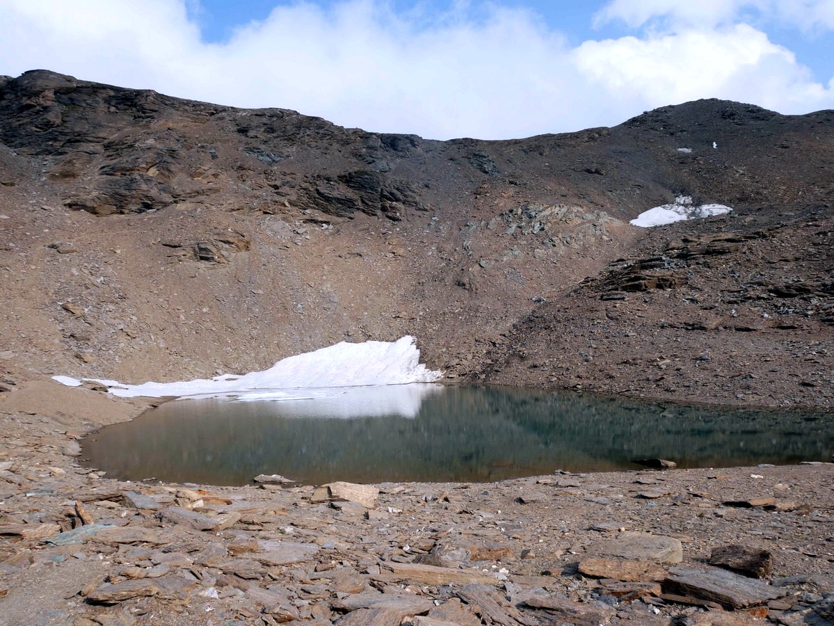
Col de la Lose hike
Difficulty Rating:
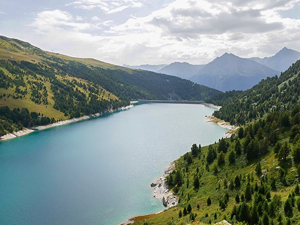
The hike up to the Col de la Lose takes you to the border between the French and Italian Alps. Starting near Val d’Isere, this hike is along a steep path through wonderful scenery. On the way up to the Col de la Lose you will find wonderful views of a waterfall, high alpine scenery, and a glacier.
Getting there
Head to Val d’Isere and take the D902 East, passing the hamlet of Le Fornet. After Le Fornet the parking is 4.7mi along the D902, just before a bridge over the Isère River.

About
| When to do | June - Fall |
| Backcountry Campsites | Yes, close to Refuge de Prariond |
| Toilets | No |
| Family friendly | No |
| Route Signage | Average |
| Crowd Levels | High |
| Route Type | Out and back |
Col de la Lose
Elevation Graph
Weather
Route Description for Col de la Lose
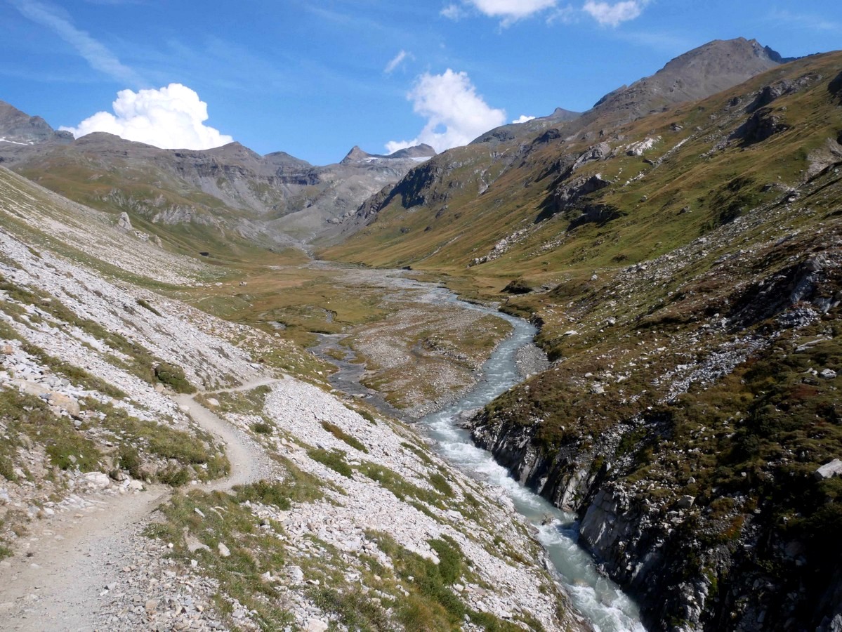
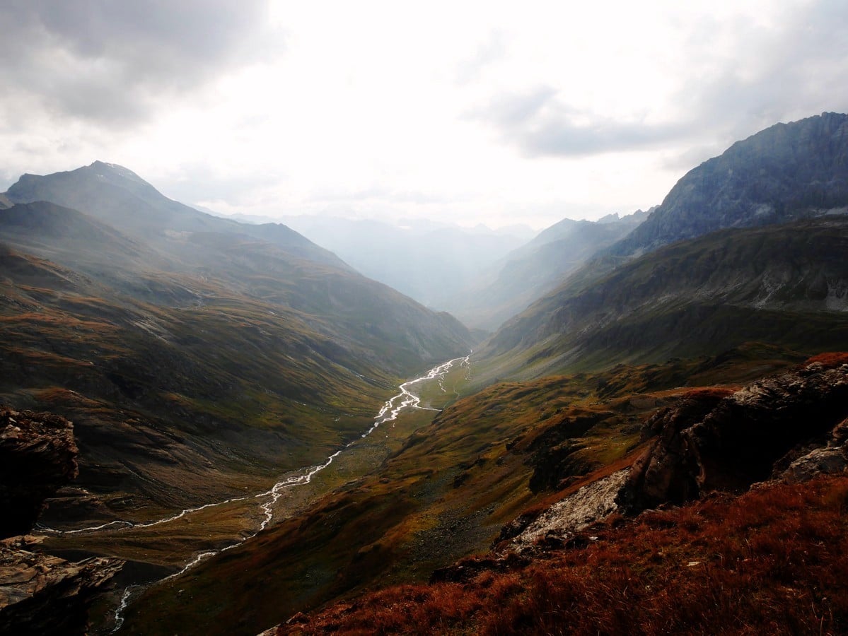
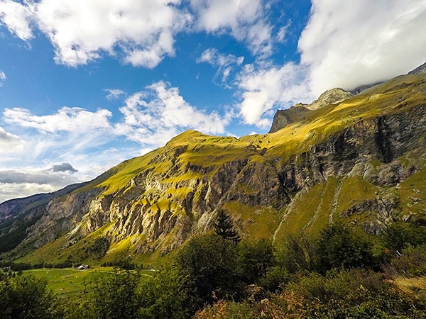
From the parking lot the hike to the Col de la Lose starts with a steep, but accessible trail above the Gorges du Malpasset. The L’Isère River is on your right as you go on the left-hand side of the gorge.
After 0.6mi you will discover the wonderful Vallon du Prariond, which is locally known as the secret kingdom of chamois, ibex, and marmots! Keep your eyes peeled here
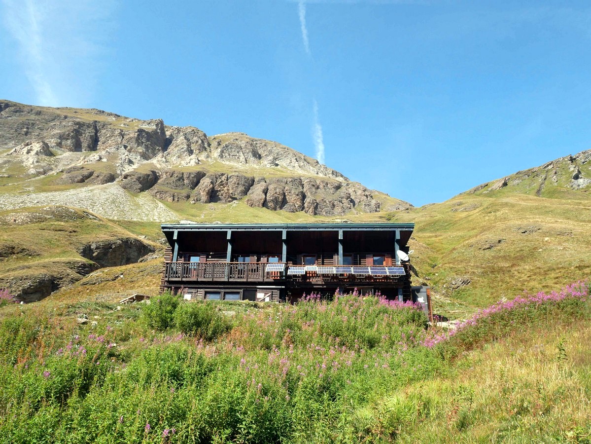
Cross the two streams which separate you from the Refuge du Prariond. You can stop here on the way up, but we prefer to stop here on the way back, there is an a la carte menu available over lunchtime. On a sunny day a drink on one of the picnic tables is about as good as life can get!
From Refuge du Prariond, follow the indication Col de la Lose until the top. The trail initially zig-zags and then soon splits. Take the trail to the right, signed to the Col de la Lose. (The left trail heads to the Col de la Galise, which is also beautiful however it is a trickier route and windier than the Col de la Lose).
Follow this path as it ascends up the valley. While hiking, make sure to keep a look out because many Ibex choose this site to graze at the end of the afternoon.
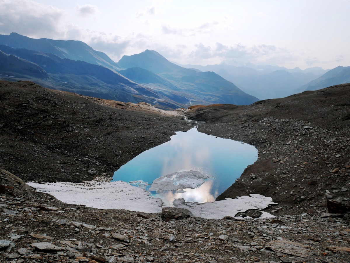
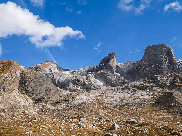
Continue as the path goes to the right. The path will be marked by the cairns until the Col de la Lose. You will pass a small lake to your right, just before the Col. From the lake, the trail goes left and heads up quite a steep incline to the Col de la Lose.
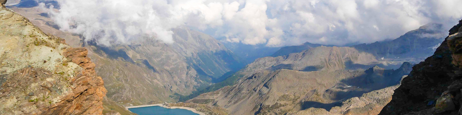
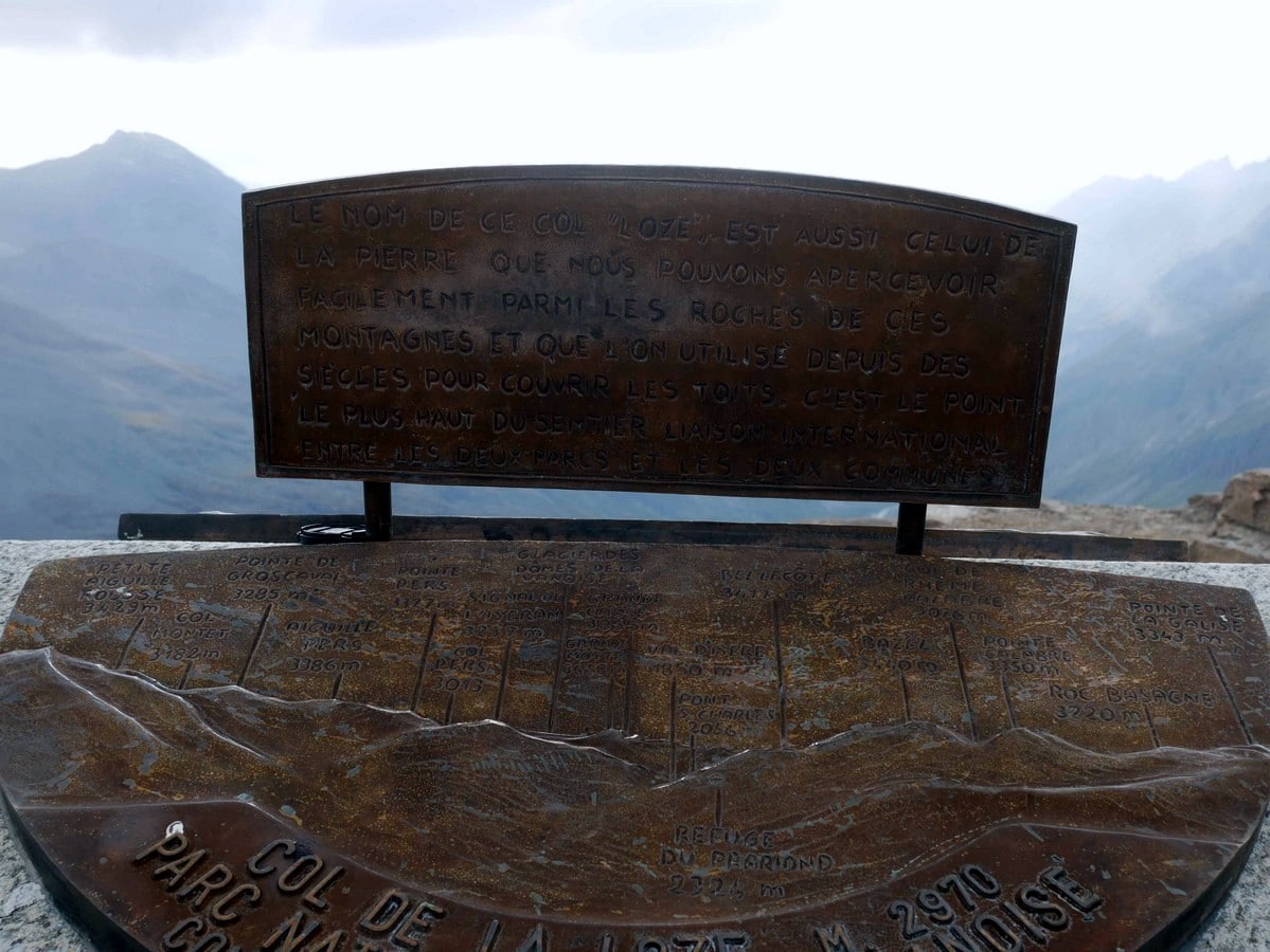
The Col de la Lose is on the border with the Italian Alps. At the top you can admire the view of the French scenery with the Vallon du Prariond and the Glacier des Sources de l’Isère, and the amazing Grand Paradiso on the Italian side.
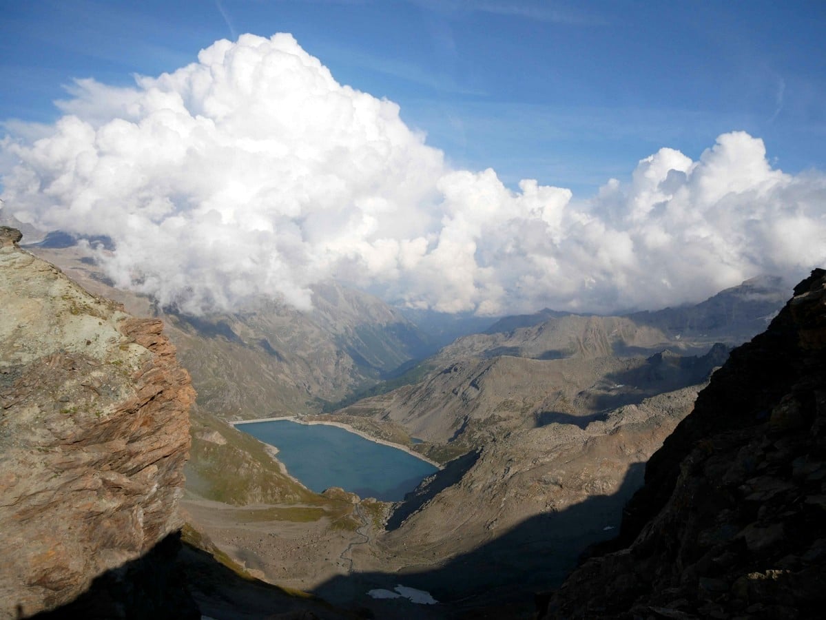
From the Col, there are tracks that wind up the hills on either side. They offer similar views, but can be hiked up if you have extra energy.
To get back from the Col de la Lose, hike back the way you came. Consider stopping for a snack and drink at the Refuge du Prariond
Insider Hints
Book a night at the Refuge du Prariond, and take some extra time to look around. Perhaps check out the Col de la Glalise if you are feeling adventurous.
While in the area, a drive up to the Famous Col de l'Iseran is a must.
Guests familiar with Val d’Isere as a winter ski destination will be surprised by how quiet this incredible mountain town is during summer, especially in June and September, when only a handful of businesses are open. You can get some great deals on accommodations during summer and this is useful base.

Similar hikes to the Col de la Lose hike
Col d’Aussois & Pointe de l’Observatoire
The Col D’Aussois hike is a wonderfully long hike, a true classic hike of the Vanoise. This hike takes you…
Lac des Vaches and Col de la Vanoise
A hike to the Lac des Vaches and then up to the Col de la Vanoise is a stunning hike…
Refuge du Mont Pourri
A hike to the Refuge du Mont Pourri will take you among bearded vultures, glaciers, waterfalls, marmots, and a lake.…
martijnvd 4 years ago
Absolutely stunning hike! Make sure you make your way up a little bit higher once you reach Col de la Lose, on either the the left or the right. It makes for an even better view, especially to the Italian side. The left trail up is tricky and dangerous, the right trail is much easier.
Gilberto Fattore 4 years ago
Heaven on earth, very calm. Nature is everywhere. Magnificent.
Matilda86 4 years ago
Incredible landscapes and spectacular views
Dolores S. 4 years ago
What an incredible quiet hike! You'll hear nothing but rustling wind and some occasional bird-calls. It was so peaceful!
Karen S. 4 years ago
An amazing view of the valley. Some of the sections were dangerous so be careful.
Mina P. 4 years ago
Impressive, wide range of scenery. A peaceful hike for us. Great views of the alpines.
Mercury Q. 4 years ago
Beautiful views of a waterfall, high alpine scenery, and glaciers. The place is worth exploring.
Arjean M. 4 years ago
This hike is along a steep path through wonderful scenery.
Arnie Q. 4 years ago
Magnificent view of the glacier. No wonder why the traffic was enormous.
Slavka Pochodi 4 years ago
A beautiful place that is really worth the trip!