Col d’Aussois & Pointe de l’Observatoire hike
View Photos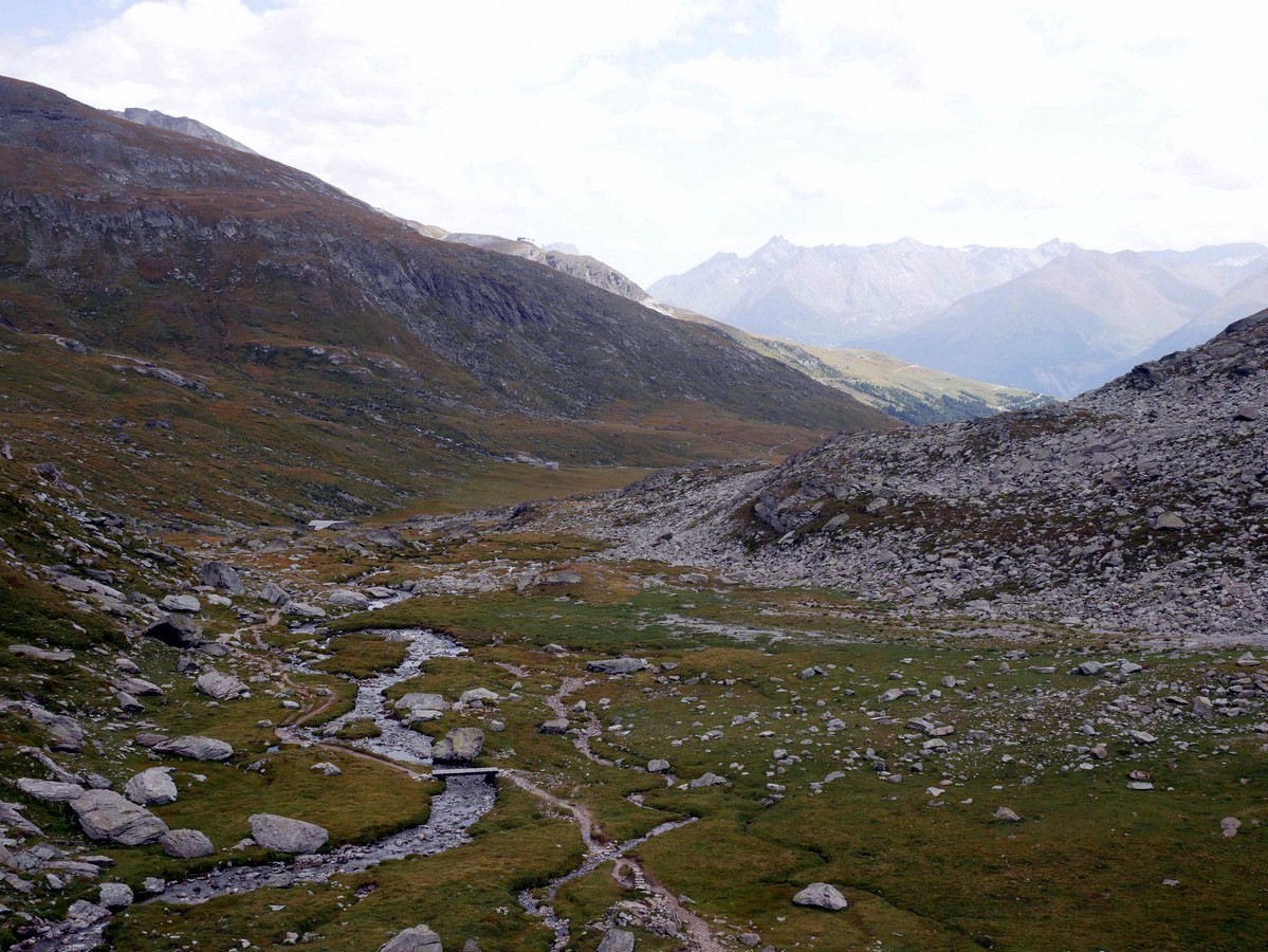
Col d’Aussois & Pointe de l’Observatoire hike
Difficulty Rating:
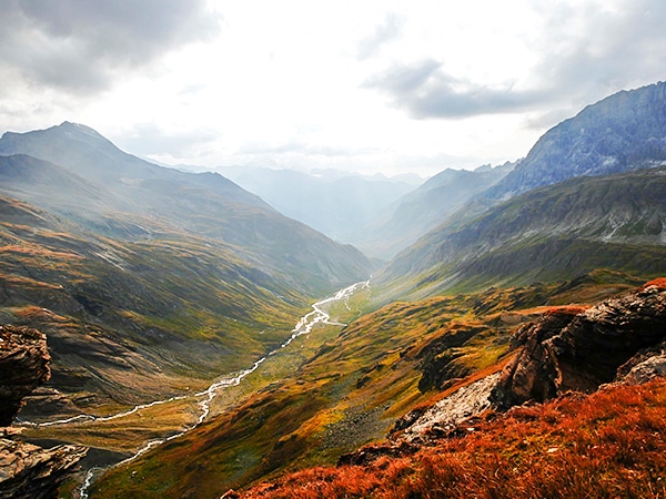
The Col D’Aussois hike is a wonderfully long hike, a true classic hike of the Vanoise. This hike takes you through green fields and ends in a very rocky, mineral landscape. You will find yourself hiking through the world of the ibex, with some of the best panoramic views in the Alps.
Getting there
At Aussois, take the D108 and follow the signs to the Plan D’Amont (a river dam). There is a lower and an upper parking lot, our map shows the route from the larger lower Parking Lot.

About
| When to do | June - Fall |
| Backcountry Campsites | Yes, close to the refuge |
| Toilets | No |
| Family friendly | No |
| Route Signage | Average |
| Crowd Levels | High |
| Route Type | Out and back |
Col d’Aussois & Pointe de l’Observatoire
Elevation Graph
Weather
Route Description for Col d’Aussois & Pointe de l’Observatoire
This is one of the best hikes in the Vanoise. It’s a big day of hiking, however the effort will be worth it.
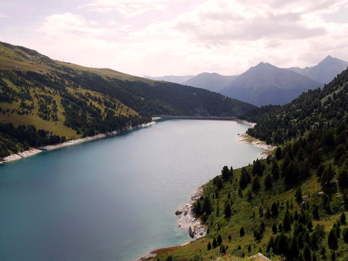
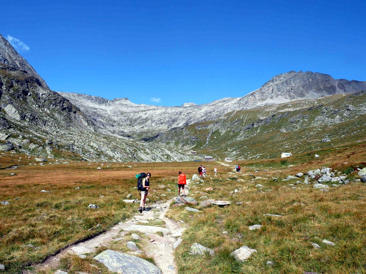
Start from the parking lot down the road from the base of the Plan d’Amont. From here, take the rocky path which goes towards the dam and then passes just below the base of the dam.
The trail then goes along the left-hand side of the lake. The trail rises on a good track until the Pont de la Sétéria, a bridge that passes over Ruisseau de Saint Benoit. Go right, over the bridge and continue bearing to the right, following the signs to the Refuge du Fond d’Aussois.
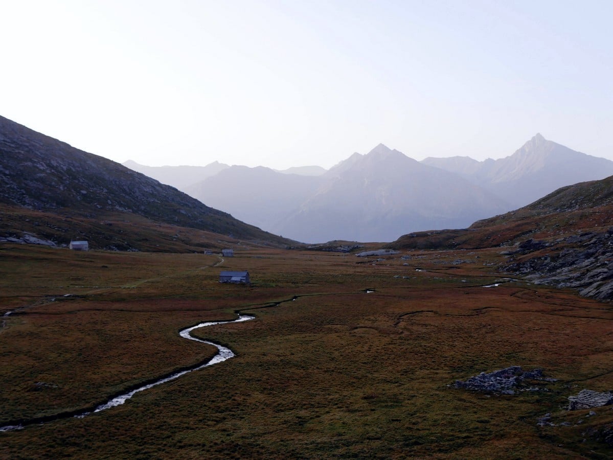
Approximately 820ft after the bridge, the path splits. Take the path to the left and continue up in the direction of the Refuge du Fond d’Aussois. Along the way you will pass the Chapelle Notre-Dame des Anges.
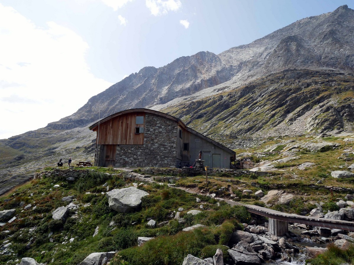
Soon after the Chapelle Notre-Dame des Anges you will get to the Fond d’Aussois Alpine Pasture. The refuge is in the back, and is well regarded. This is a great stop for a meal, and you can try either traditional hut food or vegan food for lunch. If you want a special night in the mountains, this is a great hut to stay at, with electricity, hot water, duvet, and a great team working there.
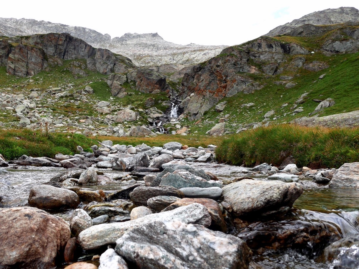
After the Refuge, continue hiking up along the steep path by the stream. There are some flat parts, however it’s mostly uphill. There can be lingering snow as you head up to the Col, so be careful if you go over snow.
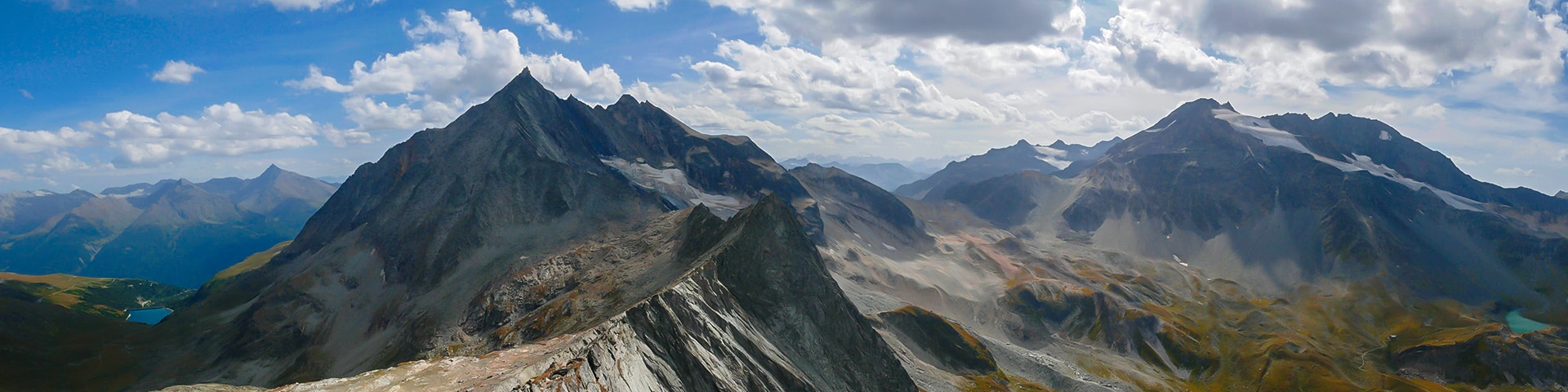
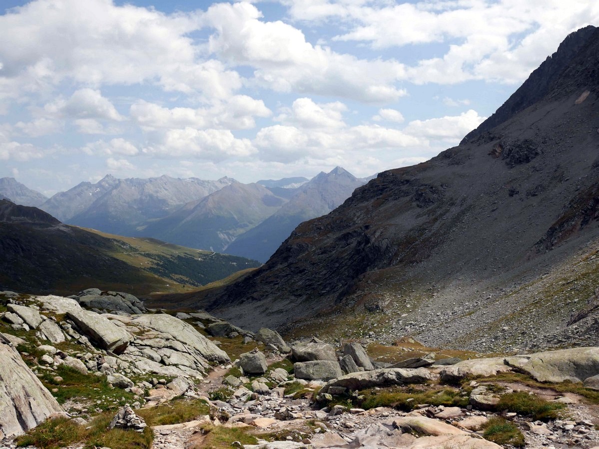
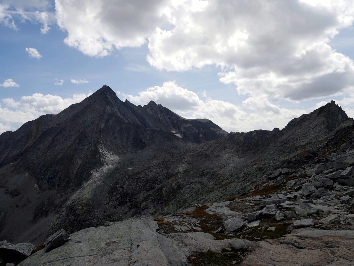
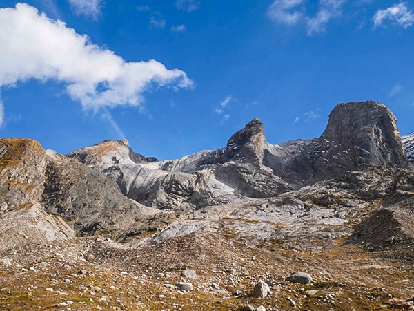
The path is clear as you head uphill towards the Col d’Aussois. At the top, you will have a view of all the mountain ranges between you and Mont Blanc.
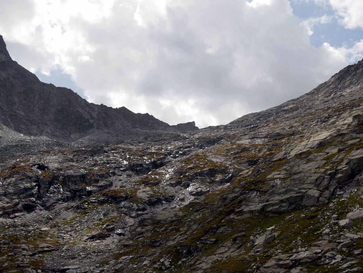
If you’re ambitious, an even better view is on your left (west). Known as the Pointe de L’Observatoire, this path is very steep. You need to climb through a boulder field, with occasional use of your hands. This can be too much for some people, so don’t push to the top if you’re uncomfortable. Those who do get to the Pointe de L’Observatoire get a special reward – the view is incredible! One of the most beautiful views of Vanoise.
To get back down from either the Pointe de l’Observatoire or Col d’Aussois simply hike back along the route you hiked up on.
Insider Hints
If you are not afraid of heights you can hike the last 328ft until the Pointe de l’Observatoire (9895ft) from the Col d’Aussois (we show the path on the GPS map). The panoramic view over Vanoise National Park is incredible. If you’re lucky with the weather, you may see Mont Blanc in the background and some Ibex on the way up!

Similar hikes to the Col d’Aussois & Pointe de l’Observatoire hike
Lac des Vaches and Col de la Vanoise
A hike to the Lac des Vaches and then up to the Col de la Vanoise is a stunning hike…
Refuge du Mont Pourri
A hike to the Refuge du Mont Pourri will take you among bearded vultures, glaciers, waterfalls, marmots, and a lake.…
Col de la Lose
The hike up to the Col de la Lose takes you to the border between the French and Italian Alps.…
Berbi 4 years ago
Hello there! The GPS file appears as an error! Any way to get it some other way? Thanks
Karen S. 5 years ago
A difficult but rewarding hike. The trail is also diverse. The panoramic view over Vanoise National Park is incredible.
Mina P. 5 years ago
You will have a view of all the mountain ranges between you and Mont Blanc at the top.
Mercury Q. 5 years ago
You will have a view of all the mountain ranges between you and Mont Blanc at the top. Get to the Pointe de L’Observatoire get a special reward – the view is incredible. I really enjoyed the hike.
Arjean M. 5 years ago
It's a fun, long hike. This hike takes you through green fields and ends in a very rocky, mineral landscape. Great panoramic view of the Alps.
Aiza S. 5 years ago
I really enjoyed the hike. Nice trails and fairly easy too.
Cole Anx. 5 years ago
The views are outstanding but a bit melancholic. Might be because of the gray sky.
Kim Pillar 5 years ago
This is a great hike in general. But one thing you should check before going here is the weather. Sometimes when it gets too foggy you won't be able to see everything clearly.
Adel Hamdani 5 years ago
Awesome hike! I totally agree with other comments! This is a remarkable hike and not to be missed!
Grendy Noire 5 years ago
We started at 5am and finished by 12:30pm . We were able to catch a glimpse of the sunrise on the way and it was awesome.