Lac des Vaches and Col de la Vanoise hike
View Photos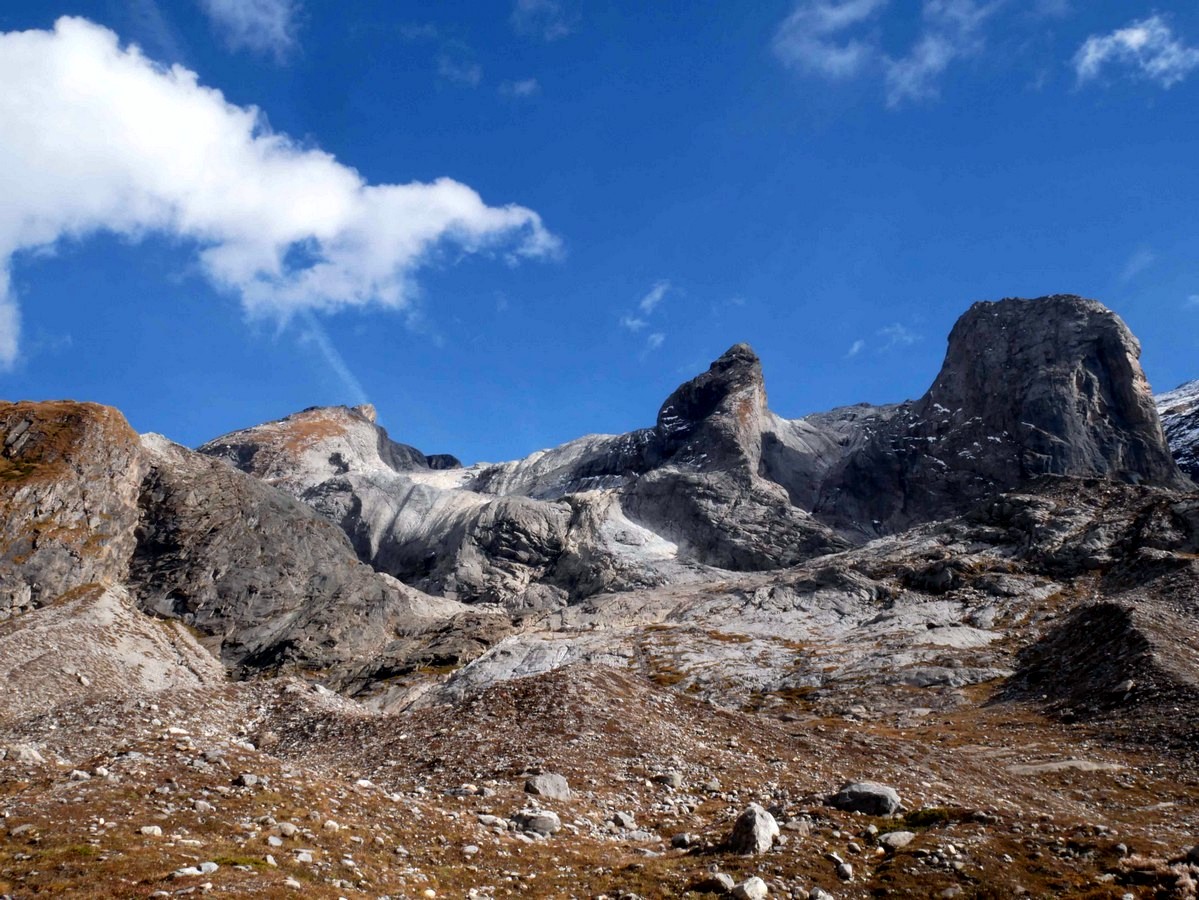
Lac des Vaches and Col de la Vanoise hike
Difficulty Rating:
A hike to the Lac des Vaches and then up to the Col de la Vanoise is a stunning hike with an impressive variety of landscapes. This hike takes you along the Vanoise portion of the historic Salt Road and some of the best high alpine scenery in the French Alps!
Getting there
From the Tourism office in Pralognan la Vanoise, drive south of Avenue de Chasseforet and then go left on the Rue du Grand Couloir which turns into Chemin du Col de la Louza. From there, turn right onto Rue du Raffort and go for 1.3mi. The road turns into Route des Fontanettes and will take you to the hamlet of Les Fontanettes, where you go through a traffic circle and then to the parking lot.

About
| When to do | June - Fall |
| Backcountry Campsites | Yes, close to refuge |
| Toilets | Yes, at the refuge |
| Family friendly | No |
| Route Signage | Average |
| Crowd Levels | High |
| Route Type | Circuit |
Lac des Vaches and Col de la Vanoise
Elevation Graph
Weather
Route Description for Lac des Vaches and Col de la Vanoise
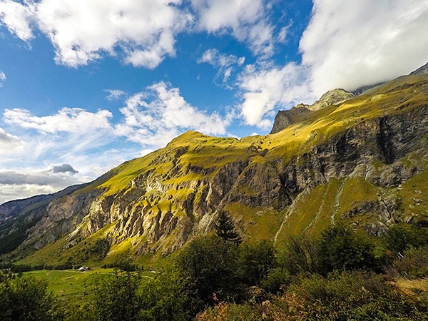
From the parking lot, the hike to the Col de la Vanoise starts in the forest and goes up under the ski lift. (You can take the ski lift between June to August, which takes off some of the ascent on this hike). Take the path which is signed for the Col de la Vanoise and in about 45 minutes passes the Refuge des Barmettes. If you have taken the ski lift, it lets you off at this refuge.
The Refuge des Barmettes is a delightful refuge, with great food and a wonderful view. This is a great option for families if you just want to get a short hike into the mountains and have a wonderful snack or meal.
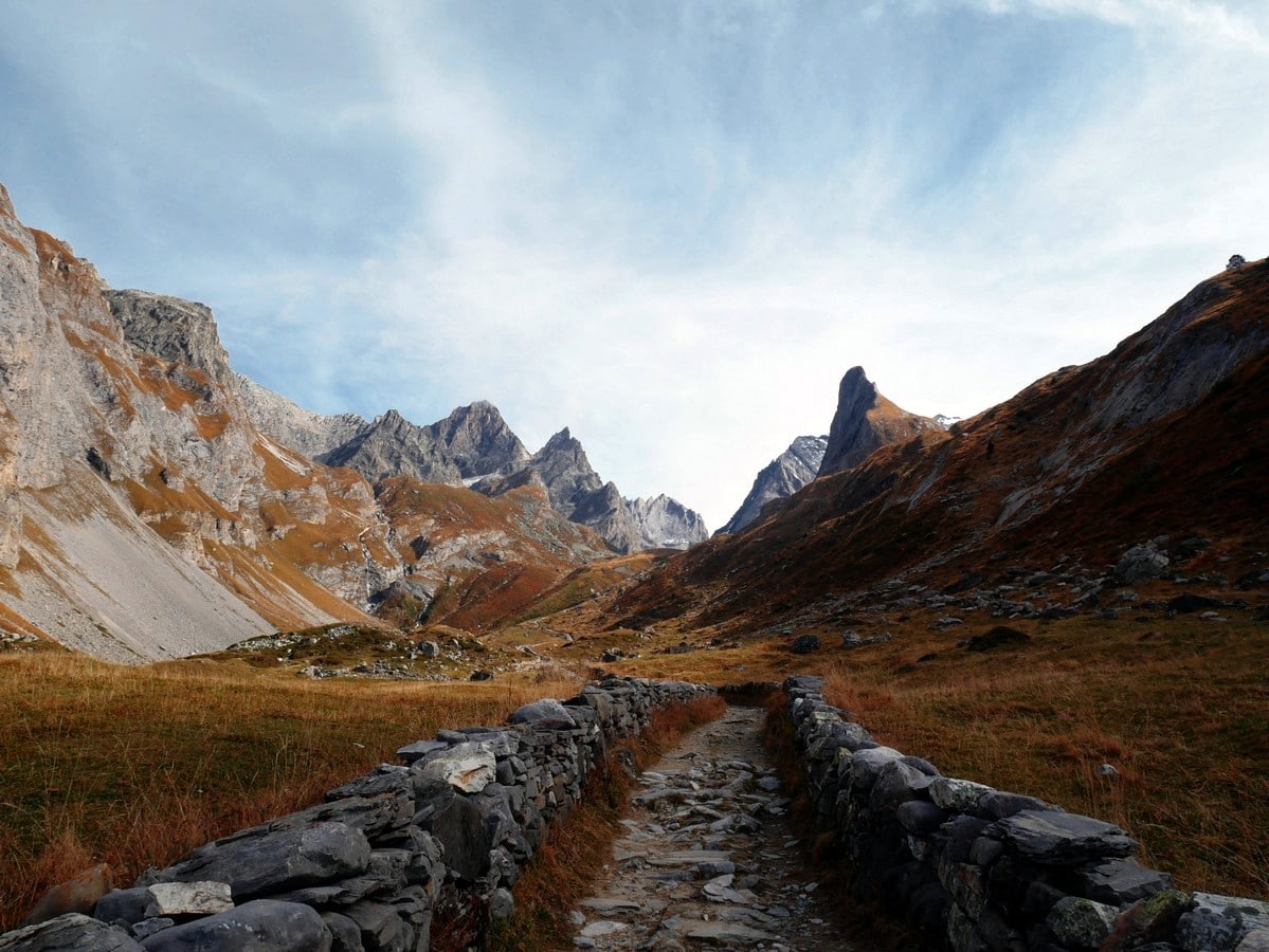
From the refuge, go across the bridge, Pont du Chanton, and keep going on the path bordered by low walls. The path takes you over to the right-hand side of the valley. Enjoy the view and the waterfall and hike the rounded hilltop until you reach the Lac des Vaches.
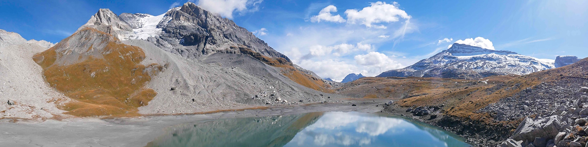
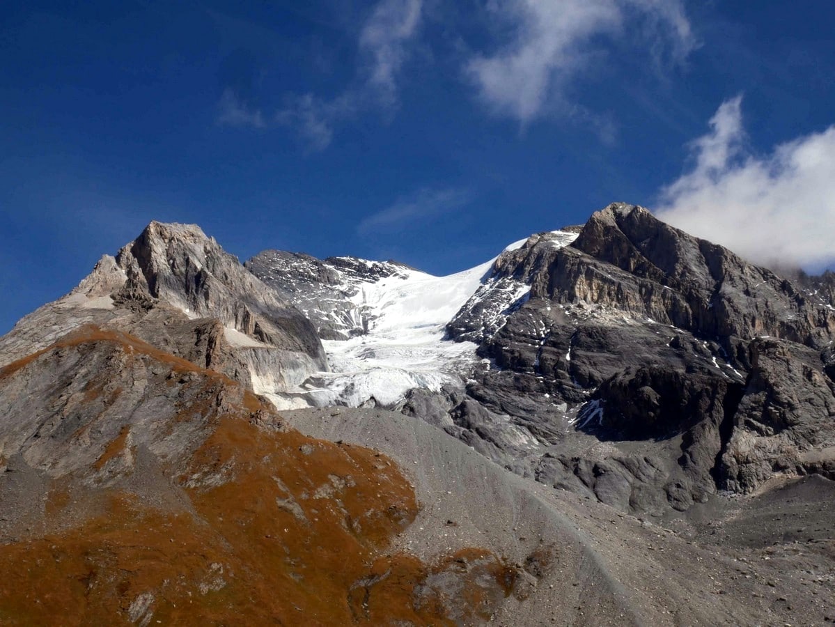
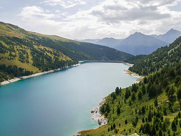
The views from the Lac des Vaches are incredible. You have the Aiguille de la Vanoise looming above you on the right side of the lake and the view of the Grande Casse (the highest peak in the Vanoise at a height of 12648ft) and its glacier is impressive.
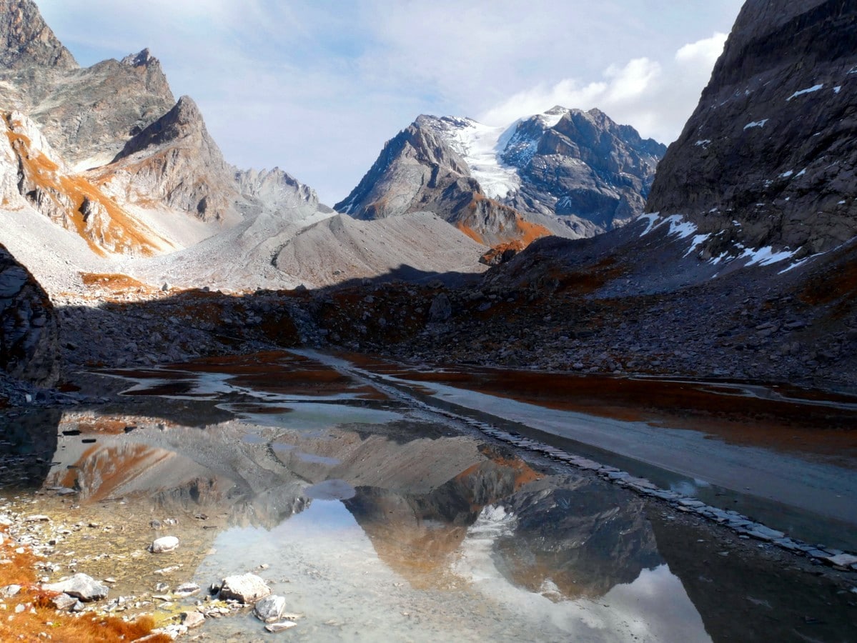
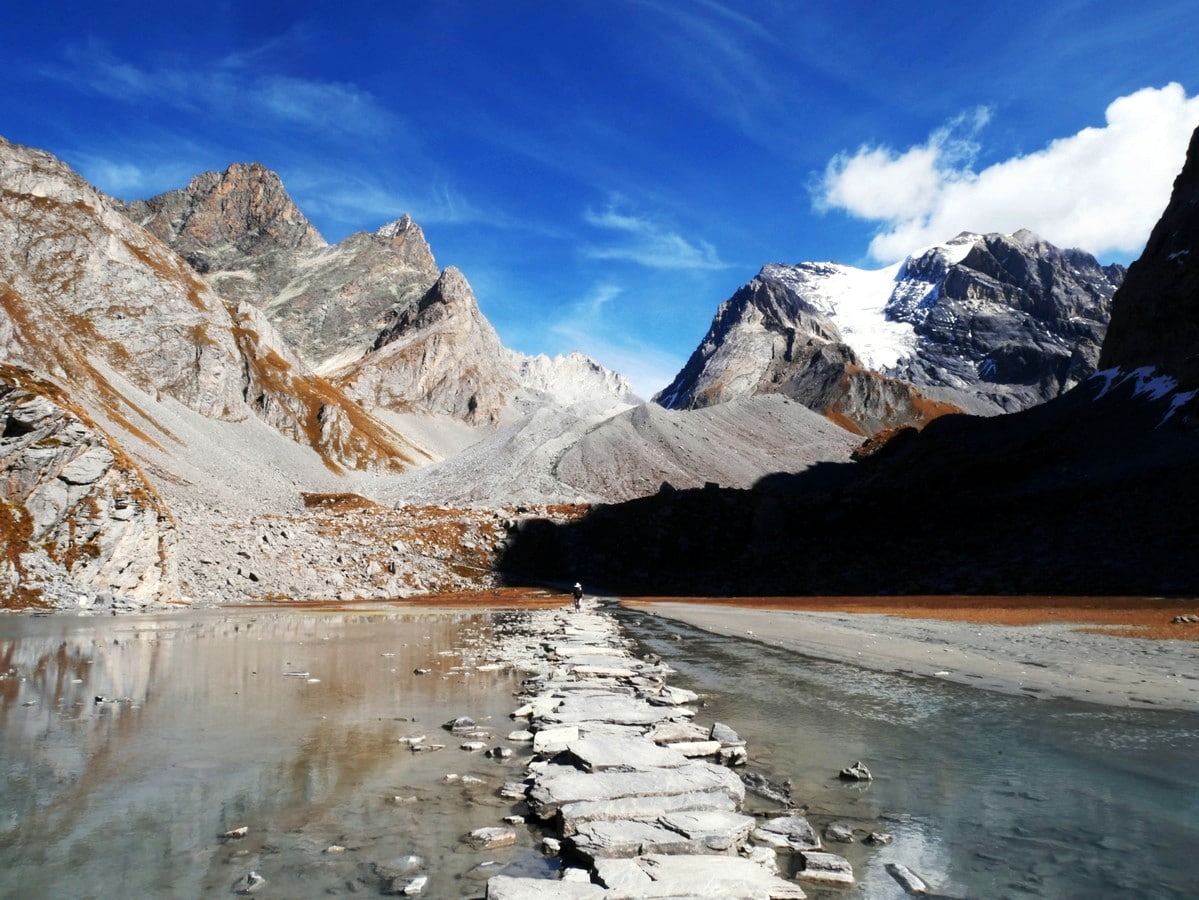
The path across Lac des Vaches is incredible, but not good for young children. This is a special path made with flat rocks that go across the lake. At the end, look back. Yes, you walked on water, you did it!
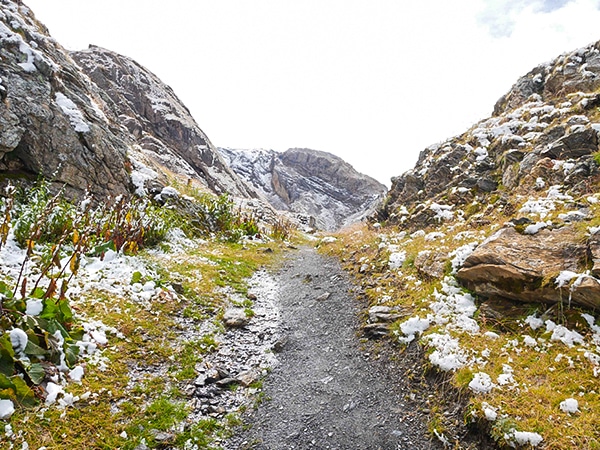
From Lac des Vaches, the hiking starts to get steep. The path goes up on the steep scree until the Lac Long at the foot of the Glacier de la Grande Casse. The color of the lake is very green, and you can hear cracks from the glacier, due to the melting ice.
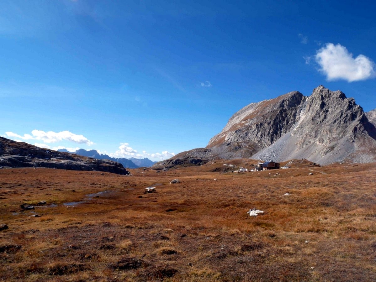
Follow the path until the restored Refuge du Col de la Vanoise. Continue past it a little ways to the Col de la Vanoise and take in the stunning views in both directions. Just down on the other side of the Col de la Vanoise is another pretty lake, Lac Rond.
Once you’ve had your fill of stunning views, return to the Refuge du Col de la Vanoise. You can break here, but we often end up taking a break at the Col, as the extra height gives even better views.
You can return the way you came up, but there is a better way to get back to your car, this time using an alternative route that goes around the other side of the Aiguille de la Vanoise.
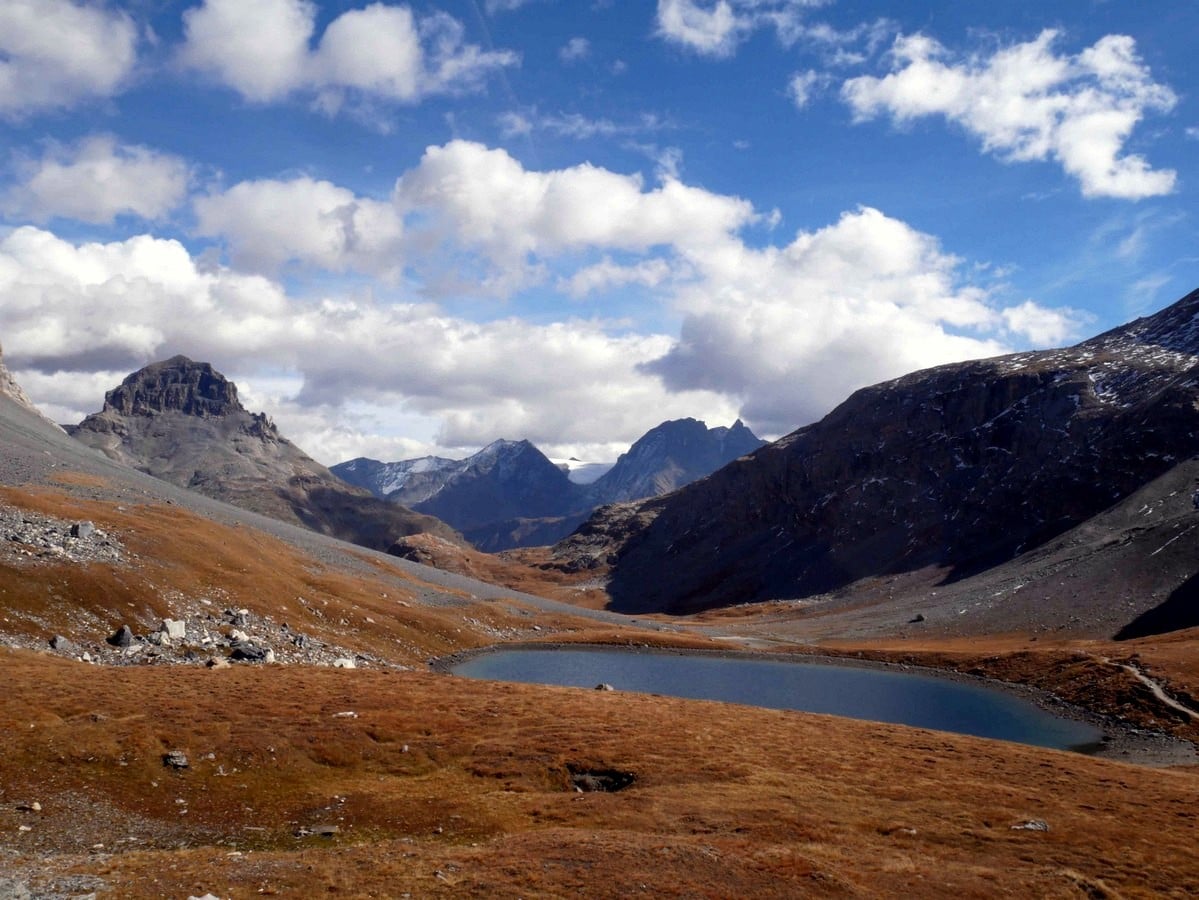
Take the path that goes away from the Refuge in a SW direction, following the sign that shows the way to the Lac des Assiettes. Very quickly the path will split, take the right-hand path, which quickly comes to the Lac des Assiettes. This lake is often dry, so don’t be surprised if you don’t see an actual lake here.
Continue hiking on this path, it eventually meets up with a stream, the Ruisseau de l’Arcellin. At this point, the path goes to the left and follows along the stream of l’Arcellin, and passes at the bottom of the Aiguilles de l’Arcellin.
Go down carefully, the slope is steep, and the rocks are quite slippery, especially if they are wet. After a while you will cross the stream of Nant de la Crépéna. At the trail intersection stay right. Admire the waterfall of the Ruisseau du Dard and continue along the path to join the parking lot Les Fontanettes.
Congratulations are in order! What a perfect day of hiking in the Vanoise.
Insider Hints
Don’t do this hike after rainy days, some parts of the path are very steep and would be dangerously slippery on the way down. More so the stream could become too big to be crossed.
At the beginning of the season, there is more water in the Lac des Vaches and it’s more impressive than at the end of the season (which will still be very beautiful)!

Similar hikes to the Lac des Vaches and Col de la Vanoise hike
Col d’Aussois & Pointe de l’Observatoire
The Col D’Aussois hike is a wonderfully long hike, a true classic hike of the Vanoise. This hike takes you…
Refuge du Mont Pourri
A hike to the Refuge du Mont Pourri will take you among bearded vultures, glaciers, waterfalls, marmots, and a lake.…
Refuge du Fond des Fours
A hike to the Refuge du Fond des Fours is a perfect family hike in Vanoise National Park. Close to…
martijnvd 4 years ago
Beautiful hike, but would have been even better if there would be more water in the lakes (I did it in early September). Especially when you like to take photographs. I would do the hike later on the day, because Lac des Vaches is covered in the shade for the most part in the morning. Or even better, do the loop in reverse because the way down in this route is more difficult than the way up. When it's wet I would definitely do it in reverse!
Dolores S. 4 years ago
It's not very easy but not that difficult also. It might not be the best but it's still worth the visit!
Arnie Q. 4 years ago
A stunning hike with an impressive variety of landscapes. This hike takes you along the Vanoise portion of the historic Salt Road. Definitely worth the hike.
Ariel R. 4 years ago
The lakes were so enchanting. There are great alpine views that you shouldn't miss as well!
Lambert MD. 5 years ago
Best high alpine scenery in the French Alps I've ever seen. It's a moderate hike with magnificent view of the lake. I really enjoyed the hike.
Ramesh Patel 5 years ago
It was worthwhile the trip! Very fulfilling.
Lena H. 5 years ago
Super satisfied with this hike! Tough climb to the lake, but we’ll worth it.
Marcel A 5 years ago
I loved how the environment changed throughout the hike.