Wasson Peak via King Canyon Trail
View Photos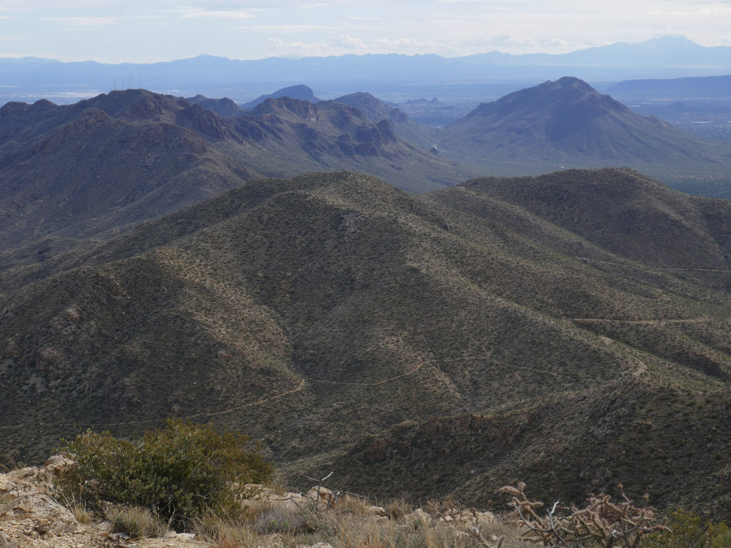
Wasson Peak via King Canyon Trail
Difficulty Rating:
Wasson Peak via King Canyon Trail is a 6.7mi heavily trafficked moderate trail in Saguaro National Park West near Tucson. Starting out on King Canyon Trail, you’ll hike through a collection of prickly pear, ocotillo, and saguaros up Wasson Peak for a fantastic view of the surrounding park. You can make a quick side trip on King Canyon Trail to see a tall stone structure and petroglyphs. This is a very rewarding hike that’s generally suitable for active kids and strong beginners.
This hike can get very hot up to the peak, which can be windy and cool. We suggest wearing layers and sun protection to adapt to the changing temperatures.
Getting there
The trailhead for Wasson Peak via King Canyon Trail is off Kinney Road.

About
| Backcountry Campground | No |
| When to do | October-May |
| Pets allowed | No |
| Family friendly | Older Children only |
| Route Signage | Good |
| Crowd Levels | High |
| Route Type | Out and back |
Wasson Peak via King Canyon Trail
Elevation Graph
Weather
Wasson Peak via King Canyon Trail Description
Wasson Peak is the tallest mountain in the Tucson Mountain District of Saguaro National Park. The hike to the top along King Canyon Trail is an interesting trip with a few unique historical finds to discover on the way. A quick side trip on King Canyon Trail takes you to a site with petroglyphs. Then, your hike up Wasson Peak is lined with ocotillo, prickly pear, and (of course) saguaros.
This is a moderately difficult hike. We find it suitable for strong beginners and active older kids, but it’s also a very enjoyable hike for stronger hikers thanks to its scenery. It’s a good way to earn a summit view without needing to hike all day.
The lower elevations of this route can be very hot during the day, but the summit can be windy and cool. Wear layers and sun protection, bring a light jacket, and bring plenty of water. You’ll want to be able to adapt to the possibility of changing temperatures.
Dogs are not permitted on this route whether leashed or not. There is a modest day use fee required for the park and for this trail.
The parking area is off N Kinney Road. It does fill up in busier months, so try to arrive early if you can. There are no restrooms and no water at the trailhead, so we recommend stopping at the visitor center before arriving if you need either.
From the parking lot, take the obvious wide path. There is a split just a few steps in where you’ll stay right onto King Canyon Trail. Continue through the gate about 200ft in.
The route is rocky, so you’ll be glad if you wore good boots. 0.6mi in, take in the view of the canyon from a ledge on the trail.
You’ll soon begin to descend, passing a picnic area. At the wash with a three-way junction, go straight to stay in the wash.
1.0mi into the hike, look for a left turn where the wash forks. This turn is easy to miss! Immediately after turning left, turn right up the ridge. There are some steps built into this ridge, but they’re mostly covered by the bushes.
Begin a steady climb to 2.2mi, where you’ll crest a saddle and find the Sweetwater Trail. Turn left to head towards the peak here. You’ll begin to switchback up the ridge through the steepest part of the hike. As you crest the ridge, you’ll reach a junction. Go right here.
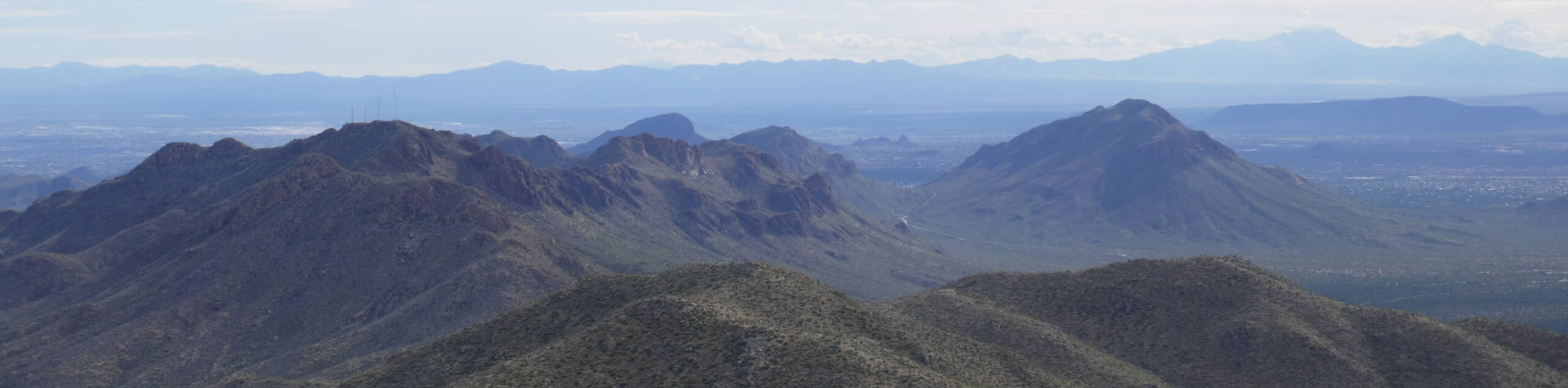
Approaching the top, the view of Tucson, the Tucson Mountains, the Santa Catalinas, and the Rincon Mountains opens up. Take a seat up top and take it all in. You might need to toss on a jacket up here, or you might just enjoy a refreshing breeze if you’re here on a hotter day.
From the top, you’ll return to the trailhead on the same route.
Hiking Route Highlights
Saguaro National Park West
The two sides of Saguaro National Forest–East and West–encompass two patches of beautiful desert scenery on the eastern and western sides of the city of Tucson. The parks may be small, but they don’t lack when it comes to scenery. Saguaro National Park West is lower in elevation with a denser saguaro forest, and Saguaro National Park East is more mountainous and offers the opportunity to backpack if desired. Wasson Mountain shows off the west park in its cactus-covered glory.
Frequently Asked Questions
Is Wasson Peak via King Canyon Trail kid-friendly?
Active children should be able to complete this trail. Younger kids might find it too difficult, but we encourage you to give it a shot!
Are dogs allowed on Wasson Peak via King Canyon Trail?
No, dogs are not allowed on this trail.
How high is Wasson Peak in Tucson?
The peak is 4687ft tall.
Insider Hints
You can take a right after the picnic area to make the return trip a loop if you’d like some different scenery.
We recommend sturdy boots for this rocky route.
Similar hikes to the Wasson Peak via King Canyon Trail hike

Shantz, Cholla, and Cactus Forest Loop
The Shantz, Cholla, and Cactus Forest Loop is an easy trail in Tucson’s Saguaro National Park East. The star of…

Cactus Forest, Squeeze Pen, and Pink Hill Loop
The Cactus Forest, Squeeze Pen, and Pink Hill Loop is an easy trail in Tucson’s Saguaro National Park East. This…

Hugh Norris, Sendero Esperanza, and Dobbie Wash Loop
The Hugh Norris, Sendero Esperanza, and Dobbie Wash Loop is a bit of a mouthful, but it’s a great hike…
Comments