
Pontatoc Ridge Trail
View Photos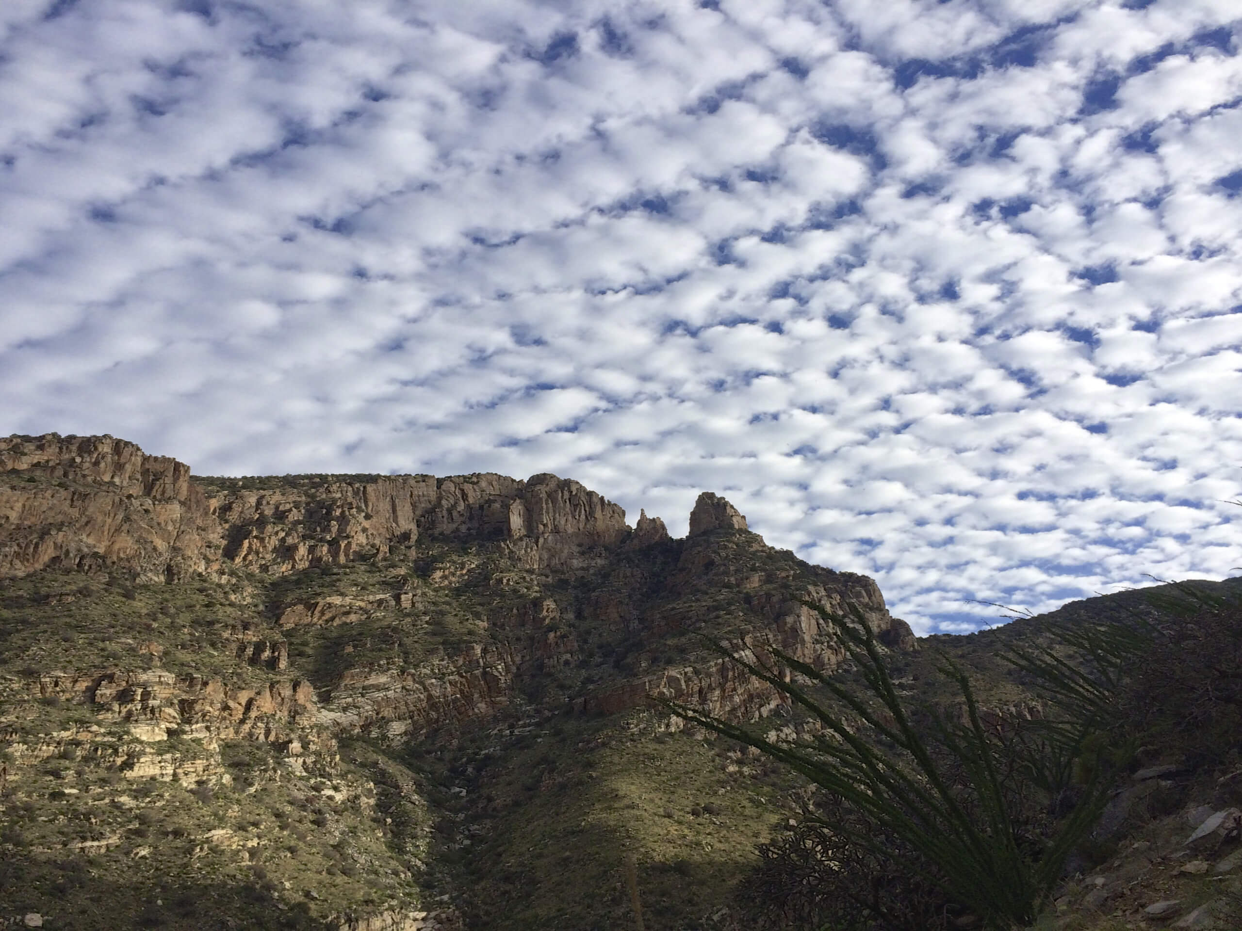
Pontatoc Ridge Trail
Difficulty Rating:
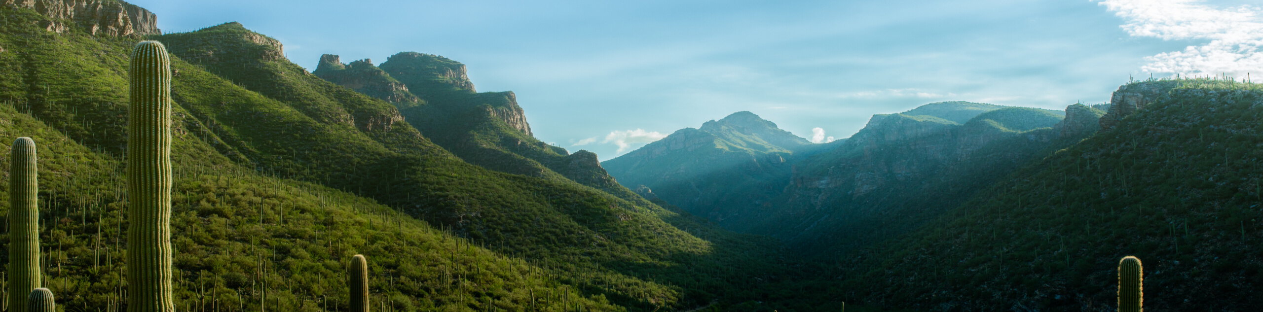
Pontatoc Ridge Trail is a 4.1mi heavily trafficked hard trail in the Pusch Ridge Wilderness of the Santa Catalina Mountains. This route is interesting for its connection to the area’s mining past. If you go a bit beyond the end of the trail, you can find an impressively long mining tunnel in the rock that’s fascinating to explore. The hike isn’t too long, but it’s fairly steep and rocky. Young children may not make it to the top, but older kids should be able to enjoy this hike.
Bring lots of water on this hike. Additionally, the trail becomes hard to follow in parts because of heavy traffic going off-trail in the past, so a downloaded GPS route is a good thing to have.
Getting there
The trailhead for Pontatoc Ridge Trail is off N Alvernon Way.

About
| Backcountry Campground | No |
| When to do | October-May |
| Pets allowed | No |
| Family friendly | Older Children only |
| Route Signage | Average |
| Crowd Levels | High |
| Route Type | Out and back |
Pontatoc Ridge Trail
Elevation Graph
Weather
Pontatoc Ridge Trail Description
The Pontatoc Ridge Trail takes you up a trail that was once an important part of the mining past of the Santa Catalina Mountains. This route is a good physical challenge with its elevation gain relative to its length. At the end of the hike, you can scramble up a little further to find an abandoned mining tunnel that reaches deep into the mountain. It’s really cool to explore, so bring a flashlight!
This hike might be too difficult for younger kids, but active families and determined beginners should be able to enjoy it. Note that there are stretches where the trail becomes hard to follow due to years of heavy traffic veering off the route. You’ll likely want a GPS route to follow, but you can also keep your eyes peeled for cairns.
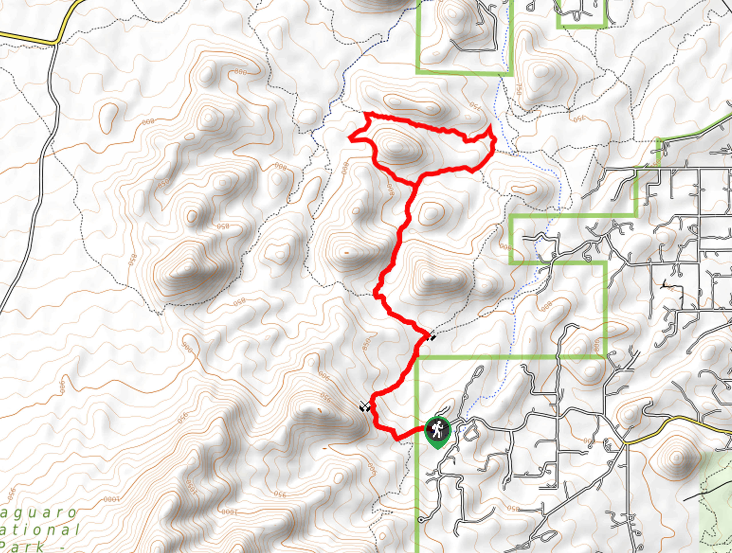
From the trailhead, hike up the road a few steps to the beginning of the hiking route. The Pontatoc Ridge Trail heads right where the trail splits just a few steps in. About 0.8mi in, you’ll come to a fork in the trail after a set of switchbacks. Go right (south) here.
The route winds around to the east on the saddle and then continues through switchbacks before straightening out to follow the ridge. Before you head out along the ridge, take a moment to appreciate the view of Tucson from the saddle. There are no more junctions between here and the mine, so it’s smooth sailing.
Once you reach the end of the trail (which is marked) you can turn back. We definitely recommend continuing just a bit further to the cave. This abandoned mine tunnel stretches at least a few hundred feet into the mountain and its walls are lined with sparkling minerals. It might not technically be on the trail, but it’s what makes this trail worth it in our opinion.
When you’re ready, turn back and retrace your steps to the trailhead.
Hiking Route Highlights
Mining Tunnel
The mining tunnel just past the end of the Pontatoc Ridge Trail is the most fascinating part of the hike. This tunnel stretches several hundred feet into the mountain. Illuminated by a flashlight, the tunnel walls sparkle with minerals. It’s a one-of-a-kind spot in the Tucson mountains and worth the extra few steps!
Frequently Asked Questions
Is Pontatoc Ridge Trail kid-friendly?
Active children should be able to complete this trail. Younger kids might find it too steep, but we encourage you to give it a shot!
Are dogs allowed on Pontatoc Ridge Trail?
No, dogs are not allowed on this trail.
Can you go inside the tunnel on Pontatoc Ridge Trail?
Yes. Bring a flashlight!
Insider Hints
Some parts of this trail traverse very smooth rock faces that can become slippery in the rain. If it’s raining, we recommend waiting for it to pass before hiking.
Similar hikes to the Pontatoc Ridge Trail hike

Hugh Norris, Sendero Esperanza, and Dobbie Wash Loop
The Hugh Norris, Sendero Esperanza, and Dobbie Wash Loop is a bit of a mouthful, but it’s a great hike…
Bear Canyon Trail
Bear Canyon Trail is one of the main routes in Tucson’s Sabino Canyon Recreation Area. The entire trail is almost…
Cactus Canyon and Gila Monster Loop
The Cactus Canyon and Gila Monster Loop is a 6.0mi hike in Tucson’s Saguaro National Park that puts…
Comments