Sabino Tram Road
View Photos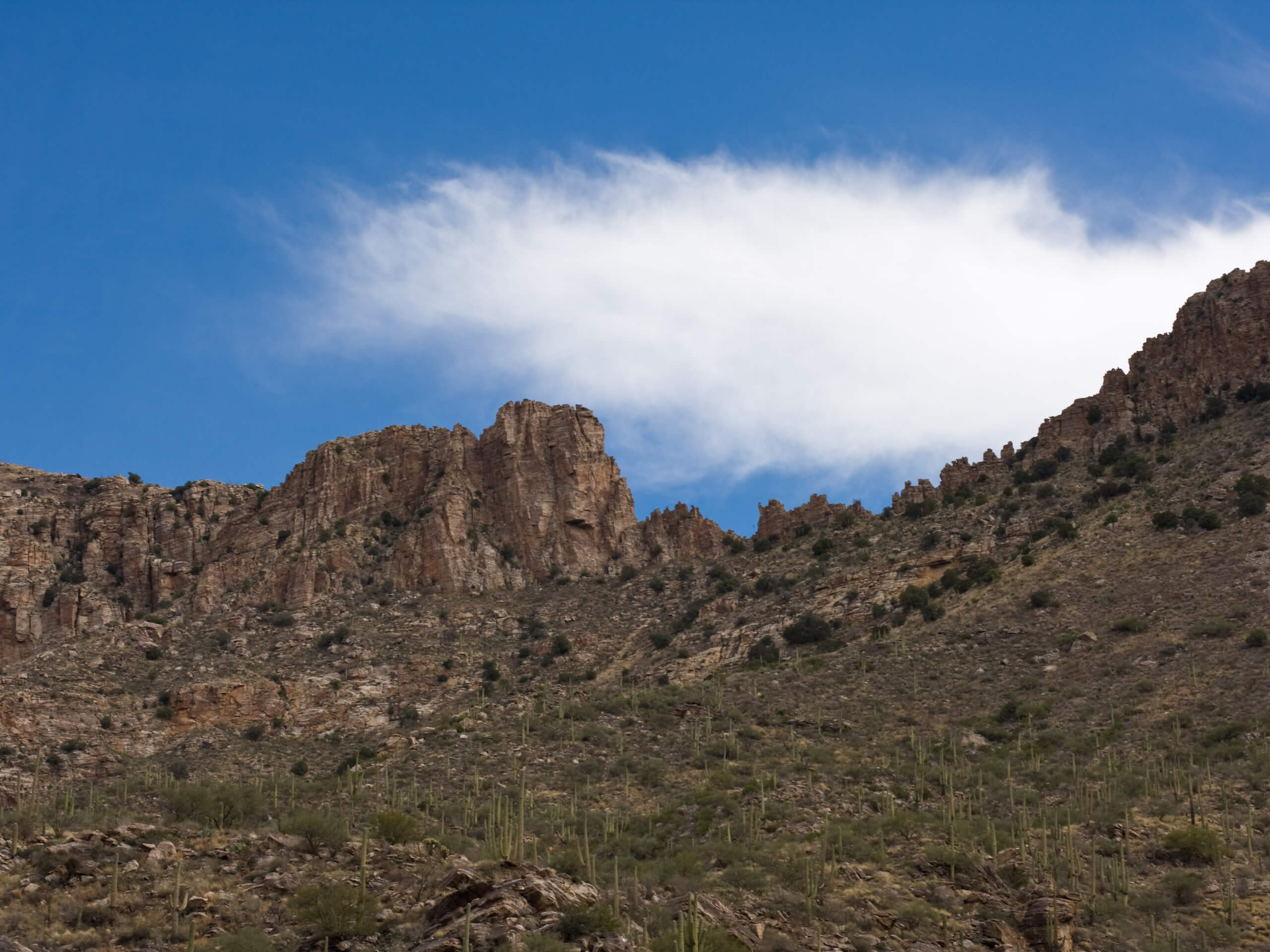
Sabino Tram Road
Difficulty Rating:
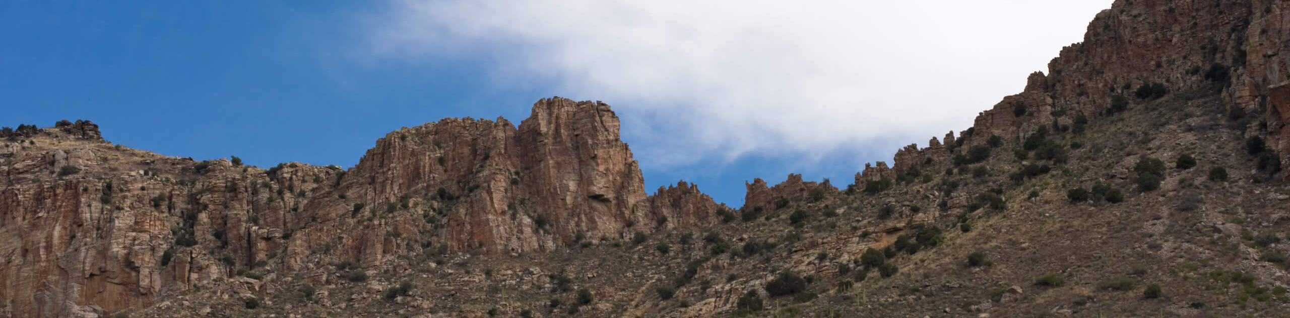
The Sabino Tram Road through the Sabino Canyon is a stellar hike. This 7.4mi moderately difficult trail is located on the north side of Saddleback and Thimble Peak in the Pusch Ridge Wilderness on the northeast edge of Tucson. This hike is excellent for its ease of access from the city and for its diverse, beautiful terrain. You’ll hike next to towering saguaros and prickly pears, witness the area’s astounding bird population fly by, and be able to appreciate the scenic canyon.
This canyon can reach scorching temperatures in the middle of the day. Start your hike early, bring plenty of water, and avoid hiking this route in the summertime if at all possible. Since this is such a popular hike, midweek visits are recommended if possible.
Getting there
The trailhead for the Sabino Tram Road is in the parking area for the Sabino Canyon Visitor Center.

About
| Backcountry Campground | No |
| When to do | October-May |
| Pets allowed | No |
| Family friendly | Yes |
| Route Signage | Average |
| Crowd Levels | High |
| Route Type | Out and back |
Sabino Tram Road
Elevation Graph
Weather
Sabino Tram Road Description
The Sabino Tram Road is one of the most popular hikes in the Tucson area. It’s conveniently accessible from the northeastern edge of the city near the Pusch Ridge Wilderness. The scenery is excellent, the trail is fairly easy, and there’s an option to take the tram along the road instead of hiking if you want an educational experience. The tram ride is narrated and interesting.
This route travels through the Sabino Canyon, where tall saguaros and big prickly pears line your path. This canyon is known for its diversity of bird species, so birders and casual enthusiasts alike will want to keep their eyes on the sky.
This route can get very hot during the heat of the day, so start your hike early. Also, bring more water than you think you might need and wear sunscreen and a hat as you hike. We generally recommend avoiding hiking around Tucson in the summer months as it presents a risk of heatstroke.
This route doesn’t allow dogs, so leave your pups at home. You’ll need to pay a small fee to access Sabino Canyon, but once you’re parked, look for the trailhead southeast of the visitor center.
Take Sabino Walkway #53 towards the canyon. Continue through to N Upper Sabino Canyon Road. Follow this road as it winds back and forth along the creek bed. The wash may be dry at certain times of the year, but other times it will be flowing.
Depending on the season, you may enjoy wildflowers on the trail. For this reason, we like this hike in the spring when the hills are in bloom.
There are restrooms near the Anderson Dam. Not far past the dam, the trail ends where the road loops. From here, turn back and retrace your steps.
Hiking Route Highlights
Sabino Canyon
The Sabino Canyon is a large canyon in the Santa Catalina Mountains and the Coronado National Forest. The Sabino Canyon Recreation Area is a popular destination for local hikers and adventurers, providing walking trails, hiking routes, and biking trails. The canyon is known for its desert vegetation and a wide variety of bird species. It’s popular with local hikers and runners as well as visitors in the Tucson area.
Frequently Asked Questions
Is there a shuttle at the Sabino Canyon Recreation Area?
Yes, there is a shuttle that runs from the visitor center, offering a narrated, educational 45-minute tour in the foothills of the Santa Catalina Mountains.
Can you drive through Sabino Canyon?
Traveling through the canyon is only allowed on foot or horseback.
Are there bears in Sabino Canyon?
Bears and mountain lions live in the mountains near Sabino Canyon, but interactions with humans are rare.
Insider Hints
There is an $8 day-use fee per vehicle or a $10 weekly fee for this hike.
Similar hikes to the Sabino Tram Road hike

Shantz, Cholla, and Cactus Forest Loop
The Shantz, Cholla, and Cactus Forest Loop is an easy trail in Tucson’s Saguaro National Park East. The star of…

Cactus Forest, Squeeze Pen, and Pink Hill Loop
The Cactus Forest, Squeeze Pen, and Pink Hill Loop is an easy trail in Tucson’s Saguaro National Park East. This…

Hugh Norris, Sendero Esperanza, and Dobbie Wash Loop
The Hugh Norris, Sendero Esperanza, and Dobbie Wash Loop is a bit of a mouthful, but it’s a great hike…
Comments