Agua Caliente Hill Trail
View Photos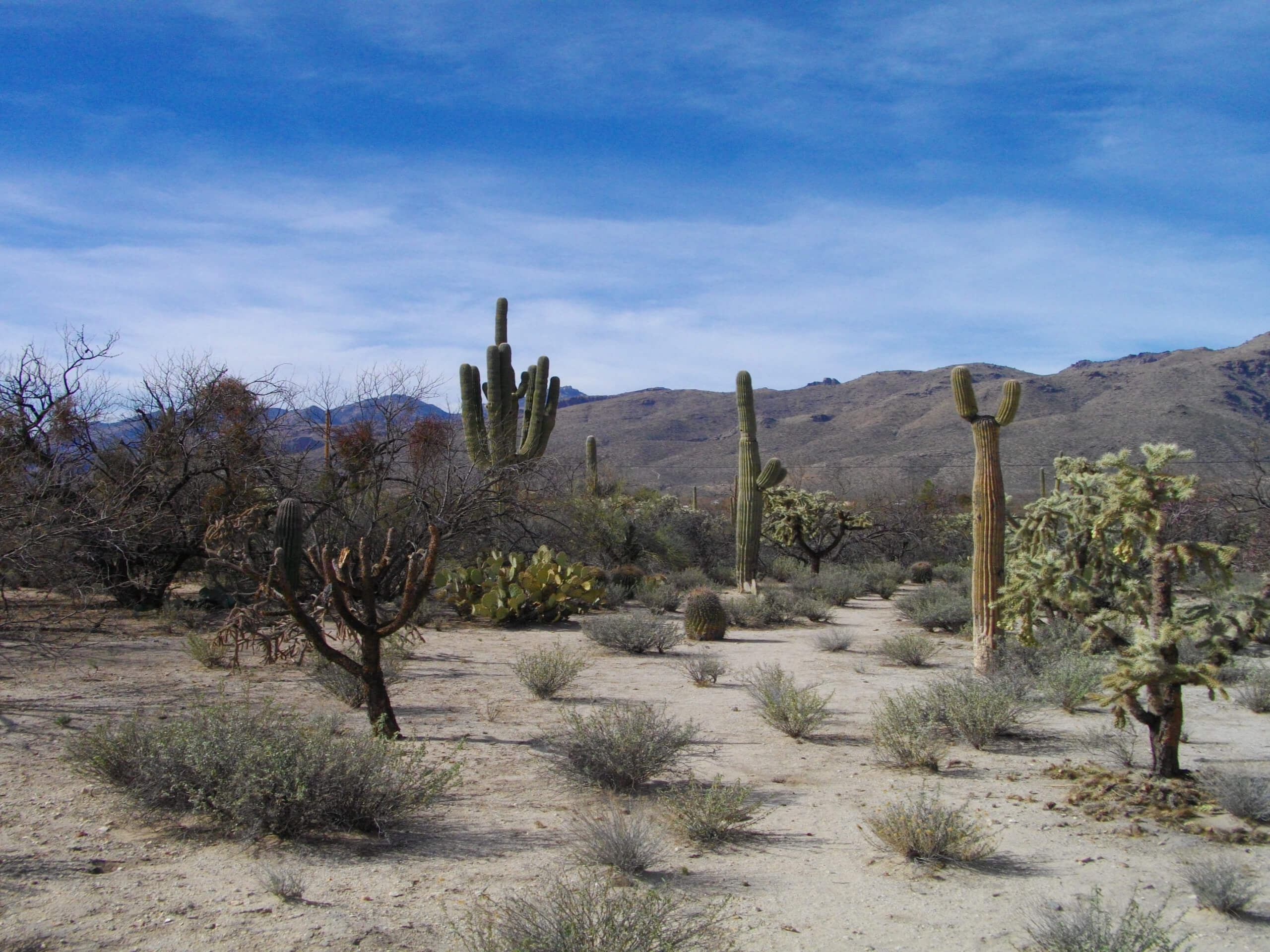
Agua Caliente Hill Trail
Difficulty Rating:
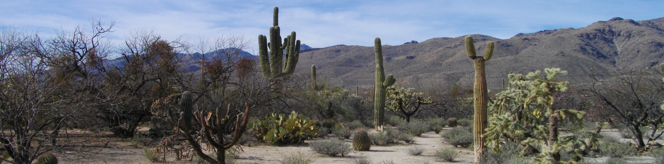
Agua Caliente Hill Trail is a great hike in the Tucson area. This route is nestled between the Pusch Ridge Wilderness and Saguaro National Park East, so the scenery pulls together the best of both areas. As one of the relatively few dog-friendly trails in the Tucson area, this hike is a favourite with local dog owners. Expect 8.8mi of difficult trail, with the difficulty increasing as you near the end of the route.
Getting there
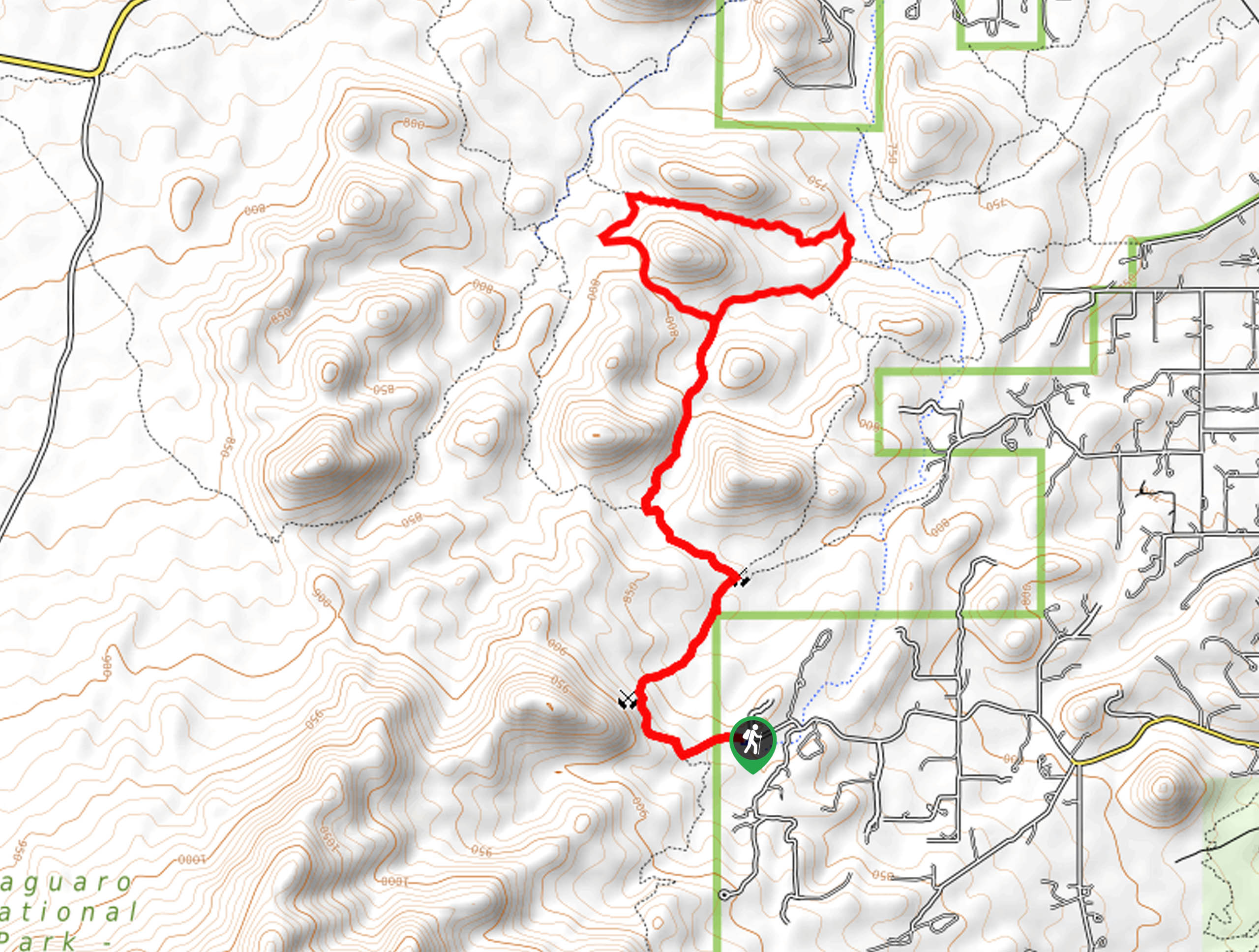
The trailhead for Agua Caliente Hill Trail is off N Camino Cantil.

About
| Backcountry Campground | No |
| When to do | October-May |
| Pets allowed | Yes - On Leash |
| Family friendly | No |
| Route Signage | Average |
| Crowd Levels | High |
| Route Type | Out and back |
Agua Caliente Hill Trail
Elevation Graph
Weather
Agua Caliente Hill Trail Description
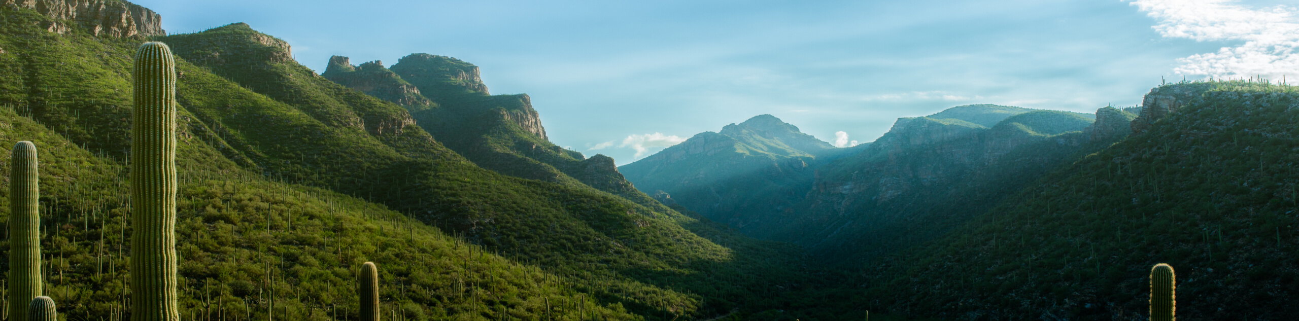
Agua Caliente Hill Trail is an almost 9.0mi hike located south of the Pusch Ridge Wilderness and north of Saguaro National Park East. This route offers excellent Sonoran Desert scenery and as one of the few dog-friendly trails in the Tucson area, it’s a go-to for local hikers with dogs in tow. The trail gets more difficult as you near the end, so beginners can still enjoy a trip out and just turn back when they’ve had enough for the day.
This route can get very caliente, so we recommend starting your hike early in the day and bringing lots of water (including for your dog). Avoid this route in the hot summertime. Additionally, sturdy boots will be helpful towards the end where the trail gets especially rocky.
From the trailhead, hike towards the base of the hill to the east and begin ascending the ridge. Switchbacks help you along in different spots along the hike, but sometimes you will need to gain elevation on straighter, steeper stretches. Dip over the shallow canyon that separates this ridge from the one north of it and complete the final few switchbacks to approach the top of Agua Caliente Hill. From here, you’ll retrace your steps.
Similar hikes to the Agua Caliente Hill Trail hike

Hugh Norris, Sendero Esperanza, and Dobbie Wash Loop
The Hugh Norris, Sendero Esperanza, and Dobbie Wash Loop is a bit of a mouthful, but it’s a great hike…
Bear Canyon Trail
Bear Canyon Trail is one of the main routes in Tucson’s Sabino Canyon Recreation Area. The entire trail is almost…
Cactus Canyon and Gila Monster Loop
The Cactus Canyon and Gila Monster Loop is a 6.0mi hike in Tucson’s Saguaro National Park that puts…
Comments