Glen Stewart Park Trail
View Photos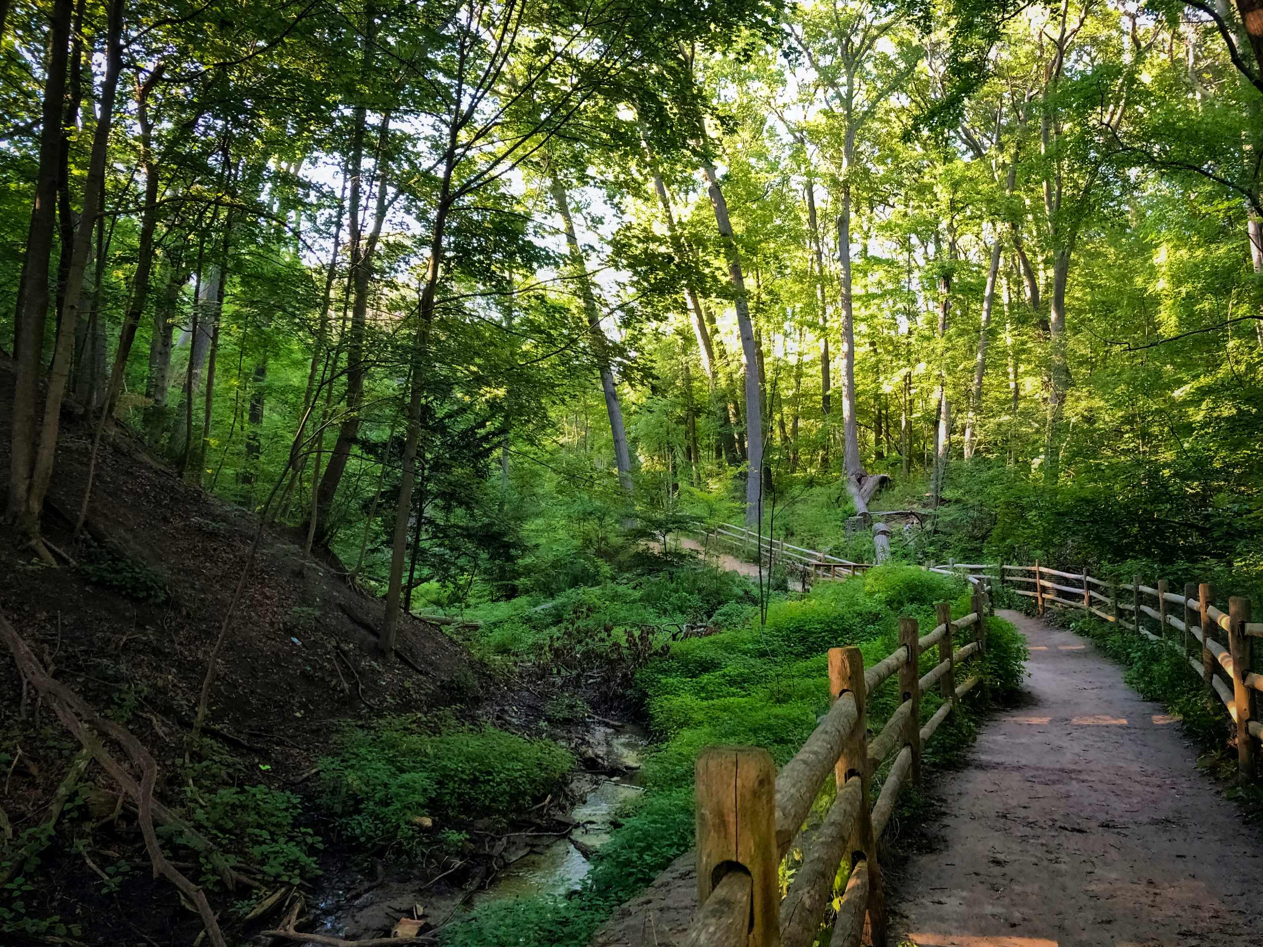
Glen Stewart Park Trail
Difficulty Rating:
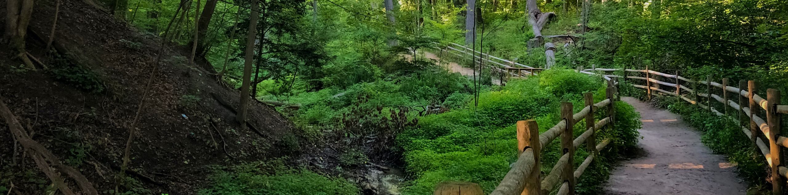
Hiking the Glen Stewart Park Trail is a quick and easy outdoor experience in the east end of Toronto that can be enjoyed by hikers of all ages and skill levels. Along the trail, you will experience a tranquil woodland atmosphere, as you make your way past mature trees that line a scenic ravine that is dissected by a quaint stream. While this route is accessible year round, portions of the trail can become icy in the winter and muddy in the spring, making it less than ideal to hike during these periods.
Getting there
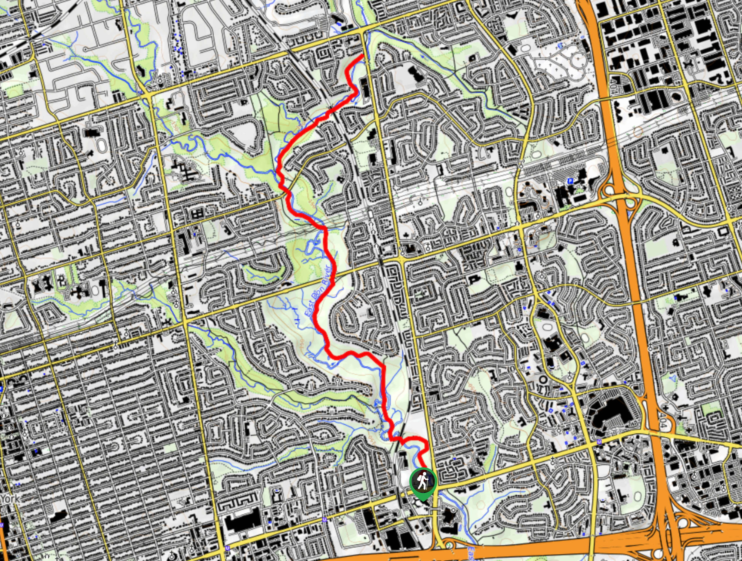
To reach the trailhead for the Glen Stewart Park Trail from Woodbine Park, head east on Eastern Avenue for 722ft and continue onto Kingston Road for another 1.3mi. Make a right onto Glen Manor Drive and follow it for 1476ft before turning left onto Glen Manor Drive E. The trail can be found on the left in 236ft and you can utilize street parking.

About
| When to do | Year-Round |
| Backcountry Campsites | No |
| Pets allowed | Yes - On Leash |
| Family friendly | Yes |
| Route Signage | Average |
| Crowd Levels | Moderate |
| Route Type | Out and back |
Glen Stewart Park Trail
Elevation Graph
Weather
Glen Stewart Park Trail Description
Although the Glen Stewart Park Trail is set in an idyllic forest setting, it is still located in the heart of the city, meaning that there will likely be a decently high volume of other people along the trail. If you are looking to enjoy a bit of peace and quiet along the walk, try arriving early in the morning or during off-peak hours. The trail begins at the west end of the park and descends slightly into the forested ravine, taking you along the winding waters of a small stream that cuts across the park. As the trail is very short, take your time as you walk along the forested path and soak up a bit of tranquility in this small retreat within the bustling city. Nearing the east side of the park, the trail will begin to climb uphill through the forest to eventually meet up with Beech Avenue. From here, you can turn back and retrace your steps through the ravine to return to the trailhead where you began your quick adventure along the Glen Stewart Park Trail.
Similar hikes to the Glen Stewart Park Trail hike
East Don Parkland Trail
Hiking the East Don Parkland Trail is a great way to spend an afternoon exploring a small slice of nature…
High Park Trail
Hiking the High Park Trail is a wonderful experience in the west end of Toronto that will expose you to…

Toronto Waterfront Trail
Also known as the Martin Goodman Waterfront Trail, the Toronto Waterfront Trail is a long multi-use route that provides a…
Comments