The Pap of Glencoe Walk
View Photos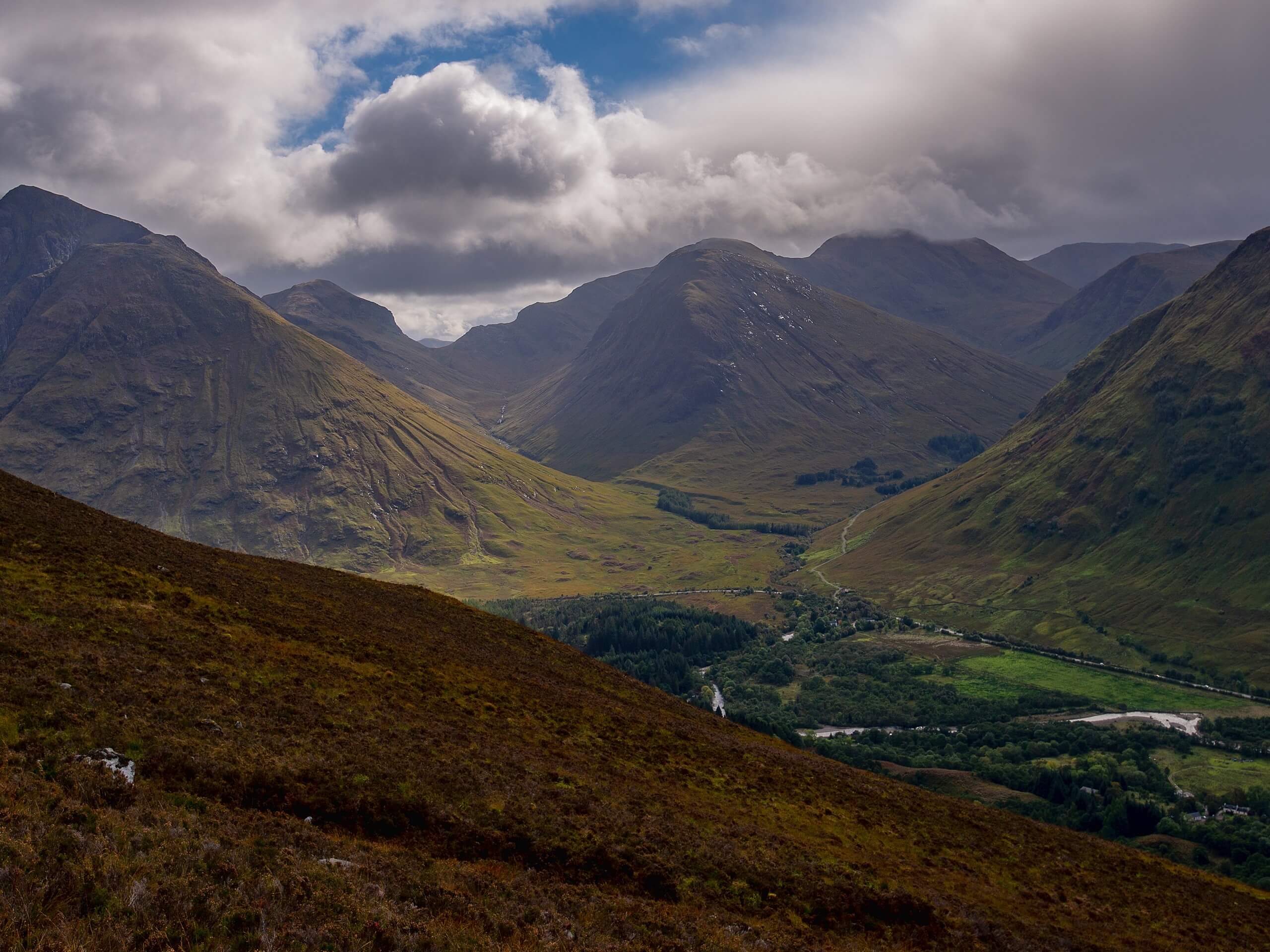
The Pap of Glencoe Walk
Difficulty Rating:
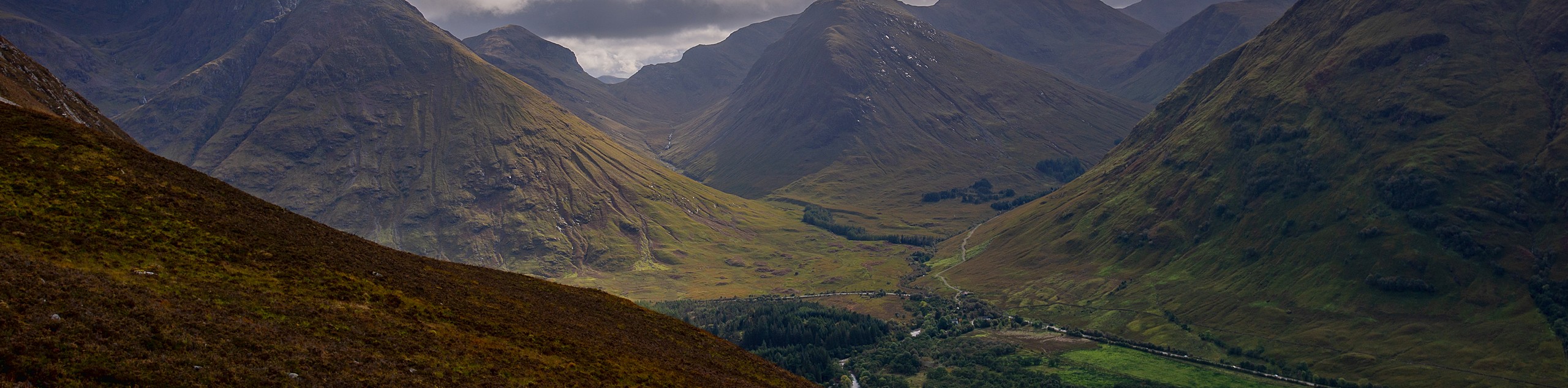
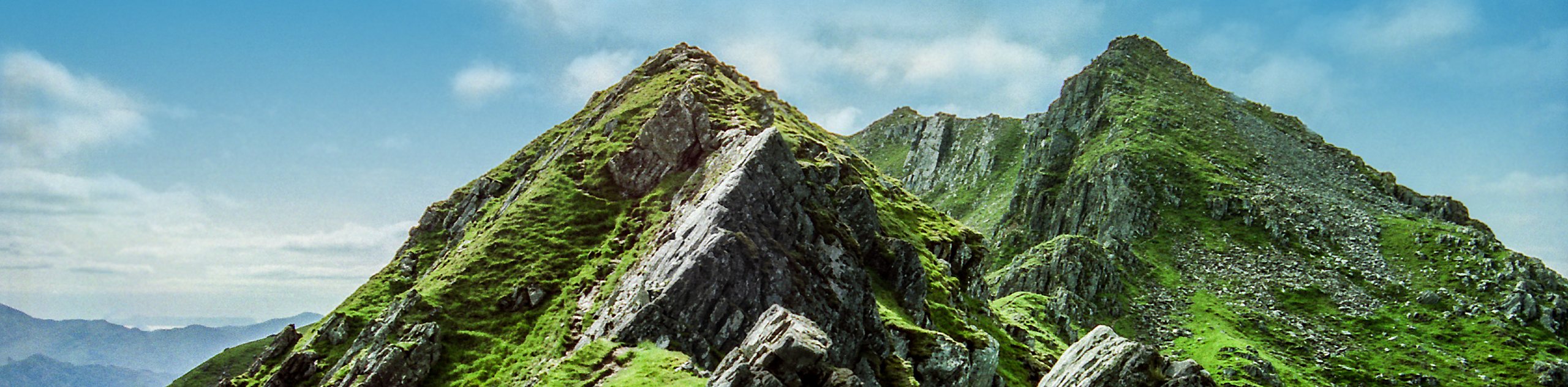
Don't let the 4.3mi distance fool you into thinking this will be a walk in the park! The Pap of Glencoe Walk is no easy feat, as it sees you gaining 2349ft over a super short distance. However, the panoramic views of Loch Leven, backed by the soaring Mamroes range, make the extreme huffing and puffing worth it.
Be prepared to navigate rocks and boulders on the final climb of the Pap!
Getting there
To get to the start of The Pap of Glencoe Walk, you can either start in Glencoe village or, if you have a car, park around 1640ft from Bridge of Coe on the beginning of a forest track, just off of a minor road. You’ll find that the parking area sits just after the electricity substation.

About
| Backcountry Campground | No |
| When to do | June-September |
| Pets allowed | Yes - On Leash |
| Family friendly | No |
| Route Signage | Average |
| Crowd Levels | Moderate |
| Route Type | Out and back |
The Pap of Glencoe Walk
Elevation Graph
Weather
The Pap of Glencoe Walk Description
Pack litres and litres of water, replenishing snacks, and get ready for an intense day on the trail! The Pap of Glencoe Walk, with 2349ft elevation gain over a short number of kilometres paired with a technical and boggy track, is a physically demanding adventure. It’s advised to go on several hillwalks before taking this one on!
However, the views behind the Pap and atop the summit are beyond incredible, making the intensity worth it. You’ll get to revel in panoramic views, with Loch Leven backed by the Mamores range being the main highlight.
Setting out from your car, with your back toward the road, follow the Orbital path to your left. You’ll walk along a track lined with trees parallel to the road. Not too long after, you’ll meet the minor road again. Follow for a short period before passing a gate on your left and heading through the next gate, which will take you to a track that takes you through yet another gate. From here, you’ll begin to ascend, encountering a stunning vista of Glencoe below! Just before the waterworks, take a right to follow a path that takes you over a footbridge.
Continue to make your way across the hill, traverse a stream, and brace yourself for an increased incline as the path snakes to the left and takes you on a more direct ascent. You’ll find yourself near the edge of the gorge with the stream bubbling below—take caution here! The next part is flat, so you’ll get a chance to rest, but the path isn’t in the best shape, and it can be boggy. Eventually, you’ll start making your way up again, following rocky terrain as the path takes you to the right, further from the stream. The trail will then veer left, and you’ll continue to ascend, tackling more boggy areas. However, take a moment to revel in the fantastic views stretching from Ballachulish bridge to Glencoe village.
Once you continue, you’ll notice a small path to your right, don’t take this! Instead, continue ahead toward the col near the Pap, with the stony dome of the Pap within eyesight now. Get ready for more technical terrain as you climb, veering to the left before ascending right at a diagonal angle up the Pap. This is where you’ll navigate boulders and rocks, but you won’t have to do any intense scrambling. Brace yourself for incredible views of Loch Leven and the Mamores as you circle behind the Pap!
Here, the summit emerges into view. Can you take on one more ascent? It’s worth it! The path takes you up toward more images of Loch Leven and the Mamores. If you continue southwest, you’ll get a better vantage point of Glencoe and the Ballachulish narrows.
Spend some time admiring the panoramic views before turning around and retracing your steps back to your car, as this is an out-and-back route.
Frequently Asked Questions
How long does it take to hike the Pap of Glencoe?
While this hike looks short on paper, its 2349ft elevation gain equates to a long walking adventure. Expect to spend 3.5 to 5 hours on the trail!
Can I take my kids on the Pap of Glencoe Walk?
No! This walk is ranked difficult, and kids will likely struggle to complete it.
Insider Hints
You can take local or Citilink buses to Glencoe village to reach the start of this walk
Bring lots of water as this walk sees you gaining elevation fast
Similar hikes to the The Pap of Glencoe Walk hike
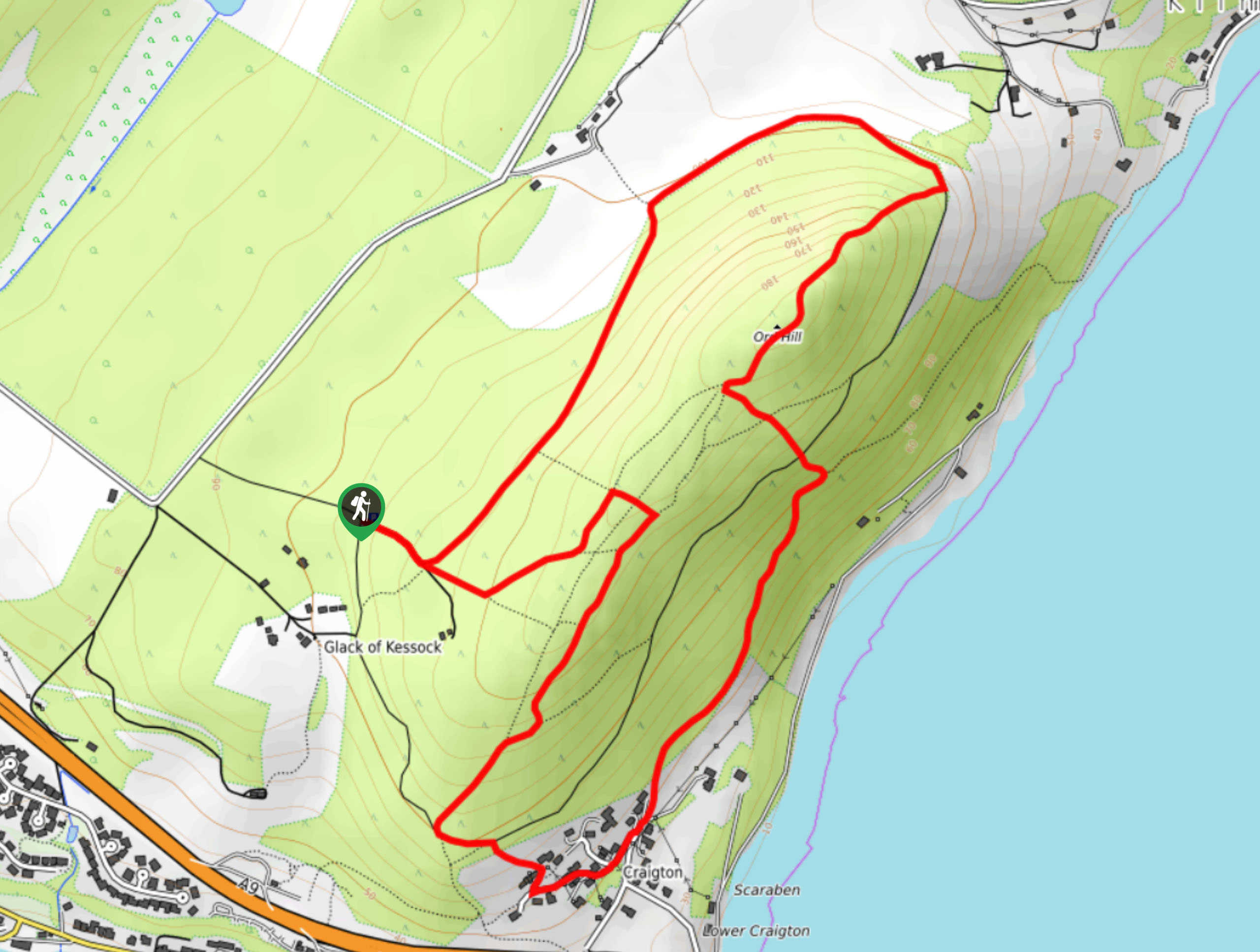
Ord Hill Walk
If you still have some gas left in the tank or have a day between activities in the Highlands and…
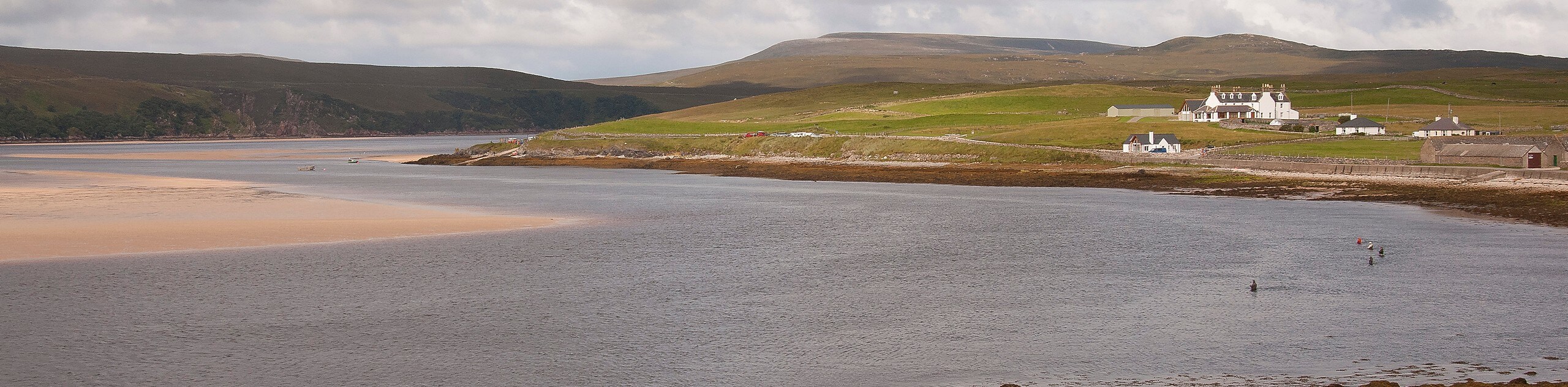
Kyle of Durness Circular Walk
The Kyle of Durness Circular Walk packs a punch when it comes to the scenery! Gaze out into the coastline,…
The Saddle, Forcan Ridge and Sgùrr na Sgìne Walk
The Saddle, Forcan Ridge and Sgùrr na Sgìne Walk is a rugged adventure that boasts a thrilling challenge while unveiling…
Comments