Suilven Walk
View Photos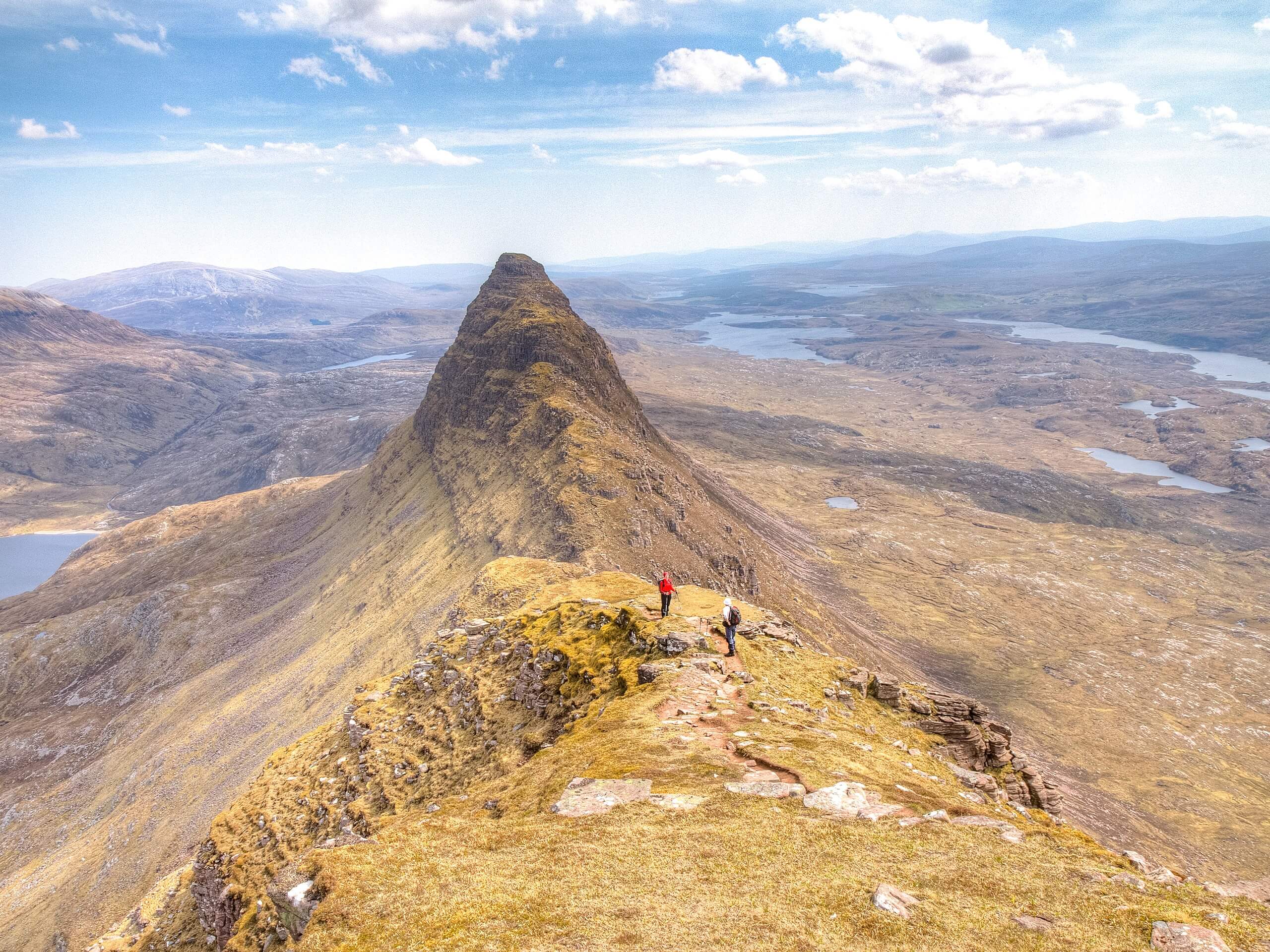
Suilven Walk
Difficulty Rating:
Looking for the ultimate day-long adventure? The Suilven Walk will keep you well entertained! Expect to travel around 12.4mi as you ascend one of Scotland’s favourite summits: Suilven (2398ft). Before reaching the true summit, you’ll trek through a compilation of mystical scenery, earning the chance to admire the Highlands’ landscape alongside you and below you. Once you’ve reached the pinnacle of Suilven, you’ll retrace your steps back to the car park, which some may find uninspiring, but this adventure makes it worth passing the same scenery twice!
Expect some minor scrambling and steep ascents along the Suilven Walk. Hopefully, the incredible surroundings will minimize any moans and groans and huffs and puffs.
Suileag Bothy closed due to COVID-19.
Getting there
To get to the start of the Suilven Walk, drive until you reach the end of the public road from Lochinver in the direction of Glencanisp Lodge (58°08'46.0"N 5°13'02.6"W).

About
| Backcountry Campground | No |
| When to do | May-October |
| Pets allowed | Yes - On Leash |
| Family friendly | No |
| Route Signage | Average |
| Crowd Levels | Moderate |
| Route Type | Out and back |
Suilven Walk
Elevation Graph
Weather
Suilven Walk Description
The Suilven Walk may take up most of your day, but it immerses you in the heart of the Highlands, committing to completing this trail all the more worthwhile. Other than being relatively strenuous, thanks to some steep ascents, this adventure only has you participating in some minor scrambling along the ridge. You won’t find many other challenges! Just know that this walk is strenuous, not for the faint of heart, and meant for more experienced hillwalkers. Do know that you’ll want to arrive early as parking is limited!
While some may find the length daunting, several are drawn toward the thought of spending hours along paths carved amid an epic landscape. Plus, the views from the summit—and to be honest, along this entire walk—will have you forgetting all about your tired limbs! Jaws drop just from looking at Suilven from afar. En route, you’ll pass by ruins, lochs, spires, and phenomenal valley scenery.
Setting out from the end of the public road from Lochinver towards Glencanisp Lodge, follow the private road to the north side of the loch, where woodland scenery flanking Glencanisp Lodge awaits. From here, take a left to travel behind the lodge, ensuring you stay right on the track. Then, at the fork, take a left to remain on the main path. The trail becomes slightly more technical here as it’s an ATV track. Go through a gate and walk across an undulating path, admiring views of Caisteal Liath, a stunning peak.
When you reach a junction, opt to go left for a brief detour up Suileag Bothy. After visiting, go back to the intersection and continue along the relatively rough ATV track. Eventually, the path dips and travels alongside the Abhainn na Clach Airigh, a stream tucked into wild-looking scenery. Follow along the path flanking the stream. A few kilometres later, you’ll cross the stream via a bridge. The path then ascends away from the stream and then reaches it again! It’s always relaxing walking near a stream, isn’t it? Around 600m after the bridge, take a less-rugged path to the right. Cross moorland first before ascending to another level of the moor—you’ll pass Loch a’ Choire Dhuibh en route!
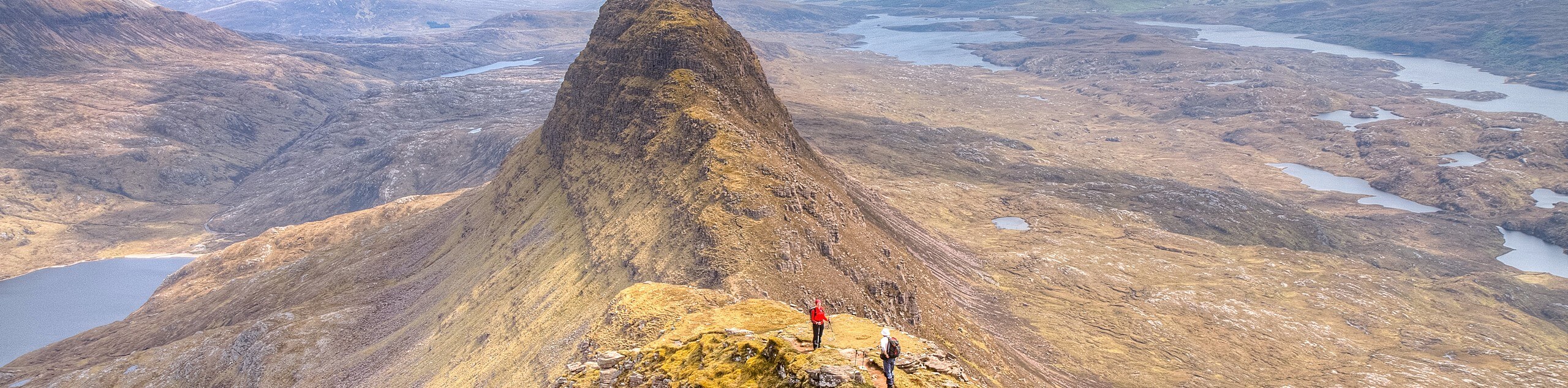
Follow the path as it hugs the right of the Loch before going into the grassy gully. You’ll take on a steep ascent here, which requires some care and effort. However, it’s not as scary as it looks! Eventually, the trail switchbacks to the left, overall reducing the steepness. When you return to the higher-up gully, you’ll go left to head towards the ridge. The top of the gully boasts phenomenal scenery. Admire Stac Pollaidh intimidating in the south!
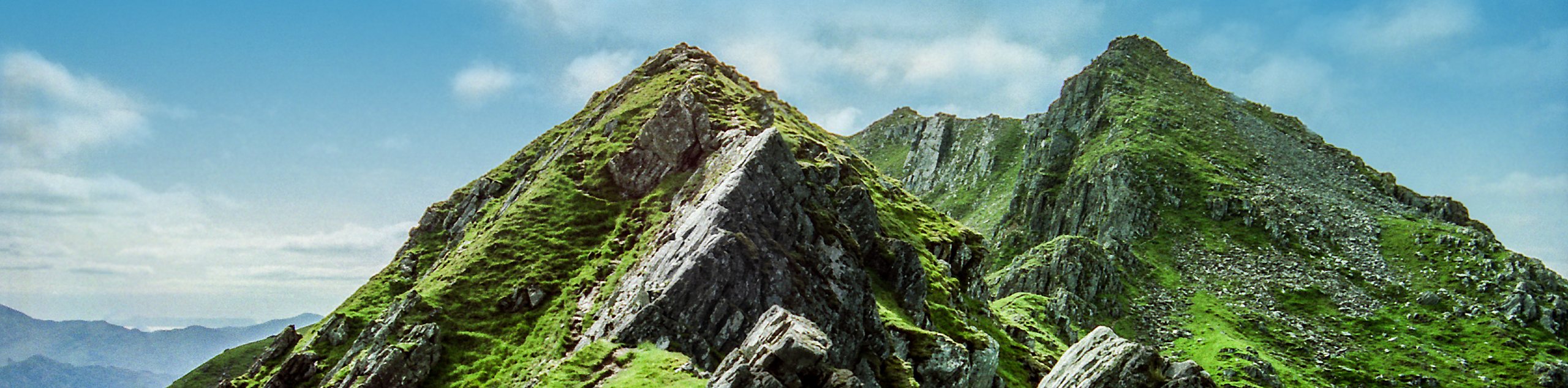
Take a right at the ridge to go towards the crumbling ruins of a drystone dyke, which is believed to have been built during the potato famine in exchange for some help. Pause here to think about times of yore before tackling the climb towards Suilven’s summit! Expect to encounter some mild scrambling as you make your way to the top. At one point, you’ll reach a levelled area. Take a moment to look behind you, where the ridge bleeds into Meall Meadhonach, a beautiful spire! After, continue ascending, eventually arriving at Caisteal Liath, a summit cloaked in grass, which is also the true top of Suilven. Spend time basking in the panoramic views of the Assynt landscape before retracing your steps and heading back to your car.
Trail Highlights
Suilven
Suilven marks one of Scotland’s favoured peaks—making climbing it all the more desirable. While at 2398ft high, it’s not precisely a Munro, but reaching the summit is as rewarding as climbing one! It’s hard to miss this remote mountain that eyes moorland, lochans, and bogs stitching together the valley below. This mountain boasts three summits: Caisteal Liath (the highest point), Meall Meadhonach, and Meall Beag.
Frequently Asked Questions
How long does it take to climb Suilven?
It often takes most people from 6-8.5 hours to make it to the top of Suilven and back!
Is the climb up Suilven kid-friendly?
We suggest leaving your kids with a sitter instead of taking them on this walk! It may not be super technical, but it’s physically demanding
Is Suilven a Munro?
No, Suilven stands at 2398ft tall, while a Munro requires a height of 3000ft!
Insider Hints
Head to the parking area early to secure a spot!
You can opt to take a detour up Meall Meadhonach after reaching the summit—this requires more intense scrambling, so take care and only attempt if you’re experienced.
Similar hikes to the Suilven Walk hike
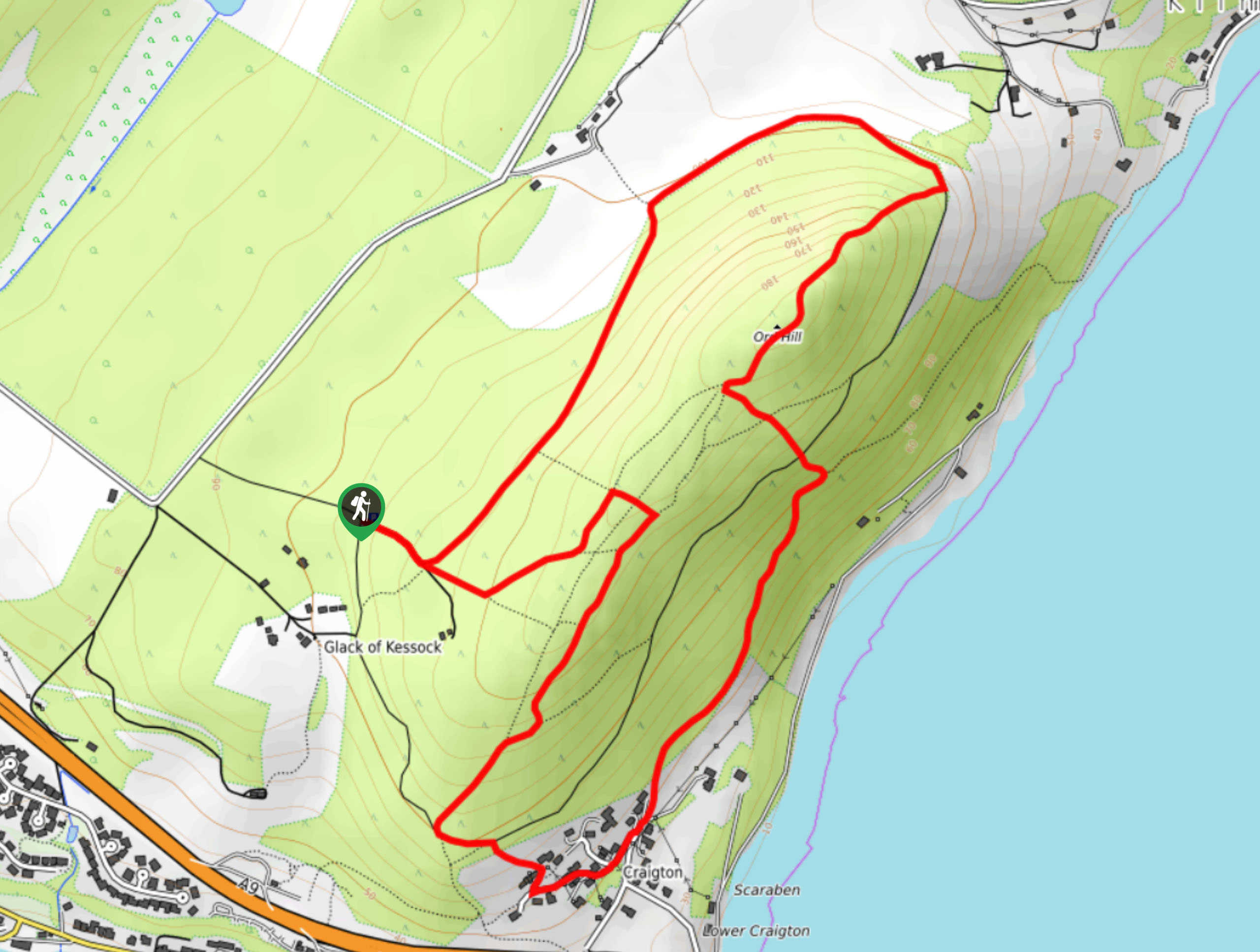
Ord Hill Walk
If you still have some gas left in the tank or have a day between activities in the Highlands and…
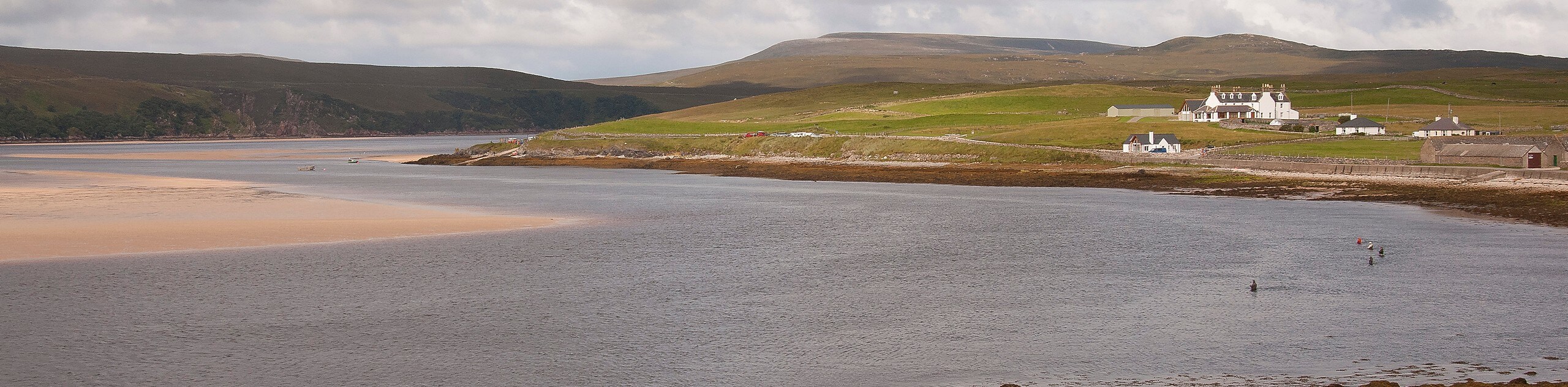
Kyle of Durness Circular Walk
The Kyle of Durness Circular Walk packs a punch when it comes to the scenery! Gaze out into the coastline,…
The Saddle, Forcan Ridge and Sgùrr na Sgìne Walk
The Saddle, Forcan Ridge and Sgùrr na Sgìne Walk is a rugged adventure that boasts a thrilling challenge while unveiling…
Comments