Meall Fuar Mhonaidh Walk
View Photos
Meall Fuar Mhonaidh Walk
Difficulty Rating:
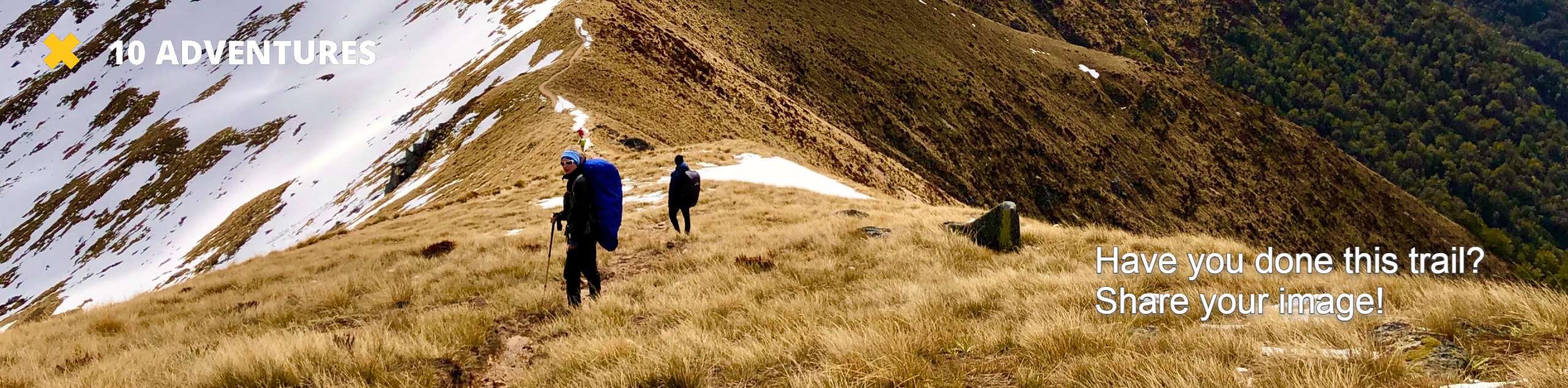
The Meall Fuar Mhonaidh Walk follows a straightforward path atop Meall Fuar Mhonaidh, the lofty summit soaring above Loch Ness. While the path is generally easy-to-follow, expect some rugged, boggy sections near the top, where phenomenal views await!
Getting there
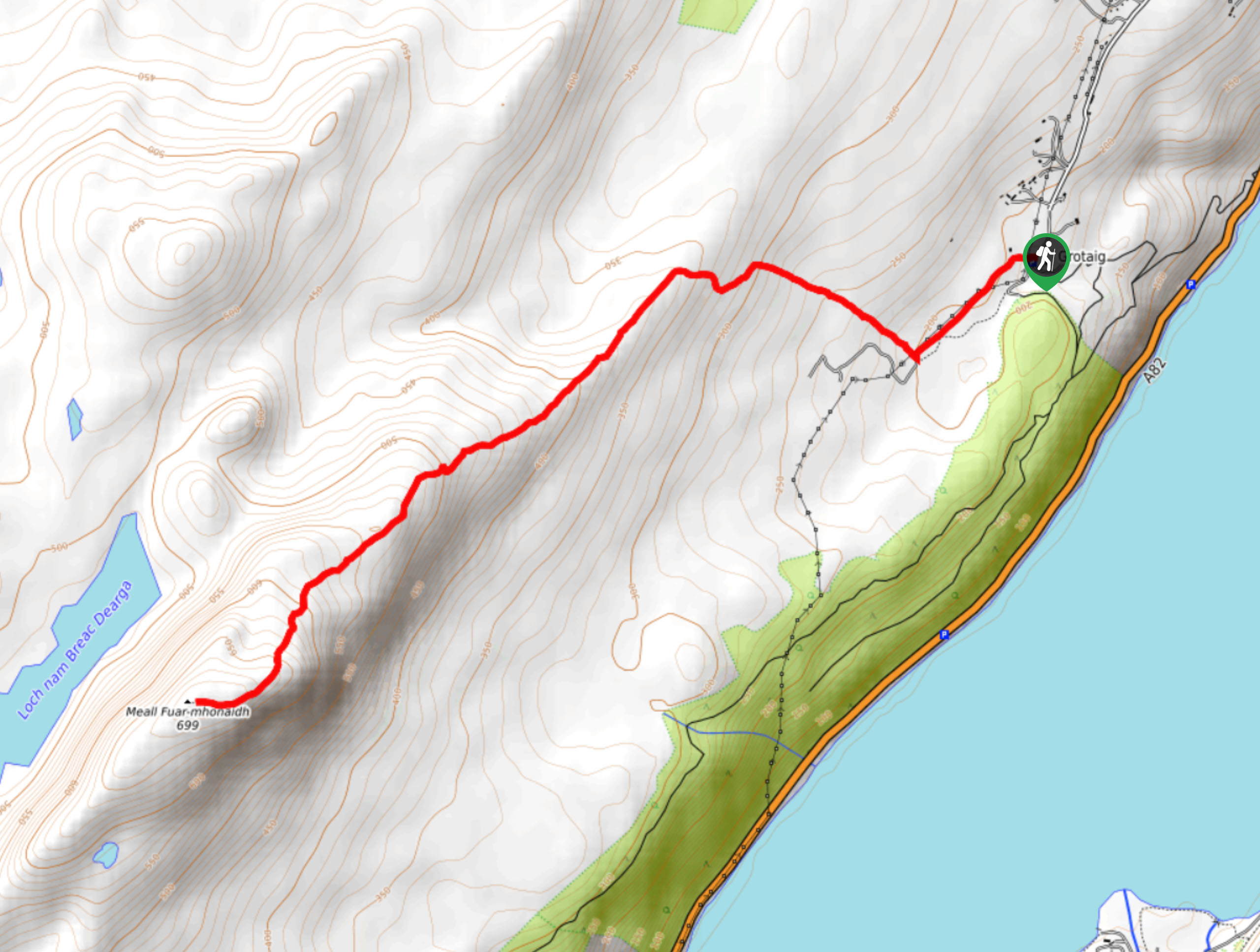
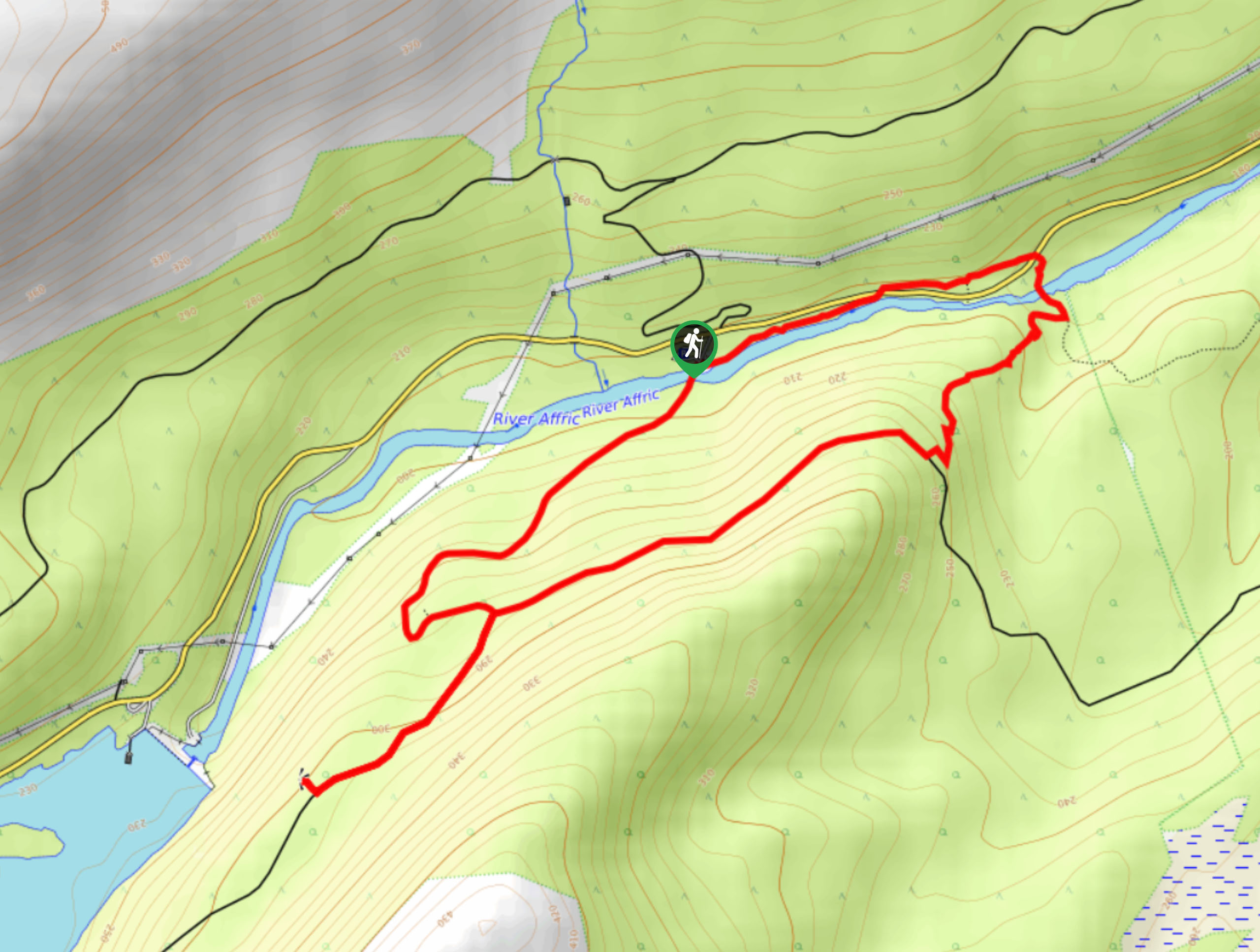
The Meall Fuar Mhonaidh Walk starts from the car park located near the end of Bunloit Road, near Loch Ness

About
| Backcountry Campground | No |
| When to do | May-October |
| Pets allowed | Yes - On Leash |
| Family friendly | Yes |
| Route Signage | Average |
| Crowd Levels | Moderate |
| Route Type | Out and back |
Meall Fuar Mhonaidh Walk
Elevation Graph
Weather
Meall Fuar Mhonaidh Walk Description
The Meall Fuar Mhonaidh Walk takes you straight up Meall Fuar Mhonaidh for a stunning view of Loch Ness, Ben Nevis, and the Great Glen. While the path is generally straightforward, there are some boggy and rough sections along the top, so come with the proper footwear and take care.
From your car, you’ll follow the sign indicating “Hill Footpath.” When you see a bridge, don’t go along it—stay right instead. Soon, Meall Fuar Mhonaidh will emerge into view! Next, you’ll walk along a stream before veering right to venture away from the stream and heading through two gates to cross a track, which will be signed! Then, the path ascends through lovely woodland before steepening. Be sure to pause, catch your breath, and bask in the views as you ascend. When the path evens out, you’ll travel across a fence, gate and keep going through hushed woodland. After the woodland fades, you’ll see another path jump out to your left, but don’t take this and keep along the current path.
From here, the path then veers left and takes you across a deer fence before venturing to the moorland ridge. When you reach the ridge, continue left to go along the ridge. This is where the terrain becomes more rugged and boggy. Keep walking towards the goal of this walk: the top of Meall Fuar Mhonaidh. Get ready for a steep ascent!
When you reach the cairn, just know that this isn’t the true summit. Continue a bit further to catch a stunning view of the Great Glen, Ben Nevis, and then keep going towards the actual summit, which is at the furthest cairn, where a fantastic view of Loch Ness awaits. After soaking in the scenery, retrace your steps back to the car park.
Similar hikes to the Meall Fuar Mhonaidh Walk hike
Ord Hill Walk
If you still have some gas left in the tank or have a day between activities in the Highlands and…
Kyle of Durness Circular Walk
The Kyle of Durness Circular Walk packs a punch when it comes to the scenery! Gaze out into the coastline,…
Dog Falls Walk
The Dog Falls Walk boasts a lovely, serene setting, punctuated by a waterfall, River Affric, and a stunning view of…
Comments