Ben Wyvis Path
View Photos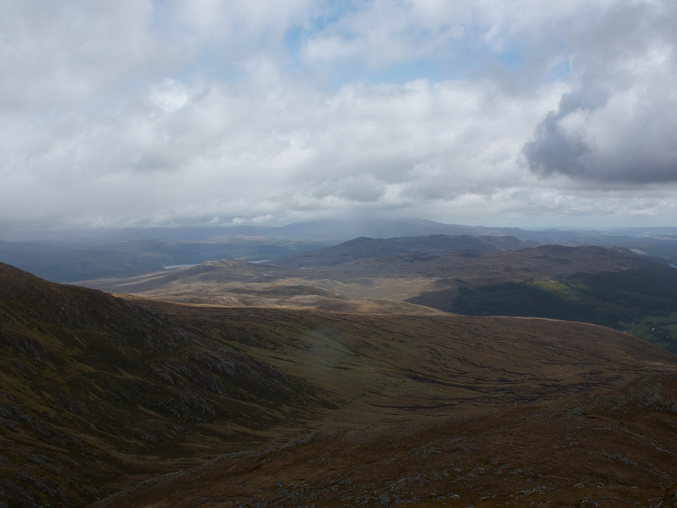
Ben Wyvis Path
Difficulty Rating:
Looking to bag Munro? The Ben Wyvis Path grants the chance to do just that! Gain elevation quickly as you ascend the easy-to-follow path towards the summit, otherwise known as Glas Leathad Mòr, which casts an incredible vista of the wild Highlands fading into the horizon.
Getting there
To get to the start of the Ben Wyvis Path, head to the Ben Wyvis car park, located south of Garbat.

About
| Backcountry Campground | Wild camping |
| When to do | May-October |
| Pets allowed | Yes - On Leash |
| Family friendly | Older Children only |
| Route Signage | Average |
| Crowd Levels | Low |
| Route Type | Out and back |
Ben Wyvis Path
Elevation Graph
Weather
Ben Wyvis Path Description
Tap into your adventurous side on the Ben Wyvis Path in the Scottish Highlands! The ascent to the top may be straightforward, but it’s definitely a challenging one to tackle. Bring loads of water to quench your thirst as you climb. It’s also not a bad idea to bring layers because the final push is quite exposed!
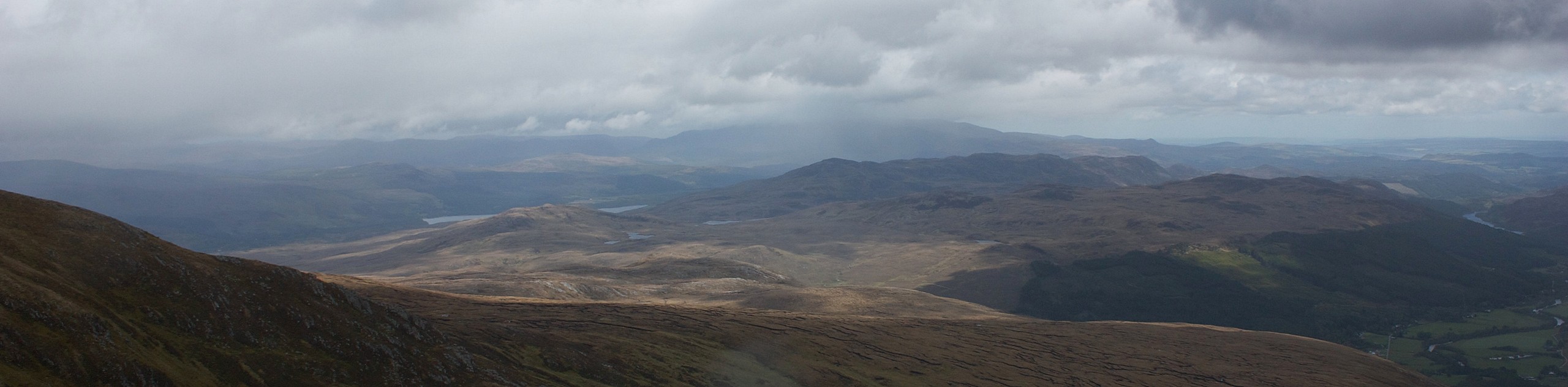
The Ben Wyvis Path—for some odd reason—isn’t the most popular Munro, but it should be! The views unveiling the Highlands below paint an excellent picture of the wild. And, the broad plateau is enough to support crowds of people, but this is a lightly trafficked route, so you may have a lot of space (and quiet) to yourself. However, despite not attracting many people in comparison to other Munro walks, the small parking lot can fill up quickly!
From the Ben Wyvis car park, go north to cross the footbridge jetting over Allt a’ Bhealaich Mhòir. On the other side of the stream, follow the path as it veers right. This path is clear to follow! Immerse in rows of birch, rowan, and aspen trees as you climb alongside the stream. Eventually, you’ll reach a forest path. Continue straight here!
A kilometre later, you’ll notice younger trees peppering the path—the climb intensifies here. Continue ascending with the stream beside you, eventually breaking free from the forest and reaching the countryside.
Next, follow some steps to reach the top of An Cabar. But, of course, this isn’t the end of your route! But take a moment to pause and look down at the scenery tumbling around and below you. From here, continue climbing, following a more gentle ascent.
Below you, you’ll notice a narrow path winding through a mossy area. You must stick to the track—stomping your boots on the surrounding mossy terrain ruins the habitat of dotterel, a rare species of bird. After walking for a bit, the route takes a tiny drop before climbing towards the summit. But don’t worry! The ascent remains gentle.
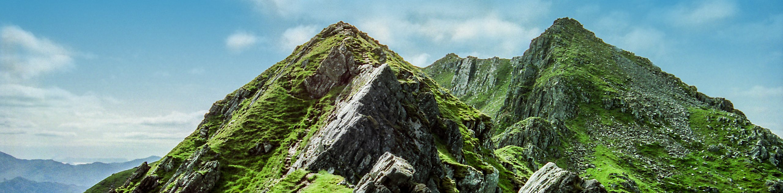
Continue along the ridge to eventually reach the summit of Ben Wyvis (Glas Leathad Mòr). This Munro stands at 3432ft. Catch your breath as you bask in northern Scotland sprawling below. Check out the Black Isle, Easter Ross, Torridon, and Sgùrr Mòr!
Some people opt to return an alternate way, but the best way to get back to the car park is to turn around and head back along the same path you came.
Trail Highlights
Ben Wyvis
Ben Wyvis may look like a flat-topped mountain, but it boasts some undulations in the form of An Cabar (3104ft), Glas Leathad Mòr (3432ft), and An t-Socach (3301ft), with some classifying Tom a’ Choinnich as a kid summit of Ben Wyvis. Ben Wyvis, translated from Gaelic, means “Hill of Terror.” It’s not that terrifying, though, so don’t worry.
Insider Hints
Go to the car park early to secure a spot. If it’s full, try the layby a few hundred metres down the road.
Wild camping is allowed, but the area surrounding Ben Wyvis may not be the best for it.
Bring layers of clothing for the exposed final push and water to quench your thirst as you climb.
Similar hikes to the Ben Wyvis Path hike
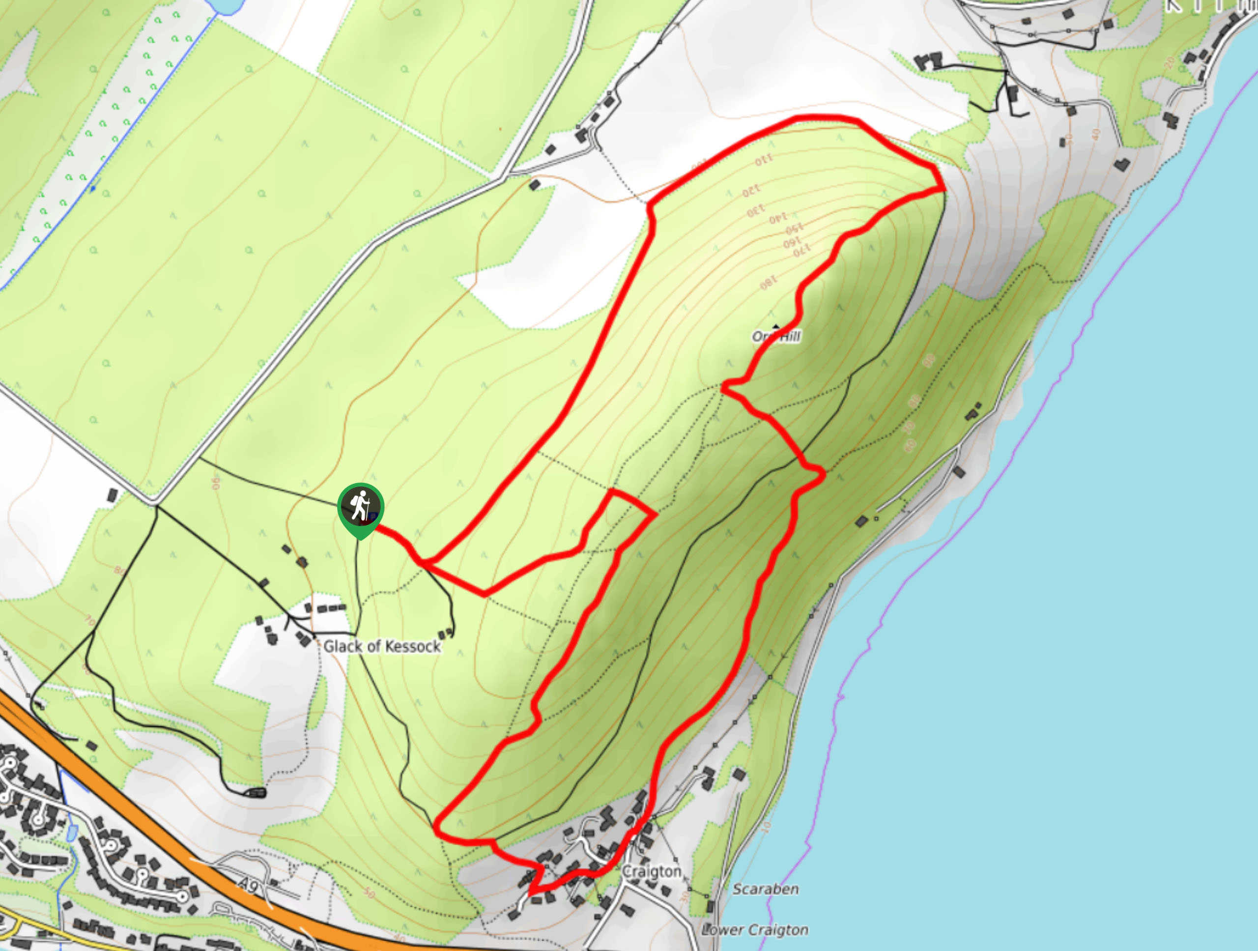
Ord Hill Walk
If you still have some gas left in the tank or have a day between activities in the Highlands and…
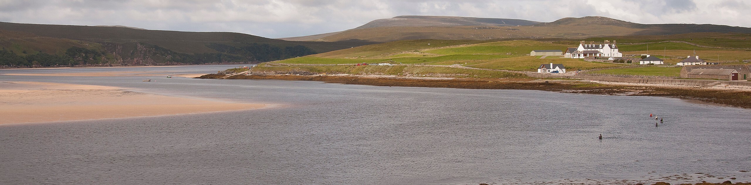
Kyle of Durness Circular Walk
The Kyle of Durness Circular Walk packs a punch when it comes to the scenery! Gaze out into the coastline,…
The Saddle, Forcan Ridge and Sgùrr na Sgìne Walk
The Saddle, Forcan Ridge and Sgùrr na Sgìne Walk is a rugged adventure that boasts a thrilling challenge while unveiling…
Comments