Behind Liathach Walk
View Photos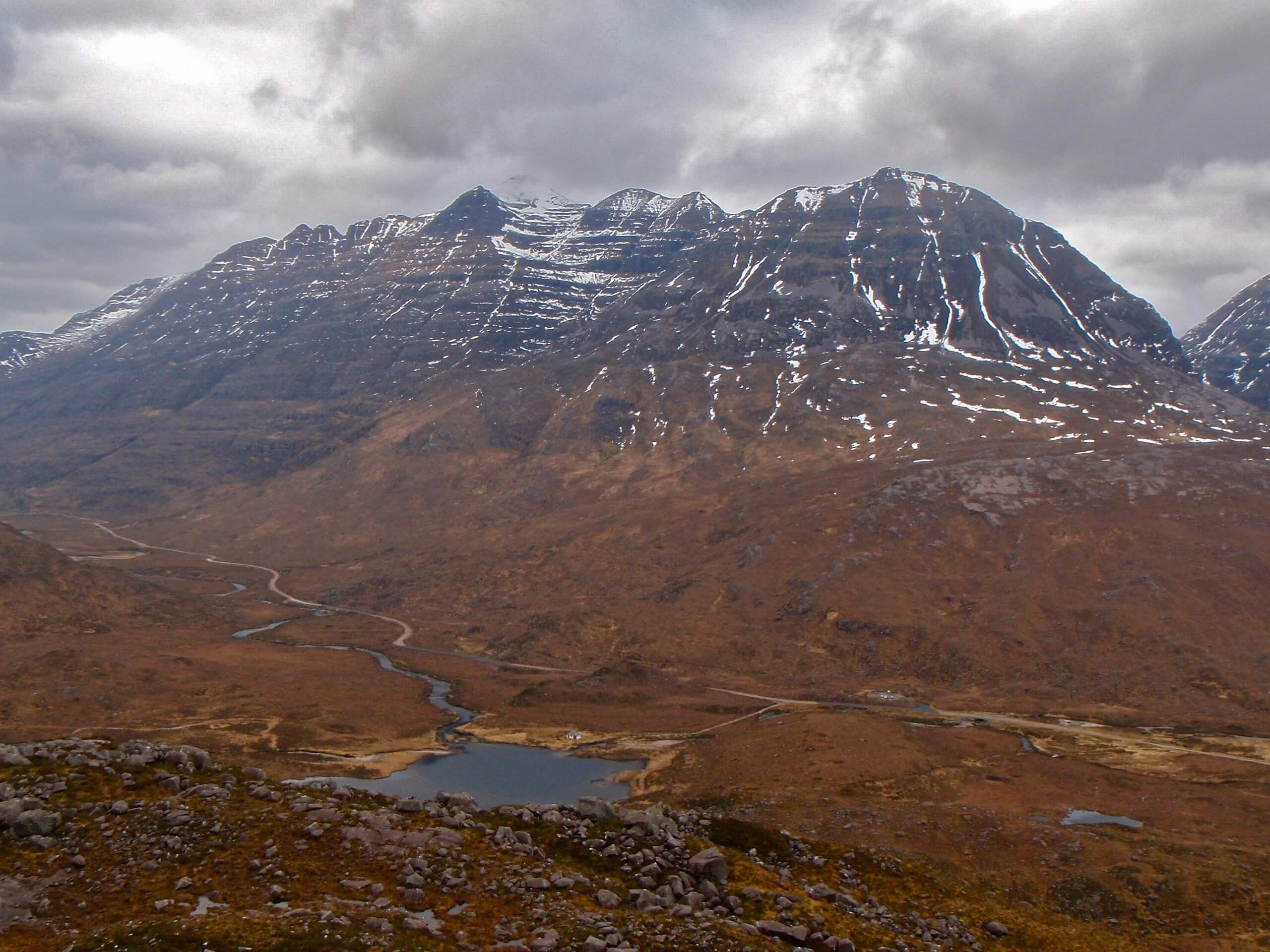
Behind Liathach Walk
Difficulty Rating:
Explore the natural character carved throughout the Behind Liathach Walk. There’s just something magical about revelling in the quirky views and scenery, such as corries, waterfalls, and grassy slopes and rocky surroundings at the bottom of steep mountain slopes. First, you’ll feel like a character in an epic fantasy before a charming fairytale setting takes over. The imagery along this hike is fun and exciting—and you can’t see the views from the road!
Getting there
To get to the start of the Behind Liathach Walk, head west over the bridge above Allt a Choire Dhuibh Mhòir (Beinn Eighe Car Park). This is a one-way walk, so you need to organize transport at the end! The walk ends near Torridon House, a B&B.

About
| Backcountry Campground | No |
| When to do | May-October |
| Pets allowed | Yes - On Leash |
| Family friendly | Older Children only |
| Route Signage | Average |
| Crowd Levels | Moderate |
| Route Type | One Way |
Behind Liathach Walk
Elevation Graph
Weather
Behind Liathach Walk Description
Step into a storybook on the Behind Liathach Walk! Discover scenery hidden to cars, making this walk all the more fun and rewarding to explore. Just beware that you need to organize transport at the end of the walk. There is no public transport going from the finish line to the trailhead, so keep this in mind. Another option is to walk the same route back, creating a 14.9mi route. You’ll follow a straightforward path throughout this adventure, but it can get boggy and rocky in the middle. So take care and watch your footing here!
Discover corries, waterfalls while immersing in a fusion of grassy, rocky and mountain-backed scenery. Plus, the lower elevation gain stretched over 7.5mi gives a range of walkers a chance to revel in quintessential Highland scenery.
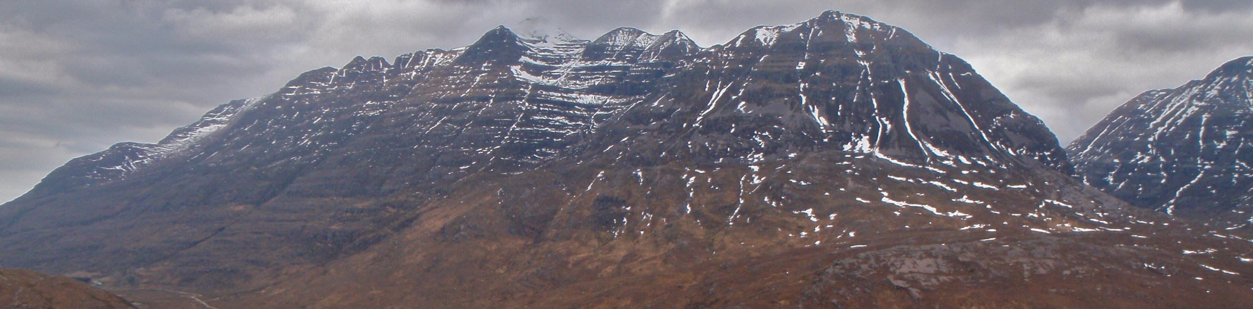
From the car park, you’ll follow a signpost for Coire Mhic Nobuil to go along an easy-to-follow path. Go up the gap to stand among the soaring mountains. To your left, you’ll see the ever-so-imposing Liathach, and on your right, scree slopes falling down Beinn Eighe. Get ready to feel small among these monstrous natural wonders!
Continue walking along, going above the stream, and gradually climbing. A kilometre or so later, you’ll pass some lochans before reaching a junction at the cairn. Go left off the main path, heading towards stunning views of Liathach. Watch out for Spidean a’Choire and Lèith, with Am Fasarinen pinnacles and Mullach an Rathain grabbing your attention in the backdrop.
Eventually, you’ll reach a rougher path (although it remains relatively straightforward) that continues to climb over glacial moraines. You’ll also tackle some boggy sections! Look for glimpses of peaks carved with corries! Continue going beyond the Mullach an Rathain, tackling some rougher moments before the path eases. Start to descend along the stream. Look out at the scenery cloaking the glen. Soon, the trail arrives at Allt a’ Bhealaich. You’ll see two paths here. Go left to go over the footbridge over Abhain Coire Mhic Nobuil. Follow this stream as you admire the views of Beinn Alligin and Loch Torridon.
Feel like you’re a fairytale character as you continue following the stream, coming across quaint waterfalls cascading tiny canyons. After travelling through pinewoods, you’ll reach a minor road alongside a bridge by a waterfall. Head to the car park on the other side, where your pre-organized transport awaits.
Insider Hints
Organize transport for the end of the walk as this is a one-way adventure,
There is no public transport travelling between the start and endpoint!
Similar hikes to the Behind Liathach Walk hike
Ord Hill Walk
If you still have some gas left in the tank or have a day between activities in the Highlands and…
Kyle of Durness Circular Walk
The Kyle of Durness Circular Walk packs a punch when it comes to the scenery! Gaze out into the coastline,…
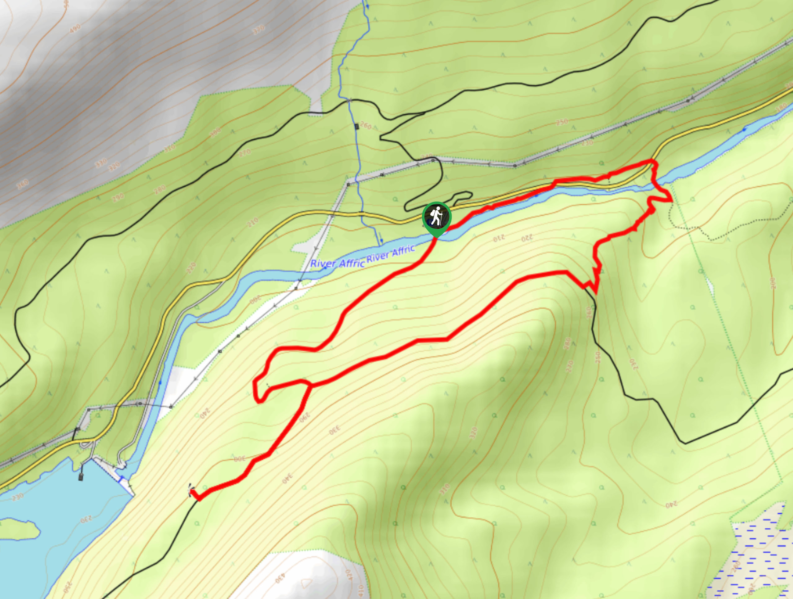
Dog Falls Walk
The Dog Falls Walk boasts a lovely, serene setting, punctuated by a waterfall, River Affric, and a stunning view of…
Comments