Beinn Eighe Mountain Trail
View Photos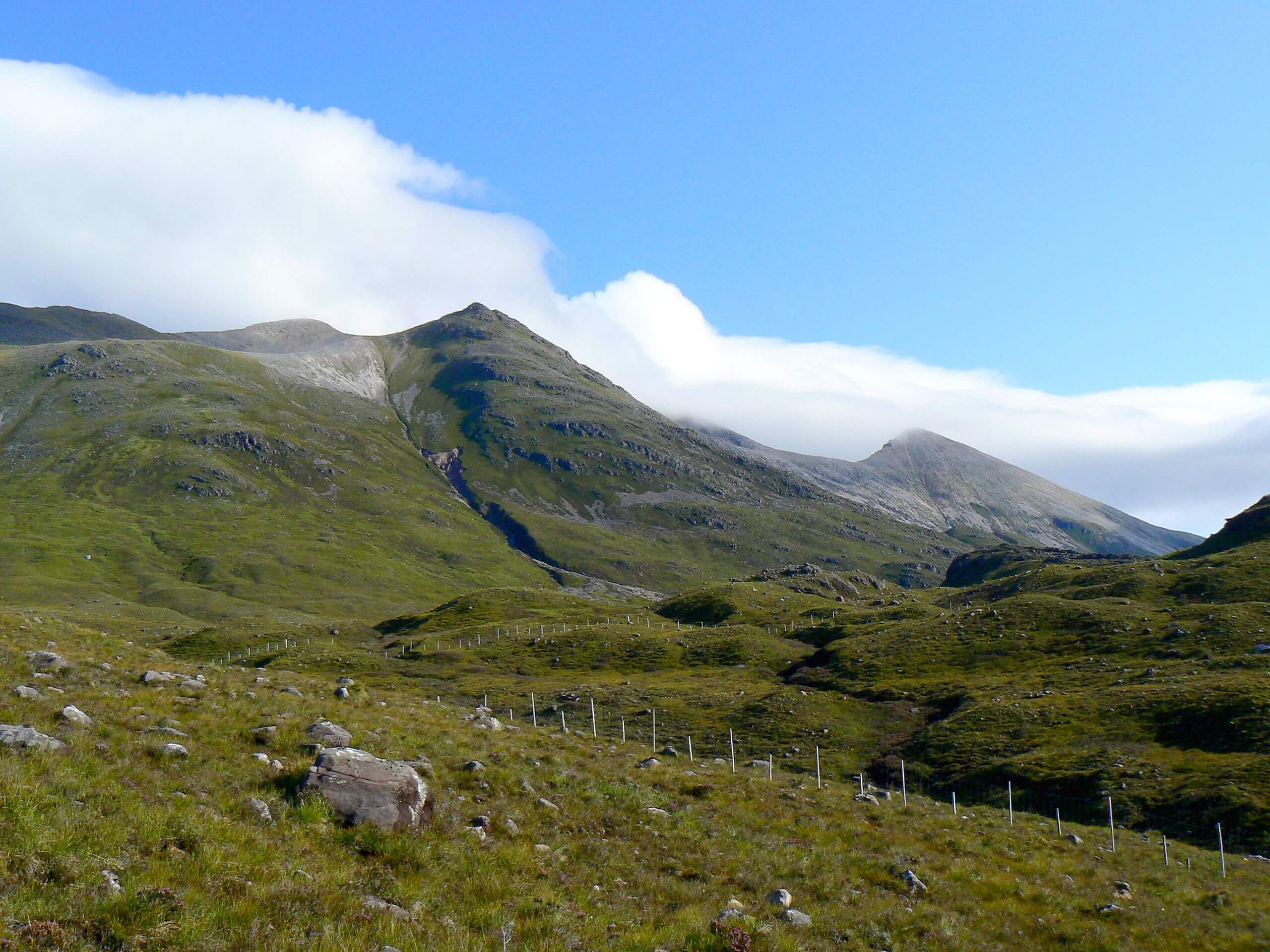
Beinn Eighe Mountain Trail
Difficulty Rating:
The Beinn Eighe Mountain Trail travels through varied terrain, following a waymarked path—Britain's singular waymarked mountain trail! But don’t let the fact that it’s waymarked fool you into thinking it’s easy. This walk climbs a steep elevation gain in a short time, with exposure at the top and more technical, rocky sections along the trail. But, despite this, every second along the Beinn Eighe Mountain Trail is worth the lung burn!
Getting there
To get to the start of the Beinn Eighe Mountain Trail, head to the Coille na Glas Letire Trails Car Park, just off the A832.

About
| Backcountry Campground | No |
| When to do | May-October |
| Pets allowed | Yes - On Leash |
| Family friendly | Older Children only |
| Route Signage | Average |
| Crowd Levels | Moderate |
| Route Type | Circuit |
Beinn Eighe Mountain Trail
Elevation Graph
Weather
Beinn Eighe Mountain Trail Description
Beinn Eighe Mountain Trail in the Highlands may be waymarked with cairns and on the shorter side of mountain walks, but you should still take it seriously! You will navigate some steep and rocky sections with an exposed area at the top. Wear proper footwear and bring layers to elevate total comfort on the trail.
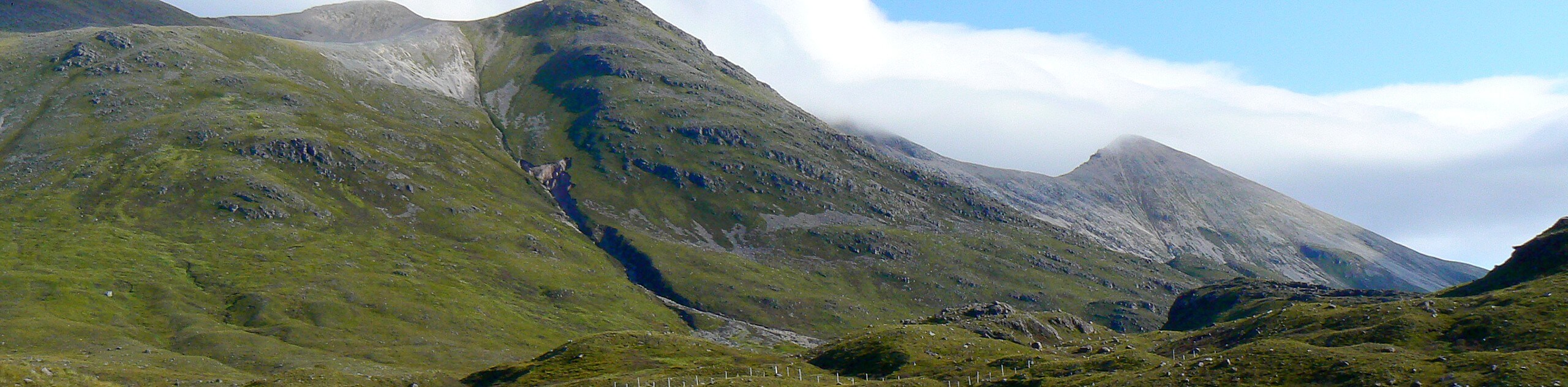
If you plan on tackling this incredible trail, you’re in for a real treat! The varied views are phenomenal. First, expect to traverse through an 8000-year-old pine forest toward a plateau built from quartzite rocks. Then, check out the craggy ridges stretching across Beinn Eighe with Slioch, another mountain, across Loch Maree just behind you at the summit. Pass by several small lochs en route as well! Seriously, this route boasts varied scenery, and we aren’t just saying that to convince you to do this one!
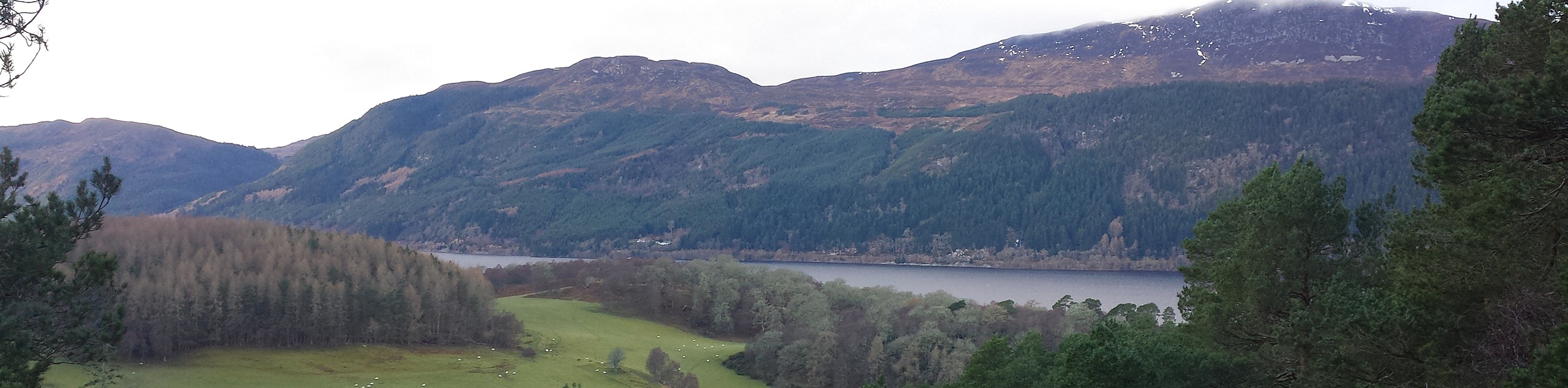
To start the walk, head to the far end of the car park to go under the main road via the underpass. Once on the other side, you’ll see a bridge—don’t take this! Instead, keep left to take the trail, where you’ll start climbing through the ancient birch and pinewood forest. Please take advantage of the gentle slope because it’s about to intensify! However, climbing higher only means better views, right? So take a moment to pause to look back at Loch Maree, backed by the ever-so-imposing Slioch. Eventually, you’ll reach a bridge that travels across the Alltan Mhic Eoheim burn. Continue along the path as it steepens and hugs the bank.
When you get out of the forest, quartzite crags will emerge into view! Follow the large cairns to stay on the path. But look out! At ‘Trumpet Rock,’ you’ll take a sharp left turn followed by another quick left just after. It’s common to miss this turn. Just keep an eye out for the waymarker cairns, and you should be fine. This section can be super steep and technical! Although, there are some natural steps and hand grips to help you out.
Eventually, the elevation gain eases, and you’ll find yourself atop the exposed plateau scraped clean by glaciers! You’ll know when you’ve reached the highest point when you arrive at the “Conservation Cairn” (1837ft). Pause here to check out the undulating ridge views stretching across Beinn Eighe, with Loch Maree and Slioch behind you!
After taking in the scenery, follow the path to the right, descending past a collection of lochs. When you see the Lunar Loch, marked on a cairn, you’ll know you’re well over halfway to going back to your car. Continue heading downhill, taking a glen to descend instead of the route you used for the ascent.
Continue going down towards the side of a gorge. Don’t cross the fence when you reach here! The drop beyond is dangerous! Instead, keep going by the gorge towards Woodland Trail (marked). Go left here and cross the bridge, heading left to reach the same underpass from the start to return to the car park.
Trail Highlights
Beinn Eighe
Beinn Eighe is a mountain that boasts of soaring summits, two even fall into the Munro category (Spidean Coire nan Clach and Ruadh Stac Mòr). Situated in the Highlands, Beinn Eighe boasts tremendous views, with Loch Maree being one of them. In Gaelic, Beinn Eighe means “file mountain.”
Insider Hints
There is a picnic site at the car park
You can take a bus from Inverness/Kinlochewe and Gairloch
Wear proper footwear for comfortability and safety traversing rocky sections
Bring layers for the exposed area at the top
Similar hikes to the Beinn Eighe Mountain Trail hike
Hermit's Castle Walk
The Hermit's Castle Walk is a fun, family-friendly adventure that reveals shimmering bright blue coastal scenery while leading you to…
Foyers Falls Walk
The Foyers Falls Walk may be short, but it does not compromise on scenery. Wander the brief, easy-to-follow path to…
Duncraig Castle from Innes Street Walk
The Duncraig Castle from Innes Street Walk is a fun, easy-going adventure tailor-made for the whole family! Cut through a…
Comments